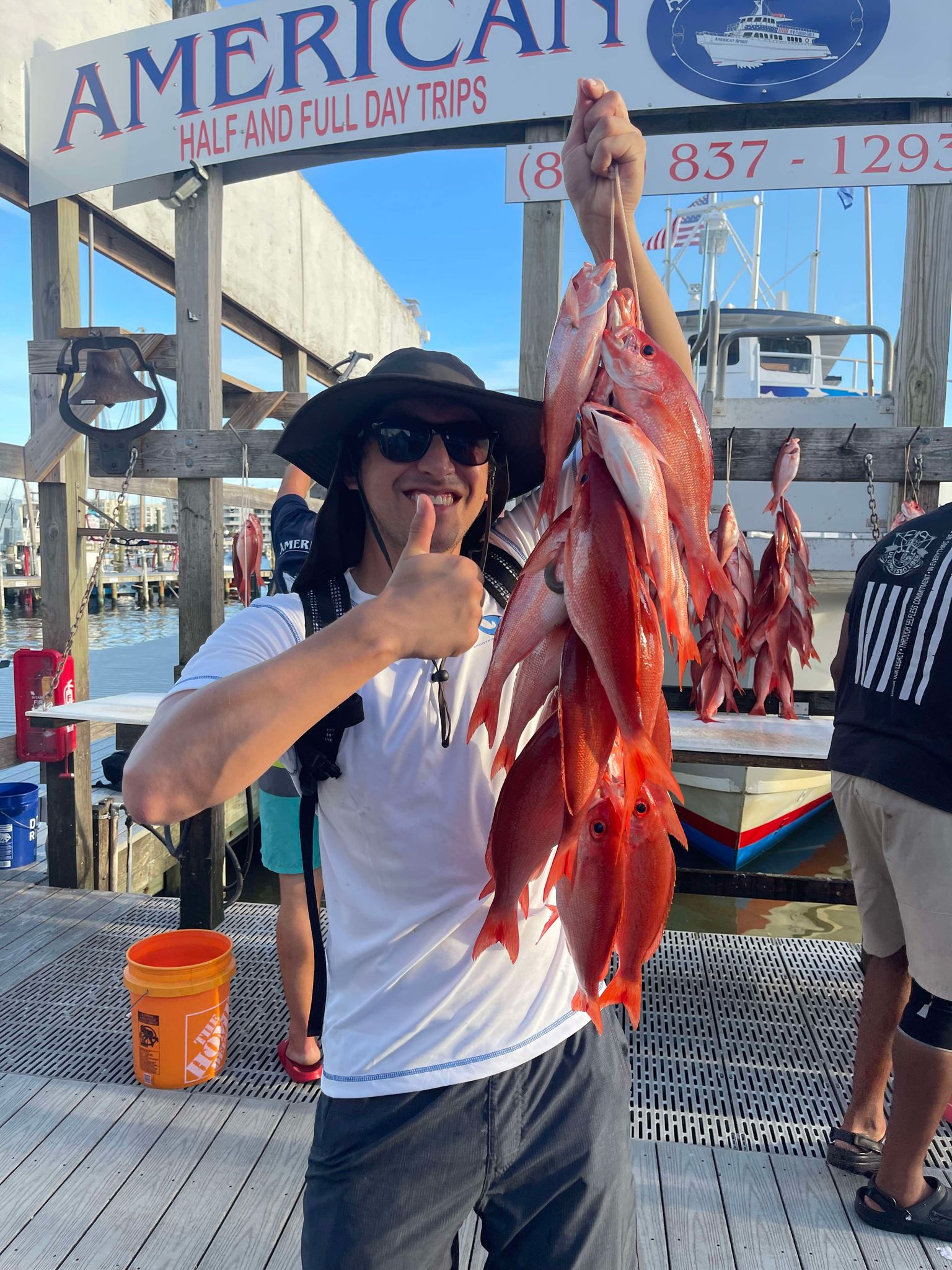
My son and his girlfriend were visiting last week and wanted to go fishing. Since she had never been deep sea fishing before, we decided that the best course of action would be to take the short four-hour trip on one of Destin’s party boats.
Party boats, also known as a head boat, are typically large boats from 50 to 100 feet long. They can accommodate many anglers and are an economical choice for first-time anglers, small, and large groups. The boat we went on holds up to 60 anglers, has restrooms, and a galley with snacks and drinks, although you can also bring your own. The cost per angler is usually in the $75 – $100 range and trips can last 4, 6, 8, or 10 hours.
We purchased our tickets through the online website and checked in at the booth 30 minutes before we departed. Everyone gets on and finds a spot next to a fishing pole already placed in a holder on the railing. For the four-hour trip, it is about an hour ride out to the reefs. On the way out, the enthusiastic and ever helpful deckhands explain what is going to happen and pass out a solo cup of bait, usually squid and cut mackerel, to each angler. When you get to the reef, you bait your hooks (two per rod) and the captain says, “start fishing.”
The rods are a bit heavy and there are some tricks you need to learn to correctly drop your bait 100 feet to the bottom of the Gulf. The deckhands are nearby to help any beginners and soon everyone is baiting, dropping, and reeling on their own. There are a few hazards like a sharp hook while baiting, crossing with your neighbor’s line and getting tangled, and the worst one, creating a “birds nest” by not correctly dropping your line. Nothing the deckhands can’t help with.
When you do finally catch a fish, you reel it up quickly and into the boat where a deckhand will measure it to make sure it’s a legal species and size and then use a de-hooker to place the fish in your bucket. After about 30 to 40 minutes, the captain will tell everyone to reel up before proceeding to another reef. At this time, you take your fish to the back of the boat where the deckhands put your fish on a numbered stringer and on ice.
For the four-hour trip, we fished two reefs. We had a lucky day with the three of us catching a total of 16 vermillion snapper, the most popular fish caught on Destin party boats. It’s a relaxing ride back to the harbor during which the deckhands pass the bucket to collect any tips. The recommended tip is 15-20% of your ticket price. These folks work hard and exclusively for tips, so if you had a good time, tip generously.
Once back in the harbor, your stringer of fish is placed on a board with everyone’s catch and they take the time for anyone that wants to get some pictures with the catch. Then, you can load your fish into your cooler, or the deckhands will clean your fish for you for another tip. If you get your fish filleted, you can take them to several local restaurants that will cook your catch for you along with some fries, hush puppies and coleslaw. It is an awesome way to end your day.
Recently I participated in a local festival to educate the public about the Rice’s Whale – the newly described species in the Gulf of Mexico that is now listed as critically endangered, possibly the most endangered whale in the world’s oceans. I honestly did not know enough about it to provide much education and chose to do terrapin conservation at my table instead (something I know more about) but have since learned much about this new member of the Gulf community.
One of the more frequent comments I heard during the event was “I did not know we even had whales in the Gulf”. This is understandable since we rarely see them – most of us have never seen one. When we think of whales we think of colder climates like Alaska, New England, and the colder waters off California. But many large whales must give birth to their smaller calves in warmer waters – so, they make the trek to tropical locations like Hawaii and Florida to do so. But there are also resident whales in the tropical seas.
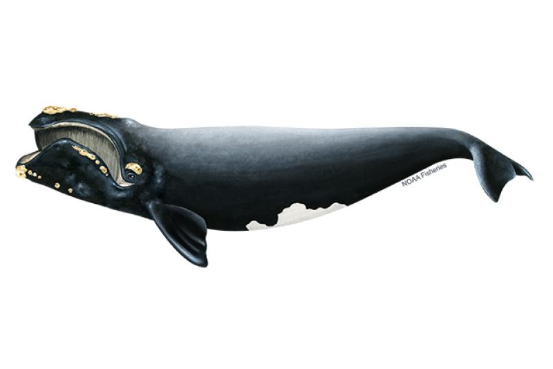
You first must understand that the term “whale” does not only mean the large creatures of whale hunting fame, but any member of the mammalian order Cetacea. Cetaceans include both the large baleen whales – like the blue, gray, and right whales – but also the toothed whales – like the sperm, orca, and even the dolphins.
The Right whale is another critically endangered whale found in the Gulf of Mexico. Image: NOAA.
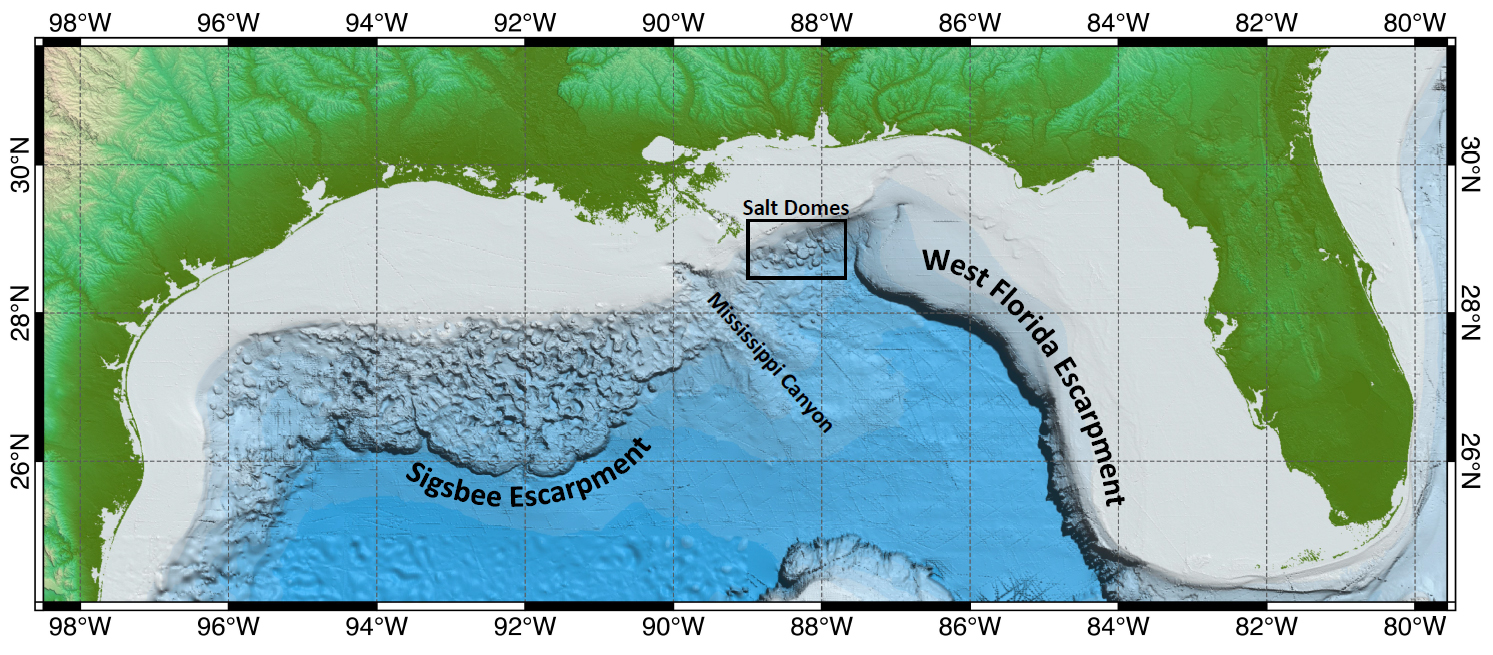
There are 28 cetaceans that have been reported from the Gulf, 21 of those routinely inhabit here. Most exist at and beyond the continental shelf – hence we do not see them. Only two frequent the waters over the shelf – the Atlantic Bottlenose Dolphin and the Atlantic Spotted Dolphin, and only one is routinely seen near shore – the Atlantic Bottlenose Dolphin.
This image shows the location of the continental shelf and thus the location of most of the whales found in the Gulf of Mexico. Image: NOAA.
But offshore, out at the edge of the continental shelf, exists several species of large and small cetaceans. The endangered Sperm, Sei, Fin, Blue, Humpback, and Northern Right whales have been seen. Of those only sperm whales are common. Others include several beaked whales (which resemble dolphins but are much larger), large pods of other species of dolphins, pygmy and dwarf sperm whales, pygmy and false killer whales (as well as the killer whale itself), and other baleen whales such as the Minke and Bryde’s whale.
The Bryde’s whale is one of interest to this story.
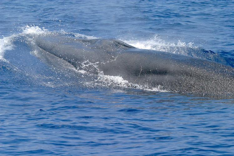
The Bryde’s whale (pronounced “brood-duss” – Balaenoptera edeni) is a medium sized baleen whale, reaching lengths of about 50 feet and weighing 30 tons. It is often confused with the larger sei whale. They are found in tropical oceans across the planet and are not thought to make the large migrations of many whales due to the fact it is already here in the tropics for birth, and its food source is here as well. They reside in the northeastern Gulf of Mexico extending from the DeSoto Canyon, off the coast of Pensacola, to the shelf edge near Tampa. They appear to travel alone or in small groups of 2-5 animals. They feed on small schooling fish, such as pilchards, anchovies, sardines, and herring. Their reproductive cycle in the Gulf is not well understood.
The Bryde’s whale was thought to be the only resident baleen whale in the Gulf of Mexico. Photo: NOAA.
Strandings have occurred – as of 2009, 33 have been logged. There are no records of mortality due to commercial fishing line entanglement, but vessel strikes have occurred. Due to their large population across the planet, they were not considered for listing under the Endangered Species Act, but that may change in the Gulf region due to human caused mortality. Between 2006-2010 it was estimated that 0.2 Bryde’s whales died annually due the vessel strikes.
In the 1960s Dr. Dale Rice described the Gulf of Mexico population as a possible subspecies. It is the only baleen whale that regularly inhabits the Gulf of Mexico. And ever since that time scientists examining stranded animals thought they may be dealing with a different species.
In the 1990s Dr. Keith Mullin began examining skull differentiation and genetic uniqueness from stranded animals of the Gulf population. Dr. Patricia Rosel and Lynsey Wilcox picked up the torch in 2008. In 2009 a stranded whale, that had died from a vessel strike, was found in Tampa Bay and provided Dr. Rosel more information. In 2019 a stranded whale, that had died from hard plastic in gut in the Everglades, was examined by Dr. Rosel and her team and, with data from this skull, along with past data, determined that it was in fact a different species. The new designation became official in 2019.
The newly described Rice’s whale only exists in the Gulf of Mexico. Photo: NOAA.
The new whale was named the Rice’s whale (Balaenoptera ricei) after Dr. Dale Rice who had first describe it as a subspecies in the 1960s. With this new designation everything changed for this whale. This new species only lives in the Gulf of Mexico, and it was believed there were only about 50 individuals left. Being a marine mammal, it was already protected by the Marine Mammal Protection Act, but with this small population it was listed as critically endangered and protected by the Endangered Species Act.
New reviews and publications began to come out about the biology and ecology of this new whale. Rice’s whales do exist alone or in small groups and currently move between the 100m and 400m depth line along the continental shelf from Pensacola to Tampa. Diet studies suggest that it may feed near the seafloor, unlike their Bryde’s whale cousins. They may have lived all across the Gulf of Mexico at the 100-400m line at one time. They prefer warmer waters and do not seem to conduct long migrations.
The area where the Rice’s whale currently exists. Image: NOAA.
Being listed under the Endangered Species Act, NOAA National Marine Fisheries (NMFS) was required to develop a recovery plan for the whale. NMFS conducted a series of five virtual workshops between October 18 and November 18 in 2021. Workshop participants included marine scientists, experts, stakeholders, and the public. There were challenges identified from the beginning. Much of the natural history of this new whale was not well understood. Current and historic abundance, current and historic distribution, population structure and dynamics, calving intervals and seasonality, diet and prey species, foraging behavior, essential habitat features, factors effecting health, and human mortality rates all needed more research.
At the end of the workshop the needs and recommendations fell into several categories.
Management recommendations
Create a protected area
Restrict commercial and recreational fishing in such – require ropeless gear
Require VMS system on all commercial and recreational vessels
Require reporting of lost gear and removal of ghost gear
Risk assessment for aquaculture, renewable energy, ship traffic, etc.
Prohibit aquaculture in core area and suspected areas
Reduce burning of fossil fuels
Prohibit wind farms in core area
Renewable energy mitigation – reduce sound, night travel, passive acoustic
Develop spatial tool for energy development and whale habitat use
Require aquaculture to monitor effluent release
Develop rapid response focused on water quality issues
Develop rapid response to stranding events
Reduce/cease new oil/gas leases
Reduce microplastics and stormwater waste discharge
Work with industry to use technologies to reduce noise
Reduce shipping and seismic sound within the core area
Restrict speed of vessels
Maintain 500m distance – require lookouts/observers while in core
Consider “areas to be avoided”
Monitoring recommendations
Long-term spatial monitoring
Long-term prey monitoring
Electronic monitoring of commercial fishing operations
Necropsies for pollution and contaminants
Outreach and Engagement are needed
Top Threats to Rice’s Whale from the workshop Include:
Small population size – vessel collisons
Noise
Environmental pollutants
Prey – Climate change – marine debris
Entanglement – disease – health
Offshore renewable energy development
The Endangered Species Act (ESA) requires the designation of critical habitat for listed species. In July 2023 NOAA proposed the area along the U.S. continental shelf between 100-400 meters depth as critical habitat. Comments on this designation were accepted through October 6, 2023.
The proposed protection zone for the Rice’s whale including the core area. Image: NOAA.
Vessel strikes are a top concern. It is understood that the most effective method of reducing them is to keep vessels and whales apart and reduce vessel speeds within the approved critical habitat.
On May 11, 2021, NOAA Fisheries received a petition submitted by five nongovernmental agencies and one public aquarium to establish a year-round 10-knot vessel speed limit in order the protect the Rice’s whale from vessel collisions. The petition included other vessel mitigation measures. On April 7, 2023, NOAA published a formal notice in the Federal Register initiating a 90-day comment period on this petition request. The comment period closed on July 6, 2023, and they received approximately 75,500 comments. After evaluating comments, and other information submitted, NOAA denied the petition on October 27, 2023.
NOAA concluded that fundamental conservation tasks, including finalizing the critical habitat designation, drafting a species recovery plan, and conducting a quantitative vessel risk assessment, are all needed before we consider vessel regulations. NOAA does support an education and outreach effort that would encourage voluntary protection measures before regulatory ones are developed.
On that note, the Bureau of Ocean Energy Management (BOEM) did issue voluntary precautionary measures the industry could adopt to help protect the Rice’s whale. These include:
Training observers to reduce vessel collisions.
Documenting and recording all transits for a three-year period.
All vessels engaged in oil and gas, regardless of size, maintain no more than 10 knots and avoid the core area after dusk and before dawn.
Maintain 500m (1700 feet) distance from all Rice’s whales.
Use automatic identification system on all vessels 65’ or larger engaged in oil and gas.
These suggestions would not apply if the crew/vessel are at safety risk.
So…
This is where the story is at the moment…
This is what is up with the Rice’s whale in the Gulf of Mexico.
2 Rosel, P.E., Mullin, K.D. Cetacean Species in the Gulf of Mexico. DWH NRDA Marine Mammal Technical Working Group Report. National Marine Fisheries Service. Southeast Fisheries Science Center.
7BOEM Issues Voluntary Precautionary Measures for Rice’s Whale in the Gulf of Mexico. 2023. U.S. Department of Interior. Bureau of Ocean Energy Management.
8NOAA Fisheries Denies Petition to Establish a Mandatory Speed Limit and Other Vessel Mitigation Measures to Protect Endangered Rice’s Whales in the Gulf of Mexico. NOAA Fisheries News. FB23-079. Gulf of Mexico Fishery Bulletin. October 27, 2023.
Even though oysters have a hard shell that even humans have a hard time opening, they do have natural predators in our waters that can easily slurp up a couple dozen. Your usual oyster slurping suspects include oyster drills, blue crabs, and fish (such as the black drum). In this article, we will focus on the 3 major predators that contribute the most toward natural mortality in oysters here in the Florida Panhandle.
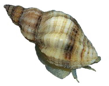
The Oyster Drill
When it comes to the marine snail world, oyster drills would win an oyster-eating contest. Oyster drills (Urosalpinx cinerea) are marine gastropods that grow to sizes of 0.5 – 1 inch. Oyster drills can be found all along the Atlantic coast of North America and the Gulf of Mexico, and they have been accidentally introduced into Northern Europe and the West Coast of North America. These small but mighty snails have become specialized in consuming oysters. Using chemotaxis, they locate their prey oyster. Once they find it, they secrete an enzyme to soften a portion of the oyster shell. Once softened, they drill into the shell and siphon out oyster meat. Oyster drills have been known to occur in great numbers when the environmental conditions are prime and can wipe out not only entire oyster beds but also clam beds. Oyster drills do have natural predators as well, but these predators also consume oysters.
An Oyster Drill (Urosalpinx cinerea) – Barnegat Bay Shellfish
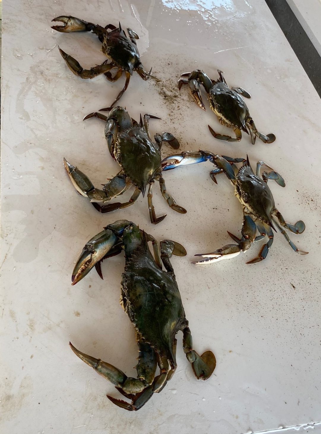
The Blue Crab
Most of us know about the very tasty blue crab (Callinectes sapidus), but many do not know that it is a major consumer of oysters, especially on an oyster farm. Blue crabs are a decapod crab (meaning 10 legs) of the swimming crab family Portunidae. Blue crabs can indeed swim and their last leg on each side has developed into what are called paddle fins. Juvenile oysters are the main target for blue crabs, but they have been observed eating adult oysters when given the opportunity. On an oyster farm, blue crabs can get into an oyster bag when they are very small. Once inside, they have an all-you-can-eat buffet of oysters, and can quickly wipe out a bag of oysters. Oyster farmers have to be very cautious and must either remove the blue crabs manually or dry their bags out in hopes of destroying any blue crabs. Blue crabs can easily break open a juvenile oyster, but for them to consume an adult oyster, they will wait for it to open to feed before shoving a claw inside of the shell to keep the oyster open. Once they have their claw in the shell, they will use their other claw to consume the oyster.
Blue Crabs (Callinectes sapidus) Pulled Out Of Oyster Bags – Thomas Derbes II
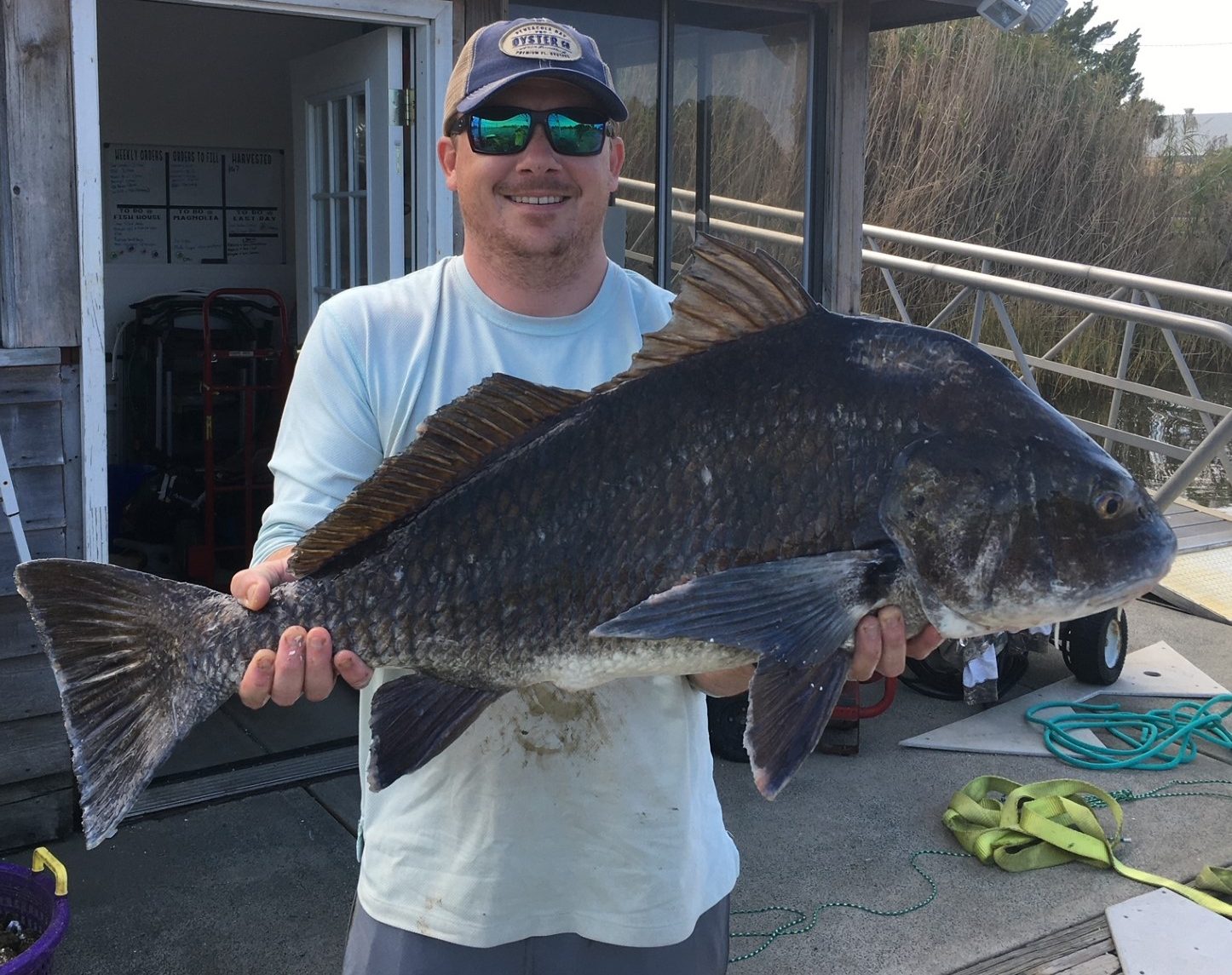
The Fish
Even though oyster-eating fish like black drum (Pogonias cromis) and sheepshead (Archosargus probatocephalus) are much bigger than snails and crabs, they tend to contribute less to oyster mortality on oyster farms. However, during certain seasons wild oysters and other shelled invertebrates can contribute up to 33% of a black drum’s diet (more here). Fish will usually congregate around oyster beds and farms, but they are more interested in consuming oyster predators like crabs and snails. The black drum is a fish that was built for oyster consumption. While black drum lack sharp teeth, they have crushing plates in their throat that can crush an oyster shell which allows the drum to eat the oyster meat. Many oyster farmers welcome these fish on their farms as a free source of anti-fouling and predator deterrent (in the form of consumption).
Black Drum (Pogonias cromis) Caught On A Whole Oyster – Thomas Derbes II
There are many more oyster predators, but these are the top 3 in terms of threat and ability to consume/do detriment to oyster beds and farms in the Florida Panhandle. While oyster drills rank up towards the top, crabs and fish can also greatly contribute to natural mortality.
References
Flimlin, G., & F Beal, B. (n.d.). Major Predators of Cultured Shellfish. https://shellfish.ifas.ufl.edu/wp-content/uploads/Major-Predators-of-Cultured-Shellfish.pdf
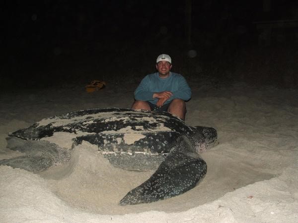
The leatherback sea turtle is the largest of the five species that have been found in the northern Gulf of Mexico. With a carapace (top shell) length between 6-7 feet and weighing between 800-1000 pounds it is truly a magnificent creature. Any encounter with them is amazing.
Most encounters occur with fishermen or divers who are out searching for artificial reefs to fish or dive. Though very rare, they have been known to nest in this area. They feed exclusively on jellyfish and will follow them close to shore if need be. But what do leatherbacks do with most of their time? Do they hang offshore and follow jellyfish in? Do they circle the entire Gulf of Mexico and we see them as they pass? Based on past studies, many encounters with this turtle occur in the warmer months. They often become entangled in commercial fishing longlines set in the central Gulf of Mexico. But what do they do during the fall and winter? One of the tagging projects presented at a recent workshop tried to answer that question.
The project was led by Dr. Christopher Sasso of the National Oceanic and Atmospheric Administration. The tag chosen for this was a satellite tag. Since the leatherback must surface to breath air, and often is found near the surface following jellyfish, orbiting satellites would be able to follow them. As we mentioned in Part 1, catching the creature is step 1, and catching a six-foot 1000-pound sea turtle is no easy task.
The team used a spotter aircraft to locate the turtles. Once found, the pilot would radio the chase boat who would zip in with a large net. The net was connected to a large metal hoop and was designed to give way once it was around the turtle. Once in the net the turtle was hauled onto a small inflatable boat where the work of tagging could be done. They would measure the animal, take blood samples, place a PIT tag within them (similar to a microchip in your pet) and then attach the satellite tag by a tether to the tail end of the turtle before releasing it. The entire operation took less than 30 minutes.
Between 2015-2019 19 leatherbacks were tagged in the northern Gulf. 17 of these were females and 2 were males. Data obtained from these tags ranged between 63 and 247 days at liberty. The behavior the team noticed was divided into foraging behavior (feeding on jellyfish) and transiting behavior (direct swimming ignoring all).
The turtles foraged in this part of the Gulf until the fall season. At that point most of them moved south along the Florida shelf, past the western peninsula of the state, heading towards the Keys. A few chose to swim directly south against the Loop Current, and a small number remained in the area.
Those moving along the Florida shelf appeared to be foraging as they went. Those crossing the open Gulf may have foraged some but seemed to be focused on getting south to the nesting beaches. Almost all of the turtles entered the Caribbean on the east side of the Yucatan channel, following the currents, with their final destination being their nesting beaches. When they returned, they did so in the warmer months and used the western side of the channel – again following the currents – until they once again reached the northern Gulf and foraging began again. One interesting note from this study, the two males tagged did not leave the Gulf.
The tagging studies do show that leatherbacks use the Gulf of Mexico year-round. They usually head south to the Caribbean when it gets colder and use the currents to do so. It is during the warmer months we are most likely to see them here foraging on jellyfish. It is an amazing experience to encounter one of these large turtles. I hope you get to experience it one day.
Satellite tracks of leatherback movement in the GoM. Red (2015), Blue (2018), Black (2019).
Image: Sasso (et.al.) 2021.
Reference
Sasso, C.R., Richards, P.M., Benson, S.R., Judge, M., Putman, N.F., Snodgrass, D., Stacy, B.A. 2021. Leatherback Sea Turtles in the Eastern Gulf of Mexico: Foraging and Migration Behavior During the Autumn and Winter. Frontiers in Marine Science., Vol. 8., https://doi.org/10.3389/fmars.2021.660798.
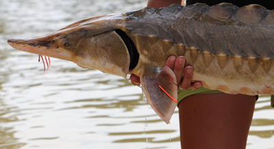
Mark Twain once said – “Everyone talks about the weather, but no one does anything about it.” A similar statement could be made about the Gulf Sturgeon – “Everyone talks about the Gulf sturgeon, but on one has actually seen one.” Those along the coast who have a dock, pier, seawall, or have placed a marina, artificial reef, or oyster farm over state submerged lands, have certainly heard about this fish. It is a portion of the permit in each case. Heck, maybe they have seen one. But it is a fish that many know about but seems elusive to encounter.
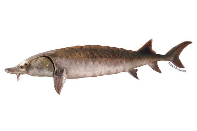
Left-facing Gulf sturgeon illustration. Lighter brown than Atlantic sturgeon. Credit: Jack Hornady for NOAA Fisheries.
The Gulf sturgeon (Acipenser oxyrinchis desotoi) is one of 27 species of sturgeon found worldwide. It is a subspecies of the Atlantic sturgeon. These are ancient fish, and they look it. Sturgeons are large, reaching lengths of up to eight feet and 300 pounds. They have armored looking scutes embedded into their skin, giving them a “dinosaur” appearance. They have a heterocercal caudal fin that resembles a shark. And like sharks, they have a cartilaginous skeleton and a spiral valve within their digestive tract. Their head has a pointed snout with whisker-like structures called barbels, which are used for detecting food buried in the sand, and they lack teeth. They have been swimming in our oceans since the era of the dinosaurs, about 225 million years.
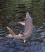
Sturgeons are anadromous fish, meaning they (like salmon) spend their adult lives in salt water, traveling miles upriver to their location of their birth to lay eggs. The Gulf sturgeon spends the colder months (November through February) inhabiting our bays and the nearshore Gulf of Mexico in waters less than 100 feet. Now is the time when you may encounter one near the coast. Because they eat very little while in the river systems, they gorge on benthic invertebrates during the winter. They spend most of their time over sand flats and sand bars, using their barbels to detect a variety of buried invertebrates. When sturgeon sense warmer months coming, they begin their long migrations up the inland rivers seeking the area where they were born. At this time, they leap from the water like mullet and make splashes that can be heard from a long distance. They are famous for this in the Suwannee River and have, at times, been a concern for boaters and jet skiers. Many boaters have had to go to the hospital due to collisions with leaping sturgeon.
The Gulf Sturgeon.
Photo: U.S. Geological Survey
Once they reach the spawning grounds, if conditions are right – temperature, water flow, and pH – the female will lay between 250,000 – 1,000,000 eggs which will become fertilized by the smaller males. Most eggs will not survive, but for those that do, the cycle will begin again with the trek back towards the Gulf of Mexico beginning in September.
Why are they declining?
Early in the 20th century they were sought after for their meat and fertilized eggs (caviar). Most of the rivers within their range (which is between the Mississippi and Suwannee Rivers) have been damned, dredged, or both. Dams impede their ability to reach their nursery grounds and dredging can reduce the required conditions to stimulate breeding, or literally bury their eggs. Between these human activities, their numbers declined drastically. In 1991 they were listed both as a federally and state threatened species and have been protected and monitored ever since. The best population, and best chance to encounter one, is in the Suwannee River. This river has been left basically pristine and has not had the habitat altering activities of the others. Locally, they are found in the Escambia, Blackwater, and Yellow Rivers.
Winter is the time to see them in the lower parts of our bay. Maybe you will be lucky enough to encounter one.
References
The Gulf Sturgeon. Florida Fish and Wildlife Conservation Commission.