by Sheila Dunning | Oct 4, 2024
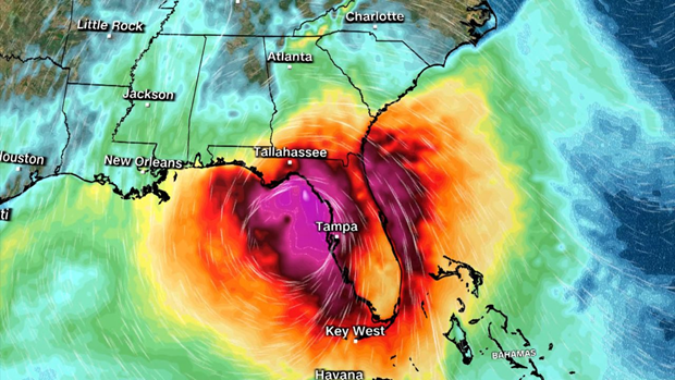
Coastal wetlands are some of the most ecologically productive environments on Earth. They support diverse plant and animal species, provide essential ecosystem services such as stormwater filtration, and act as buffers against storms. As Helene showed the Big Bend area, storm surge is devastating to these delicate ecosystems.
Hurricane Track on Wednesday evening.
As the force of rushing water erodes soil, uproots vegetation, and reshapes the landscape, critical habitats for wildlife, in and out of the water, is lost, sometimes, forever. Saltwater is forced into the freshwater wetlands. Many plants and aquatic animal species are not adapted to high salinity, and will die off. The ecosystem’s species composition can completely change in just a few short hours.
Prolonged storm surge can overwhelm even the very salt tolerant species. While wetlands are naturally adept at absorbing excess water, the salinity concentration change can lead to complete changes in soil chemistry, sediment build-up, and water oxygen levels. The biodiversity of plant and animal species will change in favor of marine species, versus freshwater species.
Coastal communities impacted by a hurricane change the view of the landscape for months, or even, years. Construction can replace many of the structures lost. Rebuilding wetlands can take hundreds of years. In the meantime, these developments remain even more vulnerable to the effects of the next storm. Apalachicola and Cedar Key are examples of the impacts of storm surge on coastal wetlands. Helene will do even more damage.
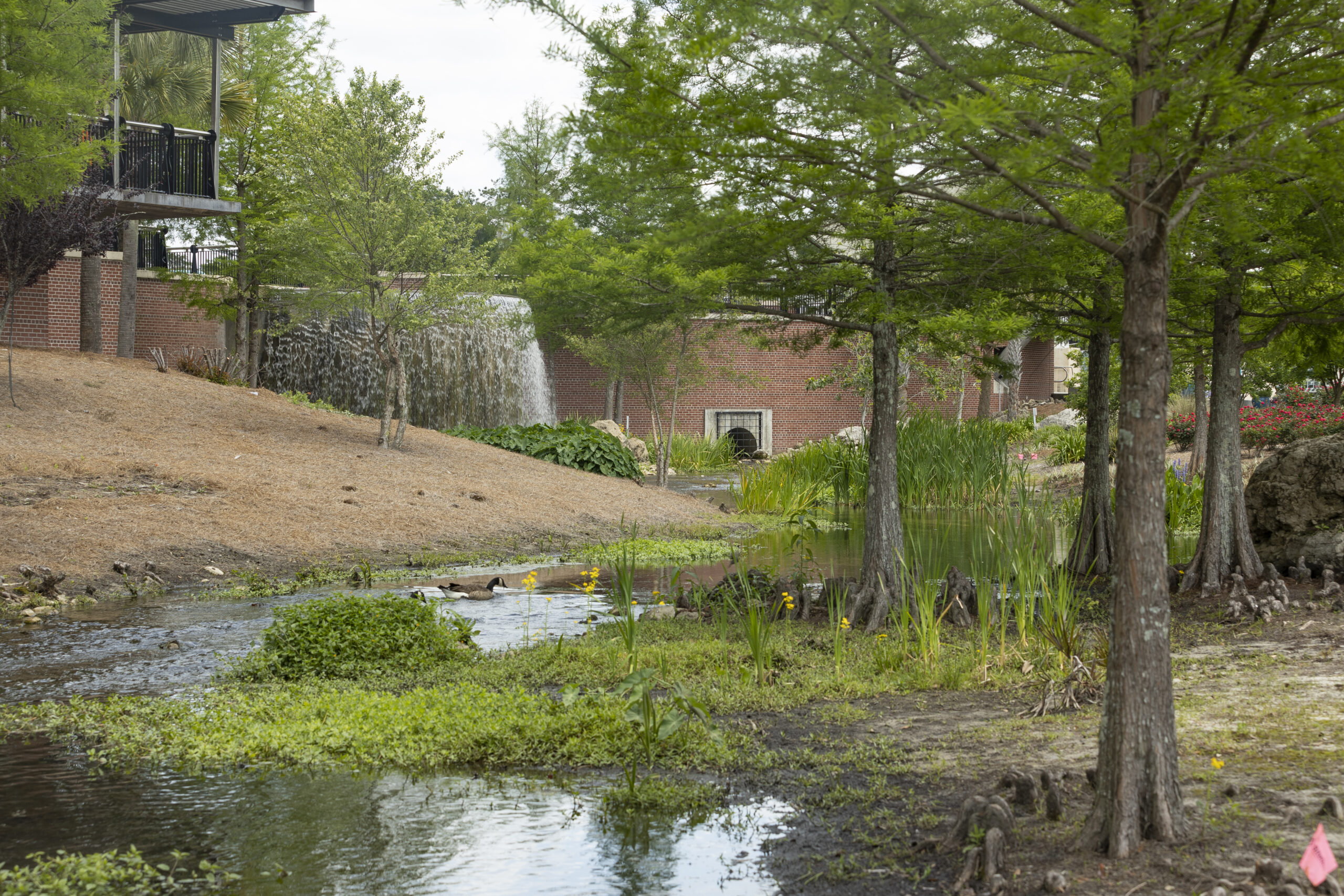
Many of the coastal cities in the Big Bend have been implementing mitigation strategies to reduce the damage. Extension agents throughout the area have utilized integrated approaches that combine natural and engineered solutions. Green Stormwater Infrastructure techniques and Living Shorelines are just two approaches being taken.
So, as we all wish them a speedy recovery, take some time to educate yourself on what could be done in all of our Panhandle coastal communities to protect our fragile wetland ecosystems. For more information go to:
https://ffl.ifas.ufl.edu/media/fflifasufledu/docs/gsi-documents/GSI-Maintenance-Manual.pdf
https://blogs.ifas.ufl.edu/news/2023/11/29/cedar-key-living-shorelines/
by Thomas Derbes II | May 10, 2024
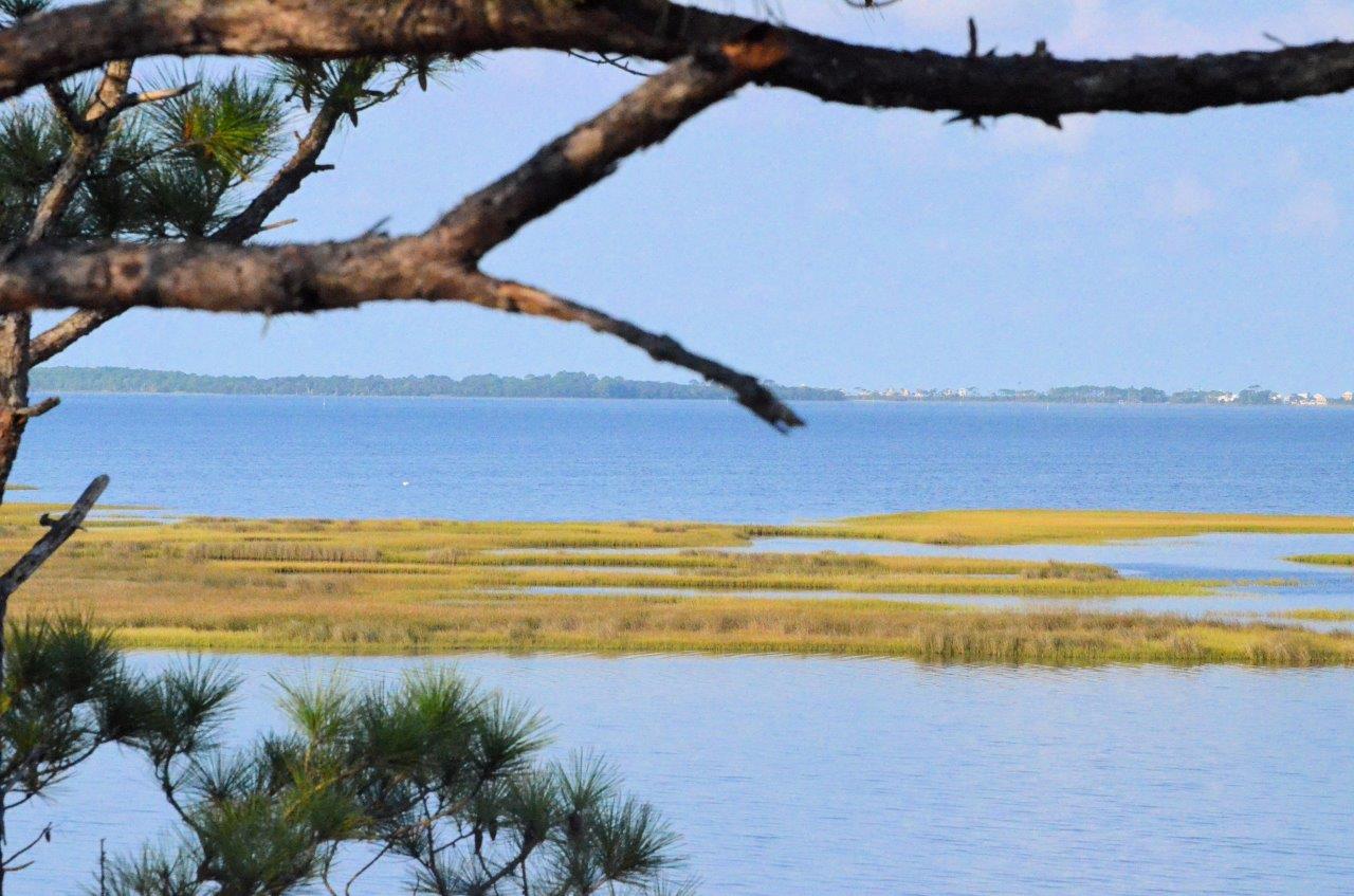
The Panhandle of Florida is home to many estuaries along the coast, from the Escambia Bay System in the west to the Apalachicola Bay System in the east. These estuaries are very important and are the intersection where rivers (fed from their respective watersheds) meet the Gulf of Mexico and contain many different organisms that help filter the waters before they reach the Gulf. These organisms include oysters, marsh plants, seagrasses, scallops, tunicates, and other invertebrates. In this two-part article, we will explore marsh plants, seagrasses, oysters, and scallops.
Marsh Plants
Marsh Plants is a broad term for a family of grasses that lines the shore and contain grasses like Smooth Cordgrass (Spartina alterniflora), Saltgrass (Distichlis spicata), and Gulf Cordgrass (Spartina spartinae). These plants help trap sediments before they enter the estuary and are excellent at erosion prevention. When the water encounters the plants, it slows the flow, and this allows for sediments to collect. Marsh Plants are a great tool for shoreline restoration and are a major part of the Living Shorelines Program. The roots of the plants are also very efficient at removing nutrient pollutants like excess nitrogen and phosphorus which are major influencers in eutrophication. Marsh Plants also absorb carbon dioxide from the atmosphere and have been tabbed as “superstars of CO2 capture and storage.” (CO2 and Marsh Plants)
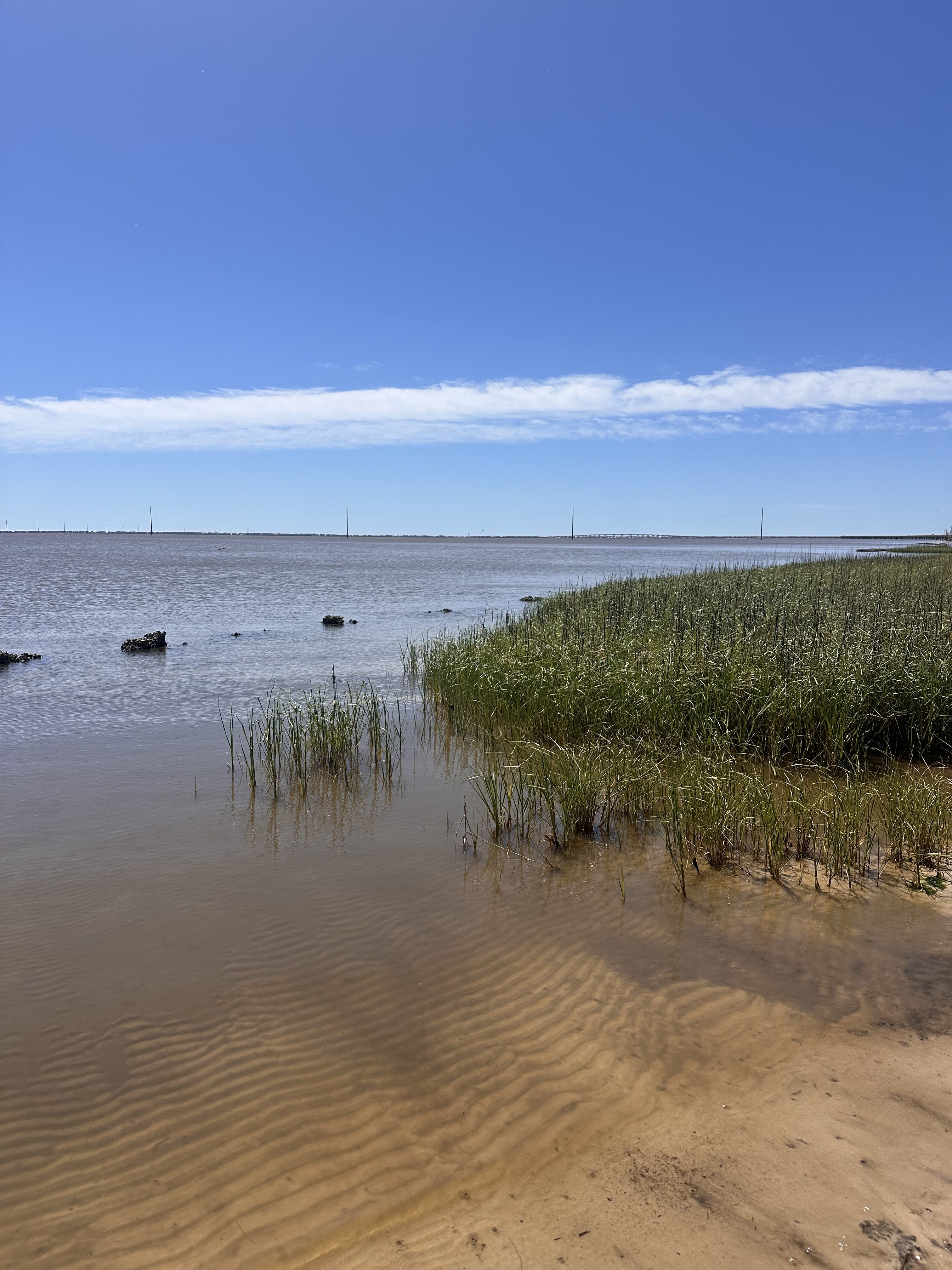
Marsh Grass and Oyster Reef in Apalachicola, Florida – Thomas Derbes II
Seagrasses
Seagrasses are different than Marsh Grasses (seagrasses are ALWAYS submerged underwater), but they offer some of the same ecological services as Marsh Grasses. The term seagrasses include Turtle Grass (Thalassia testudinum), Shoal Grass (Halodule wrightii), Widgeon Grass (Ruppia maritima), and Manatee Grass (Syringodium filiforme) to name a few. Seagrasses help maintain water clarity by trapping suspended sediments and particles with their leaves and uptake excess nutrients in their roots. Seagrasses are very efficient at capturing carbon, capturing it at rates up to 35 times faster than tropical rainforests. (Carbon Capture and Seagrasses) They also provide habitat for crustaceans, fish, and shellfish (which can filter the water too) and food for other organisms like turtles and manatees.
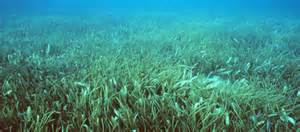
Grassbeds are also full of life, albeit small creatures.
Photo: Virginia Sea Grant
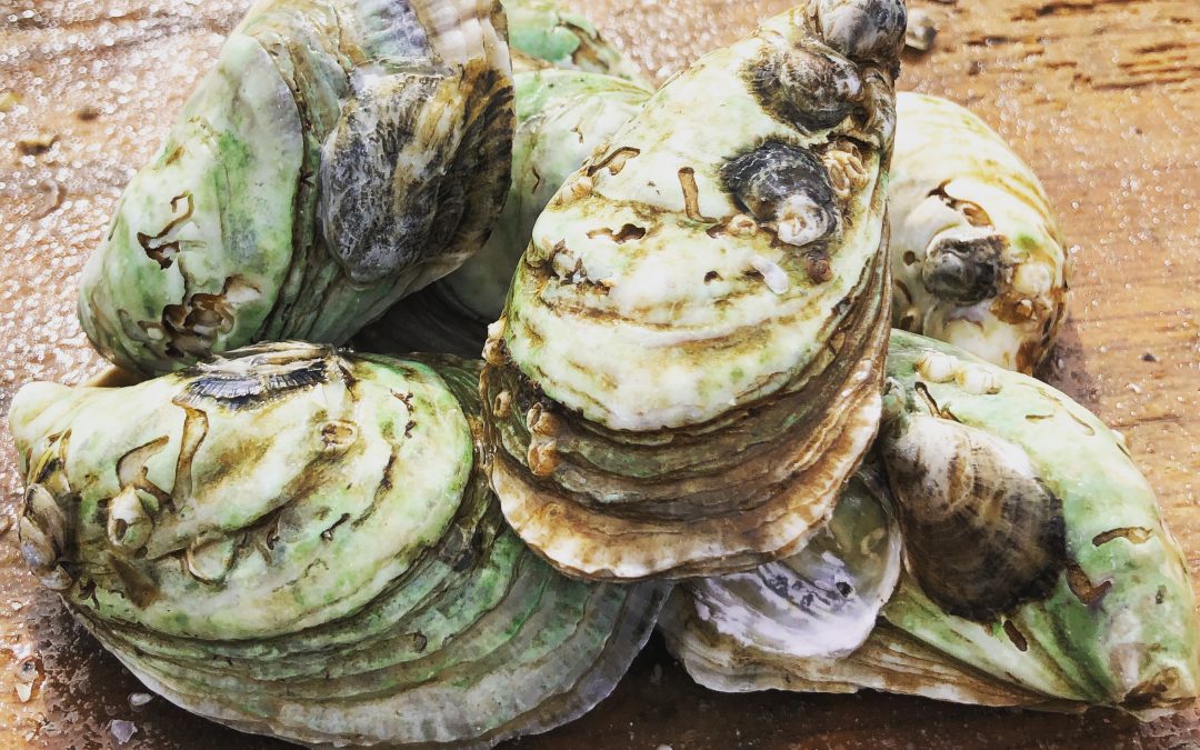
Oysters
Crassostrea virginica (or as we know them, the Eastern oyster) is a native species of oyster that is commonly found along the eastern coast of the USA, from the upper New England states all the way to the southernmost tip of Texas. Eastern oysters are prolific filter feeders and can filter between 30-50 gallons of water per day. As filter feeders, they trap nutrients like plankton and algae from the environment. In areas of high eutrophication, oysters can be very beneficial in clearing the waters by trapping and consuming the excess nutrients and sediments and depositing them on the bottom as pseudo-feces. With oyster farms popping up all over the Gulf Coast, the filtering potential of estuaries is on the rise. (Between the Hinge)

Oysters, The Powerful Filterers of the Estuary – Thomas Derbes II
Scallops
Bay Scallops (Agropecten irradians) were common along the whole Florida Gulf Coast, but their numbers have taken a recent decline and can only be found in abundance in the estuaries to the east of St. Andrews Bay in Panama City, Florida. Scallops make their home in seagrass beds and are filter feeders. While scallops do not contain the filtering potential of an oyster (scallops filter 3 gallons of water per day as an adult), they are still a key part of filtering the estuary. Just like oysters, scallops feed off of the suspended particles and plankton in the water column and deposit them as pseudo-feces on the bottom. The pseudo-feces also help provide nutrients to the seagrasses below.
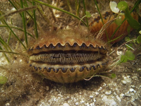
Bay Scallop.
Photo: FWC
I hope you enjoyed this first article on filterers in the estuary system. While oysters are known as the filterers of the estuary, I hope this has opened your eyes to the many different filterers that call our estuary home. Stay tuned for Part 2!
by Andrea Albertin | Apr 26, 2024

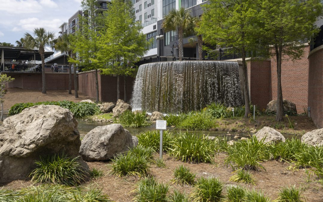
Green stormwater infrastructure at Cascades Park in Tallahassee, Florida. Image: T. Jones, UF/IFAS.
Join us for a two-part webinar series on Managing Stormwater in a Changing FL Panhandle on May 1, 2024 from 8:30-11:30 am CST (9:30-12:30 pm EST), and May 15, 2024 from 8:30-11:30 am CST (9:30-12:30 pm EST).
We are also offering two optional no-cost field tours of stormwater management sites in northwest Florida. The first will be held on May 3 in Pensacola to the Escambia County Central Office Complex, and the second on May 22 in Tallahassee to the Upper Lake Lafayette Nutrient Reduction Facility (aka Weems Pond). Detailed information as well as how to register for both the webinars and the field tours is found below.
Webinar series: Information and registration
Please register for the webinar series here: Eventbrite link Once in the registration site, you will have to register for both dates separately.
May 1: Day 1 will focus on Green Stormwater Infrastructure (GSI) and its maintenance, as well as presentations and discussion on the ecological function of GSI+LID.
May 15: Day 2 will focus on implementing GSI and LID at the community level, with presentations about ongoing research on extreme sea levels and effects on flooding events, a resiliency case study on Cedar Key and funding opportunities for GSI and LID through FDEP.
PDHs and CEUs offered:
- 4 Professional Development Hours (PDH) will be offered through the Florida Board of Professional Engineers. Two PDHs will be offered for Day 1 and two for Day 2.
- 4 Continuing Education Units (CEU) will be offered for Pesticide Applicators through FDACS in these categories: Ornamental & Turf, Private Applicator Ag, Right-of-Way, Aquatic, Natural Areas, Commercial Lawn & Ornamental, Limited Commercial Landscape Maintenance, Limited Lawn & Ornamental and Limited Urban Fertilizer.
The webinar is free for those not seeking PDHs or CEUs. For those seeking PDHs or CEUs, the cost is $50 for Day 1, and $50 for Day 2.
Field Tours: Information and registration
Please register for each tour separately through the Eventbrite links provided.
May 3 Pensacola Tour: Join us for a tour of the Escambia County Central Office Complex, a LEED Gold certified building with pervious pavement, energy efficient design, and the largest green roof in Florida. Registration: Pensacola Field Tour
May 22 Tallahassee Tour: Join us for a tour of the Upper Lake Lafayette Nutrient Reduction Facility (aka Weems Pond) which captures sediment and trash from a large upstream drainage basin and uses modern treatment methods to filter the stormwater before it enters a natural system. The tour will be led by the City of Tallahassee Stormwater Planning team. Registration: Tallahassee Field Tour
We look forward to your attendance! Please contact Andrea Albertin if you have any questions at (850) 875-7111 or via email: albertin@ufl.edu
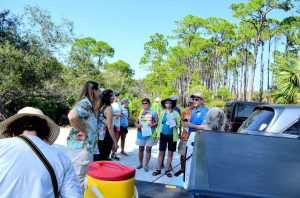
by Ray Bodrey | Jul 11, 2022

The University of Florida/IFAS Extension faculty are reintroducing their acclaimed “Panhandle Outdoors LIVE!” series. Conservation lands and aquatic systems have vulnerabilities and face future threats to their ecological integrity. Come learn about the important role of these ecosystems.
The St. Joseph Bay and Buffer Preserve Ecosystems are home to some of the one richest concentrations of flora and fauna along the Northern Gulf Coast. This area supports an amazing diversity of fish, aquatic invertebrates, turtles, salt marshes and pine flatwoods uplands.
This one-day educational adventure is based at the St. Joseph Bay State Buffer Preserve near the coastal town of Port. St. Joe, Florida. It includes field tours of the unique coastal uplands and shoreline as well as presentations by area Extension Agents.
Details:
Registration fee is $45.
Meals: breakfast, lunch, drinks & snacks provided (you may bring your own)
Attire: outdoor wear, water shoes, bug spray and sun screen
*if afternoon rain is in forecast, outdoor activities may be switched to the morning schedule
Space is limited! Register now! See below.
Tentative schedule:
All Times Eastern
8:00 – 8:30 am Welcome! Breakfast & Overview with Ray Bodrey, Gulf County Extension
8:30 – 9:35 am Diamondback Terrapin Ecology, with Rick O’Connor, Escambia County Extension
9:35 – 9:45 am Q&A
9:45- 10:20 am The Bay Scallop & Habitat, with Ray Bodrey, Gulf County Extension
10:20 – 10:30 am Q&A
10:30 – 10:45 am Break
10:45 – 11:20 am The Hard Structures: Artificial Reefs & Marine Debris, with Scott Jackson, Bay County Extension
11:20 – 11:30 am Q&A
11:30 – 12:05 am The Apalachicola Oyster, Then, Now and What’s Next, with Erik Lovestrand, Franklin County Extension
12:05 – 12:15 pm Q&A
12:15 – 1:00 pm Lunch
1:00 – 2:30 pm Tram Tour of the Buffer Preserve (St. Joseph Bay State Buffer Preserve Staff)
2:30 – 2:40 pm Break
2:40 – 3:20 pm A Walk Among the Black Mangroves (All Extension Agents)
3:20 – 3:30 pm Wrap Up
To attend, you must register for the event at this site:
https://www.eventbrite.com/e/panhandle-outdoors-live-at-st-joseph-bay-tickets-404236802157
For more information please contact Ray Bodrey at 850-639-3200 or rbodrey@ufl.edu
by Carrie Stevenson | May 7, 2021

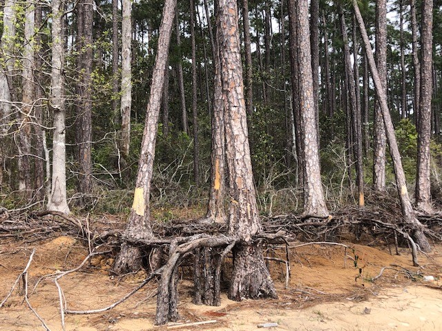
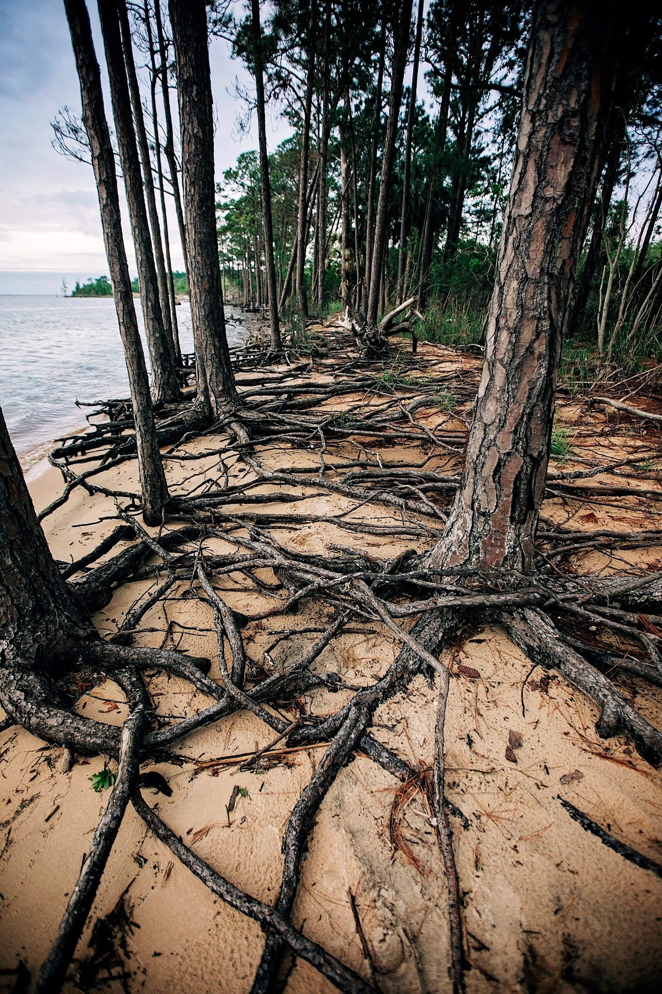
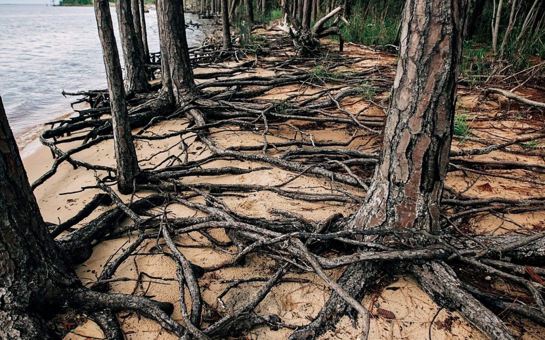
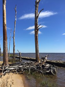
A ghost forest forming along the shoreline of Blackwater Bay in Santa Rosa County. Photo credit: Carrie Stevenson, UF IFAS Extension
As the name implies, they are haunting—wide stretches of standing, dead trees with exposed roots. These “ghost forests” are an unsettling scene in unsettling times for the environment. While coastal erosion is a fact of life—incoming waves, hurricanes, longshore drift of beach sand—the rate of its occurrence is startling lately.
Global rises in sea level due to increased atmospheric carbon levels mean more saltwater is moving into flat, coastal habitats that once served as a buffer from the open water. Salt is an exceedingly difficult compound for plants to handle, and only a few species have evolved mechanisms for tolerating it. Low-growing salt marshes and thick mangrove stands have always served as “first line of defense” buffers to take in wave action and absorb saltwater. If shorelines have too much wave action for marshes to form, wide stretches of sandy beach and dunes serve the same function, protecting the inland species of shrubs and trees. Many coastal areas are flat and stay at or just above sea level for thousands of yards, or even miles. This means that even a small increase in sea level can send saltwater deep into previously freshwater systems, drowning the marsh and flooding stands of oak and pine. The salt and sulfate in seawater will kill a tree quickly, although it may remain standing, dead, for months or years. Hurricanes and tropical storms exacerbate that damage, scouring out chunks of shoreline and knocking down already-unstable trees.

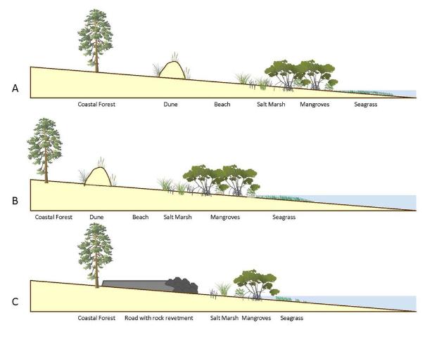
This diagram outlines the changes in coastal vegetation and shorelines as sea level rises. With “ghost forests,” the sea level moves into that coastal forest section. Figure credit: W. Gray, IAN Image Library
A slow increase in sea level could be tolerated and adapted to as salt marshes move inland and replace non-salt tolerant species. But this process of ecological succession can be interrupted if erosion and increased water levels occur too quickly. And if there is hard infrastructure inland of the marshes (like roads or buildings), the system experiences “coastal squeeze,” winnowing the marsh to a thin, eventually nonexistent ribbon, with no natural protection for that expensive infrastructure.
Ghost forests are popping up everywhere. Earlier this month, Popular Mechanics magazine reported on a recently published study that used satellite imagery to document how 11% of a previously healthy forest was converted to standing dead trees along the coast of North Carolina. The trees died within a span of just 35 years (1984-2019). During that time frame, this stretch of coastline also experienced an extended drought and Category 3 Hurricane Irene. These impacts sped up the habitat loss, with over 19,000 hectares converted from forest to marsh and 1100 hectares of marsh vegetation gone, becoming open water.

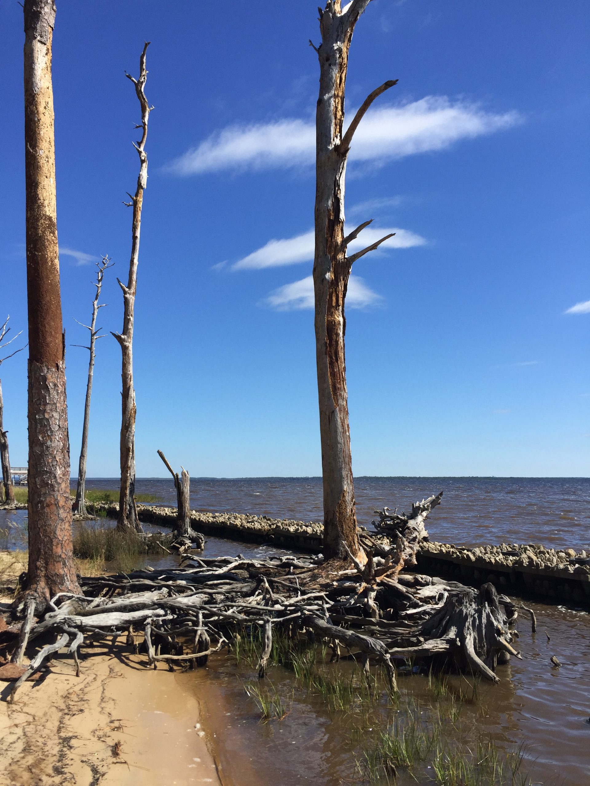
Exposed roots of a ghost forest forming along the Escambia Bay. Photo credit: Deanie Sexton
Due to increased coastal flooding and saltwater standing in forested areas, U.S. Fish and Wildlife Service employees are concerned that the historic Harriett Tubman Byway in Maryland—part of the famed underground railroad of the Civil War era—will soon be gone. Over 5,000 acres of tidal marsh have converted to open water in the area and large stands of trees have died. Even locally, trees along Escambia and Blackwater Bay are dying due to salt damage and heavy erosion. Hurricane Sally delivered a knockout punch to many remaining trees along the scenic bluffs of the bay.
Sea level has risen over 10” in the past 100 years in the Pensacola Bay area, and even mid-range Army Corps of Engineers estimates expect 0.6 to 1.4 feet of rise in the area by 2045. There are some actions we can take to mitigate future damage. Building a “living shoreline” of vegetation along a piece of waterfront property instead of using a seawall can help, especially if the vegetation growth outpaces sea level rise. You can also visit the City of Pensacola’s Climate Task Force report to learn more about climate action recommended (and being taken) locally, such as increasing the use of renewable energy and dedicating staff to sustainability measures.
by Carrie Stevenson | Jul 31, 2020
A living shoreline project was implemented on this bay in Santa Rosa County to try and prevent further erosion. Photo credit: Carrie Stevenson, UF IFAS Extension
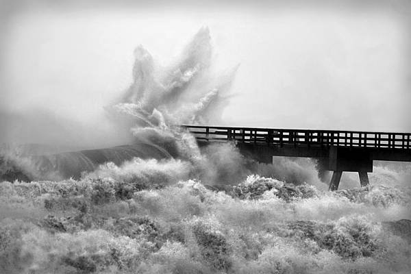
We have reached that time of year when the Atlantic starts cranking out storms, and they will continue to roll out as the dog days of summer progress. Over the last decade, many experts have speculated on how climate change and sea level rise might impact hurricanes in the Gulf of Mexico. Two big issues are coastal erosion and flooding from storm surge and rainfall.
Those who live on the water or frequently visit area shorelines have probably noticed coastal erosion. While a natural part of a coastal ecosystem–and often exacerbated by heavy boat traffic–rising seas can also cause erosion. Sea level rise moves water slowly inland and washes away the roots of grasses and trees that once held the shoreline in place. Buildings and roads close to the water are impacted as well, with “sunny day flooding” on the roads and under pilings in many south Florida cities where water has moved in to stay. Large scale beach renourishment projects, living shorelines, and even road relocations (like the one at Ft. Pickens on Pensacola Beach) are all ways that local officials and property owners can respond to rising seas. However, these efforts always come with a big price tag. When that “line in the sand” is drawn beyond government and household budgets, there will come a point when we can no longer support protection of highly vulnerable coastal infrastructure. The closer a building is physically located to the water (whether built there intentionally or reached by rising seas), the greater the likelihood a hurricane will cause flooding damage from dangerous storm surge. Storm surge and heavy flooding cause 75% of the deaths in any given hurricane.
During a recent webinar, the appropriately named Dr. Chris Landsea of the National Hurricane Center answered several frequently asked questions on the impacts of global warming on hurricanes. Some of the predictions are surprising based on assumptions that have been put out in the media. He made a disclaimer that these are his predictions based on years of expertise and data analysis, and not an official proclamation by the National Hurricane Center. Following are a few of the points he made during his talk.
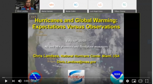
Dr. Chris Landsea of the National Hurricane Center recently met with floodplain managers around the Gulf Coast to discuss hurricanes.
Question: Will hurricanes get stronger based on increased temperatures?
Answer: The world average temperature has gone up 1.5 degrees Fahrenheit in the past 100 years. Based on data and computer modeling from the NOAA Geophysics Lab, typical hurricane wind intensity will increase slightly, by 3%. In this example, a storm with 100 mph average winds would be 103 mph by the end of the 21st century.
Question: Will we experience more tropical storms as the climate changes?
Answer: Dr. Landsea does not expect more tropical storms as the temperature increases. In fact, frequency may drop very slightly. While there may be more heat energy for hurricanes to feed on, the surrounding conditions will make it tougher for a storm to form. Those conditions may be atmospheric or include a vertical wind shear that tears up the storm.
Question: How will global warming affect rainfall during hurricanes?
Answer: Models and recent experience show that rainfall will increase by 10-20% during tropical storms. Global warming increases the amount of moisture in the atmosphere, and a hurricane can recycle this water into a constant loop of rainfall. Hurricane Harvey in Texas was one example of this situation, during which nearly 8 feet of rainfall fell, flooding neighborhoods. One of the aphorisms of climate change is “wet places get wetter, and dry places get drier.”
Dr. Landsea’s full presentation can be found online here, if you are interested in learning more. Keep in mind that these predictions can change based on land use, atmospheric carbon levels, and human practice change. For more on the work UF IFAS is doing on climate, visit this Florida Sea Grant Climate page.