by Laura Tiu | Apr 22, 2016
The Deepwater Horizon (DWH) oil spill occurred about 50 miles offshore of Louisiana in April 2010. Approximately 172 million gallons of oil entered the Gulf of Mexico. Five years after the incident, locals and tourists still have questions. This article addresses the five most common questions.
QUESTION #1: Is Gulf seafood safe to eat?
Ongoing monitoring has shown that Gulf seafood harvested from waters that are open to fishing is safe to eat. Over 22,000 seafood samples have been tested and not a single sample came back with levels above the level of concern. Testing continues today.
QUESTION #2: What are the impacts to wildlife?
This question is difficult to answer as the Gulf of Mexico is a complex ecosystem with many different species — from bacteria, fish, oysters, to whales, turtles, and birds. While oil affected individuals of some fish in the lab, scientists have not found that the spill impacted whole fish populations or communities in the wild. Some fish species populations declined, but eventually rebounded. The oil spill did affect at least one non-fish population, resulting in a mass die-off of bottlenose dolphins. Scientists continue to study fish populations to determine the long term impact of the spill.
Question #3: What cleanup techniques were used, and how were they implemented?
Several different methods were used to remove the oil. Offshore, oil was removed using skimmers, devices used for removing oil from the sea’s surface before it reaches the coastline. Controlled burns were also used, where surface oil was removed by surrounding it with fireproof booms and burning it. Chemical dispersants were used to break up the oil at the surface and below the surface. Shoreline cleanup on beaches involved sifting sand and removing tarballs and mats by hand.
QUESTION #4: Where did the oil go and where is it now?
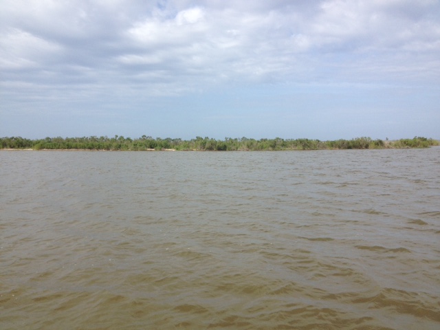
The oil spill covered 29,000 square miles, approximately 4.7% of the Gulf of Mexico’s surface. During and after the spill, oil mixed with Gulf of Mexico waters and made its way into some coastal and deep-sea sediments. Oil moved with the ocean currents along the coast of Texas, Louisiana, Mississippi, Alabama, and Florida. Recent studies show that about 3-5% of the unaccounted oil has made its way onto the seafloor.
QUESTION #5: Do dispersants make it unsafe to swim in the water?
The dispersant used on the spill was a product called Corexit, with doctyl sodium sulfosuccinate (DOSS) as a primary ingredient. Corexit is a concern as exposure to high levels can cause respiratory problems and skin irritation. To evaluate the risk, scientists collected water from more than 26 sites. The highest level of DOSS detected was 425 times lower than the levels of DOSS known to cause harm to humans.
For additional information and publications related to the oil spill please visit: https://gulfseagrant.wordpress.com/oilspilloutreach/
Adapted From:
Maung-Douglass, E., Wilson, M., Graham, L., Hale, C., Sempier, S., and Swann, L. (2015). Oil Spill Science: Top 5 Frequently Asked Questions about the Deepwater Horizon oil spill. GOMSG-G-15-002.
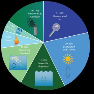
An estimate of what happened to approximately 200 million gallons oil from the DWH oil spill. Data from Lehr, 2014. (Florida Sea Grant/Anna Hinkeldey)
The Foundation for the Gator Nation, An Equal Opportunity Institution.

by Rick O'Connor | Apr 22, 2016
ALL PHOTOS: MOLLY O’CONNOR
As many of you already know each month we have posted articles about nature tourism locations along the Intracoastal Waterway in the Florida Panhandle. This month we visit coastal Okaloosa County.
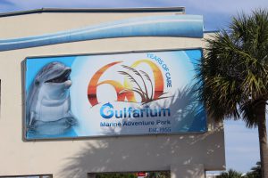
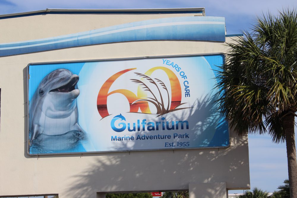
The Gulfarium in Ft. Walton Beach gives those who do not get a chance to go offshore, or dive, to see some of the unique marine organisms found in the Gulf of Mexico.

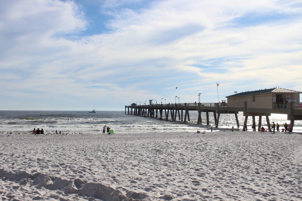
As with many other fishing piers along the panhandle, the Okaloosa Pier not only provides a spot for good fishing but a good spot to watch for marine life and great sunsets.
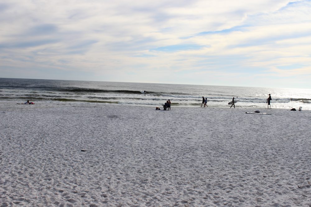
For years’ tourists have been visiting the beaches of Ft. Walton and Destin. The big draw has been the clean white sand but the area is also known for its really clear water. This clear water has supported a charter fleet that focuses on diving and fishing, but in recent years several operations have included inshore snorkeling and even trawling for marine life for tourists to view.
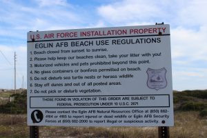
Many feel that you are not allowed on Eglin property. This is true for much of the island under their jurisdiction but there are places where you can park and enjoy the beach – though you must obey their rules.
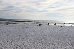
Residents enjoying the beach at one of the public access points on Eglin property.
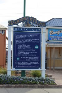
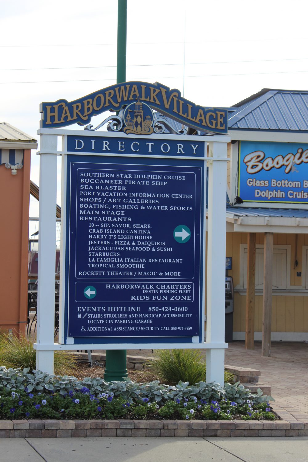
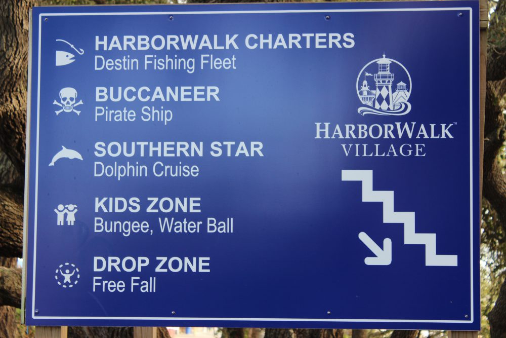
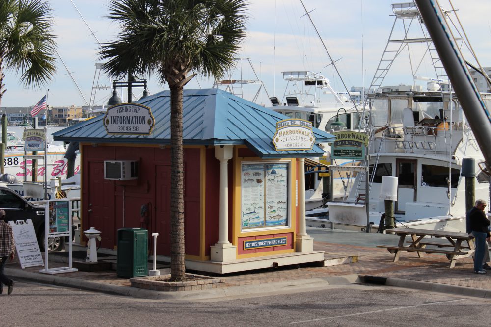
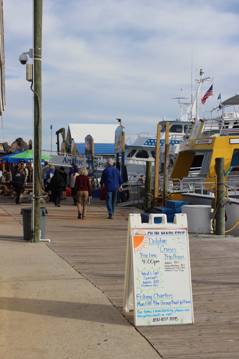
Destin harbor is now home the Haborwalk. There is a lot to see and do on the Haborwalk – and plenty of boat tours.
This sign gives the visitor some idea of the different activities that can be found along the Haborwalk.
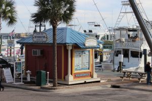
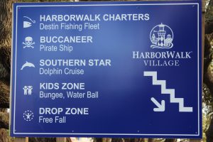
There are numerous types of tours to found along the Harborwalk. Information booths such as this one can help you find what you are looking for.
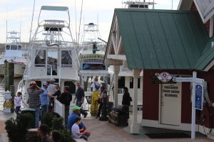
Charters include fishing, diving, snorkeling, and some collect marine life for you to see.

Dolphin cruises are very popular.
There are sailing charters that will allow you to experience the Gulf of Mexico, sunset cruises, and there are some designed with kids in mind.
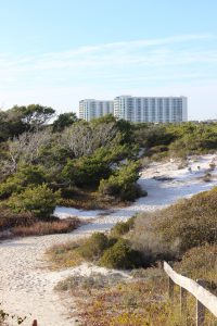
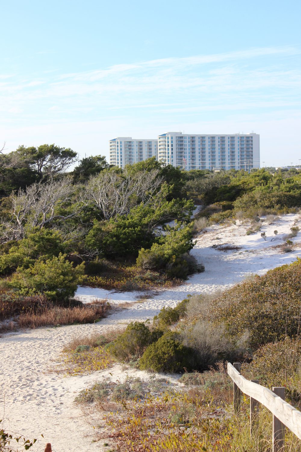
Henderson State Park is on the south side of Highway 98. It has hiking trails, a campground, and access to the Gulf. This is a nice natural location within a very urban area.
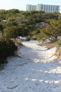
One of the scenic trails where you can explore the natural dune ecosystem in Henderson State Park
ARTIFICIAL REEFS
The natural substrate for most of the northern Gulf of Mexico is quartz sand. There are areas of hard bottom, shell hash, and even some natural reefs but sand dominates the landscape beneath the waves. There is no question that the natural coral reefs of the Florida Keys have been a huge economic engine for that part of the state. The clear, high saline water is filtered by the Everglades and allows much needed light to reach the tiny coral polyps and their symbiotic plant partners, which in turn produce limestone substrate for the polyp colonies to live and grow on.
Locally we have rivers that discharge into the Gulf but the water clarity is still pretty good. The bigger problem for coral development here is the cold winter temperatures and the lack of hard substrate for coral colonies to attach. There are several species of corals, and other encrusting invertebrates and plants, that can tolerate our cooler winters but substrate is still an issue. The answer… artificial substrate… artificial reefs.
Northwest Florida and Alabama have one of the most active artificial reef programs anywhere. Thousands of structures from small concrete pyramids, to chicken coops, to U.S. Navy vessels have been dropped to the bottom. The concept is “build it… and they will come” – meaning the encrusting organisms and eventually larger predatory fishes. At first artificial reefs were just left over rubble and car bodies that were indiscriminately dropped on the Gulf floor. But over years’ marine scientists began to monitor and evaluate what works and what does not and artificial reefs became a science. One question has not been answered… do artificial reefs generate more fish for fishermen – or do they just congregate the existing number of fish into more easily accessible points in the Gulf for easy capture? There is science that supports both arguments… and the debate continues. But if you want to know whether artificial reefs have been an economic success the answer is… yes… by the tens of millions of dollars it has. The charter fleets of Ft. Walton, Destin, Panama City, and Pensacola have all benefited from the artificial reef program. There are numerous structures to dive and many are part of the Florida Panhandle Shipwreck Trail.
If you get a chance take a charter and dive, or fish, one of these interesting and well thought out habitats. Next month we head further east to Walton County and the famous “30A” highway.

by Rick O'Connor | Apr 22, 2016
Many folks are putting together a “bucket list” of things they would like to do or see before they can no longer do them. For many interested in natural resources there are certain national parks and scenic places they would like to visit. Other natural resource fans have a list of wildlife species they would like to see.
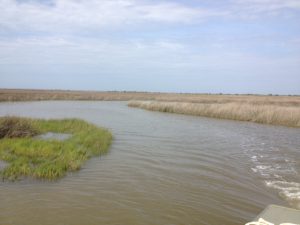
Terrapins inhabit creeks, such as this one, within the expanse of the salt marsh. Here you can see their heads pop up above the water and you may get lucky enough to find one basking.
Photo: Rick O’Connor
Recently I hooked with famed Alabama outdoorsman Jimbo Meador to search for locations to find Alabama turtles. Jimbo has been fishing, hunting, and enjoying the Mobile Bay area all of his life and he now using that knowledge as a guide in a nature-based tourism project. He recently received a call from a group of gentleman from another part of the country who had on their bucket list viewing 1000 reptilian species in their native habitat. In Alabama they were interested in the Black-knobbed Map Turtle, the Alabama Red Belly, and the Diamondback Terrapin. Jimbo has just begun the first module of the Florida Master Naturalist Program and reached out to us for advice on where to find these guys. Luckily, after working with scientists from the University of Alabama at Birmingham, I knew where to find diamondback terrapins – and have a pretty good idea on the others.
These “diamonds of the marsh” – as they are sometimes called – are very elusive creatures. They inhabit muddy bottom creeks within extensive salt marsh habitat all along the Gulf and East coast of the United States. I spent two years searching the Florida panhandle before I found my first live animal. It was one of the odd things though – once you have seen one, you now know what you are looking for and begin to find more.
I took Jimbo to a location near Dauphin Island where about 150 terrapins are believed to exist. Terrapins spend most of their day within creeks that meander through acres of salt marsh. The odd thing is there may be hundreds of creeks within these marshes and the terrapins – for some reason – will select their favorites and hang there. You can spend all day paddling through perfect looking creeks not seeing a head at all… then all of sudden… you enter one creek… not really any different than the others… and there they are.
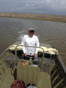
Veteran waterman and outdoor guide, Jimbo Meador, explores the marshes near Dauphin Island for the elusive diamondback terrapin.
Photo: Rick O’Connor
Within these creeks they feed on a variety of shellfish but particularly like the marsh periwinkles. These small snails are the ones that climb the cordgrass and needlerush plants during high tide to avoid their nemesis the blue crab and the diamondback terrapin. Terrapins do crawl out of the water to bask in the sun and have been known to bury in the loose fine mud. Females must find high dry ground to lay her eggs. She may swim as far as 5 miles from her home creek to find a suitable beach. They do like sandy beaches that are open and free of most plants. They emerge onto these beaches during May and June to lay about 7-10 eggs. Most females will lay more than one clutch each season emerging once every 16 days or so. Different from sea turtles – terrapins nest during the daylight hours. Actually the sunnier – the better. Raccoons are a big problem… find and consuming the eggs; on some beaches researchers have reported 90% or more of the nest have been raided by the furry guys. Crows, snakes, and possibly armadillos will take nests as well. If the developing young survive the 60+ days of incubation, they will emerge and head for the grass areas of the marsh… not the water. Here they will spend the first year of their life living more like a land turtle before they make their way to the brackish waters of the salt marsh.
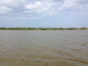
Open sandy beaches, such as the one in this photograph, are the spots females terrapins seek when they are ready to dig a nest.
Photo: Rick O’Connor
These are fascinating creatures and should be on everyone’s natural resource bucket list. The hard effort of finding them really makes doing so very rewarding. On this day Jimbo saw only one head – I did not see any. I have found in my study site that I see more heads in the afternoon (we were out in the morning). I do not know if this is the case at all terrapin nesting sites, but something to consider when looking. Though we did not find many that day he now knows what to look for when searching for them. Next we will have to hunt the Alabama Red Belly Turtle. That is another story for another day.
We will continue this series with other interesting wildlife creatures to “hunt” in the Florida panhandle.
by Chris Verlinde | Apr 8, 2016
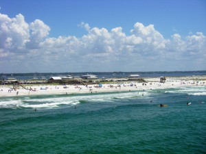
The sugary white sands along the Panhandle, attract millions of visitors to our area throughout the year. It is important for locals and visitors to understand and consider the following tips for safety at the beach.
The danger of rip currents far outweighs the danger of having a shark encounter. As a result of past storms, the nearshore sandbars along our beaches have changed and the frequency of rip currents has increased. A rip current is a turbulent, fast flowing current that can carry a swimmer out to sea very quickly. The currents are formed when water rushes out to sea in a narrow path (like a break in the nearshore sandbar or from an obstruction of the current caused by a groin or jetty or other type of barrier). Rip currents can last for a few hours or may be permanent; they usually exist when the surf is rough and after storms, but can occur on calm days.
Some signs of rip currents include:
- A difference in water color. The water may be murkier from increased sediments or appear darker because it is deeper.
- A channel of churning, choppy water.
- A line of foam, seaweed or debris being carried directly out to sea.
Rip currents can be difficult to spot. Wearing polarized sunglasses will help you recognize changes in water color. Click here to learn more about rip currents.
If you are caught in a rip current, try not to panic or swim against the current. Swim to the left or right of the current, parallel to shore until you are out of the current. Rip currents range in width from a few feet to many feet wide. If you can’t break out of the current, float calmly out until it ends, usually just beyond the breakers. Then swim diagonally to shore.
Remember, always use common sense and swim responsibly. For current surf conditions check out the National Weather Service rip current forecast.
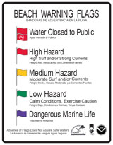
Know the meaning of the beach warning flags:
- A double red flagmeans the water is closed to the public.
- A single red flag means the surf is very dangerous and you should stay out of the water.
- A yellow flag indicates that you should take caution when in the water.
- A green flag indicates that conditions are safe for swimming.
- A purple flag means there could be dangerous marine life such as jellyfish.
When swimming at the beach it is important to remember that the Gulf of Mexico is a wilderness, not a swimming pool. Use common sense when enjoying the Gulf. Some safety tips to remember include:
- Swim near a life guard.
- Know your swimming abilities and limits, if you can’t swim stay out of the water.
- Swim in groups or use the buddy system; never swim alone.
- Be aware of weather conditions; get out of the water and away from the beach during electrical storms. Taking shelter in a building is best, but otherwise a car.
- Always enter the water, feet first every time!
- Don’t swim in murky waters or between dusk and dawn.
- Stay calm in the event of an emergency.
- Pay attention and know the meaning of beach warning flags. Pay attention to lifeguards.
- Avoid swimming in areas where people are fishing.
- To avoid being stung by a sting ray, shuffle your feet, this will stir up the sand and scare away sting rays.
- Always wear sunscreen or protect your skin with clothing.
- If you see someone in trouble, get help from a lifeguard, have someone call 9-1-1. Throw the victim something that will float and yell instructions on how to escape. Remember, many drown while trying to save someone from a rip current.
Follow these tips to help make a visit to the beach a safe one!
by Carrie Stevenson | Apr 8, 2016
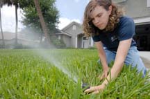
Extension agent Janet Bargar checks the water flow and direction of a pop-up irrigation system at a home. (AP photo/University of Florida/Josh Wickham)
Early spring is a great time of year to reevaluate your lawn and landscape water needs. University of Florida studies have shown that in homes utilizing automatic sprinkler systems, 50% of total home water consumption in the summer comes from running a sprinkler system. When a homeowner is using utility water, they are typically charged twice; first for bringing the water in and second for wastewater fees. Estimated costs for irrigating a 5,000 square foot yard range from $5-$25 per irrigation session. So how does one cut down?
To start with, check your sprinkler system for efficiency. Turn on the water, stand back, and watch it run. Look for broken or clogged heads (evident by uneven and high-volume spray), or leaks within the water line. Clean out the heads or replace these broken parts—most are very inexpensive and found in the plumbing section of home improvement stores. Look at the reach of the spray, and make sure irrigation water is not landing wastefully on roads, sidewalks, or adjacent houses. To paraphrase a wise colleague, “No matter how much you water it, concrete won’t grow.”
Many of our clientele ask how long an irrigation system should be run and how much water plants should get. Ideally, turf and landscape plants should get ½” to ¾” of water per application. The frequency of application varies by plant needs, weather, and soil type. For very sandy soils, some specialists have recommended applying less water at a slightly more frequent rate, since sandy soils are unable to hold water in the root zone of plants for long. Mulching around plants and amending soils with organic material can help improve a soil’s water-holding capacity.

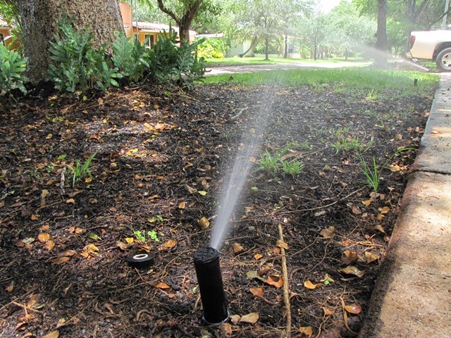
An efficient irrigation system should direct water to the root system of a landscape and reduce overspray onto homes and sidewalks. Photo credit: UF IFAS
A simple sprinkler calibration can be conducted by spreading empty aluminum cans around one’s yard, and turning on each sprinkler zone. Run each zone for 30 minutes and measure how deep the water is in the cans. If the water depth is within the recommended amounts, no changes are needed. However if it’s not deep enough or greater than ¾” of an inch, run times should be adjusted accordingly. If some of the cans receive a noticeably different amount of water than those adjacent to them, it is a signal that the reach of the spray heads is not adequately set and should be corrected to make sure the entire landscape has even coverage.
The primary goal of supplemental irrigation is for the plants’ root zones to be wet, but not saturated or too dry. Ideally, established lawns and landscapes should thrive on rainfall after initial establishment, and only take irrigation in longer periods of drought. However, this is contingent on the planting of Florida-friendly vegetation and a homeowner with a keen eye to the condition of one’s plants, who is willing to turn the sprinkler system to “manual” and wait for his or her plants to start drooping before turning on the water. In reality, most homeowners find it difficult to take this much time and care with their irrigation system, and opt for the “water every two or three days whether needed or not” approach, even in parts of the state with water restrictions. In fact, anecdotal evidence seems to show that homeowners only allowed to water lawns one or two days a week will overdo it just to make sure their plants survive.
Luckily, new technology exists that can take the guesswork out of irrigation for a homeowner, while keeping plants alive and conserving water at the same time. “Smart” irrigation systems include soil moisture sensors and evapotranspiration (ET) controllers. Soil moisture sensors (SMS) use electrodes buried within the root zone of turf, which are calibrated to a certain level of moisture in the soil. The system is only allowed to run when water levels drop below a preset threshold. ET (evapotranspiration) controllers monitor weather conditions on site or from a nearby weather station, using satellite signals to determine when plants will need additional water.