by Andrea Albertin | Jun 8, 2018
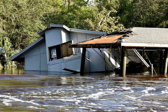
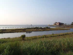
Flooding along the South Prong of the Black Creek River in Clay County on September 13, 2017. Photo credit: Tim Donovan, Florida Fish and Wildlife Conservation Commission (FWC).
As hurricane season is upon us again, I wanted to share the results of work that UF/IFAS Extension staff did with collaborators from Virginia Tech and Texas A&M University to help private well owners impacted by Hurricanes Irma and Harvey last year. This work highlights just how important it is to be prepared for this year’s hurricane season and to make sure that if flooding does occur, those that depend on private wells for household use take the proper precautions to ensure the safety of their drinking water.
About 2.5 million Floridians (approximately 12% of the population) rely on private wells for home consumption. While public water systems are regulated by the U.S. Environmental Protection Agency to ensure safe drinking water, private wells are not regulated. Private well users are responsible for ensuring the safety of their own water.
Hurricanes Irma and Harvey
In response to widespread damage and flooding caused by Hurricane Harvey in Texas and Irma in Florida in August and September 2017, Virginia Polytechnic Institute and State University (VT) received a Rapid Research Response Grant from the National Science Foundation to offer free well water testing to homeowners impacted by flooding.
They partnered with Texas A&M AgriLife Extension’s Well Owner Network (run by Diane Boellstorff and Drew Gholson) and us, at UF/IFAS Extension to provide this service. The effort at VT was led by members of Marc Edward’s lab in the Civil Engineering Department: Kelsey Pieper, Kristine Mapili, William Rhoads, and Greg House.
VT made 1,200 sampling kits available in Texas and 500 in Florida, and offered free analysis for total coliform bacteria and E. coli as well as other parameters, including nitrate, lead, arsenic, iron, chloride, sodium, manganese, copper, fluoride, sulfate, and hardness (calcium and magnesium). Homeowners were also asked to complete a needs assessment questionnaire regarding their well system characteristics, knowledge of proper maintenance and testing, perceptions of the safety of their water and how to best engage them in future outreach and education efforts.
Response in the aftermath of Irma
Although the sampling kits were available, a major challenge in the wake of Irma was getting the word out as counties were just beginning to assess damage and many areas were without power. We coordinated the sampling effort out of Quincy, Florida, where I am based, and spread the word to extension agents in the rest of the state primarily through a group texting app, by telephone and by word of mouth. Extension agents in 6 affected counties (Lee, Pasco, Sarasota, Marion, Clay and Putnam) responded with a need for sample kits, and they in turn advertised sampling to their residents through press releases.
Residents picked up sampling kits and returned water samples and surveys on specified days and the samples were shipped overnight and analyzed at VT, in Blacksburg, VA. Anyone from nearby counties was welcome to submit samples as well. This effort complemented free well water sampling offered by multiple county health departments throughout the state.
In all, 179 water samples from Florida were analyzed at VT and results of the bacterial analysis are shown in the table below. Of 154 valid samples, 58 (38%) tested positive for total coliform bacteria, and 3 (2%) tested positive for E. coli. Results of the inorganic parameters and the needs assessment questionnaire are still being analyzed.
Table 1. Bacterial analysis of private wells in Florida after Hurricane Irma.
| County |
Number of samples (n) |
Positive for total coliform (n) |
Positive total coliform (%) |
Positive for E. coli (n) |
Positive for E. coli (%) |
| Citrus |
1 |
0 |
0% |
0 |
0% |
| Clay |
13 |
5 |
38% |
0 |
0% |
| Hernando |
2 |
1 |
50% |
0 |
0% |
| Hillsborough |
1 |
1 |
100% |
0 |
0% |
| Marion |
19 |
5 |
26% |
1 |
5% |
| Monroe |
1 |
0 |
0% |
0 |
0% |
| Pasco |
40 |
19 |
48% |
1 |
3% |
| Putnam |
61 |
19 |
31% |
0 |
0% |
| Sarasota |
16 |
8 |
50% |
1 |
6% |
| Overall |
154 |
58 |
38% |
3 |
2% |
Of 630 samples analyzed in Texas over the course of 7 weeks post-Hurricane Harvey, 293 samples (47% of wells) tested positive for total coliform bacteria and 75 samples (2%) tested positive for E. coli.
What to do if pathogens are found
Following Florida Department of Health (FDOH) guidelines, we recommended well disinfection to residents whose samples tested positive for total coliform bacteria, or both total coliform and E. coli. This is generally done through shock chlorination by either hiring a well operator or by doing it yourself. The FDOH website provides information on potential contaminants, how to shock chlorinate a well and how to maintain your well to ensure the quality of your well water (http://www.floridahealth.gov/environmental-health/private-well-testing/index.html).
UF/IFAS extension agents that led the sampling efforts in their respective counties were: Roy Beckford – Lee County; Brad Burbaugh – Clay County; Whitney Elmore – Pasco County; Sharon Treen – Putnam and Flagler Counties; Abbey Tyrna – Sarasota County and Yilin Zhuang – Marion County.
We at IFAS Extension are working on using results from this sampling effort and the needs assessment questionnaire filled out by residents to develop the UF/IFAS Florida Well Owner Network. Our goal is to provide residents with educational materials and classes to address gaps in knowledge regarding well maintenance, the importance of testing and recommended treatments when pathogens and other contaminants are present.
Remember: Get your well water tested if flooding occurs
It’s important to remember that if any flooding occurs on your property that affects your well and/or septic system, you should have your well water tested in a certified laboratory for pathogens (total coliform bacteria and E. coli) and any other parameters your local health department may recommend.
Most county health departments accept samples for water testing. You can also submit samples to a certified commercial lab near you. Contact your county health department for information about what to have your water tested for and how to take and submit the sample.
Contact information for county health departments can be found online at: http://www.floridahealth.gov/programs-and-services/county-health-departments/find-a-county-health-department/index.html
You can search for laboratories near you certified by FDOH here: https://fldeploc.dep.state.fl.us/aams/loc_search.asp This includes county health department labs as well as commercial labs, university labs and others.
You should also have your well water tested at any time when:
- The color, taste or odor of your well water changes or if you suspect that someone became sick after drinking your well water
- A new well is drilled or if you have had maintenance done on your existing well
Testing well water once a year is good practice to ensure the safety of your household’s drinking water.
by Sheila Dunning | Apr 14, 2018
Having just completed the Okaloosa/Walton Uplands Master Naturalist course, I would like to share information from the project that was presented by Ann Foley.
The Florida Torreya. Photo provided by Shelia Dunning
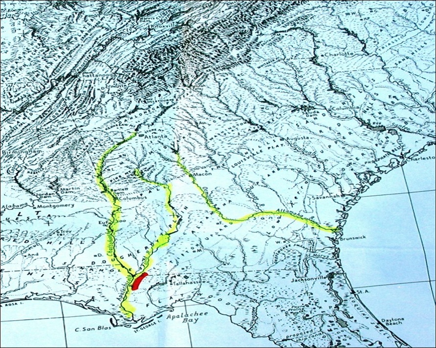
The Florida Torreya is the most endangered tree in North America, and perhaps the world! Less than 1% of the historical population survives. Unless something is done soon, it may disappear entirely! You can see them on public lands in Florida at Apalachicola Bluffs and Ravines Preserve and beautiful Torreya State Park.
The Florida Torreya (Torreya taxifolia) is one of the oldest known tree species on earth; 160 million years old. It was originally an Appalachian Mountains ranged tree. As a result of our last “Ice Age” melt, retreating Icebergs pushed ground from the Northern Hemisphere, bringing the Florida Torreya and many other northern plant species with them.
The Florida Torreya was “left behind” in its current native pocket refuge, a short 40 mile stretch along the banks of the Apalachicola River. There were estimates of 600,000 to 1,000,000 of these trees in the 1800’s. Torreya State Park, named for this special tree, is currently home to about 600 of them. Barely thriving, this tree prefers a shady habitat with dark, moist, sandy loam of limestone origin which the park has to offer.
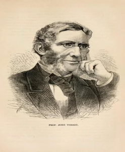
Hardy Bryan Croom, Botanist, discovered the tree in 1833, along the bluffs and ravines of Jackson, Liberty and Gadsen Counties, Florida and Decatur County in Georgia. He named it Florida Torreya (TOR-ee-uh), in honor of Dr. John Torrey, a renowned 18th century scientist.
Torreya trees are evergreen conifers, conically shaped, have whorled branches and stiff, sharp pointed, dark green needle-like leaves. Scientists noted the Torreya’s decline as far back as the 1950’s! Mature tree heights were once noted at 60 feet, but today’s trees are immature specimens of 3-6 feet, thought to be ‘root/stump sprouts.’
Known locally as “Stinking Cedar,” due to its strong smell when the leaves and cones are crushed, it was used for fence posts, cabinets, roof shingles, Christmas trees and riverboat fuel. Over-harvesting in the past and natural processes are taking a tremendous toll. Fungi are attacking weakened trees, causing the critically endangered species to die-off. Other declining factors include: drought, habitat loss, deer and loss of reproductive capability.
With federal and state protection, the Florida Torreya was listed as an endangered species in 1983. There is great concern for this ancient tree in scientific community and with citizen organizations. Efforts are underway to help bring this tree back from the edge of extinction!
Efforts include CRISPR gene editing technology research being done by the University of Florida Dept. of Forest Resources and Conservation- making the tree more resistant to disease. Torreya Guardians “rewilding and “assisted migration”. Reintroducing the tree to it’s former native range in the north near the Biltmore Estate in Asheville, NC, which has maintained a grove of Torreya trees and offspring since 1939 and supplying seeds for propagation from their healthy forest. Long before saving the earth became a global concern, Dr. Seuss (Theodor Seuss Geisel), spoke through his character the Lorax warning against urban progress and the danger it posed to the earth’s natural beauty. All of these groups, and many others, hope their efforts will collectively help bring this tree back from the brink!
by Rick O'Connor | Feb 16, 2018
As a young boy growing up here in the panhandle, I had heard of this thing called a manatee – but had never seen one. They came more into the light when I was a teenager and becoming interested in marine biology. I was the president of the high school marine biology club and one of our goals was to raise money for a trip to Crystal River to snorkel with them. The Save the Manatee Club originated in that time trying to bring more awareness to the plight of this endangered Floridian and at one point, Jimmy Buffett had led the way.
I had learned a lot about them, found out their original range was from North Carolina south to the Caribbean and the entire Gulf of Mexico, but were now down to about 1000 animals and those were found in Florida. Eventually I did get to see manatees, and have snorkeled with them many times, but still thought of them as a south Florida animal – rarely found in the panhandle.

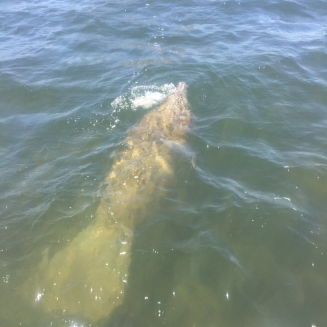
Manatee swimming in Big Lagoon near Pensacola.
Photo: Marsha Stanton
Then the recent news report – two dead manatees in the last two weeks. One washed ashore in Okaloosa county and the other in Escambia. Probably victims of the recent cold fronts. It is not unheard of finding manatees in the panhandle in recent years. I recall since the 1990’s a manatee seen in Bayou Texar in Pensacola. In another year, one was seen near Ft. Pickens. My son worked at a local marina and saw at least one a year there. There have been so many seen in the Mobile Bay area that Dauphin Island Sea Lab now has a Manatee Watch program. There are about 40 individuals that now visit Wakulla Springs. In addition, this summer there were two separate groups living in the Pensacola area. One group was residing near Gulf Breeze and a second group of about eight animals was frequently seen near Perdido Key. These once rare animals in the panhandle are now being found each year, and sometimes in groups.
What is going on?
Why are manatees beginning to visit our area?
Your first hunch would be climate change. Manatees are marine mammals but unlike their dolphin cousins their blubber layer is not as thick and they must seek warm water refuge during the winter months. When water temperatures drop below 67°F, they locate the warm water springs found in central Florida – or move south Florida where the water remains comfortable year round. If they are remaining here, could the average water temperatures have warmed enough for them to make this move?
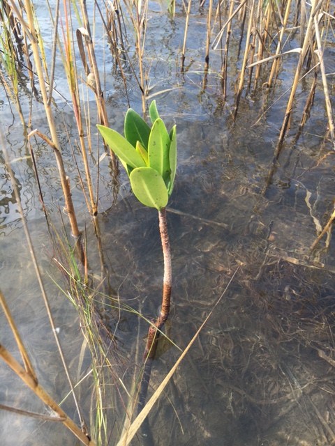
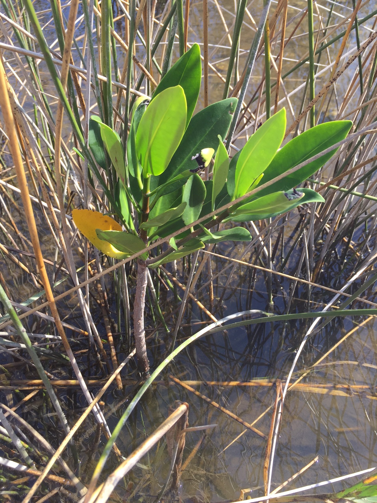
Along this same line, mangroves are now being found in the panhandle. Both red and black mangroves have been found growing in local estuaries. In the Apalachicola area there have been quite a few located. In the western panhandle there a few individuals here and there. Further west they are found on the islands of Mississippi and have been in the Chandeleurs for many years now. Later this spring Florida Sea Grant will be conducting surveys in each county to see where these tropical trees may be growing.

A small red mangrove growing in Big Lagoon near Pensacola FL
Photo: Rick O’Connor
And most recently are sightings of snook, a south Florida fish that have, though rare, been seen in the northern Gulf of Mexico. No doubt this Januarys hard freezes probably killed the mangroves that were here, and probably the two manatees washed ashore recently, but it will be an interesting time to see what other tropical species begin their slow migration northward. If it does happen, what will that mean? How will these changes impact local ecosystems? At this point, I am not sure if it will happen or, if it does, how fast – but it will be interesting.
by Carrie Stevenson | Nov 3, 2017
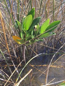
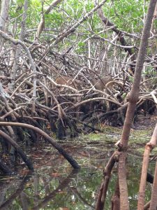
Red mangrove growing among black needlerush in Perdido Key. Photo credit: Carrie Stevenson, UF IFAS Extension
Discovering something new is possibly the most exciting thing a field biologist can do. As students, budding biologists imagine coming across something no one else has ever noticed before, maybe even getting the opportunity to name a new bird, fish, or plant after themselves.
Well, here in Pensacola, we are discovering something that, while already named and common in other places, is extraordinarily rare for us. What we have found are red mangroves. Mangroves are small to medium-sized trees that grow in brackish coastal marshes. There are three common kinds of mangroves, black (Avicennia germinans), white (Laguncularia racemosa), and red (Rhizophora mangle).
Black mangroves are typically the northernmost dwelling species, as they can tolerate occasional freezes. They have maintained a large population in south Louisiana’s Chandeleur Islands for many years. White and red mangroves, however, typically thrive in climates that are warmer year-round—think of a latitude near Cedar Key and south. The unique prop roots of a red mangrove (often called a “walking tree”) jut out of the water, forming a thick mat of difficult-to-walk-through habitat for coastal fish, birds, and mammals. In tropical and semi-tropical locations, they form a highly productive ecosystem for estuarine fish and invertebrates, including sea urchins, oysters, mangrove and mud crabs, snapper, snook, and shrimp.
Interestingly, botanists and ecologists have been observing an expansion in range for all mangroves in the past few years. A study published 3 years ago (Cavanaugh, 2014) documented mangroves moving north along a stretch of coastline near St. Augustine. There, the mangrove population doubled between 1984-2011. The working theory behind this expansion (observed worldwide) is not necessarily warming average temperatures, but fewer hard freezes in the winter. The handful of red mangroves we have identified in the Perdido Key area have been living among the needlerush and cordgrass-dominated salt marsh quite happily for at least a full year.
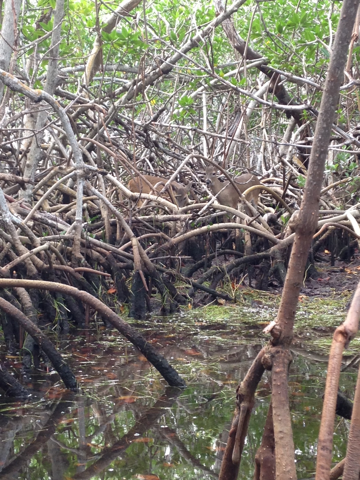
Key deer thrive in mangrove forests in south Florida. Photo credit: Carrie Stevenson, UF IFAS Extension
Two researchers from Dauphin Island Sea Lab are planning to expand a study published in 2014 to determine the extent of mangrove expansion in the northern Gulf Coast. After observing black mangroves growing on barrier islands in Mississippi and Alabama, we are working with them to start a citizen science initiative that may help locate more mangroves in the Florida panhandle.
So what does all of this mean? Are mangroves taking over our salt marshes? Where did they come from? Are they going to outcompete our salt marshes by shading them out, as they have elsewhere? Will this change the food web within the marshes? Will we start getting roseate spoonbills and frigate birds nesting in north Florida? Is this a fluke due to a single warm winter, and they will die off when we get a freeze below 25° F in January? These are the questions we, and our fellow ecologists, will be asking and researching. What we do know is that red mangrove propagules (seed pods) have been floating up to north Florida for many years, but never had the right conditions to take root and thrive. Mangroves are native, beneficial plants that stabilize and protect coastlines from storms and erosion and provide valuable food and habitat for wildlife. Only time will tell if they will become commonplace in our area.
If you are curious about mangroves or interested in volunteering as an observer for the upcoming study, please contact me at ctsteven@ufl.edu. We enjoy hearing from our readers.
by Carrie Stevenson | Aug 25, 2017
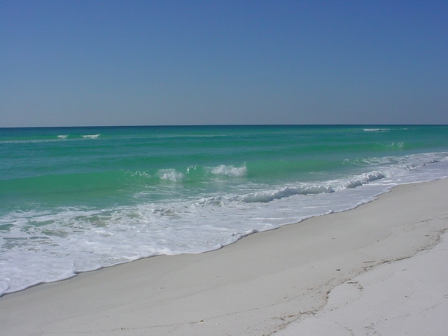
Life on the Gulf Coast can be beautiful, but has its share of complications. Photo credit: Carrie Stevenson, UF IFAS Extension
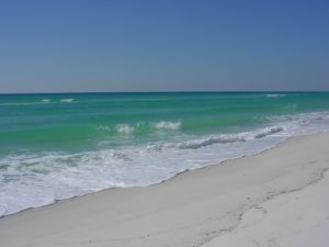
Life on the coast has tremendous benefits; steady sea breezes, gorgeous beaches, plentiful fishing and paddling opportunities. Nevertheless, there are definite downsides to living along it, too. Besides storms like Hurricane Harvey making semi-regular appearances, our proximity to the water can make us more vulnerable to flooding and waterborne hazards ranging from bacteria to jellyfish. One year-round problem for those living directly on a shoreline is erosion. Causes for shoreline erosion are wide-ranging; heavy boat traffic, foot traffic, storms, lack of vegetation with anchoring roots, and sea level rise.
Many homeowners experiencing loss of property due to erosion unwittingly contribute to it by installing seawalls. When incoming waves hit the hard surface of the wall, energy reflects back and moves down the coast. Often, an adjacent homeowner will experience increased erosion and bank scouring after a neighboring property installs a seawall. This will often lead that neighbor to install a seawall themselves, transferring the problem further.
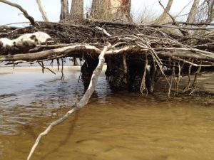
Erosion can damage root systems of shoreline trees and grasses. Photo credit: Carrie Stevenson, UF IFAS Extension
Currently, south Louisiana is experiencing significant coastal erosion and wetlands losses. The problem is compounded by several factors, including canals dredged by oil companies, which damage and break up large patches of the marsh. Subsidence, in which the land is literally sinking under the sea, is happening due to a reduced load of sediment coming down the Mississippi River. Sea level rise has contributed to erosion, and most recently, an invasive insect has caused large-scale death of over 100,000 acres of Roseau cane (Phragmites australis). Add the residual impacts from the oil spill, and you can understand the complexity of the situation.
Luckily, there are ways to address coastal erosion, on both the small and large scale. On Gulf and Atlantic beaches, numerous coastal communities have invested millions in beach renourishment, in which offshore sand is barged to the coast to lengthen and deepen beaches. This practice, while common, can be controversial because of the cost and risk of beaches washing out during storms and regular tides. However, as long as tourism is the #1 economic driver in the state, the return on investment seems to be worth it.
On quieter waters like bays and bayous, living shorelines have “taken root” as a popular method of restoring property and stabilizing shorelines. This involves planting marsh grasses along a sandy shore, often with oyster or rock breakwaters placed waterward to slow down wave energy, and allow newly planted grasses to take root.
Locally in Bayou Grande, a group of neighbors were experiencing shoreline erosion. Over a span of 50 years, the property owners used a patchwork of legally installed seawalls, bulkheads, rip rap piles, private boat ramps, piers, mooring poles and just about anything else one can imagine, to reduce the problem. Over time, the seawalls and bulkheads failed, lowering the property value of the very property they were meant to protect and increasing noticeable physical damage to the adjacent properties.”
Project Greenshores is a large-scale living shoreline project in Pensacola. Photo credit: Carrie Stevenson, UF IFAS Extension
In 2011, a group of neighboring property owners along the bayou decided to take action. After considering many repair options, the neighbors decided to pursue a living shoreline based on aesthetics, long-term viability, installation cost, maintenance cost, storm damage mitigation and feasibility of installation. By 2017, the living shoreline was constructed. Oyster shell piles were placed to slow down wave energy as it approached the transition zone from the long fetch across the bayou, while uplands damage was repaired and native marsh grasses and uplands plants were restored to slow down freshwater as it flowed towards the bayou. Sand is now accruing as opposed to eroding along the shoreline. Wading shorebirds are now a constant companion and live oysters are appearing along the entire 1,200-foot length. Additionally the living shoreline solution provided access to resources, volunteer help, and property owner sweat equity opportunities that otherwise would have been unavailable. An attribute that has surprisingly appeared – waterfront property owners are now able to keep their nicely manicured lawns down to within 30 feet of the water’s edge. At that point, the landscape immediately switches back to native marsh plants, which creates a quite robust and attractive intersection. (Text and information courtesy Charles Lurton).
Successes like these all over the state have led the Florida Master Naturalist Program to offer a new special topics course on “Coastal Shoreline Restoration” which provides training in the restoration of living shorelines, oyster reefs, mangroves, and salt marsh, with focus on ecology, benefits, methods, and monitoring techniques. Keep an eye out for this course being offered near you. If you are curious about living shorelines and want to know more, reach out to the Florida Department of Environmental Protection Ecosystem Restoration section for help and read through this online document.
by Carrie Stevenson | Jul 14, 2017

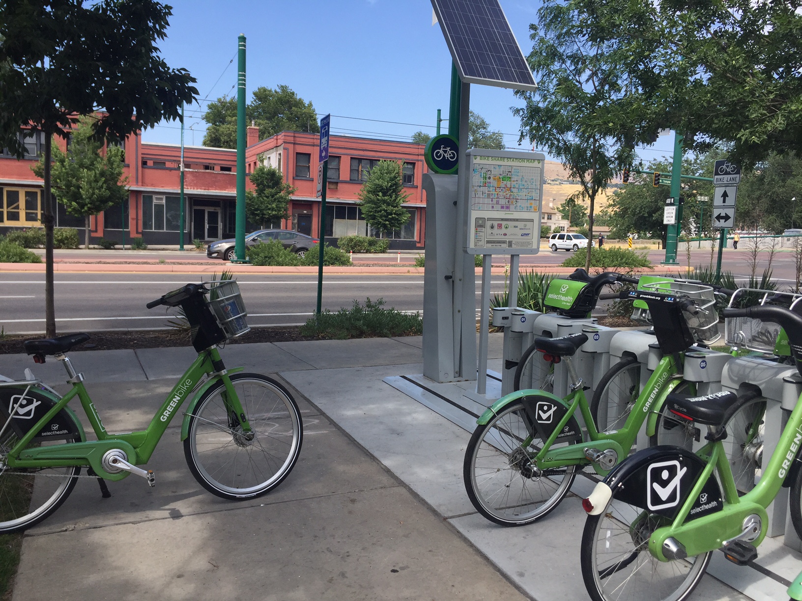
This solar-powered bicycle rental facility provides a healthy alternative to driving around a large city. Photo credit: Carrie Stevenson, UF IFAS Extension
Climate change is one of those topics that most people don’t want to think much about. It can be overwhelming, it can be controversial, and it can be downright frightening. A year ago, Yale and George Mason University completed the most recent surveys in the “Six Americas” study, which determined levels of belief and concern in global warming. The “Six Americas” range from people who are alarmed, concerned, cautious, disengaged, doubtful, or dismissive when asked about climate change. Interestingly enough, 34% of Americans consider themselves concerned while 23% were cautious. Ranking third were 11% who are doubtful about climate change.
When you start to drill down into the individual questions asked on the survey, you see more agreement. For example, when Escambia County citizens were asked whether global warming is caused by human activities, somewhere between 45%-50% said yes. However, when asked whether they think global warming is actually happening (regardless of cause), the percentage went up to 65%-70%. When asked if they support funding research into renewable energy sources, Escambia County residents jumped up to an 80%-85% agreement. That, to me, is nothing short of a miracle, having lived in Escambia County long enough to know there’s rarely that much agreement on anything!
The takeaway message from that survey, to me, is that regardless of where people stand on climate change/global warming, there are some starting points that can be common ground. If the majority of a community believe climate change is happening and that supporting renewable energy research is a good thing, then they can work towards those outcomes to the mutual benefit of all.
An example of one small but significant step towards sustainable energy use includes bicycle share/rental facilities. On a recent trip to Salt Lake City, solar-powered bike stations were strategically placed around the downtown area. For a small fee, the bicycles could be checked out (for 30 minutes at a time) up to 24 hours. This ensures there are plenty of bicycles available for other users, and stations are close enough to one another that it’s easy to check bikes in and out if you need more time. The benefits of encouraging bicycles are numerous; reduced traffic and burning of fossil fuels, reduced need for parking in high-value real estate, and health benefits for riders. The other investment necessary to make biking more prevalent and successful are bike lanes, which were plentiful in Salt Lake City to keep riders and drivers safe. Once safe bike lanes are in place, those who live in the area with their own bikes are more likely to use them on a regular basis, further decreasing vehicular traffic.
There are many great organizations and publications around the country dedicated to increasing bicycle use and safety. For more information, check out Trail Link, Momentum Magazine, or the Burlington Bikeway.