by Rick O'Connor | Jan 14, 2020
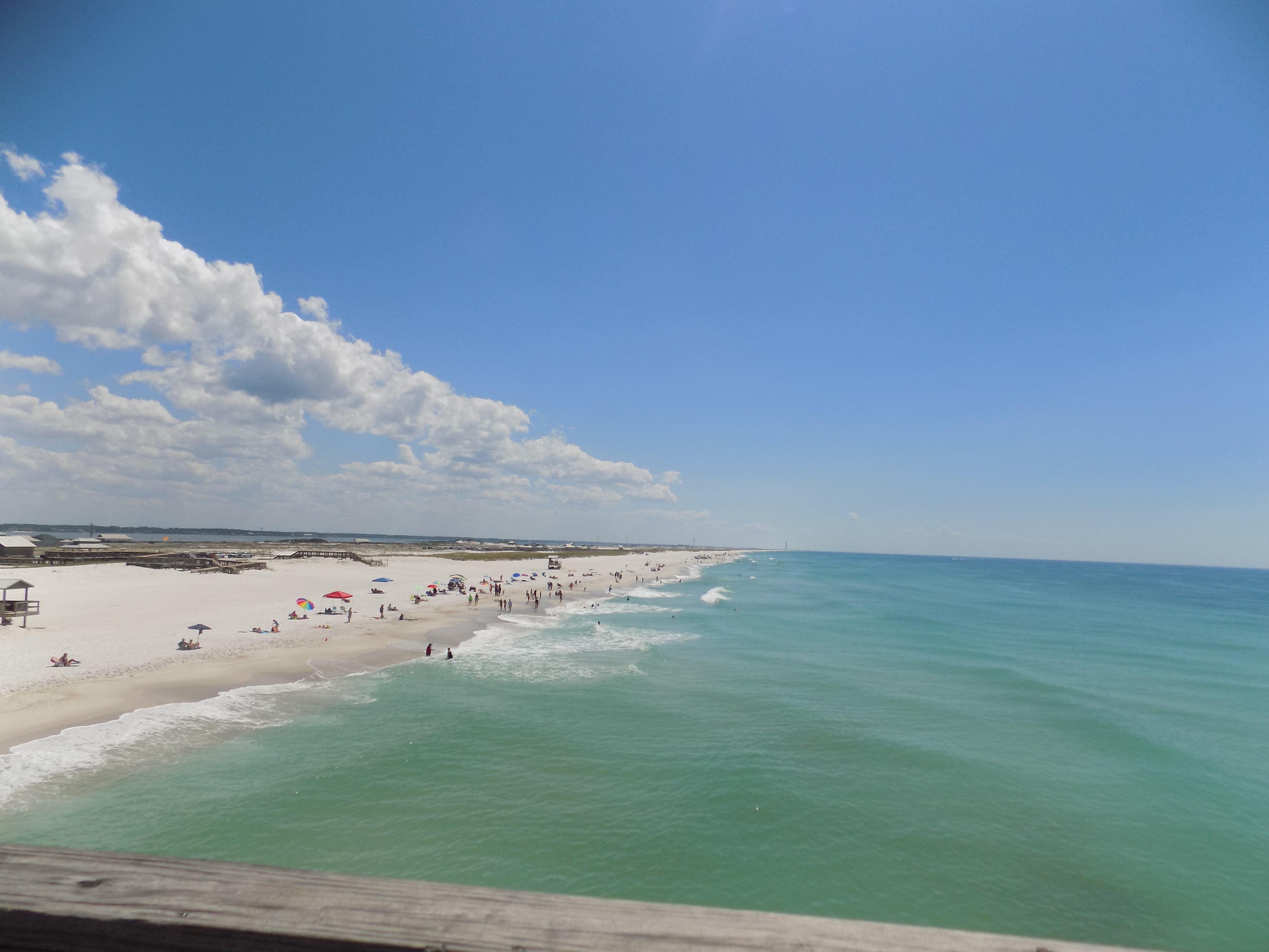
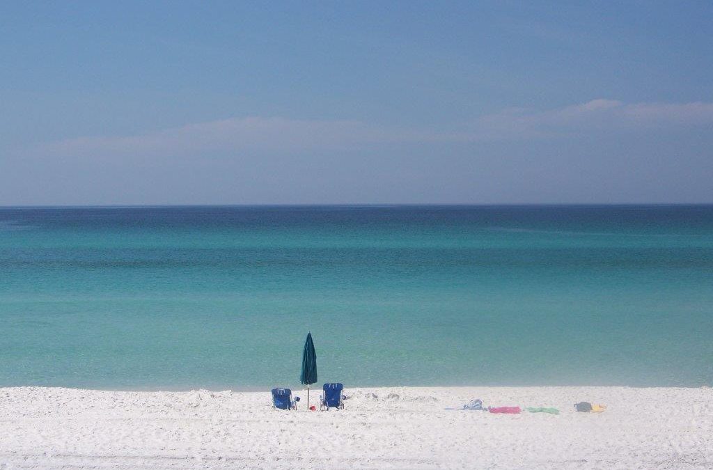
Standing on one of our local beaches, the Gulf of Mexico appears to be a wide expanse of emerald green and cobalt blue waters. We can see the ripples of offshore waves, birds soaring over, and occasionally dolphins breaking the surface. But few of us know, or think, about the environment beneath the waves where 99% of the Gulf lies. We might dream about catching some of the large fish, or taking a cruise, but not about the geology of the bottom, what the water is doing beneath the waves, or what other creatures might live there.
The Gulf of Mexico as seen from Pensacola Beach.
Photo: Molly O’Connor
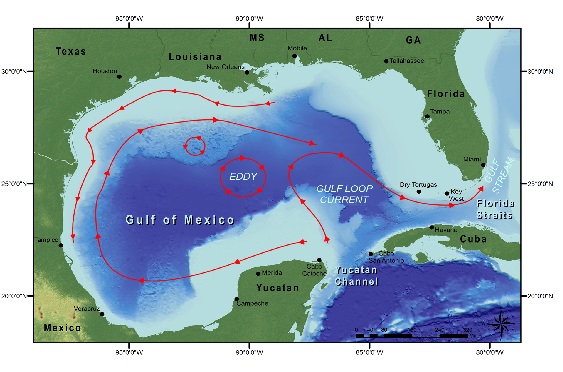
Scanning the horizon from the beach, you are gazing at 600,000 square miles of open water. It is about 950 miles from the panhandle to Mexico. Traveling at 10 knots, it would take you about 3 days to cross at its widest point. The Gulf is almost an enclosed body of water. The bottom is somewhat “bowl” shaped with the deepest portion slightly west of center at a location known as the Sigsbee Deep. The island of Cuba serves as the “median” between where the ocean enters and exits the Gulf. Cycling water from the Atlantic crosses from Africa, through the Caribbean, and enters the between Cuba and the Yucatan. The seafloor here sinks and spills into the Sigsbee Deep. The pass between Cuba and Yucatan is about 6500 feet deep and the bottom of the Sigsbee Deep is about 12,000. If you are looking due south from the Florida Panhandle, you would be looking at this pass.
If your gaze shifted slightly to the right – maybe “1:00” – you would be looking at the Yucatan. The Yucatan itself forms a peninsula and a portion of it is below sea level extending further into the Gulf. This submerged portion of the Yucatan is what oceanographers refer to as a continental shelf. On the “leeward” side of the Yucatan Peninsula lies an area of the Gulf known as the Bay of Campeche. There is a shallow section of this “bay” known as the Campeche Banks which supports amazing fisheries and some mineral extraction. Off the Yucatan shelf there is a current of water that rises from the ocean floor called an upwelling. These upwellings are usually cold water, high in oxygen, and high in nutrients – producing an area of high biological productivity and good fishing.
Continuing to circle the Sigsbee Deep and looking about “2:00”, northwest of the Bay of Campeche, you enter the western Gulf which extends from Vera Cruz Mexico to the Rio Grande River in Texas. The shelf is much closer to shore here and the marine environment is still tropical. There is a steep continental slope that drops into the Sigsbee Deep. Water from the incoming ocean currents usually do not reach these shores, rather they loop back north and east forming the Loop Current. The shelf extends a little seaward where the Rio Grande discharges, leaving a large amount of sediment. In recent years, due to human activities further north, water volume discharge here has decreased.
In the direction of about “2:30”, is the Northwestern Gulf. It begins about the Rio Grande and extends to the Mississippi Delta. Here the continental shelf once again extends far out to sea. One of the larger natural coral reefs in the Gulf system is located here; the Flower Gardens. This reef is about 130 miles off the coast of Texas. The cap is at 55 feet and drops to a depth of 160 feet. Because of the travel distance, and diving depth, few visit this place. Fishing does occur here but is regulated. This shelf is famous for billfishing, shrimping, and fossil fuel extraction. The Mississippi River, 15th largest in the world and the largest in the Gulf, discharges over 590,000 ft3 of water per second. The sediments of this river create the massive marshes and bayous of the Louisiana-Mississippi delta region, which has been referred to as the “birds’ foot” extending into the Gulf. This river also brings a lot of solid and liquid waste from a large portion of the United States and is home to one of the most interesting human cultures in the United States. There is much to discuss and learn about from this portion of the Gulf over this series of articles.

The basin of the Gulf of Mexico showing surface currents.
Image: NOAA
At this point we have almost completely encircled the Sigsbee Deep and move into the eastern Gulf. Things do change here. From the Mississippi delta to Apalachee Bay west of Apalachicola is what is known as the Northeastern Gulf – also known as the northern Gulf – locally called the Gulf coast. This is home to the Florida panhandle and some of the whitest beaches you find anywhere. Offshore the shelf makes a “dip” close to the beach near Pensacola forming a canyon known as the Desoto Canyon. The bottom is a mix of hardbottom and quartz sand. Near the canyon is good fishing and this area, along with the Bay of Campeche, is historically known for its snapper populations. It lies a little north of the Loop Current but is exposed to back eddies from it. Today there is an artificial reef program here and some natural gas platforms off Alabama.
Looking between “9:00-10:00” you are looking at the west coast of Florida and the Florida shelf. Here the shelf extends for almost 200 miles offshore. Off the Big Bend the water is shallow for miles supporting large meadows of seagrass and a completely different kind of biology. The rock is more limestone and the water clearer. In southwest Florida the grassflats support a popular fisheries area and a coral system known as the Florida Middle Grounds. At the edge of the shelf is a steep drop off called the Florida Escarpment, which forms the eastern side of the “bowl”. Another ocean upwelling occurs here.
Looking at “11:00” you are looking towards the Florida Keys. Between the Keys and Cuba is the exit point of the Loop Current called the Florida Straits. It is not as deep as here as it is between Cuba and the Yucatan; only reaching a depth of 2600 feet. This is mostly coral limestone and the base of one of the largest coral reef tracks in the western Atlantic. The coral and sponge reefs, along with the coastal mangroves, forms one of the more biological productive and diverse regions in our area. It supports commercial fishing and tourism.

We did not really talk about the bottom of the “bowl”. Here you find remnants of tectonic activity. Volcanos are not found but you do find cold and hot water vent communities, which look like chimneys pumping tremendous amounts of thermal water from deep in the Earths crust. These vent communities support a neat group of animals that we are just now learning about. Brine lakes have also been discovered. These are depressions in the seafloor where VERY salty water settles. These “lakes” have water much denser than the surrounding seawater and can even create their own waves. Many of them lie as deep as 3300 feet and can be 10 feet deep themselves. There is one known as the “Jacuzzi of Despair”. They are so salty they cannot support much life.
In the next addition to this series we will begin to look at the some of the interesting plant and animals that call the Gulf home.
Embrace the Gulf.
by Rick O'Connor | Jan 10, 2020
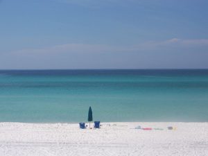
It’s an amazing place really – the Gulf of Mexico. Covering over 598,000 square miles this almost a complete circle of water and home to some interesting geological features, amazing marine organisms, some of busiest ports in the United States, offshore mineral extraction, great vacation locations, and amazing local culture.

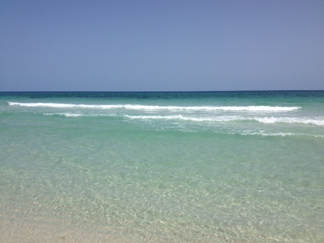
View from the Navarre Beach pier Photo credit: Lydia Weaver
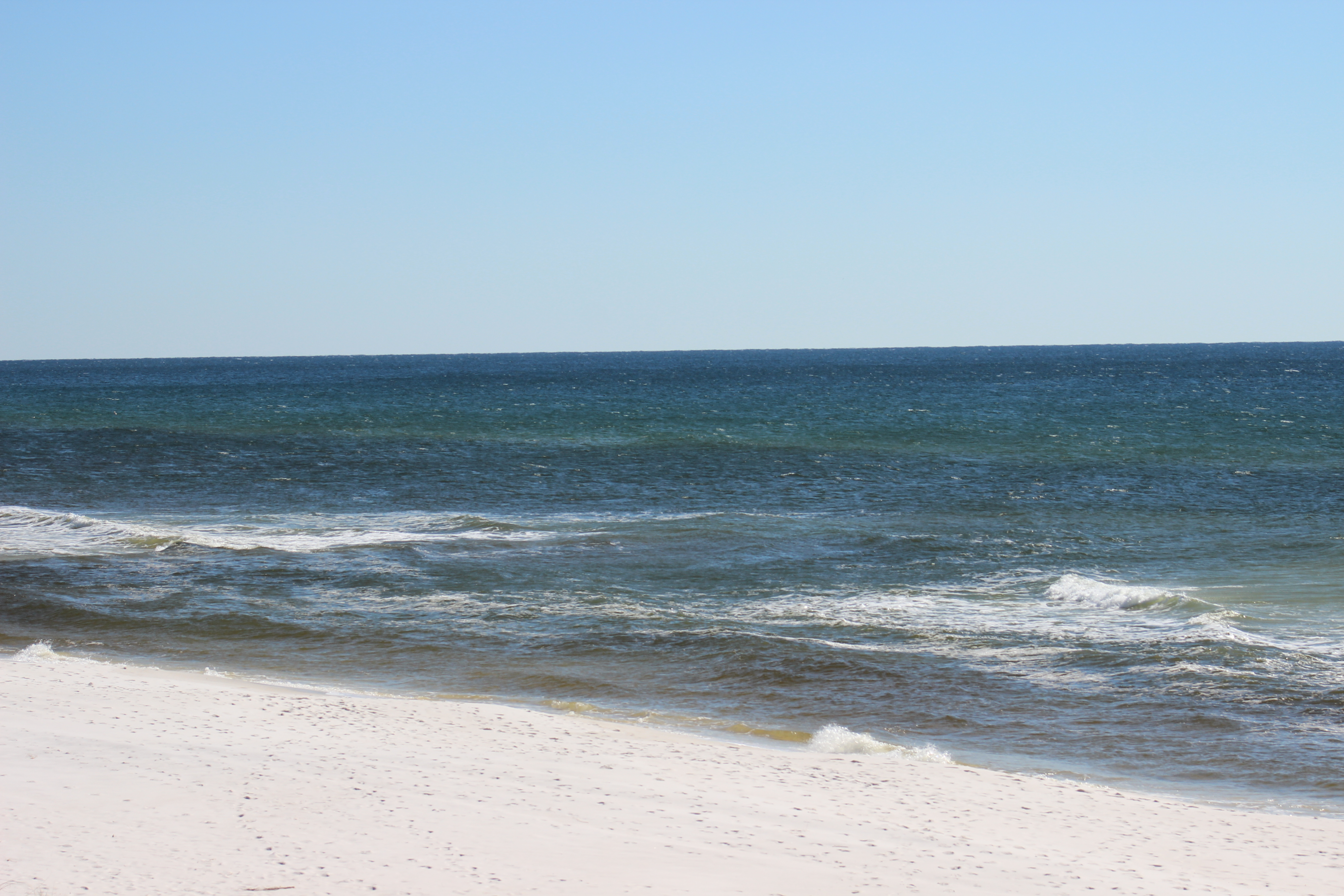
As you stand along Pensacola Beach and look south, you see a wide expanse of water that seems to go on forever. However, in oceanographic terms, the Gulf is not that large of a body of water. Though it is close to 600,000 square miles in size, the Atlantic Ocean is 41,000,000 and the Pacific is 64,000,000 square miles. In addition to area, the mean depth of the Atlantic is a little over 12,000 feet and the Pacific is 14,000 feet. In comparison, the deepest point of the Gulf is 14,000 feet and the mean depth is only 5,000. The shape of the bottom is like a ceramic bowl that was not centered well when fired. The deepest point, the Sigsbee Deep, is about 550 miles southwest (about “2:00” if you are looking from the beach). The shape appears like a hole made by a golf ball that landed in a sand trap. As a matter of fact, there are scientists who believe this is exactly what happened – a large asteroid or comet made have hit the Earth near the Gulf forming a large series of tsunamis and created the Gulf as we know it today.
Either way the “pond” (as some oceanographers refer to it) is an amazing place. The bottom is littered with hot vents, brine lakes, and deep-sea canyons. Large areas of the continental shelf support coral reef formation and a great variety of marine life. Some of the busiest ports in the United States are located along its shores, and it supplies 14% of the wild domestic harvested seafood. Everyone is aware of the mineral resources supplied on the western shelf of the Gulf and the tremendous tourism all states and nations that bordering enjoy.
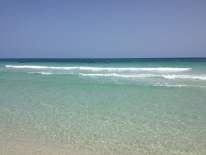
The emerald waters of the Gulf of Mexico along the panhandle.
This year the Gulf of Mexico Alliance will be celebrating “Embracing the Gulf” with a variety of activities and programs across the northern Gulf region. We will be dedicating this column to articles about the Gulf of Mexico all year and discussing some of the topics mentioned above in more detail. We hope you enjoy your time here and get a chance to explore the Gulf’s seafood, fishing, diving, marine life, ship cruises, unique cultures, and awesome sunsets. Embrace the Gulf!
by Laura Tiu | Jan 10, 2020
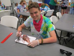
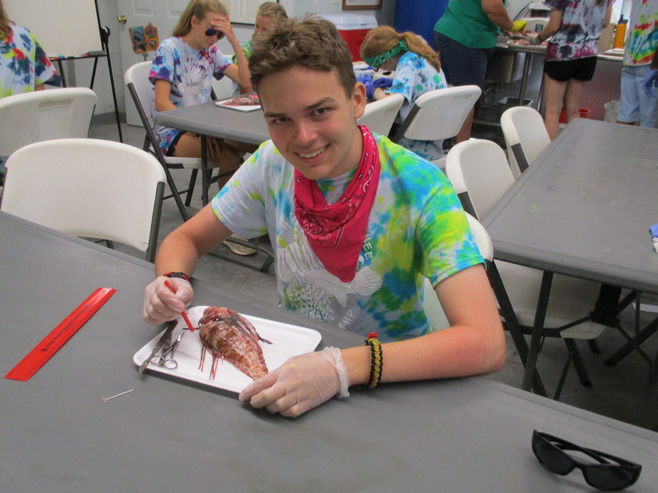
A 4-H youth at Camp Timpoochee Marine Camp dissecting a lionfish.
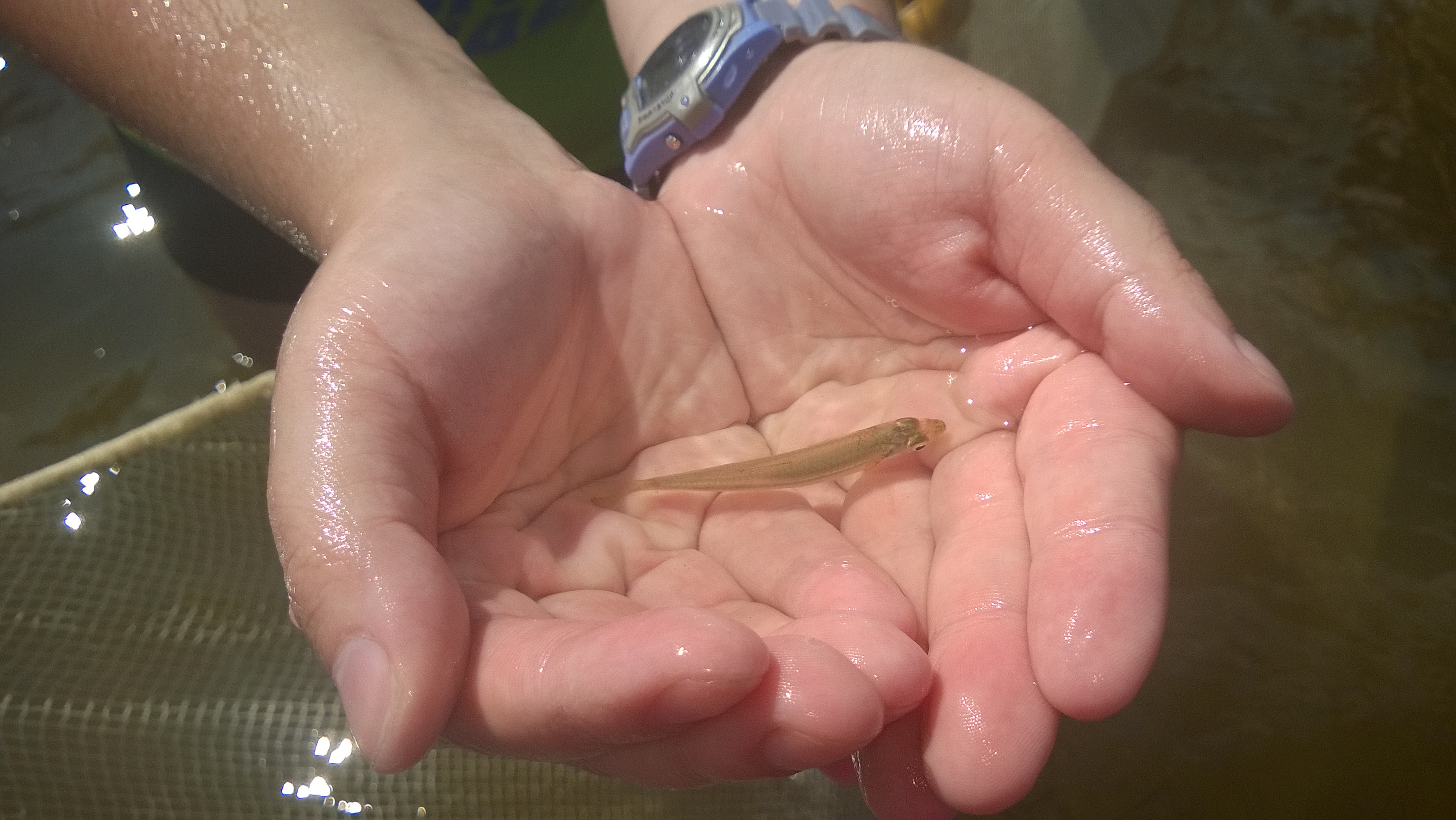
Are you interested in learning about marine life, going fishing, or exploring the underwater world with a mask and snorkel? If so, this is the camp for you! This local education opportunity for budding marine scientists will be happening this summer at Camp Timpoochee in Niceville, FL. The camps enable participants to explore the marine and aquatic ecosystems of Northwest Florida; especially that of the Choctawhatchee Bay. Campers get to experience Florida’s marine environment through fishing, boating snorkeling, games, STEM (science, technology, engineering & math) activities and other outdoor adventures. University of Florida Sea Grant Marine Agents and State 4-H Staff partner to provide hands-on activities exploring and understanding the coastal environment.
Florida Sea Grant has a long history of supporting environmental education for youth and adults to help them become better stewards of the coastal zone. This is accomplished by providing awareness of how our actions affect the health of our watersheds, oceans and coasts and marine camp is a great opportunity for sharing that information. Many of the Sea Grant youth activities use curriculum developed by the national Sea Grant program and geared toward increasing student competency in math, science, chemistry and biology. The curriculum is fun and interesting!
Registration opens Monday, January 13th at 11:00 am CST. The camps fill up quickly, so early registration is encouraged. Marine Camp is open to 4-H members and non 4-H members between the ages of 8-12 (Junior Camp) and ages 13-17 (Senior Camp). In the summer of 2020, there will be one Senior camp, June 22-26, and two Junior Camps, July 13-17 and July 20-24. The cost for Senior Camp is $350 for the week and $300 for Junior Camp.
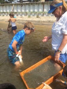
Sampling the benthic community at Timpoochee.
If Marine Camp sounds interesting to someone you know, visit the Camp Timpoochee website at http://florida4h.org/camps_/specialty-camps/marine/ for the 2020
dates and registration instructions. A daily snack from the canteen and a summer camp T-shirt are included in the camp fees, along with three nutritious meals per day prepared on site by our certified food safety staff. All cabins are air-conditioned. So many surprises await at marine camp, come join the fun.
by Rick O'Connor | Jan 8, 2020
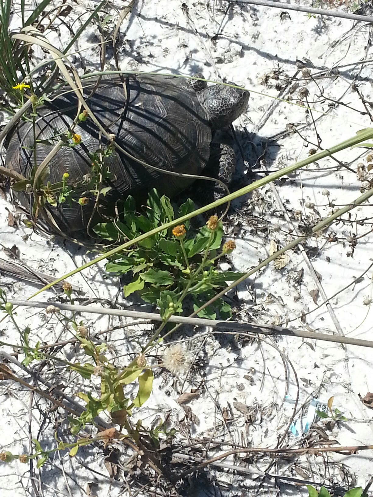
How cool, there is nothing wrong with other animals, but how cool for a year to be dedicated to turtles. And how fitting for the Florida panhandle. Based on the publication Biology and Conservation of Florida Turtles (2006), there are 38 taxa of turtles in our state. The majority of these can be found in the panhandle, particularly near the Apalachicola and Escambia Rivers. Within our state some species are only found at these two locations, and some are only found there on the planet.
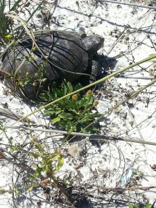
A terrestrial gopher tortoise crossing the sand on Pensacola Beach.
Photo: DJ Zemenick
Everyone loves turtles.
I hear a lot of stories about families trying to rescue while they are crossing highways. And when it comes to conservation, most will tell you “don’t mess with the turtles”. They are not kola bears… but they’re close. So, we are excited that 2020 is not only the year to Embrace the Gulf of Mexico, but also the Year of Turtle, and we plan to post one article a month highlighting the species richness of our area.
Let’s start with turtles in general.
Most know they are vertebrates but may not know the backbone and ribs support the framework for their famous shell. The top portion of this shell, where the backbone is, is called the carapace. The hard portion covering their chest area is the plastron. And they are connected by the bridge. The shell is a series of bony plates covered with scales (scutes). These scales are what put them in the class Reptilia. Fish also have scales but differ from reptiles in that they have gills instead of lungs. Most turtles are excellent swimmers, but they must hold their breath underwater, and some can do this for quite a long time.
All turtles are in the same Order Chelonia. The terms tortoise and terrapin are more cultural than biological. There are 7 families, and 25 species, of turtles found in Florida. Some are marine, and some terrestrial, but most are what we call “riverine”, living in freshwater.
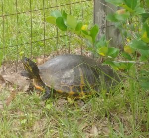
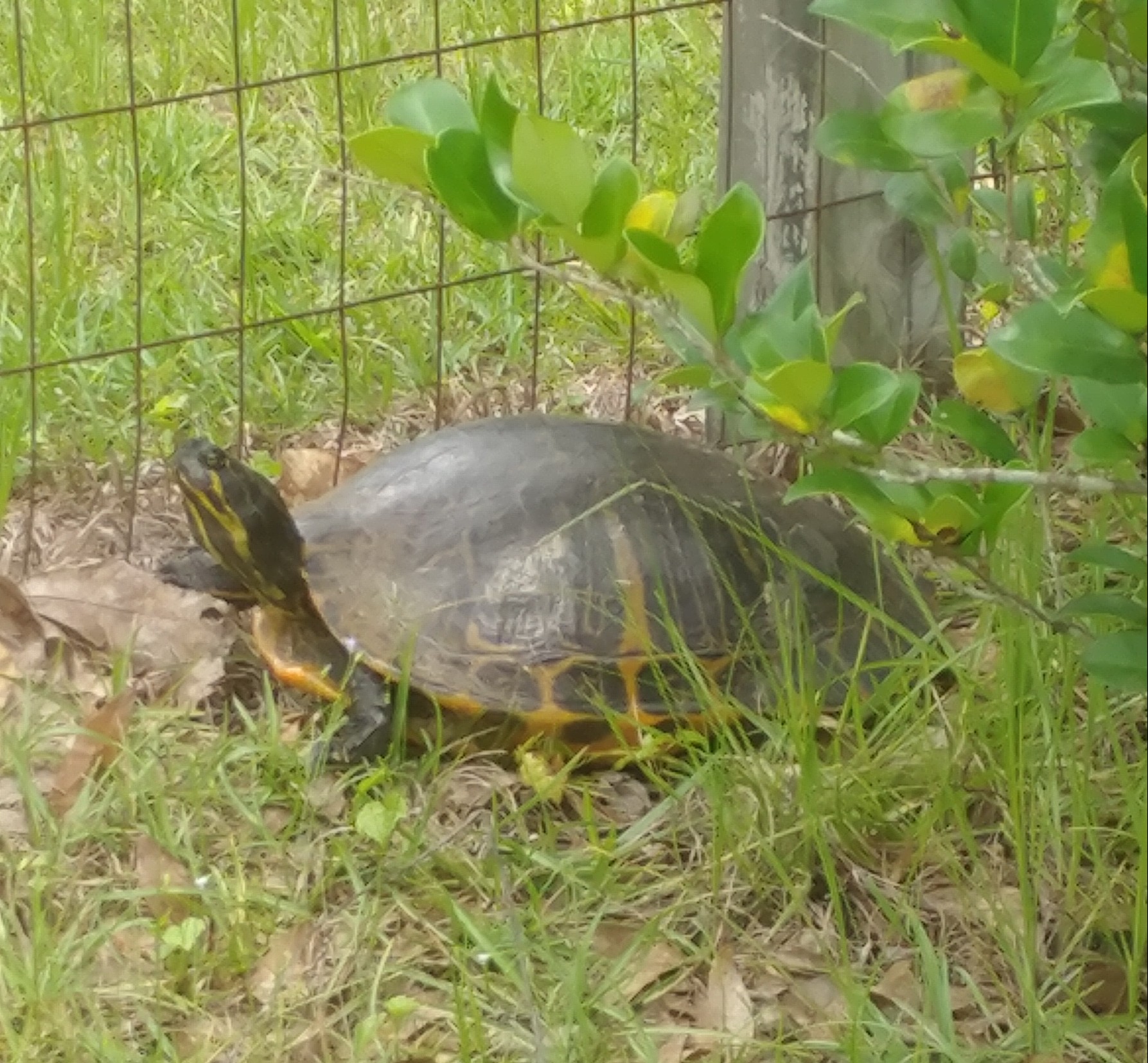
This aquatic Florida Cooter was found crossing a locals yard.
Photo: Deb Mozert
Turtles lack teeth but do have a blade like beak they can cut with. In general, smooth blades are carnivorous, serrated ones herbivorous, and their omnivorous turtles as well. Most prey are small, and most carnivores must conceal themselves to ambush their prey. Though depicted as slow animals in fairy tales and stories, turtles can be quite fast for a few seconds.
Most are diurnal (active during daylight hours) but some nocturnal activity does occur. They spend parts of their day basking on logs and other platforms to warm – turtles are ectothermic and rely on the sun for heat.
Mating occurs in the spring. And despite the fact that most are aquatic, nesting occurs on land for all. Except for a few live bearers, reptiles lay cledoic eggs (shelled) buried on dry ground. Sex is determined by the temperature of the egg in all except the softshell turtles, with eggs at 30° C or higher producing females.
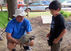
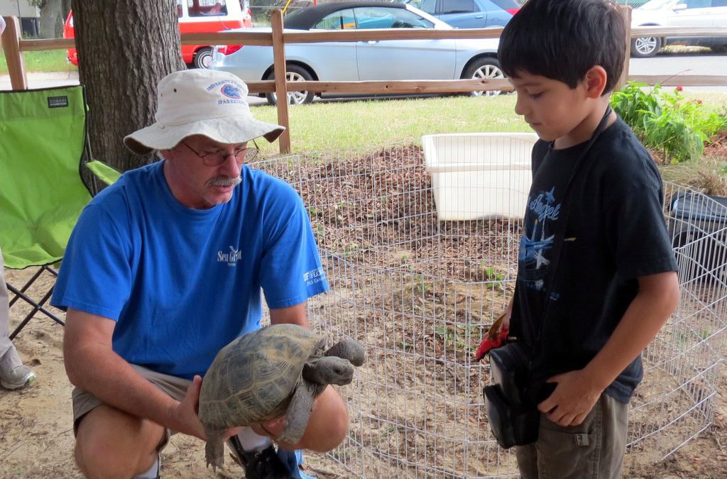
Teaching our youth about the great diversity of Florida’s turtles.
Photo: Molly O’Connor
Despite their need for warm climates, they can be found throughout the United States. But it is the warm humid southeast where they thrive. Especially the northern Gulf Coast where 60″ of rainfall each year is the norm. We will bring you an article about a new species every other week throughout this year.
Let’s Celebrate the Year if the Turtle.
by Sheila Dunning | Dec 13, 2019
As the migratory birds stop off or stay in the Panhandle this winter, they need to find food, food and more food. There is a wide variety of migration activity in Florida beginning in the fall months of September, October, and November. From woodland song birds to waterfowl to the annual warbler invasion, so many different species show up in Florida. While year-to-year migration patterns and winter foraging grounds can shift for some species due to a variety of reasons, some birds stay in Florida for the winter months of December, January, and February. Some may arrive early and others may stay late.
Some North American breeding birds endure harsh winters; however, they are physically suited for cold environments in a number of ways. One, they are able to drop their metabolic rate to a near comatose state using very little energy. Two, they are able to position their feathers, or puff up, to trap heat generated by their own body. Others need to head to warmer climates.
Birds migrate for two reasons. Food and weather avoidance. North American breeding birds who nest in the northern part of the continent will migrate south for the winter. As winter approaches, insect and plant life diminishes in the snow-covered states. Migrating birds head south in search of food. Places like Florida are rich in insects, plant life, and nesting grounds.
Birds need high energy food to stay warm. Berry and seed producing plants contain proteins, sugars and lots of fats. Many native trees, shrubs and grasses can aid migratory and winter visiting birds in their relentless search for food. Gardening for birds and other wildlife enables an opportunity for people to experience animals up close, which providing an important habitat in the urban environment.
For more information on which plants are preferred by specific bird species go to: https://www.audubon.org/native-plants
For more information on landscaping for wildlife refer to: https://edis.ifas.ufl.edu/pdffiles/UW/UW17500.pdf

by Sheila Dunning | Oct 10, 2019
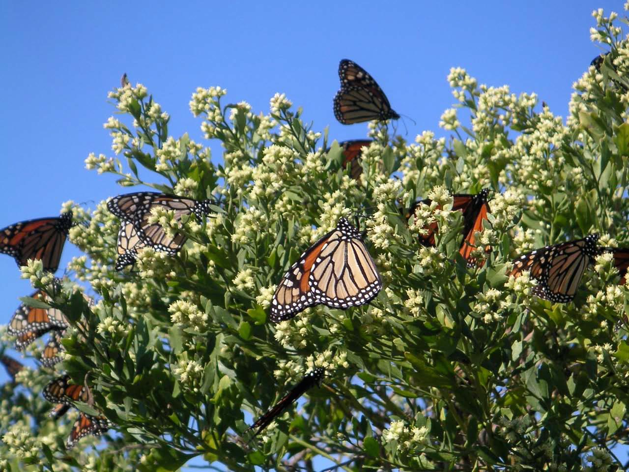
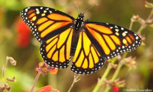 Over 1.8 million Monarch butterflies have been tagged and tracked over the past 27 years. This October these iconic beauties will flutter through the Florida Panhandle on their way to the Oyamel fir forests on 12 mountaintops in central Mexico. Monarch Watch volunteers and citizen scientists will be waiting to record, tag and release the butterflies in hopes of learning more about their migration and what the 2019 population count will be.
This spring, scientists from World Wildlife Fund Mexico estimated the population size of the overwintering Monarchs to be 6.05 hectacres of trees covered in orange. As the weather warmed, the butterflies headed north towards Canada (about three weeks early). It’s an impressive 2,000 mile adventure for an animal weighing less than 1 gram. Those butterflies west of the Rocky Mountains headed up California; while the eastern insects traveled over the “corn belt” and into New England. When August brought cooler days, all the Monarchs headed back south.
What the 2018 Monarch Watch data revealed was alarming. The returning eastern Monarch butterfly population had increased by 144 percent, the highest count since 2006. But, the count still represented a decline of 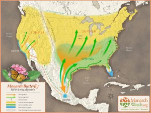 90% from historic levels of the 1990’s. Additionally, the western population plummeted to a record low of 30,000, down from 1.2 million two decades ago. With estimated populations around 42 million, the U.S. Fish and Wildlife Service began the process of deciding whether to list the Monarch butterfly as endangered or threatened in 2014. With the additional information, FWS set a deadline of June 2019 to decide whether to pursue the listing.
Scientists estimate that 6 hectacres is the threshold to be out of the immediate danger of migratory collapse. To put things in scale: A single winter storm in January 2002 killed an estimated 500 million Monarchs in their Mexico home. However, with recent changes on the status of the Endangered Species Act, the U.S. Fish and Wildlife Service has delayed its decision until December 2020. One more year of data may be helpful to monarch conservation efforts.
 Individuals can help with the monitoring and restoring the Monarch butterflies habitat. There are two scheduled tagging events in Panhandle, possibly more. St. Mark’s National Wildlife Refuge is holding their Butterfly Festival on Saturday, October 26 from 10a.m. to 4 p.m. Henderson Beach State Park in Destin will have 200 butterflies to tag and release on Saturday, November from 9 – 11 a.m. Ask around in the local area. There may be more opportunities.
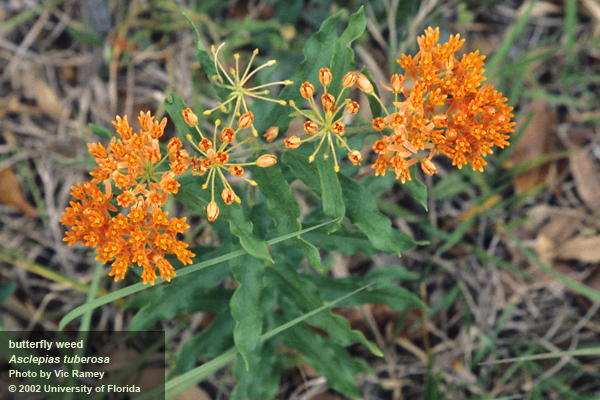
There is something more you can do to increase the success of the butterflies along their migratory path – plant more Milkweed (Asclepias spp.). It’s the only plant the Monarch caterpillar will eat. When they leave their hibernation in Mexico around February or March, the adults must find Milkweed all along the path to Canada in order to lay their eggs. Butterflies only live two to six weeks. They must mate and lay eggs along the way in order for the population to continue its flight. Each generation must have Milkweed about every 700 miles. Check with the local nurseries for plants. Though orange is the most common native species, Milkweed comes in many colors and leaf shapes.