In Part 1 of The Estuary’s Natural Filtration System article, we discussed the major contributors to natural filtration inside of the estuary. These examples included oysters, marsh plants, and seagrasses. In Part 2, we will discuss the smaller filter-feeding organisms including tunicates, barnacles, clams, and anemones.
Tunicates
Pleated Sea Squirt – Photo Credit: Don Levitan, PH.D. FSU
Tunicates, also known as sea squirts, are very interesting marine invertebrates and can be easily confused for a sponge. There are many different types of tunicates in the estuaries and can be either solitary or colonial. You might’ve seen these at an aquarium attached to different substrates, and when removed from the water, their name sea squirt comes into play. Tunicates have a defense mechanism to shoot out the water inside their body in hopes of being released by any predator.
Tunicates are filter feeders and intake water through their inhalant siphons and expel waste and filtered water through their exhalant siphons. Tunicates can filter out phytoplankton, algae, detritus, and other suspended nutrients. The tunicate produces a mucus that catches these nutrients as it passes through, and the mucus is then conveyed to the intestine where it is digested and absorbed.
An invader to the Gulf of Mexico, the Pleated Sea Squirt (Styela plicata), hitched rides on the hulls of ships and found the Gulf of Mexico waters very favorable. You can sometimes spot these organisms on ropes that have been submerged for a long period of time in salty waters. Even though they are non-native, these sea squirts can filter, on average, 19 gallons of water per day.
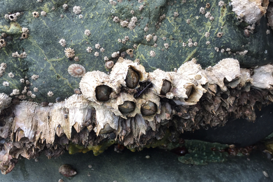
Barnacles
Barnacles along the seashore is a common site for many. Photo: NOAA
One organism that seems ubiquitous worldwide is the barnacle (Genus Semibalanus and Genus Lepas). The Genus Semibalanus contains the common encrusting barnacle we are accustomed to seeing in our waterways along pilings, submerged rocks, and even other animals (turtles, whales, crabs, and oysters). The Genus Lepas contains Gooseneck Barnacles and can be seen attached to flotsam, floating organic debris, and other hard surfaces and have a stalk that attaches them to their substrate. Interesting fact, certain gooseneck barnacle species are eaten in different parts of the world.
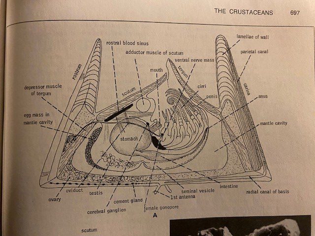
This image from a textbook shows the internal structure of a barnacle. Notice the shrimplike animal on its back with extendable appendages (cirri) for feeding. Image: Robert Barnes Invertebrate Zoology.
Barnacles have over 2,100 species, are closely related to crabs and lobsters, and are a part of the subphylum Crustacea. At first glance, you might not think a barnacle is closely related to crabs, but when you remove the hard plates surrounding it, the body looks very similar to a crab. Barnacles also have life cycle stages that are similar to crabs; the nauplius and cyprid developmental stages. Inside of the hard plates is an organism with large feather-like appendages called cirri. When covered by water, the barnacles will extend their cirri into the water and trap microscopic particles like detritus, algae, and zooplankton. Barnacles are at the mercy of tides and currents, which makes quantifying their filtering ability difficult.
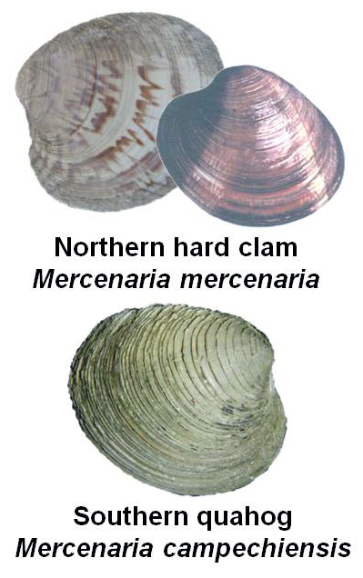
Hard Clams
Clams of North Florida – UF/IFAS Shellfish
Even though not as abundant in the Florida Panhandle as they were in the 1970’s – 1980’s, hard clams (Mercenaria mercenaria and M. campechiensis) can still be found in the sand along the shoreline and near seagrass beds. These clams are also known as Quahogs and are in the family Veneridae, commonly known as the Venus clam family, and contain over 500 living species. Most of the clams in the family Veneridae are edible and Quahogs are the types of clams you would see in a clam chowder or clam bake.
Being the only bivalve on this list does not make it any less important than the oyster or scallop on Part 1’s list. In fact, a full-grown adult Southern Quahog clam can filter upwards of 20 gallons of water per day and have a lifespan of up to 30 years. Clams also live a much different lifestyle than their oyster and scallop cousins. Clams spend the majority of their life under the sand. Their movement under the sand helps aerate and mix the soil, which can sometimes stimulate seagrass growth.
Right outside the Florida Panhandle and in the Big Bend area, Quahog clams are commercially farmed in Cedar Key. Southern Quahog clams are also being used for restoration work in South Florida. Clams are being bred in a hatchery and their “seed” are being released into Sarasota Bay to help tackle the Red Tide (Karenia brevis) issue. According to the project’s website, they have added over 2 million clams since 2016, and the clams are filtering over 20 million gallons of seawater daily.
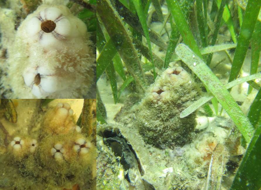
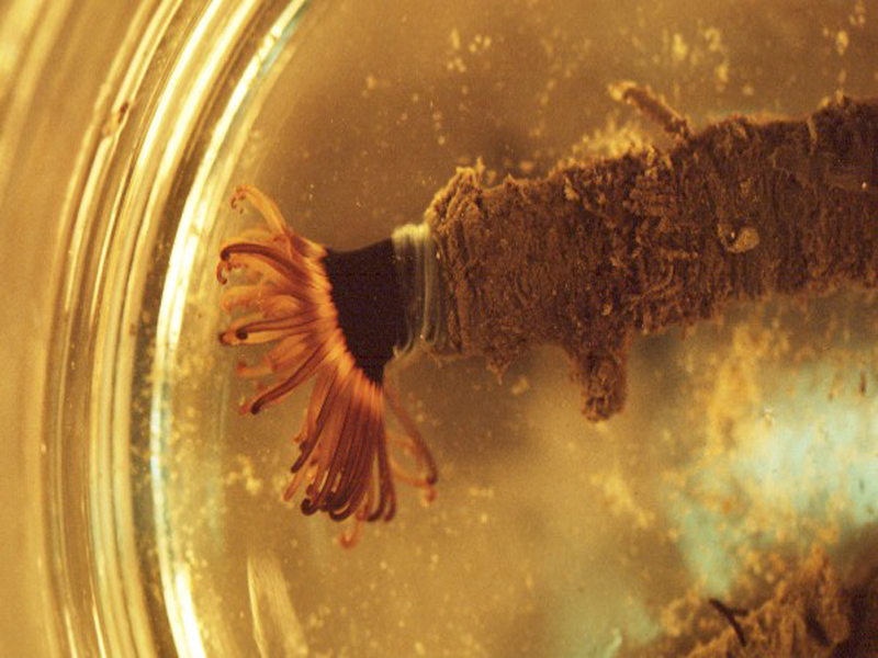
Anemones
Tube-Dwelling Anemone Under Dissection Scope – UF/IFAS Shellfish
Anemones are beautiful Cnidarians resembling an upside-down, attached jellyfish, which couldn’t be closer to the truth. The phylum Cnidaria contains over 11,000 species of aquatic animals including corals, hydroids, sea anemones, and, you guessed it, jellyfish. Anemones come in many different shapes and sizes, but the common estuary anemones include the tube-dwelling anemone (Ceriantheopsis americana) and the tricolor anemone (Calliactis tricolor), also known as the hitchhiking anemone. If you have ever owned a saltwater aquarium, you might have run into the pest anemone Aiptasia (Aiptasia sp.).
Anemones filter feed with their tentacles by catching plankton, detritus, and other nutrients as the tide and current flows. The tentacles of the anemone are lined with cnidocytes that contain small amounts of poison that will stun or paralyze the prey. The cnidae are triggered to release when an organism touches the tentacles. If the anemone is successful in immobilizing the prey, the anemone will guide the prey to their mouth with the tentacles. Just like the barnacle, anemones are at the mercy of the tides and currents, and filtration rates are hard to calculate. However, if you ever see an anemone with food around, they move those tentacles to and from their mouths quickly and constantly!
In Parting
As you can see, there are many different natural filters in our estuary. Healthy, efficiently filtering estuaries are very important for the local community and the quality of the waters we love and enjoy. For more information on our watersheds and estuaries and how to protect them, visit Sea Grant’s Guide To Estuary-Friendly Living.
The University of Florida/IFAS Extension & Florida Sea Grant faculty are reintroducing their acclaimed “Panhandle Outdoors LIVE!” series on St. Joseph Bay. This ecosystem is home to some of the richest concentrations of flora and fauna on the Northern Gulf Coast. This area supports an amazing diversity of fish, aquatic invertebrates, turtles and other species of the marsh and pine flatwoods. Come learn about the important roles of ecosystem!
Registration fee is $40. You must pre-register to attend.
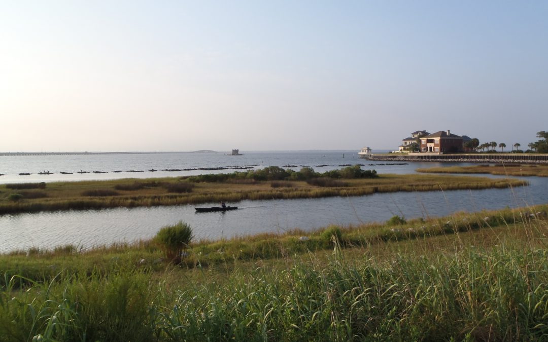
The Panhandle of Florida is home to many estuaries along the coast, from the Escambia Bay System in the west to the Apalachicola Bay System in the east. These estuaries are very important and are the intersection where rivers (fed from their respective watersheds) meet the Gulf of Mexico and contain many different organisms that help filter the waters before they reach the Gulf. These organisms include oysters, marsh plants, seagrasses, scallops, tunicates, and other invertebrates. In this two-part article, we will explore marsh plants, seagrasses, oysters, and scallops.
Marsh Plants
Marsh Plants is a broad term for a family of grasses that lines the shore and contain grasses like Smooth Cordgrass (Spartina alterniflora), Saltgrass (Distichlis spicata), and Gulf Cordgrass (Spartina spartinae). These plants help trap sediments before they enter the estuary and are excellent at erosion prevention. When the water encounters the plants, it slows the flow, and this allows for sediments to collect. Marsh Plants are a great tool for shoreline restoration and are a major part of the Living Shorelines Program. The roots of the plants are also very efficient at removing nutrient pollutants like excess nitrogen and phosphorus which are major influencers in eutrophication. Marsh Plants also absorb carbon dioxide from the atmosphere and have been tabbed as “superstars of CO2 capture and storage.” (CO2 and Marsh Plants)
Marsh Grass and Oyster Reef in Apalachicola, Florida – Thomas Derbes II
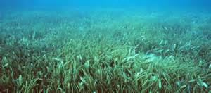
Seagrasses
Seagrasses are different than Marsh Grasses (seagrasses are ALWAYS submerged underwater), but they offer some of the same ecological services as Marsh Grasses. The term seagrasses include Turtle Grass (Thalassia testudinum), Shoal Grass (Halodule wrightii), Widgeon Grass (Ruppia maritima), and Manatee Grass (Syringodium filiforme) to name a few. Seagrasses help maintain water clarity by trapping suspended sediments and particles with their leaves and uptake excess nutrients in their roots. Seagrasses are very efficient at capturing carbon, capturing it at rates up to 35 times faster than tropical rainforests. (Carbon Capture and Seagrasses) They also provide habitat for crustaceans, fish, and shellfish (which can filter the water too) and food for other organisms like turtles and manatees.
Grassbeds are also full of life, albeit small creatures. Photo: Virginia Sea Grant
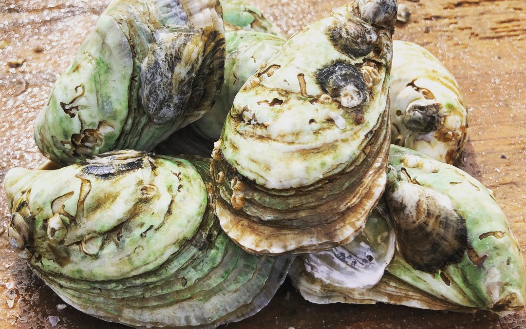
Oysters
Crassostrea virginica (or as we know them, the Eastern oyster) is a native species of oyster that is commonly found along the eastern coast of the USA, from the upper New England states all the way to the southernmost tip of Texas. Eastern oysters are prolific filter feeders and can filter between 30-50 gallons of water per day. As filter feeders, they trap nutrients like plankton and algae from the environment. In areas of high eutrophication, oysters can be very beneficial in clearing the waters by trapping and consuming the excess nutrients and sediments and depositing them on the bottom as pseudo-feces. With oyster farms popping up all over the Gulf Coast, the filtering potential of estuaries is on the rise. (Between the Hinge)
Oysters, The Powerful Filterers of the Estuary – Thomas Derbes II
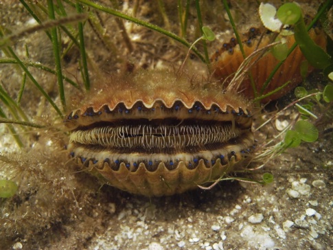
Scallops
Bay Scallops (Agropecten irradians) were common along the whole Florida Gulf Coast, but their numbers have taken a recent decline and can only be found in abundance in the estuaries to the east of St. Andrews Bay in Panama City, Florida. Scallops make their home in seagrass beds and are filter feeders. While scallops do not contain the filtering potential of an oyster (scallops filter 3 gallons of water per day as an adult), they are still a key part of filtering the estuary. Just like oysters, scallops feed off of the suspended particles and plankton in the water column and deposit them as pseudo-feces on the bottom. The pseudo-feces also help provide nutrients to the seagrasses below.
Bay Scallop. Photo: FWC
I hope you enjoyed this first article on filterers in the estuary system. While oysters are known as the filterers of the estuary, I hope this has opened your eyes to the many different filterers that call our estuary home. Stay tuned for Part 2!
Understanding Salinity in Northwest Florida’s Waters with a Family Activity
Dana Stephens, 4-H Agent
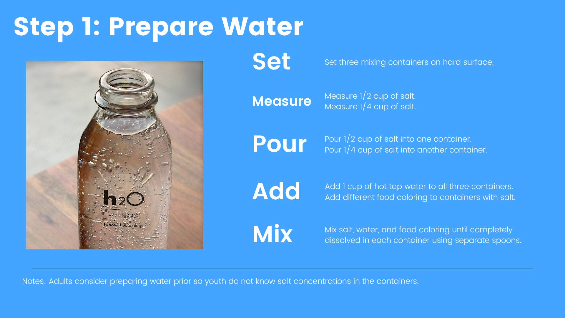
Salinity is the amount of total dissolved salts in water. This includes all salts not just sodium chloride, or table salt. Salinity is important in aquatic environments as many flora and fauna depend on salt and the level of dissolved salts in the water for survival. People interested in the composition of water frequently measure chemical and physical components of water. Salinity is one of the vital chemical components measured and often measured by a device determining how readily electrical conductance passes between two metal plates or electrodes. These units of electrical conductance, the estimate of total dissolved salts in water, is described in units of measurement of parts per thousand (PPT).
At the large scale, Earth processes, such as weathering of rocks, evaporation of ocean waters, and ice formation in the ocean, add salt to the aquatic environment. Earth processes, such as freshwater input from rivers, rain and snow precipitation, and ice melting, decrease the concentration of salt in the aquatic environment. Anthropogenic (human-induced) activities, such as urbanization or atmospheric deposition, can also contribute to changes in salinity.
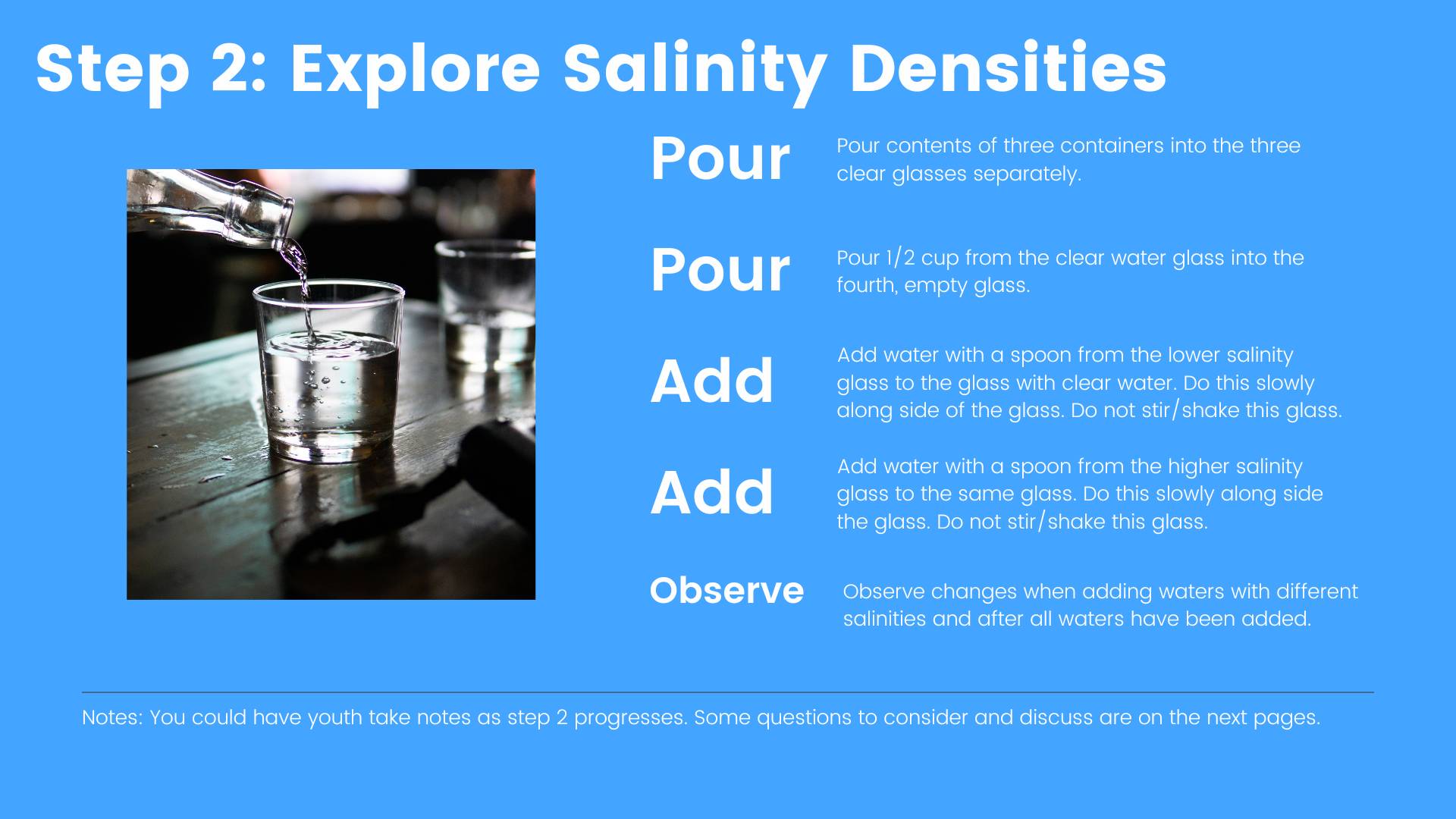
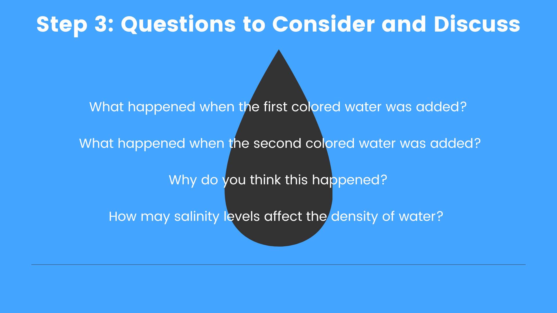
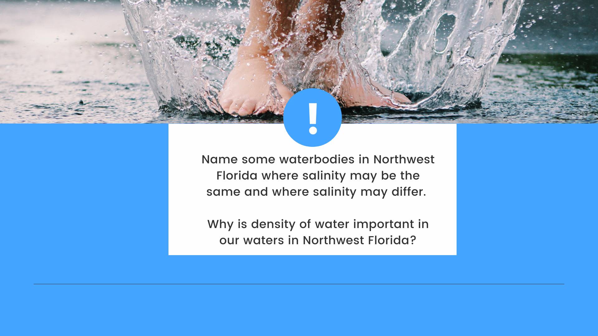
Salinity and changes in salinity affect how water moves on Earth due to contrasts in the density of water. Water containing no dissolved salts is less dense than water containing dissolved salts. Density is weight per volume, so water with no dissolved salts (less dense) will float on top of water with dissolved salts (denser). This is why swimming in the ocean may feel easier than swimming in a lake because the denser water provides increased buoyancy.
Northwest Florida is a unique place because we have a variety of surface waters that range in salinity. There are ponds, lakes, streams, rivers, and springs, which have no to low salinity levels (0 to 0.5 PPT), and commonly referred to as freshwater systems. We house six estuaries—Perdido Bay, Pensacola/Escambia Bay, Choctawhatchee Bay, St. Andrews Bay, St. Joseph Bay, and Apalachicola Bay. Estuaries are bodies of water with freshwater input(s) (e.g., rivers) and a permanent opening to the ocean (e.g., Destin Pass in the Choctawhatchee Bay). Estuarine waters are termed brackish water (0.5 to 30 PPT) due to the dynamic changes in salinity at spatial and temporal scales. Waterbodies with an even more dynamic change in salinity are the coastal dune lakes Northwest Florida’s Walton and Bay Counties. Coastal dune lakes are waterbodies perched on sand dunes that intermittently open and close to the Gulf of Mexico. Sometimes these waterbodies are fresh and sometimes they have the same salinity as the Gulf of Mexico, like after a large storm event. Finally, the Gulf of Mexico, or ocean, has the highest salinity (> 30 PPT) among the waterbodies of Northwest Florida.
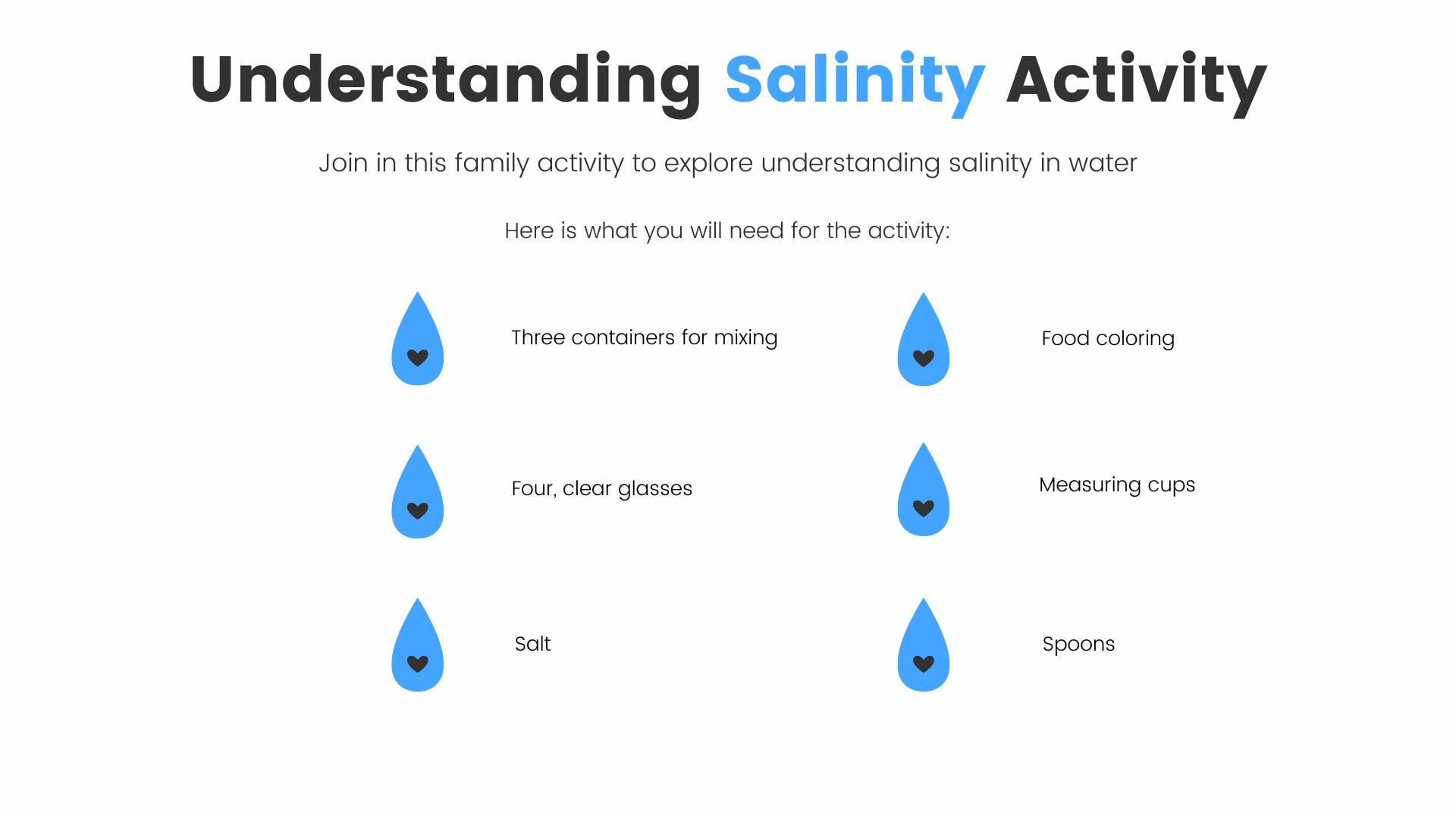
Here is an educational activity for the family to explore salinity and how salinity differs among Northwest Florida waters.
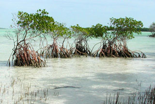
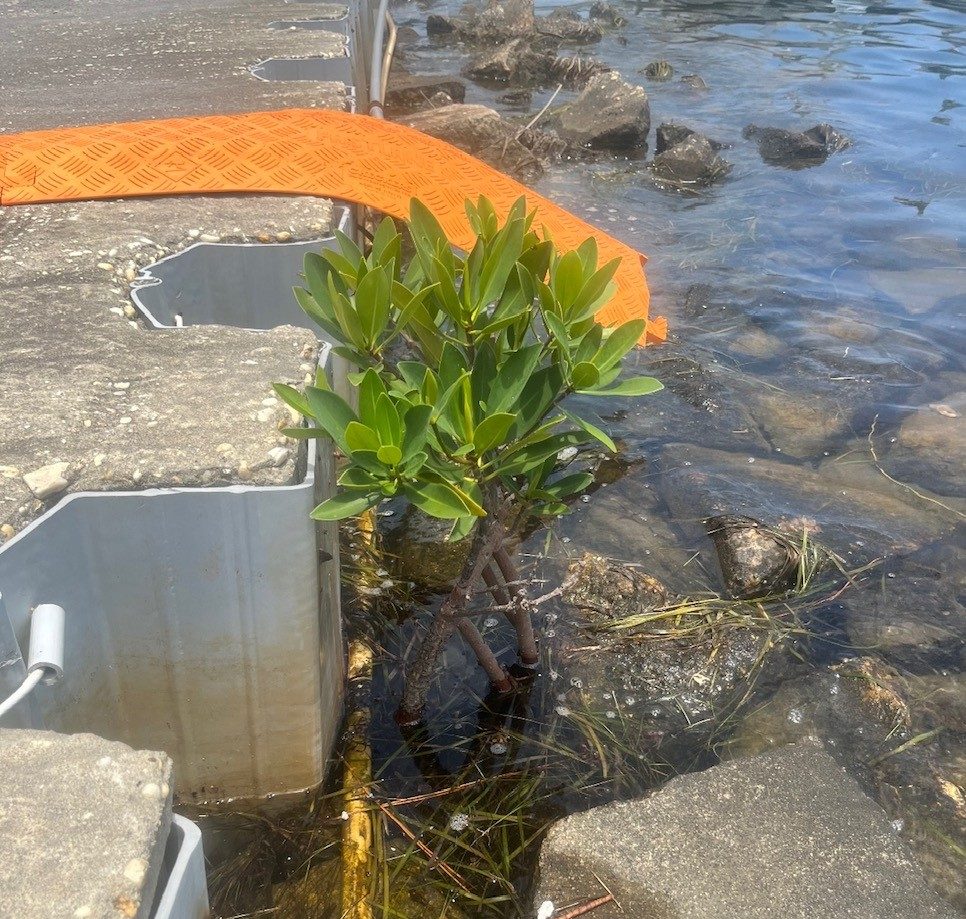
In 2005 I was leading a field trip with high school students in a salt marsh on Santa Rosa Island near Pensacola Beach. As we explored a brackish water creek, we came across a three-foot red mangrove tree, prop roots and all. To say we were surprised and excited would be an understatement.
Most know that mangroves are trees that can tolerate seawater and grow along estuarine shorelines across the tropics, including south Florida. They can form dense forests that support all sorts of aquatic and terrestrial wildlife. They need calm protected waters to establish themselves but once established are excellent at protecting shoreline communities during hurricanes. However, they cannot tolerate cold weather, only surviving freezing temperatures for one or two nights.
The red mangrove. Photo: University of Florida
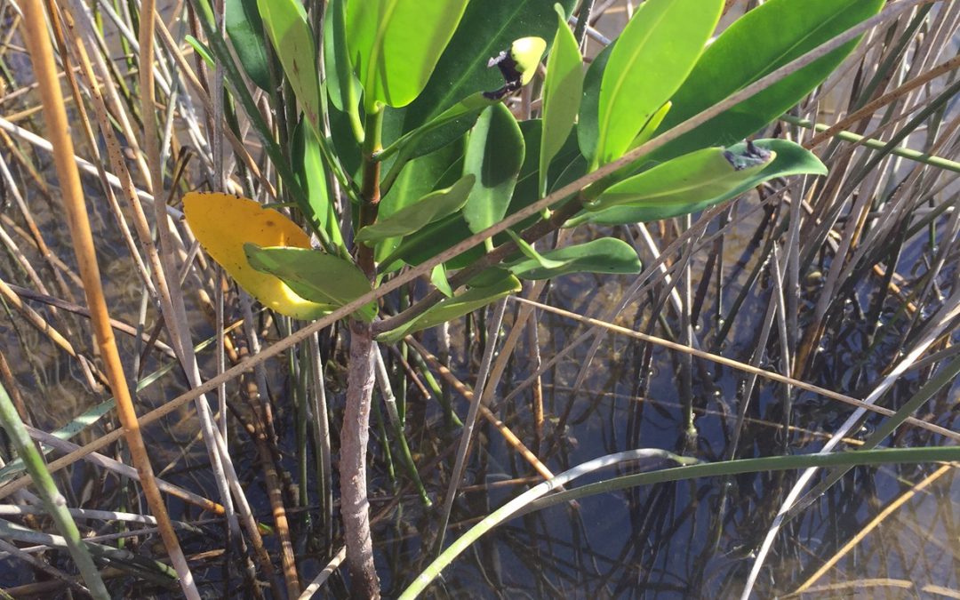
Growing up in Pensacola we would often find red mangrove propagules (seedlings) washed ashore arriving from the tropical parts of the Gulf. They were generally on the Gulf side of Santa Rosa Island and Perdido Key but never germinated. If they were carried into the estuary, and found a protected lagoon to begin germination, they would not survive our winters. This is what made finding an established three-foot mangrove in a lagoon off Santa Rosa Sound in 2005 so surprising.
Mangrove propagule washed ashore. Photo: Rick O’Connor
Historically mangroves were not found north of Tampa Bay. However, in recent decades they have become established as far north as Cedar Key. Trying to determine whether the mangrove we found was the northern most in Florida I found that they were also expanding along the east coast of Florida as far north as St. Augustine, and there were records in the Jacksonville area. Many attribute this to climate change. Our winters are milder than they were when I was a kid, and this may be leading to what many are calling the “tropicalization of northern Gulf of Mexico”. Not only mangroves, but other historically south Florida species, such as snook and bonefish, have been reported along the panhandle.
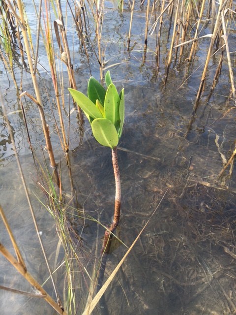
In 2017 I was leading another high school group on a field trip in a salt marsh in Big Lagoon State Park. We found a germinated seedling of a red mangrove doing very well. We explored more and found seven others in the nearby area. How many more were growing in the Pensacola Bay area?
A small red mangrove growing in Big Lagoon near Pensacola FL Photo: Rick O’Connor
We partnered with a research team from Dauphin Island Sea Lab who was looking into this as well. The team included extension agents and specialists from Florida and Mississippi-Alabama Sea Grant, as well as biologists from the National Estuarine Research Reserves in Mississippi, Alabama, and Florida panhandle. Each county/region selected 10 transect sites that had the highest probability of mangroves to monitor each year. Mangroves appear to be established on some of the Mississippi barrier islands, as well as in St. Joe Bay. Individuals have been reported from Bay County. A ninth mangrove was found in Escambia County but a hard freeze in 2018 killed them all. Since then, one young multi-year red mangrove was found on NAS Pensacola. It died in the hard freeze of 2023. Despite the hard freezes, those established in St. Joe Bay seem to be holding on. I decided to make a visit and see.
A red mangrove growing at NAS Pensacola. Photo: Whitney Scheffel.
Black mangroves growing near St. George Island in Franklin County. Photo: Joshua Hodson
Wading out from the buffer preserve with Gulf County Sea Grant Agent Ray Bodrey, we found relatively large patches of mangroves, and seeds suggesting active expansion was ongoing. But I noticed the species we were seeing were black mangroves. I mentioned to Ray that what we had seen in Pensacola were red mangroves. He said that the red mangroves have a hard time here as well. Black mangroves are more tolerant of cold weather, and it is they who are establishing these large patches. There are reports of large patches of mangroves on the Mississippi barrier islands – and they are the black mangroves as well. I know that black mangroves have been established in the Chandeleur Islands in Louisiana for decades. I am convinced that if black mangroves seeds were to reach protected lagoons in Pensacola Bay, they would probably do well here as well.
I continue to conduct our transects each year in the Pensacola Bay area. I have a couple of trained volunteers helping me but could always use more. If you think you have seen a mangrove growing in the Florida panhandle, we would love to know and document their location. We know they are established in Gulf County, so our focus is now Escambia to Bay counties. If you think you have seen one, contact me at roc1@ul.edu or your county Sea Grant Agent.
Even though oysters have a hard shell that even humans have a hard time opening, they do have natural predators in our waters that can easily slurp up a couple dozen. Your usual oyster slurping suspects include oyster drills, blue crabs, and fish (such as the black drum). In this article, we will focus on the 3 major predators that contribute the most toward natural mortality in oysters here in the Florida Panhandle.
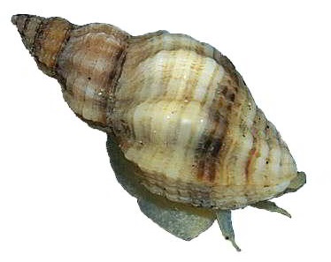
The Oyster Drill
When it comes to the marine snail world, oyster drills would win an oyster-eating contest. Oyster drills (Urosalpinx cinerea) are marine gastropods that grow to sizes of 0.5 – 1 inch. Oyster drills can be found all along the Atlantic coast of North America and the Gulf of Mexico, and they have been accidentally introduced into Northern Europe and the West Coast of North America. These small but mighty snails have become specialized in consuming oysters. Using chemotaxis, they locate their prey oyster. Once they find it, they secrete an enzyme to soften a portion of the oyster shell. Once softened, they drill into the shell and siphon out oyster meat. Oyster drills have been known to occur in great numbers when the environmental conditions are prime and can wipe out not only entire oyster beds but also clam beds. Oyster drills do have natural predators as well, but these predators also consume oysters.
An Oyster Drill (Urosalpinx cinerea) – Barnegat Bay Shellfish
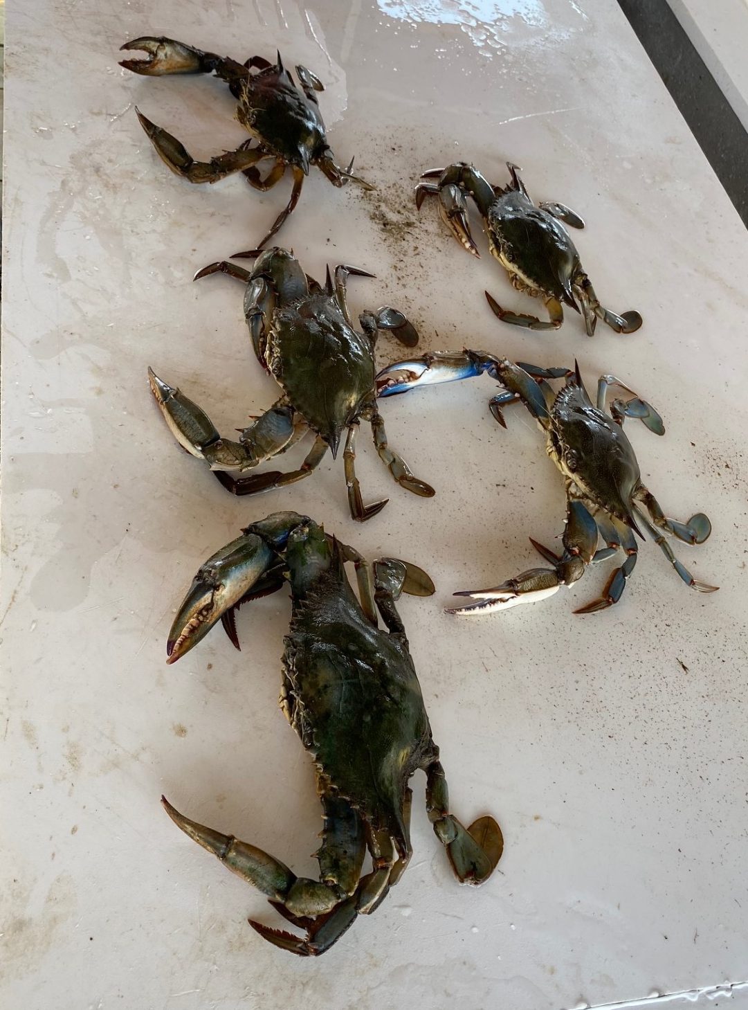
The Blue Crab
Most of us know about the very tasty blue crab (Callinectes sapidus), but many do not know that it is a major consumer of oysters, especially on an oyster farm. Blue crabs are a decapod crab (meaning 10 legs) of the swimming crab family Portunidae. Blue crabs can indeed swim and their last leg on each side has developed into what are called paddle fins. Juvenile oysters are the main target for blue crabs, but they have been observed eating adult oysters when given the opportunity. On an oyster farm, blue crabs can get into an oyster bag when they are very small. Once inside, they have an all-you-can-eat buffet of oysters, and can quickly wipe out a bag of oysters. Oyster farmers have to be very cautious and must either remove the blue crabs manually or dry their bags out in hopes of destroying any blue crabs. Blue crabs can easily break open a juvenile oyster, but for them to consume an adult oyster, they will wait for it to open to feed before shoving a claw inside of the shell to keep the oyster open. Once they have their claw in the shell, they will use their other claw to consume the oyster.
Blue Crabs (Callinectes sapidus) Pulled Out Of Oyster Bags – Thomas Derbes II
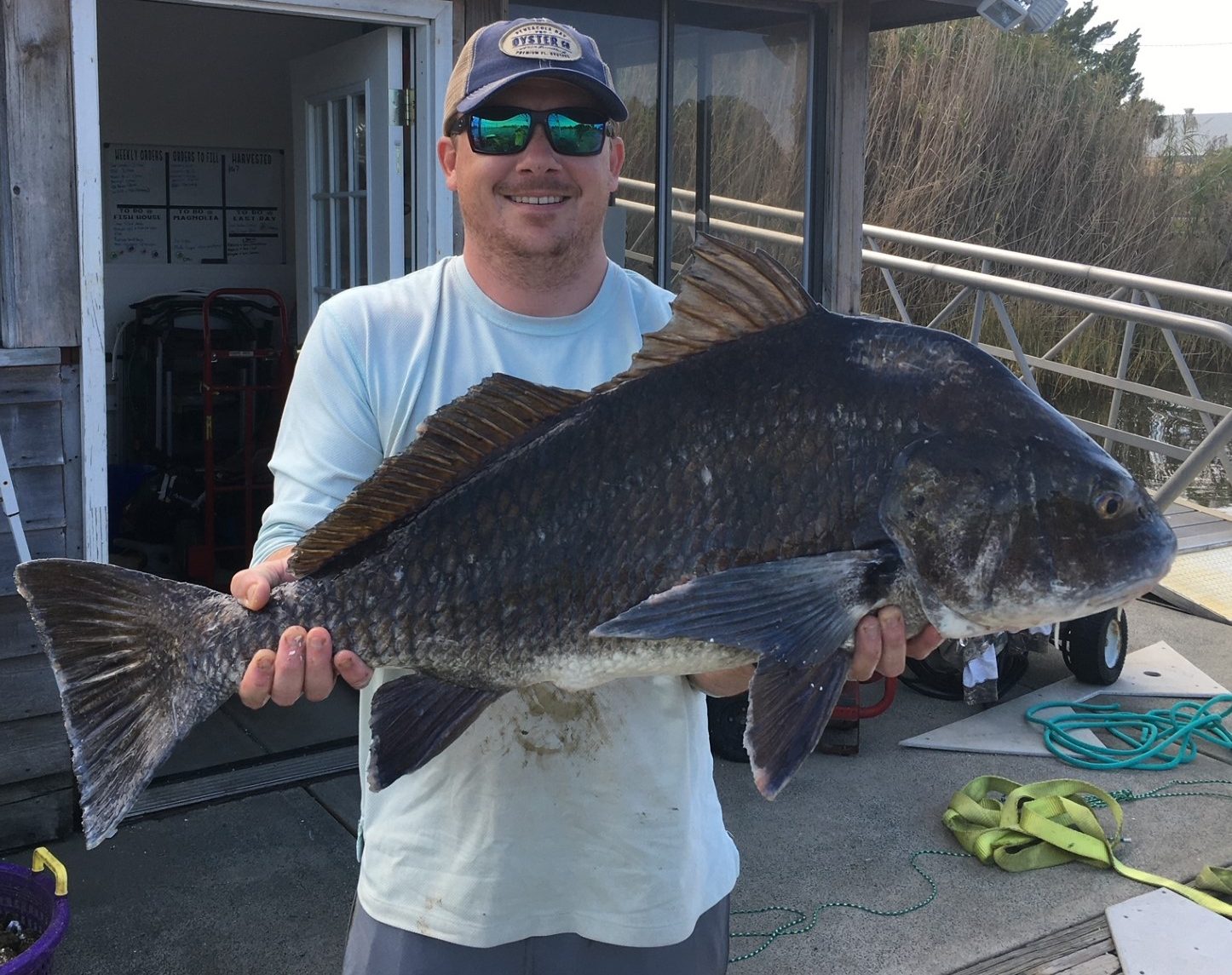
The Fish
Even though oyster-eating fish like black drum (Pogonias cromis) and sheepshead (Archosargus probatocephalus) are much bigger than snails and crabs, they tend to contribute less to oyster mortality on oyster farms. However, during certain seasons wild oysters and other shelled invertebrates can contribute up to 33% of a black drum’s diet (more here). Fish will usually congregate around oyster beds and farms, but they are more interested in consuming oyster predators like crabs and snails. The black drum is a fish that was built for oyster consumption. While black drum lack sharp teeth, they have crushing plates in their throat that can crush an oyster shell which allows the drum to eat the oyster meat. Many oyster farmers welcome these fish on their farms as a free source of anti-fouling and predator deterrent (in the form of consumption).
Black Drum (Pogonias cromis) Caught On A Whole Oyster – Thomas Derbes II
There are many more oyster predators, but these are the top 3 in terms of threat and ability to consume/do detriment to oyster beds and farms in the Florida Panhandle. While oyster drills rank up towards the top, crabs and fish can also greatly contribute to natural mortality.
References
Flimlin, G., & F Beal, B. (n.d.). Major Predators of Cultured Shellfish. https://shellfish.ifas.ufl.edu/wp-content/uploads/Major-Predators-of-Cultured-Shellfish.pdf