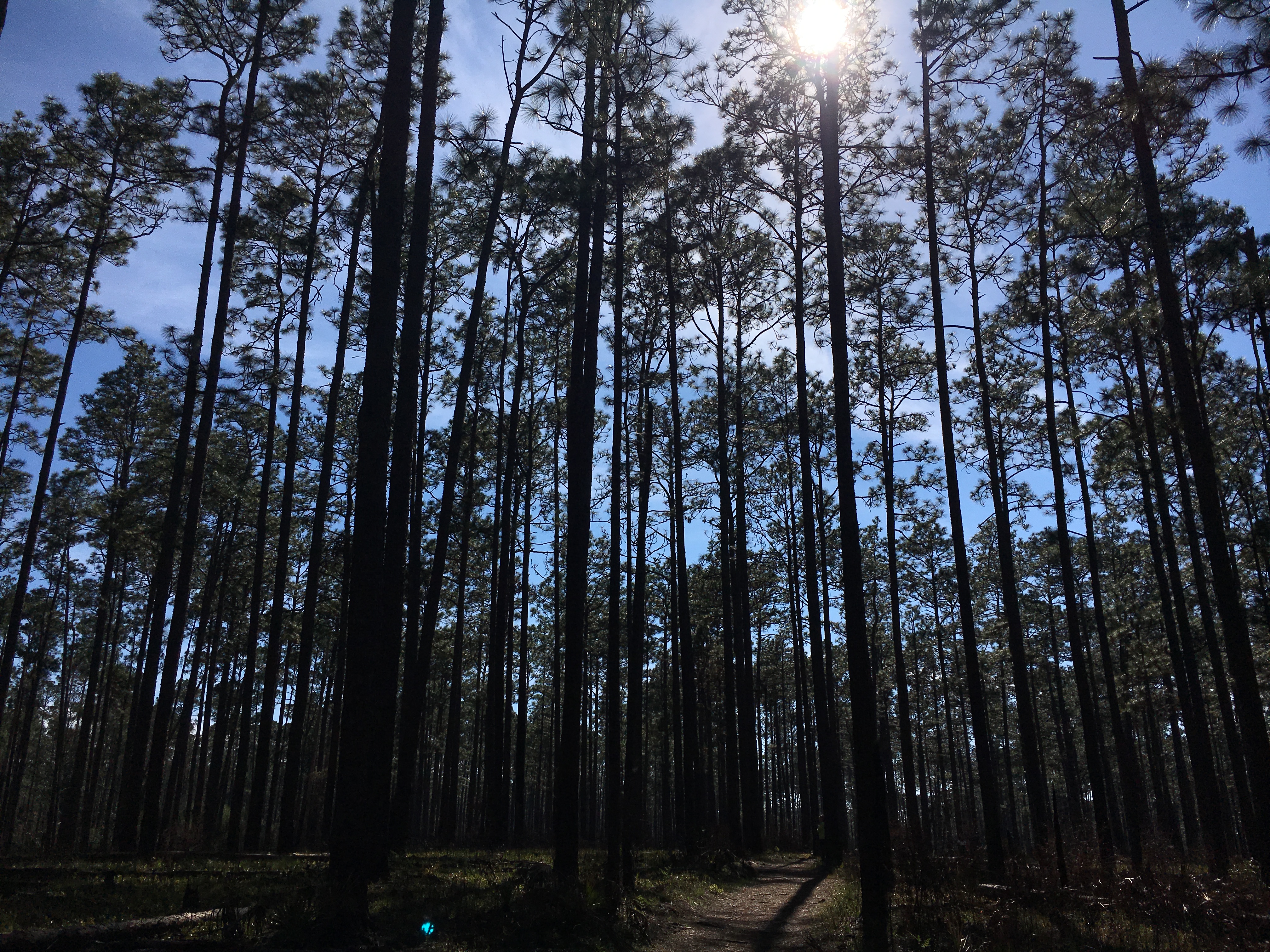
Spring has sprung and it is time to get outside and explore this great Florida Panhandle area. In neighboring Santa Rosa County, a terrific destination for a variety of outdoor activities is Blackwater River State Park. Visitors can canoe, kayak, tube, fish and swim the river. Hikers can enjoy trails through nearly 600 acres of undisturbed natural communities. Bring a picnic and hang out at one of several pavilions or white sand beaches that dot the river (restroom facilities available). Near the pavilions, stop and see one of the largest and oldest Atlantic white cedars, recognized as a Florida Champion tree in 1982. The park also offers 30 campsites for tents and RVs. Park entry is $4.00 per car, payable at the ranger station or via the honor system (bring exact change, please).
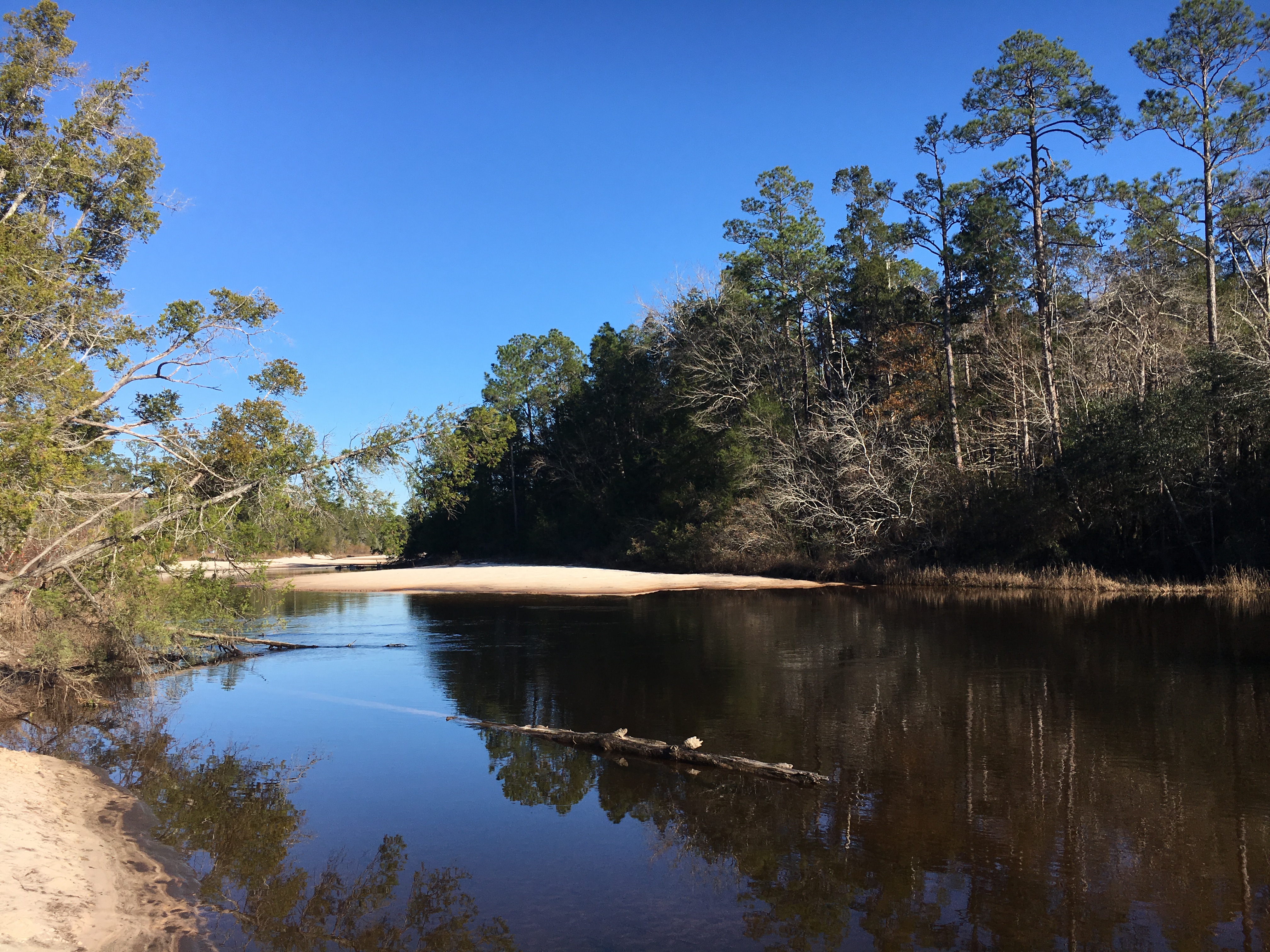
The Blackwater River is considered one of the purest and pristine sand-bottom rivers in the world. The water is tea-colored from the tannins and organic matter that color the water as it weaves through the predominantly pine forest. The river is shallow with a beautiful white sandy bottom, a nice feature for those tubing or paddling the trail. The river flows for over 50 miles and is designated as a Florida canoe trail. Multiple small sand beach areas line the river and provide plenty of space to hang out, picnic, or throw a Frisbee. Blackwater eventually flows into Pensacola Bay and the Gulf of Mexico bringing high quality freshwater into this important estuary.
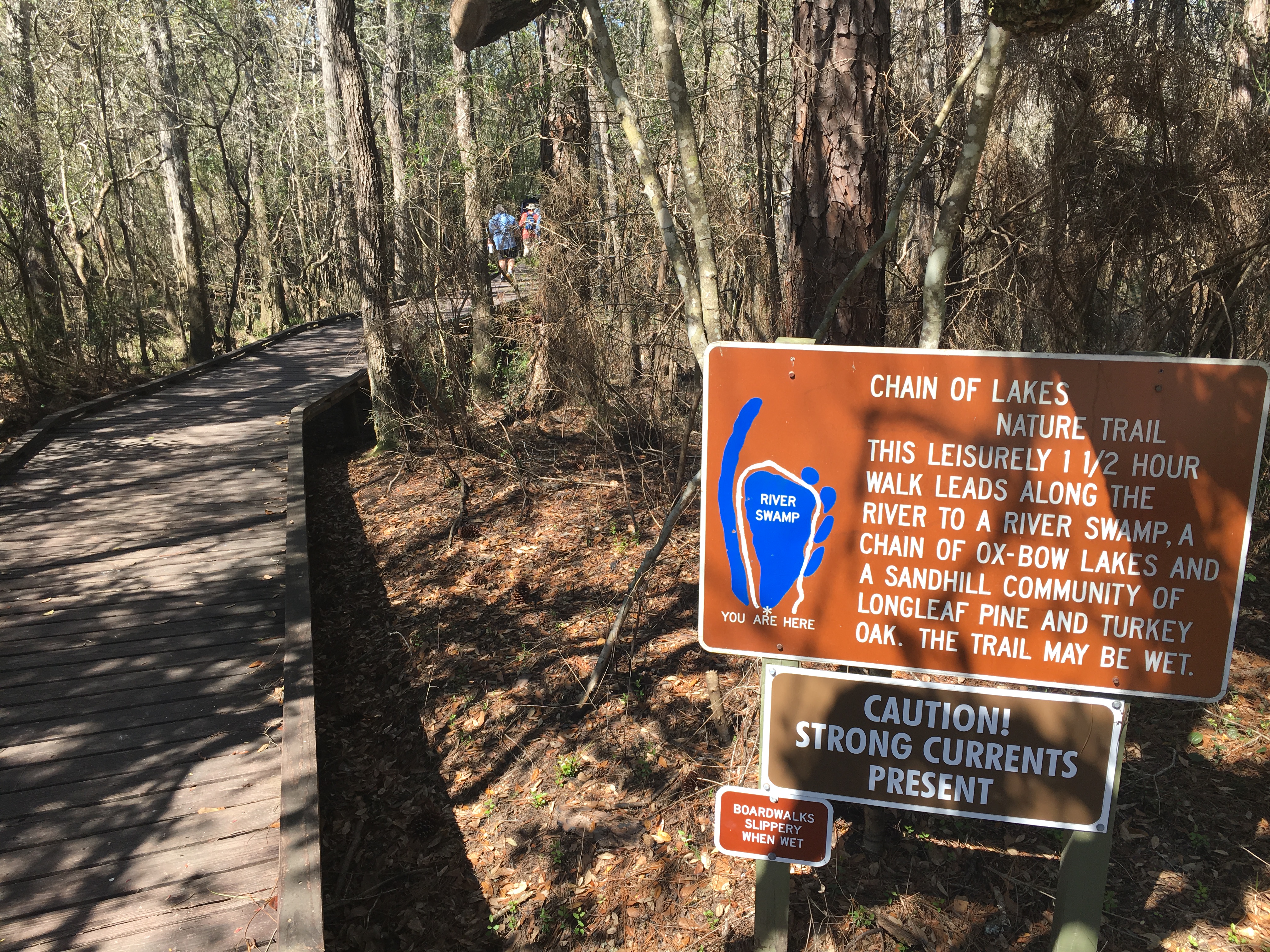
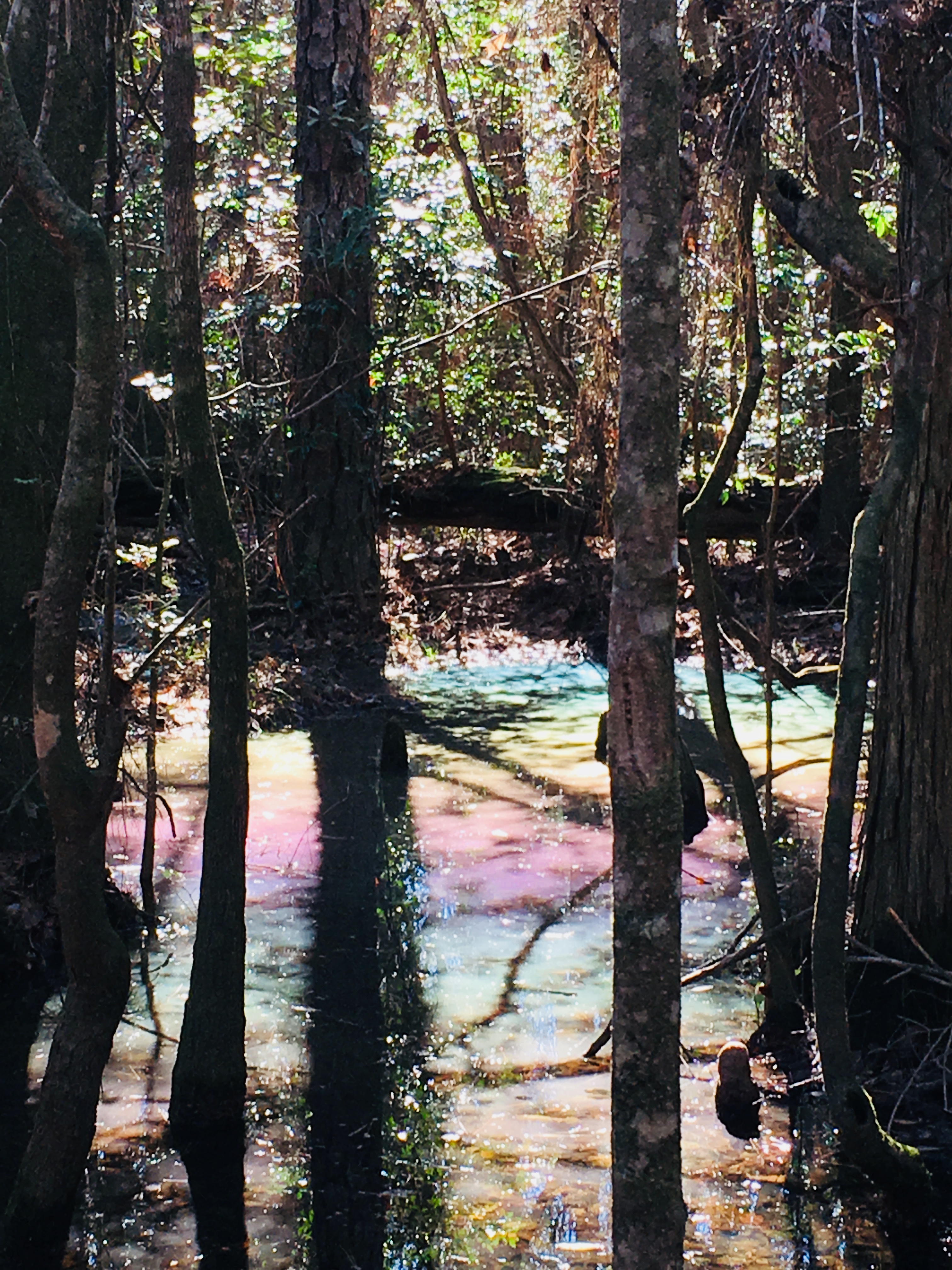
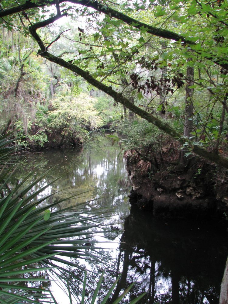
A favorite trail in the Park is the Chain of Lakes Nature Trail. Parking for this 1.75 mile loop trail is at South Bridge on Deaton Bridge Road. The trail head is well marked and has a boardwalk that leads into the floodplain forest. The trail winds through a chain of shallow oxbow lakes and swamp that dot the former route of the river. If you are lucky and it is a clear, blue-sky day, you may see a beautiful rainbow effect as the sun hits the water. We call this the pastel swamp rainbow effect. This is a result of the natural oils from the cypress cones settling on the surface of the water and associated trapped pollen.
The trail then turns to sneak through the sandhill community in the park with giant longleaf pines, wiregrass and turkey oak. Evidence of prescribed burning shows management efforts to maintain the forest. Cinnamon ferns, bamboo and other natives appear in pockets along the trail. The trail in this section is blanketed with a mosaic of exposed root systems, so be careful as you step. Finally, pack some bug spray and a water bottle for this fun hike.
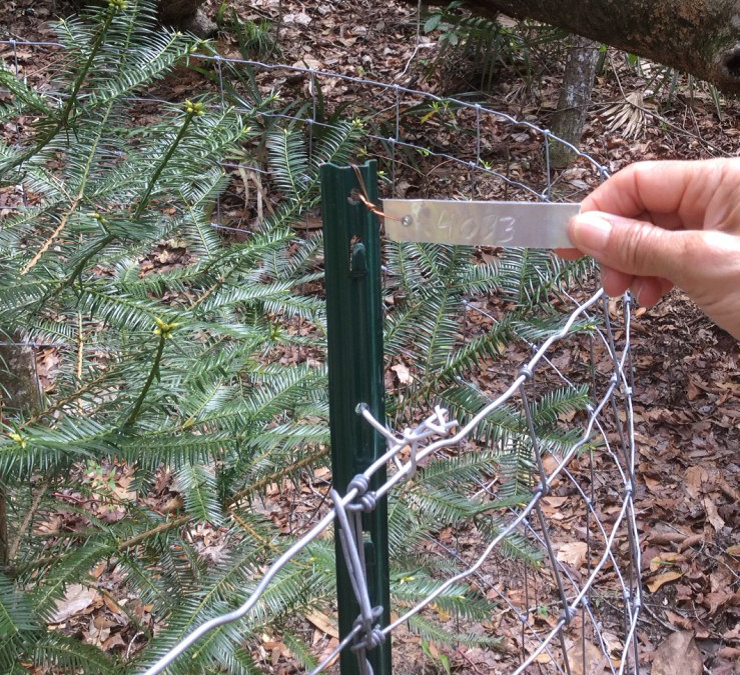
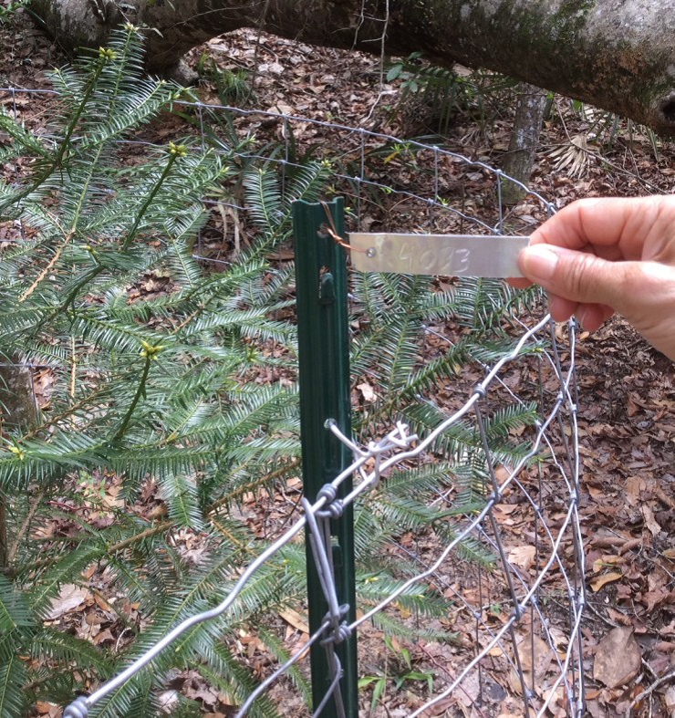
Having just completed the Okaloosa/Walton Uplands Master Naturalist course, I would like to share information from the project that was presented by Ann Foley.
The Florida Torreya. Photo provided by Shelia Dunning
The Florida Torreya is the most endangered tree in North America, and perhaps the world! Less than 1% of the historical population survives. Unless something is done soon, it may disappear entirely! You can see them on public lands in Florida at Apalachicola Bluffs and Ravines Preserve and beautiful Torreya State Park.
The Florida Torreya (Torreya taxifolia) is one of the oldest known tree species on earth; 160 million years old. It was originally an Appalachian Mountains ranged tree. As a result of our last “Ice Age” melt, retreating Icebergs pushed ground from the Northern Hemisphere, bringing the Florida Torreya and many other northern plant species with them.
The Florida Torreya was “left behind” in its current native pocket refuge, a short 40 mile stretch along the banks of the Apalachicola River. There were estimates of 600,000 to 1,000,000 of these trees in the 1800’s. Torreya State Park, named for this special tree, is currently home to about 600 of them. Barely thriving, this tree prefers a shady habitat with dark, moist, sandy loam of limestone origin which the park has to offer.
Hardy Bryan Croom, Botanist, discovered the tree in 1833, along the bluffs and ravines of Jackson, Liberty and Gadsen Counties, Florida and Decatur County in Georgia. He named it Florida Torreya (TOR-ee-uh), in honor of Dr. John Torrey, a renowned 18th century scientist.
Torreya trees are evergreen conifers, conically shaped, have whorled branches and stiff, sharp pointed, dark green needle-like leaves. Scientists noted the Torreya’s decline as far back as the 1950’s! Mature tree heights were once noted at 60 feet, but today’s trees are immature specimens of 3-6 feet, thought to be ‘root/stump sprouts.’
Known locally as “Stinking Cedar,” due to its strong smell when the leaves and cones are crushed, it was used for fence posts, cabinets, roof shingles, Christmas trees and riverboat fuel. Over-harvesting in the past and natural processes are taking a tremendous toll. Fungi are attacking weakened trees, causing the critically endangered species to die-off. Other declining factors include: drought, habitat loss, deer and loss of reproductive capability.
With federal and state protection, the Florida Torreya was listed as an endangered species in 1983. There is great concern for this ancient tree in scientific community and with citizen organizations. Efforts are underway to help bring this tree back from the edge of extinction!
Efforts include CRISPR gene editing technology research being done by the University of Florida Dept. of Forest Resources and Conservation- making the tree more resistant to disease. Torreya Guardians “rewilding and “assisted migration”. Reintroducing the tree to it’s former native range in the north near the Biltmore Estate in Asheville, NC, which has maintained a grove of Torreya trees and offspring since 1939 and supplying seeds for propagation from their healthy forest. Long before saving the earth became a global concern, Dr. Seuss (Theodor Seuss Geisel), spoke through his character the Lorax warning against urban progress and the danger it posed to the earth’s natural beauty. All of these groups, and many others, hope their efforts will collectively help bring this tree back from the brink!
The Florida Master Naturalist Program is an adult education University of Florida/IFAS Extension program. Training will benefit persons interested in learning more about Florida’s environment or wishing to increase their knowledge for use in education programs as volunteers, employees, ecotourism guides, and others.
Through classroom, field trip, and practical experience, each module provides instruction on the general ecology, habitats, vegetation types, wildlife, and conservation issues of Coastal, Freshwater and Upland systems. Additional special topics focus on Conservation Science, Environmental Interpretation, Habitat Evaluation, Wildlife Monitoring and Coastal Restoration. For more information go to: http://www.masternaturalist.ifas.ufl.edu/ Okaloosa and Walton Counties will be offering Upland Systems on Thursdays from February 15- March 22. Topics discussed include Hardwood Forests, Pinelands, Scrub, Dry Prairie, Rangelands and Urban Green Spaces. The program also addresses society’s role in uplands, develops naturalist interpretation skills, and discusses environmental ethics. Check the website for a Course Offering near you :http://conference.ifas.ufl.edu/fmnp/
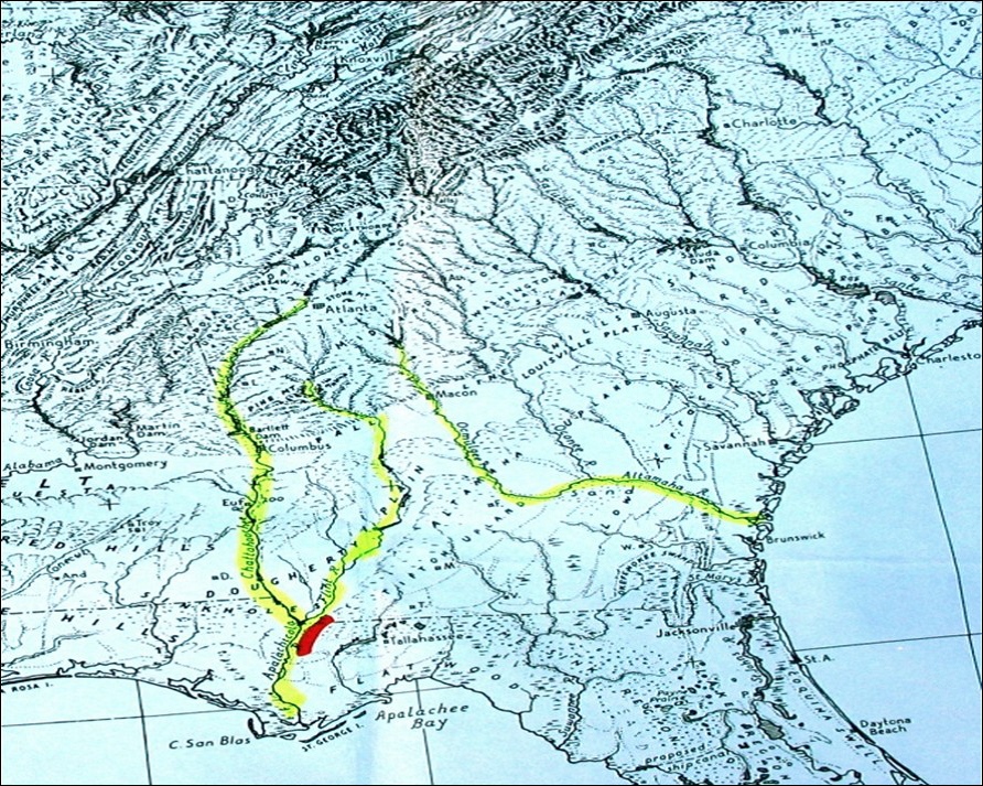
What do the Ochlockonee and Aucilla rivers have in common? Not much, it would seem, beyond the fact that both have headwaters in Georgia and flow through Florida to the Gulf of Mexico. These two rivers do share the distinction of being unusual, although they’re unusual in very different ways.
The Ochlockonee runs yellow-brown between Leon and Gadsden counties. Photo: Rosalyn Kilcollins
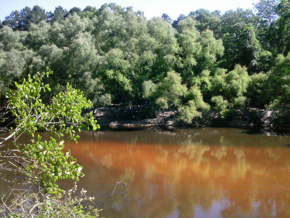
The Aucilla is a blackwater stream that goes underground and rises again before reaching the Gulf – a disappearing act that has fascinated early settlers, paddlers and naturalists alike. The Aucilla drains a smaller watershed, has lower flows, and features stream channel sediments that are predominantly sands and decaying organic material – the sediment signature of coastal plain streams with water stained dark brown, the color of tea.
In fact, blackwater rivers like the Aucilla get their color by steeping fallen and decaying tree leaves and twigs in slow-moving water, just as we steep shredded tea leaves or ground up coffee beans to dissolve their tannic acids into beverages. Blackwater steeping occurs in swamp forests up river tributaries, and in oxbow sloughs and other quiescent side channels of the downstream reaches. These form as a river “in flood” meanders and changes course within its floodplain.
The Ochlockonee is unusual among rivers originating in the Coastal Plain: in its upper reaches it has alluvial characteristics common to streams flowing from the Piedmont. The Ochlockonee drains soils rich in silt and clay that give it a yellowish brown color when those extremely fine sediments are suspended in the water. Land use activities such as paving roads and tilling farm fields elevate the fine sediment load when it rains by setting up larger volumes of fast-moving runoff. Higher rain runoff volume and velocity conspire to erode bare fields, construction sites and river banks, accentuating this river’s color.
But in spite of these differences, the Aucilla and Ochlockonee were once branches of the same river drainage system – the Paleo-Ochlockonee River. How could that possibly be? Well, sea level rise has drowned the lower reaches of this once mightier river, leaving its upper branches to empty into the Gulf separately, as smaller streams.
Sea level along Florida’s Big Bend coastline has been rising since the end of Earth’s last Ice Age – roughly 18,000 years ago. Our shallow, gently sloping underwater continental shelf was exposed during that last period of glaciation. As higher temperatures began melting ice sheets, not only did sea level rise, but more water evaporated and fell as rain. Southeastern rivers began carrying greater volumes of water.
Before annual rainfall reached today’s level during this prehistoric period of climate change, it is likely that the Aucilla from headwaters to Gulf was even more discontinuous than it is today. A current hypothesis is that the Aucilla was more like a string of sinkholes than a river, resembling its lower reaches today in a section known as the “Aucilla Sinks.”
The Aucilla is a tannic river. Thus not as yellow-brown but rather more “blackwater”. Photo: Jed Dillard
But the nature of the Paleo-Aucilla is just one part of this intriguing story. Using sophisticated technology, scientists have discovered clues about the ancient route of the entire Paleo-Ochlockonee as it meandered across that more expansive, exposed Continental shelf to the Gulf.
In their 2008 publication Aucilla River, Tall Timbers Research Station & Land Conservancy reports that, “Ten thousand years ago, the Florida coastline was located 90 miles away from its present position. Scientists have discovered a buried river drainage system indicating that approximately 15 to 20 miles offshore from today’s coast — and now underwater — the Aucilla River combined with the Ochlockonee, St. Marks, Pinhook, and Econfina rivers to create what archeologists call the Paleo-Ochlockonee, which flowed another 70 miles before reaching the Gulf.”
“Well, I’ll be!” you say, “That’s all pretty cool to think about.” That was my reaction, too, until I remembered that this process of sea level rise continues still, albeit at an accelerating rate thanks to global warming. Which means our rivers that join forces today before emptying into the Gulf will one day be separated. Sea level rise eventually will dismember the Wakulla from the St. Marks, and the Sopchoppy from the Ochlockonee – but thankfully not in our lifetime.
True, that’s happened before, but long before humans were on the scene. Today and for many tomorrows to come, I am grateful that we and our children and grandchildren have a wonderful watery world patiently awaiting our exploration, not far beyond the urban bustle of Tallahassee.
We’re far removed in time from the first humans beckoned by these rivers. A pause in the rate of sea level rise 7,000 years ago enabled development of coastal marsh ecosystems and more successful human habitation – supported in part by the bounty of fish and shellfish that depend on salt marshes. Farther upstream and still inland today, the sinks and lower reaches of the Aucilla hold archaeological sites about twice that old, that are integral to our evolving understanding of very early prehistoric human habitation on the Gulf Coastal Plain.
If you’re intrigued by the myriad of fascinating rivers and wetlands of the Big Bend region – this globally significant biodiversity hotspot we live in, and want to experience some of them first-hand, you’re in luck. Several Panhandle counties offer Florida Master Naturalist courses on Freshwater Systems (and also courses on Upland Habitats and Coastal Systems). You can check the current course offerings at: http://conference.ifas.ufl.edu/fmnp/
You can also explore on your own. There are many public lands in our region (and across the Panhandle) that provide good access.
Go see the Aucilla’s remaining string of sinks by hiking a short segment of the Florida Trail through the Aucilla Wildlife Management Area in Taylor County. And the Ochlockonee’s floodplain of sloughs and swamps, bluffs and terraces by taking trails that follow old two-track roads “down to the river” through the Lake Talquin State Forest in Leon County.
Get some maps of your public lands, get some tips on trails, get outside, and go exploring!
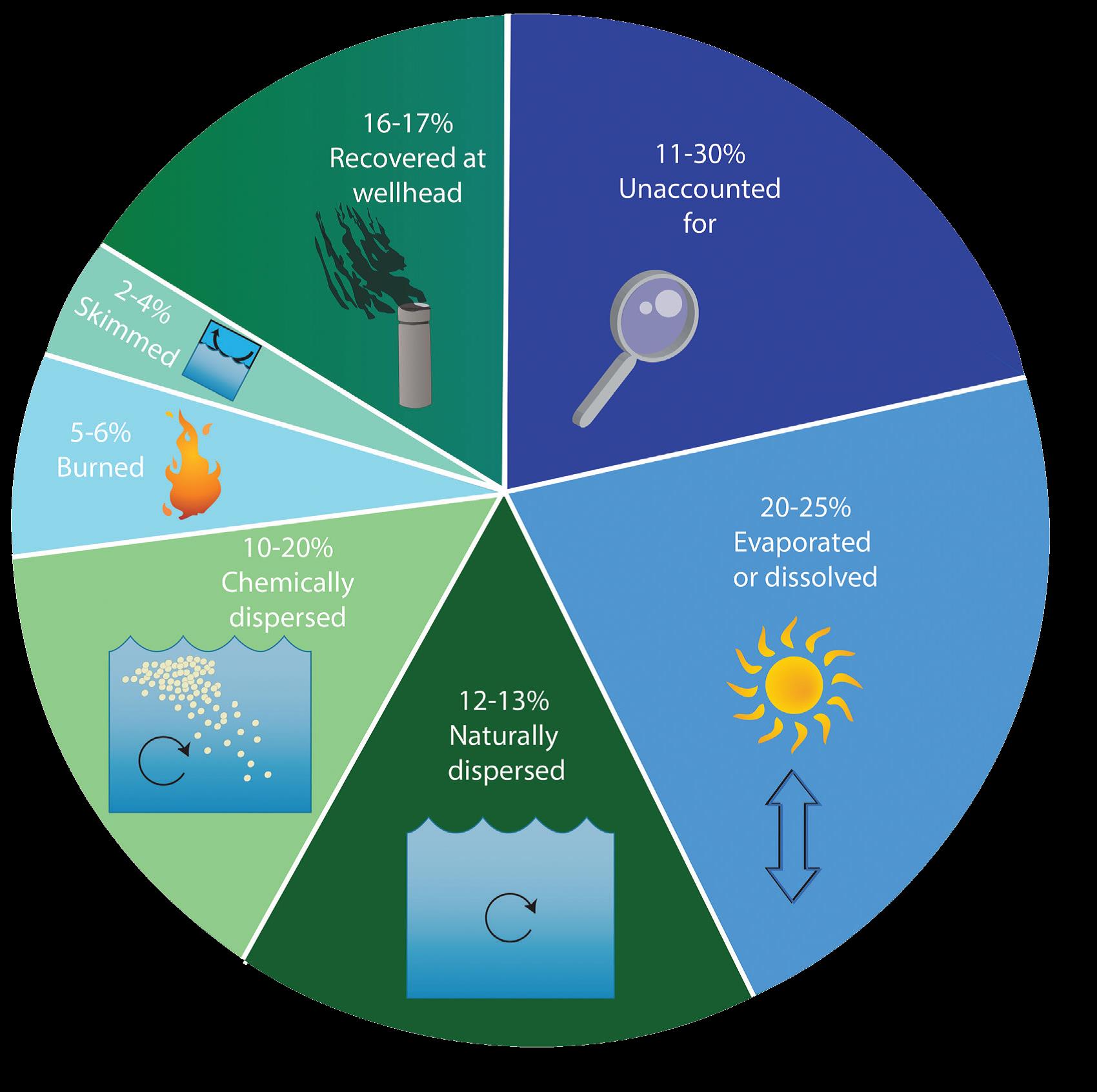
The Deepwater Horizon (DWH) oil spill occurred about 50 miles offshore of Louisiana in April 2010. Approximately 172 million gallons of oil entered the Gulf of Mexico. Five years after the incident, locals and tourists still have questions. This article addresses the five most common questions.
QUESTION #1: Is Gulf seafood safe to eat?
Ongoing monitoring has shown that Gulf seafood harvested from waters that are open to fishing is safe to eat. Over 22,000 seafood samples have been tested and not a single sample came back with levels above the level of concern. Testing continues today.
QUESTION #2: What are the impacts to wildlife?
This question is difficult to answer as the Gulf of Mexico is a complex ecosystem with many different species — from bacteria, fish, oysters, to whales, turtles, and birds. While oil affected individuals of some fish in the lab, scientists have not found that the spill impacted whole fish populations or communities in the wild. Some fish species populations declined, but eventually rebounded. The oil spill did affect at least one non-fish population, resulting in a mass die-off of bottlenose dolphins. Scientists continue to study fish populations to determine the long term impact of the spill.
Question #3: What cleanup techniques were used, and how were they implemented?
Several different methods were used to remove the oil. Offshore, oil was removed using skimmers, devices used for removing oil from the sea’s surface before it reaches the coastline. Controlled burns were also used, where surface oil was removed by surrounding it with fireproof booms and burning it. Chemical dispersants were used to break up the oil at the surface and below the surface. Shoreline cleanup on beaches involved sifting sand and removing tarballs and mats by hand.
QUESTION #4: Where did the oil go and where is it now?
The oil spill covered 29,000 square miles, approximately 4.7% of the Gulf of Mexico’s surface. During and after the spill, oil mixed with Gulf of Mexico waters and made its way into some coastal and deep-sea sediments. Oil moved with the ocean currents along the coast of Texas, Louisiana, Mississippi, Alabama, and Florida. Recent studies show that about 3-5% of the unaccounted oil has made its way onto the seafloor.
QUESTION #5: Do dispersants make it unsafe to swim in the water?
The dispersant used on the spill was a product called Corexit, with doctyl sodium sulfosuccinate (DOSS) as a primary ingredient. Corexit is a concern as exposure to high levels can cause respiratory problems and skin irritation. To evaluate the risk, scientists collected water from more than 26 sites. The highest level of DOSS detected was 425 times lower than the levels of DOSS known to cause harm to humans.
Maung-Douglass, E., Wilson, M., Graham, L., Hale, C., Sempier, S., and Swann, L. (2015). Oil Spill Science: Top 5 Frequently Asked Questions about the Deepwater Horizon oil spill. GOMSG-G-15-002.
An estimate of what happened to approximately 200 million gallons oil from the DWH oil spill. Data from Lehr, 2014. (Florida Sea Grant/Anna Hinkeldey)
The Foundation for the Gator Nation, An Equal Opportunity Institution.
White Shark (Carcharhinus carcharias). Credit: Florida Sea Grant Stock Photo
From Fear to Fascination: White Sharks in the Florida Panhandle
UF/IFAS Extension – Florida Sea Grant
By Rick O’Connor (Escambia County) and L. Scott Jackson (Bay County)
Recently, I was walking on our local Gulf fishing pier checking fishing line recycle bins. You can’t walk on a Gulf pier without looking over to possibly catch a glimpse of a sea turtle or a shark, and I was not disappointed. It was hard to tell which species of shark but it was about 6 feet in length. It swam south along the edge of the pier and then east to make a large arching circle through the emerald water, past bathers at the surf break, and back to the pier only to swim the pattern again. Onlookers from out-of-town were giggling with delight to see the animal while a couple of local fishermen tried tossing bait at it, but most ignored it and went on with their fishing.
Bob Shipp’s book, Fishes of the Gulf of Mexico, lists 29 species of shark found locally. Most are members of the requiem shark family, such as blacktips and bulls, and hammerheads. Though these sharks are certainly capable of attacking humans, their presence usually does not interrupt water activities. Divers who encounter sharks may be startled at first but rarely do they end their dive or have problems with them. Even in 2005, remembered as the “summer of the shark attack”, few people stopped diving or surfing. Individuals have become educated regarding shark behavior and are not as startled when they see one. However, in 2015 there were several encounters with White Sharks.
Sightings in the Gulf of Mexico are rare but usually occur in the cooler months. Is the increased interaction with White Sharks unusual or something to worry about?
Burgess assured me that White Sharks do occur in the Gulf of Mexico usually during cooler months and are transients, as opposed to residents. Their movement in and out of the Gulf is temperature driven. As late spring Gulf waters continue to warm into early summer, sighting a White Shark is less likely to occur. According to Burgess, White Sharks use deep water when traveling but prefer shallow water when hunting fish, turtles, and marine mammals. So, inshore encounters especially in cooler months would not be unusual.
Why is there a sudden increase in the numbers of encounters?
One part of the answer lies with the increased number of White Sharks. Conservation of sharks has been effective. Additionally, with the passing of the Marine Mammal Protection Act, there are more marine mammals, thus an increase in their predators, White Sharks. The other part is the number of humans visiting the northern Gulf has increased. There are more more visitors to marine waters, especially since the Deepwater Horizon oil spill. Everyone has a camera. Beachgoers, Swimmers, Divers, and Anglers all have improved technology to record their adventures.
Is Northwest Florida a “hot spot” for White Sharks? Burgess indicated that the northern Gulf of Mexico is more productive than the peninsular Florida due to the number of nutrient rich rivers in the region. Seeing more White Sharks here would not be any more unusual than finding more snapper, lionfish, or other species of shark. As far as worrying, there have been no records of White Shark attacks in the northern Gulf of Mexico since they began keeping records in 1872.
Finally, what does one do if they encounter a White Shark?
The quick answer is nothing different than with any other shark. It is true that most White Shark attacks occur at the surface but there are no records of any attacks in Florida. Burgess indicated that the Bull Shark is probably a bigger threat than the White Shark. For more information about Bull Sharks and general tips to avoid a negative shark encounter read this articlehttps://nwdistrict.ifas.ufl.edu/nat/sharktips
In a recent video, recorded near Apalachicola, a diver was on an anchor line on a decompression stop when he saw a White Shark approaching from depth. What should a diver do in this situation? Should they swim for the surface and risk decompression sickness, remain still, or return to the bottom?
The answer has a lot to do with what the shark is actually doing. Is the shark interested in the diver or acting aggressively? Burgess suggests, you assess the situation and the shark’s behavior. All options are on the table and have to be weighed against the consequences given in this scenario. As a last resort, a diver may need to make a quick but graceful exit out of the water, past the shark, and depend on their diving partners to render aid as needed. The lesson is for divers to be prepared for a variety of potential issues on every dive.