by Rick O'Connor | Sep 2, 2021
Eels… when that name comes up most think of either the vicious moray eels or the famous electric eel. Moray eels do exist in the Florida panhandle, and we will talk about them. Electric eels do not, they are found in the Amazon River system. That said, we do have eels here – quite a few. There are at least 18 species found in six different families. Most are 2-3 feet in length, though the Banded Shrimp Eel (Ophichthus) can reach six feet. About half of them are found offshore on the middle and outer shelves, the other half can be found in the inner shelf and estuaries, a few species swim into freshwater. Shrimpers often catch them when trawling and occasionally anglers will catch them with rod and reel.
Eels superficially resemble snakes and sometimes are confused with them. I have been told more than once that we do have sea snakes here. We do not. What people are finding are one of the 18 species of eels in the area. We do have snakes swimming across our estuaries, but we do not have sea snakes.
Eels differ from snakes primarily in that they, being fish, possess gills – not lungs. Most eels do have sharp teeth, the morays are famous for theirs, but no eels are venomous – so no worries there. Most of our eels have very small scales or are completely scaleless and are often very slimy and difficult to handle. They have been used as bait and one species, the American eel (Anguilla rostrata), has been used for food.
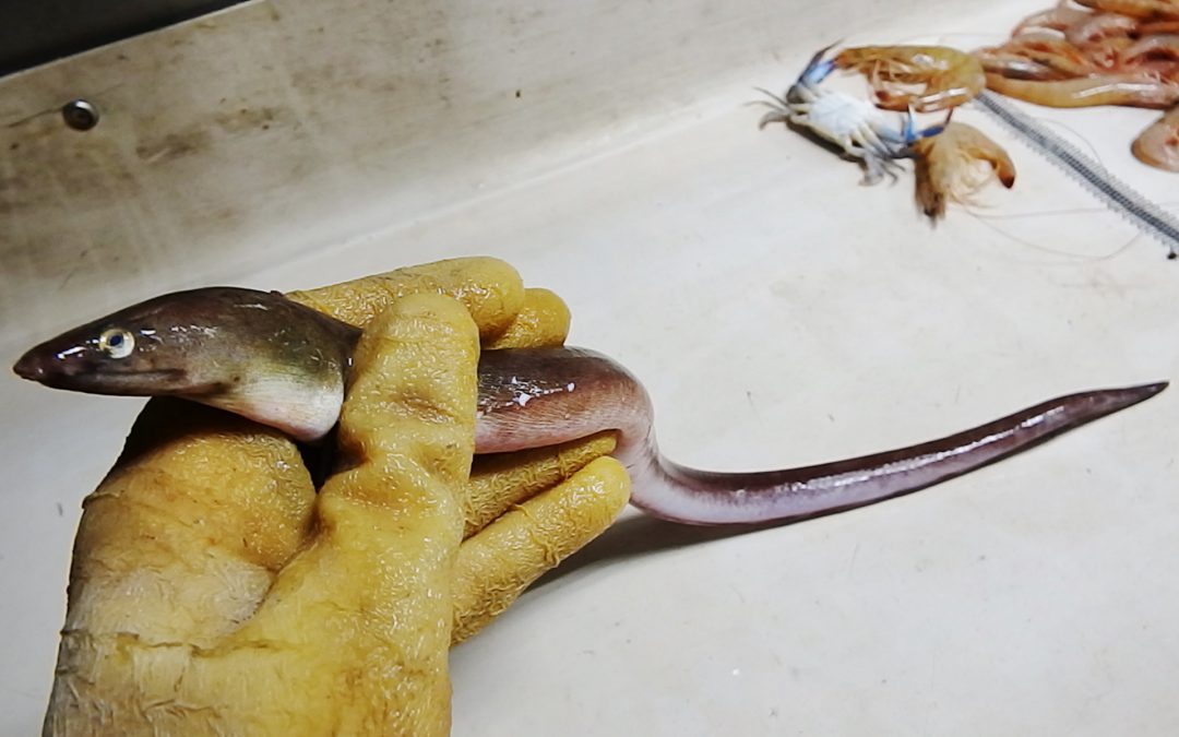
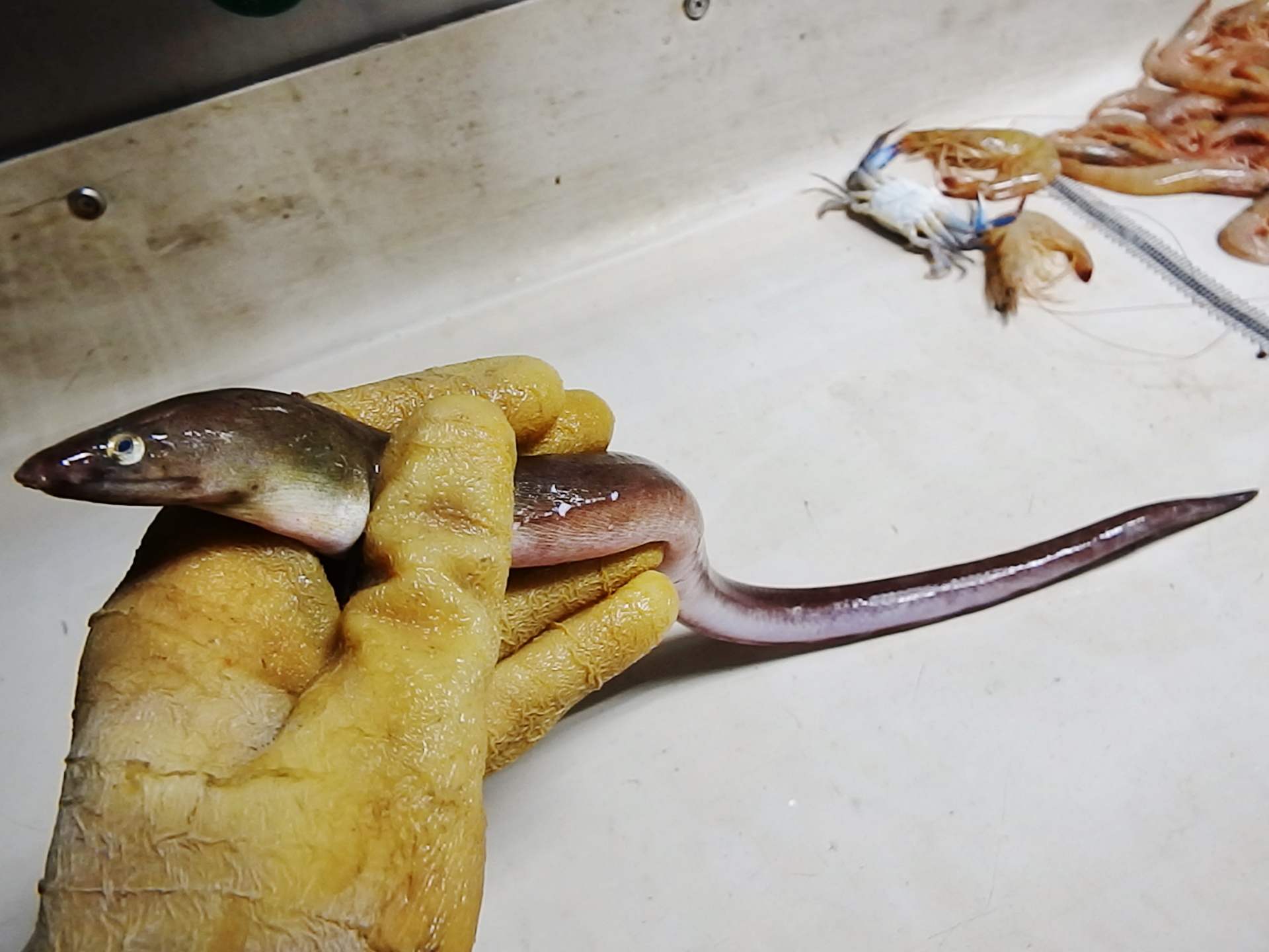
The Anguilla eel, also known as the “American” and “European” eel.
Photo: Wikipedia.
The American eel has an interesting life history. They spawn in the Sargasso Sea, an area in the middle of the Atlantic Ocean. Their developing leptocephalus larva are thin, flat, and transparent in the water. They drift with the ocean currents into the Gulf of Mexico and eventually into our estuaries. I have found them along the shores of Project Greenshores (in Pensacola Bay) during certain parts of the year. From here they work their ways into our local rivers where people encounter the large adults. I have found them living in submerged caves near Marianna and many locals have found them at the bottom of our rivers. When time to breed, the adults will leave and head back to the open Atlantic to begin the cycle again. An amazing trip.
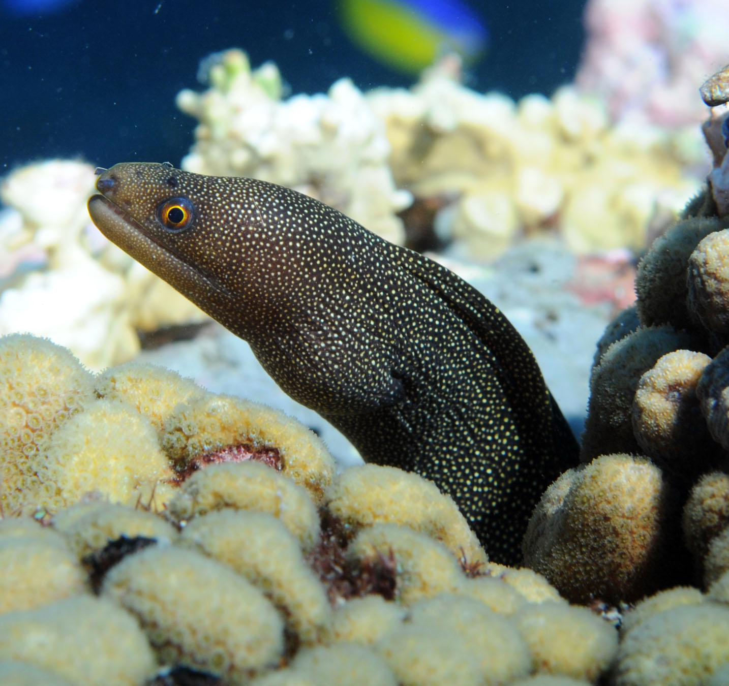
Moray eel.
Photo: NOAA
Moray eels are famous for the nasty attitudes and vicious bites. They are more tropical and associated with offshore reefs, though the ocellated moray (Gymnothorax ocellatus) is often caught in shrimp trawls. They live in the crevices of the reef ambushing prey. Some, like the green moray, can get quite large – over six feet. Like all eels, they have very powerful muscles and sharp teeth.
The shrimp eel is common on our inner and middle continental shelf.
Photo: NOAA
Conger eels are very common despite few people ever seeing them. There are six species and they frequent the middle continental shelf, so are rare in estuaries.
There are eight species of snake, or worm, eels. These are more common on the inner shelf and the coastal estuaries. Many prefer muddy bottoms where they bury tail first to ambush prey swimming by.
The majority of these marine eels have a large geographic distribution. Their larva can be carried great distances in the currents and their need for sandy or muddy bottoms can be met just about anywhere. They appear to have few barriers keeping them from colonizing much of the Gulf and surrounding waters. Most fall into the category we call “Carolina Fish”. Meaning their distribution occurs from the Carolinas, throughout the Gulf of Mexico, south to Brazil. There are a few species that can tolerate the lower salinities of the estuaries and one, the Anguilla eel, that can even venture into freshwater.
There are few species restricted to the tropical reefs, such as the morays. But morays are found on our smaller middle shelf and artificial reefs in the northern Gulf. Though found in parts of the Atlantic Ocean, Hoese and Moore1 reported one species of conger eel, Uroconger syringus, as only occurring near south Texas in the Gulf of Mexico. What barriers keep it from colonizing other Gulf habitats is unknown.
Eels are true fish that we rarely encounter. Encounters are usually startling but exciting at the same time. They are pretty amazing fish.
Reference
Hoese, H.D., R.H. Moore. 1977. Fishes of the Gulf of Mexico; Texas, Louisiana, and Adjacent Waters. Texas A&M University Press, College Station TX. Pp. 327.
by Laura Tiu | Jun 23, 2021
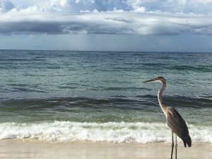
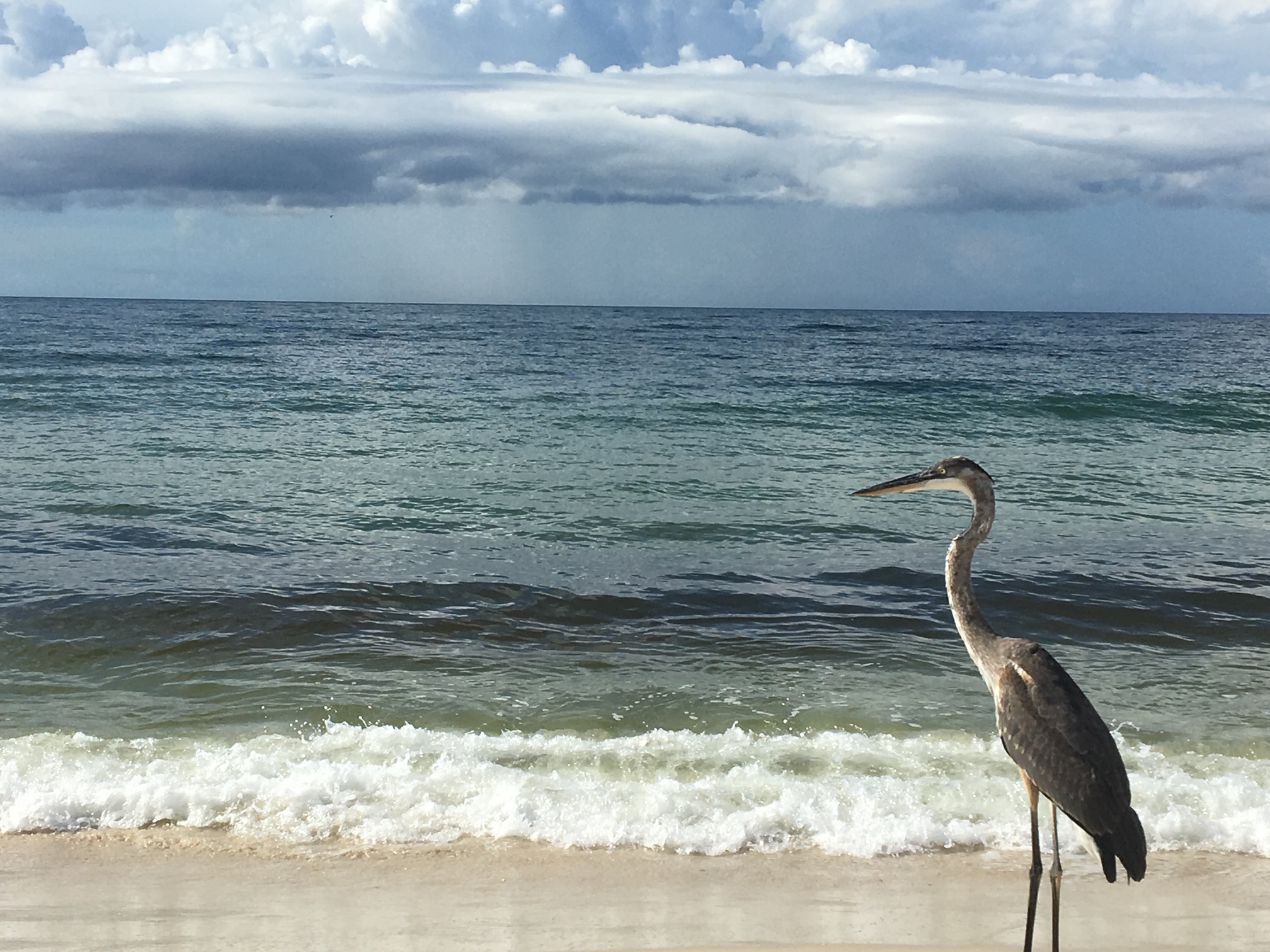
A great blue heron enjoying the Gulf of Mexico.
Photo: Chris Verlinde
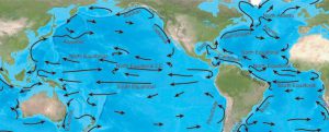
June is National Ocean Month. Close your eyes and think about just how many oceans there are. Surprise, there is only one! The ocean is huge, covering over 70 percent of the earth’s surface. Traditionally, the ocean was divided into four named ocean basins: the Pacific, Atlantic, Indian, and Arctic. However, most countries, including the United States, now recognize the Southern (Antarctic) as the fifth ocean. No matter where you live, you are connected to our one global ocean.
What do you know about our ocean? The ocean is where life began over 3.5 billion years ago. The ocean covers over 70% of the Earth’s surface and includes over 96% of the Earth’s water. Australia’s Great Barrier Reef is the largest living structure on Earth and can be seen from the moon! The deepest part of the ocean is in the Mariana Trench, and nearly 7 miles beneath the waves! Coral reefs cover only 1/50th of the ocean floor but about one quarter of all the marine species make coral reefs their home. No light penetrates the ocean at depths greater than 3,280 feet. Aided by deep diving rovers and remote sensing cameras, scientists are still discovering new species beneath the waves. The Gulf Stream transports more water than all the Earth’s rivers combined. The mid-ocean ridge crisscrosses the globe for over 40,000 miles and is the largest geological feature on Earth. Did you know that about 95% of the ocean remains unexplored?
What about our beloved Gulf of Mexico? Is it an ocean? No! While both oceans and gulfs are large bodies of saltwater, gulfs are smaller and are bordered on three sides by land. In the case of the Gulf of Mexico, it’s bordered by the United States and Mexico. So, although it is large and salty like the ocean, the Gulf of Mexico is considered part of the Atlantic Ocean.
Happy National Oceans Month!
Reference: National Oceanic and Atmospheric Administration https://oceanservice.noaa.gov/ocean/30days/welcome.html
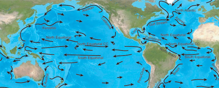
The equatorial currents of the Pacific.
Image: NOAA
by Rick O'Connor | Jun 18, 2021
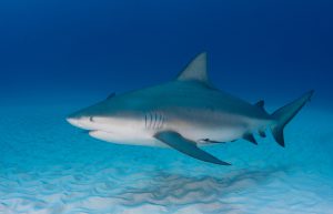
In our continuing series on the biogeographic distribution of island vertebrates, this week we look at a creature that, for some, is as scary as sharks – the rays. The term stingray conjures up stinging barbs and painful encounters, and these have happened, but rays are easily scared away by our activity. Occasionally people will step on one and the venomous spine is used to make you move your foot. You can avoid this by shuffling your feet when moving across the sand. Rays detect the pressure and move before you reach them. Again, negative encounters with rays are not common.
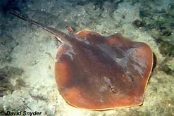
The Atlantic Stingray is one of the common members of the ray group who does possess a venomous spine.
Photo: Florida Museum of Natural History
There are 18 species of rays (from 9 families) found in our area. An interesting note, only eight of those possess a barb for stinging, and five are from the family Dasyatidae (the stingrays). Others that have barbs include the butterfly ray, cownose ray, and the eagle ray.
Rays are related to sharks but differ in that (a) the pectoral fin begins before the gills slits, and (b) the gill slits are on the underneath of the body – not on the side as found in sharks. Shark distribution seems to be controlled by water temperature. We see this with ray distribution as well, but interestingly the skates seem to be restricted to the Gulf of Mexico. Some are found almost exclusively in the east or west side of the Gulf.
Skates resemble stingrays but lack the venomous barb. They will usually have small thorns on their bodies and lay their developing embryos in a leathery egg case folks call “mermaid’s purse” when they wash ashore. There are four species found in the Gulf, but the spreadfin skate is ONLY found in the Gulf of Mexico and is not found along the Florida peninsula. The clearnose skate, which can be found all along Florida and the eastern seaboard of the U.S., is absent from western Gulf. It is interesting to try and understand why. What barrier keeps these two skates from colonizing the entire Gulf?
There is a large plume of muddy freshwater that expands from the Mississippi River into the Gulf off Louisiana. This plume could be a barrier for coastal species trying to expand their range. However, the spreadfin skate is reported to be an outer continental shelf species and may not be influenced by this lower salinity water. So, what is their story?
And why are these not found in the Caribbean? In the Caribbean you do enter tropical waters where coral reefs become more common. There is certainly a species shift when you reach this zone and it could be the food needed by these skates is not found here – a biological barrier. Many find these biogeographic situations interesting.
There are 12 species that have the typical “Carolina marine fish” distribution, which means they are found throughout the Gulf up the eastern seaboard to Massachusetts and south to Brazil. Two, the Atlantic torpedo ray and the roughtail stingray, expand their range farther into Canada. As a matter of fact, the roughtail stingray prefers colder waters.
Torpedo rays are an interesting group. This family of fish includes two species here in the Gulf, the Atlantic torpedo ray and the lesser electric ray. Yep… these two have special muscle cells that can deliver an electric shock. It is believed this electric current can detect and stun prey as well as repel predators. The voltage is not dangerous but will get your attention.
Three of those “Carolina marine species,” the guitarfish, the lesser electric ray, and the yellow stingray, do not reach Massachusetts. Their distribution ends at North Carolina. You would have to guess water temperature as a barrier here. The warm Gulf stream begins heading east across the Atlantic Ocean off Cape Hatteras towards Europe. They could follow this current to Bermuda, but they have not been reported there. This could be due to depth (pressure), being benthic fish, or food barriers.
There is one family that is tropical, the sawfish. These bizarre dinosaur looking creatures were once common in the estuaries of the Gulf region. They are now rare and protected.
One species of stingray, the Atlantic stingray has been found in the lower reaches of Louisiana rivers. Like bull sharks, salinity may not be a barrier for them.
And then we have our “world travelers”. The manta and eagle rays are found across the globe in tropical waters, and eagle rays are common in temperate parts of the world.
The distribution of our rays is not as universal as sharks. The skates in particular have an interesting distribution pattern. Pensacola lies right at the boundary of the eastern and western Gulf of Mexico, so we find both geographic groups here. Though they may scare many people, rays are fascinating creatures and cool to see.

by Rick O'Connor | Jun 3, 2021
With this article we are going to begin a short series on the biogeography of panhandle vertebrates. Biogeography is the study of distribution of life and why species are found where they are. Many are interested in what species are found in a specific location, such as which sharks are found in our area, but understanding why others are not is as interesting.
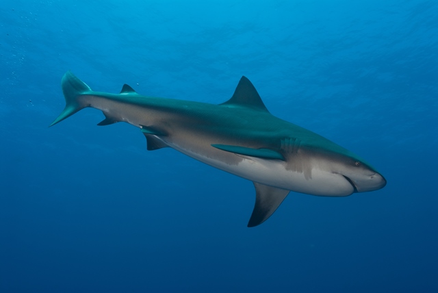
The Bull Shark is considered one of the more dangerous sharks in the Gulf. This fish can enter freshwater but rarely swims far upstream. Photo: Florida Sea Grant
All species have a point of origin and from there they disperse across the landscape, or ocean, until they reach a barrier that stops that dispersal. These barriers can be something physical, like a mountain range, something climatic, like the average temperature, or something biological, like to abundance of a specific food or predator. There are a lot of barriers that impede dispersal and explain why some species are not present in some locations.
Sharks are marine fish. In general, there is little to impede the dispersal of marine fish. All oceans are connected and there is no reason why a shark found in the Gulf of Mexico could not swim to Australia, and some have. But there are barriers that keep some species of south Florida fish from reaching north Florida – mean water temperature being one.
There are 24 species of sharks from nine different families found in the Gulf of Mexico. Most have a wide distribution range, and some are found worldwide. Nurse sharks are more tropical, common in the Keys, but are found in our area of the northern Gulf of Mexico. They are fans of structure and are often found near our artificial reefs.
Whale sharks and hammerheads are circumtropical, meaning they are restricted by water temperature but found worldwide in warmer waters. Whale sharks are the largest of all fish, reaching a mean length of 45 feet, and are not common near shore. They are plankton feeders and, though large, are harmless to humans. There are five species of hammerheads found in the Gulf of Mexico. They are easily identified by their “hammer” shaped head and are known for their large dorsal fin that, at times, will extend above the surface while they are swimming. Finding species of hammerhead inside the bay is not uncommon.
Several of our local sharks are not as restricted by water temperature and are found as far north as Canada. Sand tigers, threshers, and dogfish seem to prefer the cooler waters and, though found in the Gulf, are not common. There are two members of the mackerel shark family found here. Great whites, of movie fame, prefer cooler waters and are found worldwide – except for polar waters. There are records in the Gulf, but most are offshore in cooler waters. As you know, these are large predatory sharks, reaching up to 25 feet in length, and are known to feed on large prey such as seals. Their cousin the shortfin mako, prefers warmer waters and is more common here. Nearshore encounters with makos is rare but has happened.
The largest family, and best known, are the requiem sharks. There are 13 species in the Gulf, and many are common in our area. Many are not as restricted by water temperature and can be found as far north as New York. Bull sharks are not restricted by salinity and have been found up rivers in Alabama, and Louisiana. Silky sharks are more tropical, and the tiger and spinner sharks are more circumtropical.
The geographic distribution of sharks seems centered on water temperature. Most can easily swim the oceans to locations across the globe but congregate in areas of preferred temperatures and food. Though feared because of attacks on humans, a rare thing actually, they are fascinating animals and world travelers.
by Laura Tiu | Mar 26, 2021
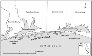
I am a curious person by nature. When I first moved to the Emerald Coast, I had many questions about the area. For example, why do they call this the Emerald Coast? To help answer my questions, I turned to the Destin History and Fishing Museum in Destin, FL. If you haven’t yet visited the museum, I highly recommend it for locals and visitors alike.
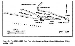
It was easy to see why they call this the Emerald Coast once one lays eyes on the beautiful emerald color water. Other questions weren’t so easily explained. For example, I wanted to know why the pass out of Destin Harbor is called the East Pass, when it is clearly on the west side of Choctawhatchee Bay? In fact, in the early 1900’s, the only outlet from the Bay to the Gulf was about 1.5 miles east of where the current pass resides and was called Old Pass Channel. In 1929, a storm sealed off Old Pass Channel and a heavy dose of spring rain raised Choctawhatchee Bay five feet. The threat of flooding inspired four local fishermen to take matters into their own hands and they dug a small trench across Santa Rosa Island to let the water out of the Bay. By the next morning, the trench had significantly widened into the East Pass we have today, connecting Choctawhatchee Bay to the Gulf of Mexico.
However, that still didn’t explain the East Pass moniker. To explain, we need to look west. Choctawhatchee Bay is connected to Pensacola Bay by the Santa Rosa Sound. This narrow passageway is the space between the Santa Rosa Island, a barrier island, and the mainland. In the early 1900’s, many of the goods and services traded between inhabitants in Okaloosa and Walton counties traveled on ships from Choctawhatchee Bay, through the Santa Rosa Sound, and over to Pensacola Bay, instead of going out into the Gulf. The opening between the Sound and Pensacola Bay is the West Pass, and hence the opening between the Sound and Choctawhatchee Bay is the East Pass. Another mystery solved.
If you are interested in knowing more about the history of this area, the Destin History and Fishing Museum is the place to go.
Citation: Morang, A. . A study of geological and hydraulic processes at East Pass, Destin, FL. Accessed: https://apps.dtic.mil/dtic/tr/fulltext/u2/a253890.pdf
“Foundation for a Gator Nation”

by Rick O'Connor | Nov 13, 2020
This is not a word that most visitors to the beach want to hear. However, shark attacks are actually not that common and the risk is very low. People hear this every year on shark programs, but it does not seem to make them feel any better. Here is what the International Shark Attack File says (as of 2020)…
– Since the year 1580 there have been 3164 unprovoked shark attacks around the world.
Let that sink in for a moment… 3000 unprovoked attacks on humans in the last 440 years.
Now consider the number of car accident victims that have occurred in the last month within the United States. See what they are getting at? Let’s look at more…
– Of the 3164 reported unprovoked attacks (yes… these data only include what was reported) 1483 were from the United States… 47% of them. This may be due to the fact we are “water people”. The other top countries are Australia, South Africa, and Brazil, all “water people” as well.
– Of the 3164 reports 851 were from Florida (27%). This is the number of reported shark attacks in our state since the Spanish settled it. This comes out to 2 each year – though the data shows a sharp increase in attacks starting in the 1970s (most have occurred since then).
– Of the 3164 reports 25 were from the panhandle region (0.8%) and 7 from the Pensacola Bay area (0.2%).
Let that sink in for a moment. Seven reported attacks from the Pensacola Beach area since the time DeLuna landed here in 1559… 7.
And lets once again consider the number of vehicle accidents that will occur in the bay area today.
These numbers have been posted before. Yet people are still very worried when the hear sharks are in the Pensacola Beach region. When attacks occur, they are big news. The International Shark Attack File does give trends and suggestions on what to do. But as many say, sharks are the least of your worries when you are planning a day at the beach.
Now that we have said all of that, they are truly amazing animals.
They are fish but differ in that their skeletons lack hard calcified bone – they are cartilaginous. There are 25 species in 9 different families in the Gulf of Mexico. Many are completely harmless – 13 of the 25 have been reported to have had unprovoked attacks somewhere around the world – the white, tiger, and bull sharks leading the way. Several rarely come close to shore.
Sharks lack a swim bladder and thus cannot “float” in the water column the way your aquarium fish do. Some, like the nurse and angel sharks, rest on the bottom. Others, like the white and blue sharks, swim constantly to get water flowing over their gills.
Because of this, they are very streamlined with reduce scales. They actually have modified teeth for scales – called placoid scales. Their fins are angular and rigid (as are other open water fish) and some can swim quite fast – makos have been clocked at over 30 mph for short distances. Many have seen video of large white sharks exploding with a burst of speed on a sea lion and actually leaping out of the water with it.
Many species do lay eggs, but others keep the eggs within and give live birth after they hatch. One species, the sand tiger, produce four embryos within the mother. The first to hatch consumes the other three!
The teeth of sharks are famous. Rows of them, some pointed, some are serrated, all are designed to cut and swallow. The tiger shark has a serrated tooth that is angled like a can opener. They can use this to “open” sea turtle shells – adding them to their rather large menu. They “shed” these frequently – placing a new sharp tooth where the dull old one was – and will go through tens of thousands of teeth in a lifetime.
The sensory system is one of the most amazing in the world. Tiny gelatinous cells along their sides, called the lateral line, detect pressure waves from great distances. Splashing, thrashing movements made by fish can be detected a mile away – and get their attention. As they approach the sound their sense of smell kicks in. It has been said that a shark can detect one drop of blood in thousands of gallons of water – and it is true. However, the sharks must be down current of the victim to detect it. Their eyes are much better than most think. They have “crystals” within their retina that act as mirrors reflecting light that enters. Imagine turning on a flashlight in a dark room. Now imagine doing this if the walls and ceiling were mirrors – you kind of understand how they can actually see pretty well even in the low light. That said, light does not travel well under water, so they rely on their other senses more. And as if that were not enough. They have small gelatinous cells around the head region that can detect small electric fields. When a shark bites, it must close its eyes and – as the fishermen say – “roll back” out of the head. At this point the shark is basically blind and cannot see the target it is trying to bite. However, if you move out of the way, the weak electric fields produced by your muscles in doing so can be detected by these cells and the shark knows where you are.
Cool – and scary at the same time. Let’s meet a few of these amazing fish in our area.
https://www.floridamuseum.ufl.edu/shark-attacks/
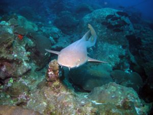
The nurse shark. Notice the barbels (whiskers) on its head.
Photo: NOAA
Nurse Shark
This is one of the bottom dwelling sharks that appear harmless – and they are – but if provoked, they will bite. They have less angular fins, or a brownish-bronze color, and really like structure – they are found on our reefs. They posses a “whisker-like” structure called a barbel. These are common on other bottom fish, like catfish, and possess chemo-sensory cells to detect prey buried in the sand. They are not as common here as they are in the Keys, but they have been seen. They can reach lengths of 14 feet.
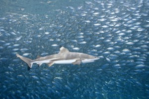
Blacktip sharks are one of the smaller sharks in our area reaching a length of 59 inches. They are known to leap from the water. Photo: Florida Sea Grant
Blacktip – Spinner
These are grouped together because (a) they resemble each other, and (b) they are both common here.
They are both stream-lined in shape and have blacktips on their fins. Actually, spinner sharks have more fins tipped-black than the blacktip. The anal fin of the spinner is tipped black, but this is not the case for the blacktip. The spinner gets its name from the habit of leaping from the water and spinning very fast as it does so. Both are quite common in the Gulf and the bay. They reach about eight feet in length and unprovoked attacks are very rare.
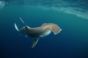
The Scalloped Hammerhead is one of five species of hammerheads in the Gulf. It is commonly found in the bays. Photo: Florida Sea Grant
Hammerheads
This is a creepy group – check out the head. It is one that many people fear, and unprovoked attacks have occurred. The reader may not know that there are more than one kind – five species actually. They have a tall dorsal fin which sometimes extends above the water when swimming near the surface – the classic “shark is coming” look. Their heads are aerofoil shaped and there are several possible explanations for this. 1) It is more aerodynamic, making it easier for this ram-jetter to swim, using less energy to do so. 2) It is a battery of sensory cells. By swinging the head back and forth, as they do, it is an advanced radar searching for prey, possibly finding it before other sharks do. There are stories of hammerheads arriving first. 3) It is also believed they use their electric sense to detect buried prey – the shape making this easier to find and expose them. It could very well be that all of these could explain the shape.
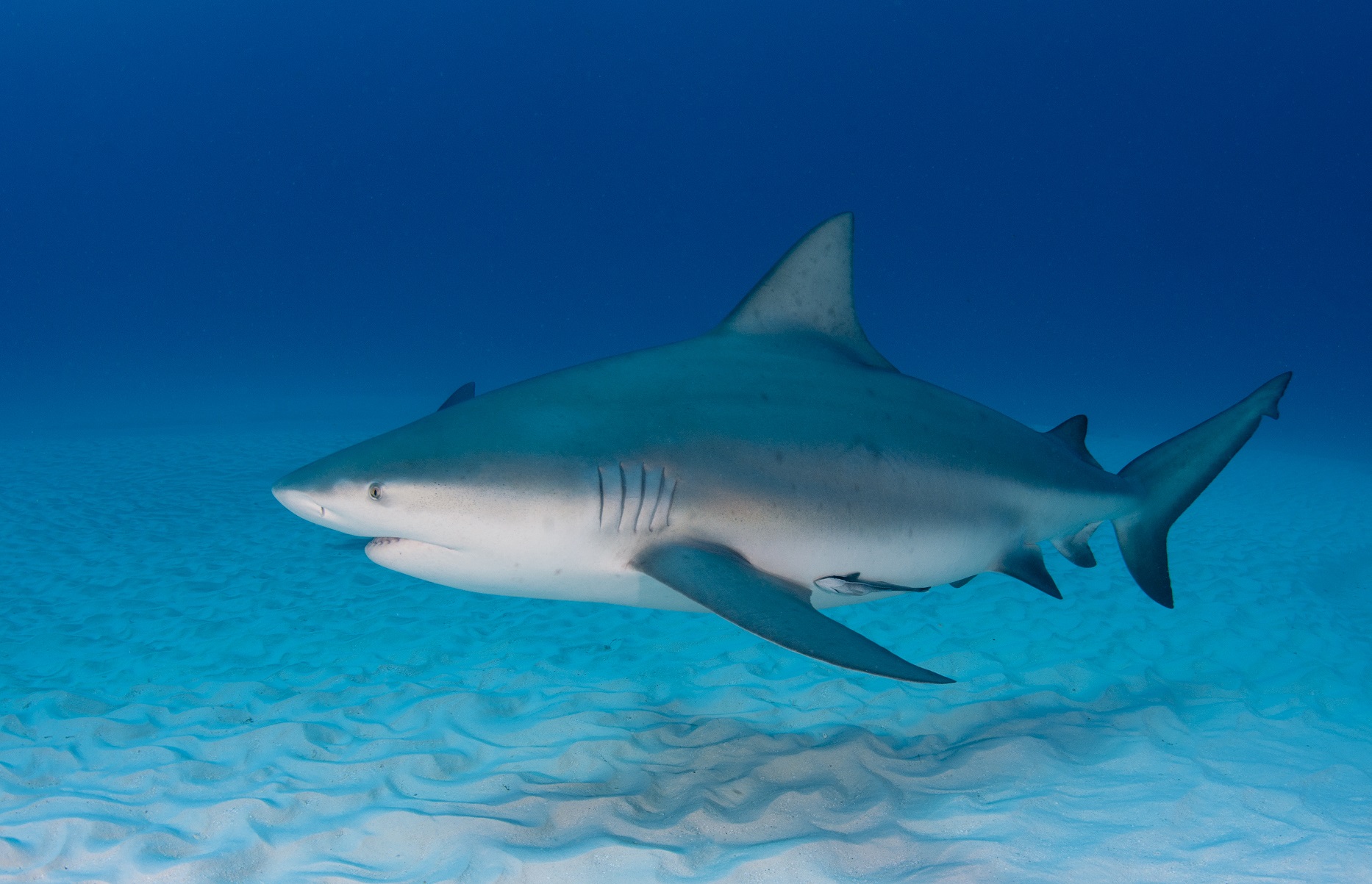
This pregnant bull shark has an impressive girth.
Bull Shark
Since the film Jaws the world has turned its attention from solely the white shark – to the bull shark. As you can imagine, it is hard for a shark attack victim to tell you which species bit them – “I don’t know… it was a big gray thing chomping on my leg!” or “It was a great white!” because that is the only one many know. But studies sine the 1970s suggest that the bull shark is an aggressive species and may be responsible for a lot of attacks. Particularly in the estuaries and upper estuaries. Bull sharks are what we call euryhaline – they have tolerance for a wide range of salinities. This shark has been reported in low salinities of the upper estuaries and even into freshwater rivers. One report had them over 100 miles from the coast – they are certainly where the people are.
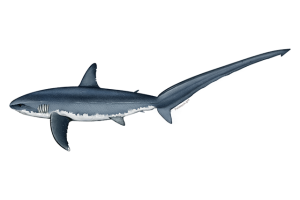
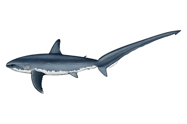
The extremely long upper lobe of the thresher shark.
Image: NOAA
Thresher Sharks
These are bizarre looking sharks. Most sharks have what we call a heterocercal tail – different – different meaning the upper lobe of the forked tail is longer than the lower. But the threshers take this to the extreme – the tail can make up almost half of their body length, which can be 20 feet. It is believed that use this extremely long tail to herd and stun baitfish – their favorite prey. They prefer colder waters and records in the Gulf are not common. Those that exist suggest they live offshore and are rarely encountered near beaches. There are no unprovoked attacks reported from this shark.

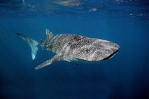
The massive whale shark.
Photo: Florida Museum of Natural History.
Whale Shark
Amazing… heart stopping… what else can you say. Encounters with the largest fish on our planet are rare – but when they do happen you will never forget it – it will be one of the highlights of your life. As the name suggest – these are large sharks, with a mean length of 45 feet but some reporting in at 60 feet. They are easily recognized first by their size, but also their coloration. They are brownish color with beige or white spots in nice rows running across the dorsal side. They swim slowly filtering plankton from the sea – though will occasionally take in a fish. Some reports show them vertical in the water column moving up and down filtering from a school of plankton or tiny fish. They are rarely seen because they tend to dive deeper during the day with the plankton layer – then surfacing at night following the same plankton. They are, unfortunately, sometimes struck by boats while at the surface.