by Mark Mauldin | Oct 10, 2019

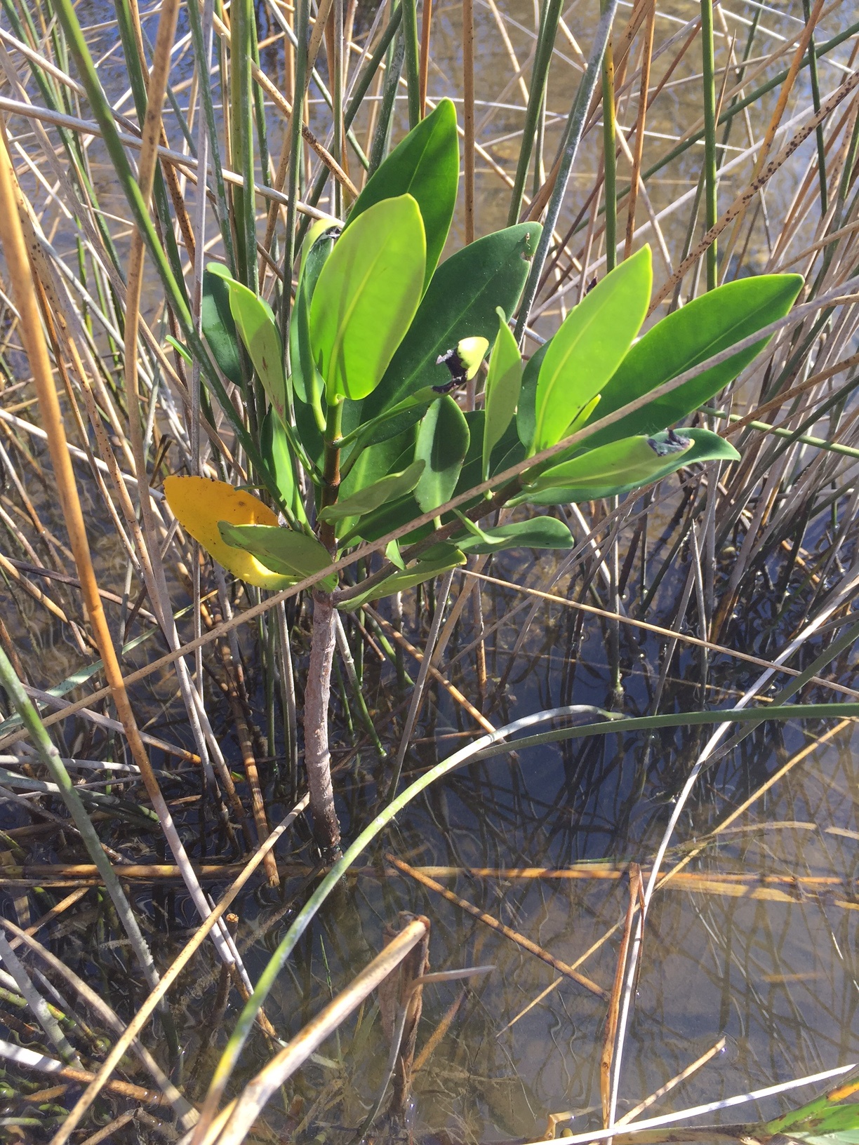
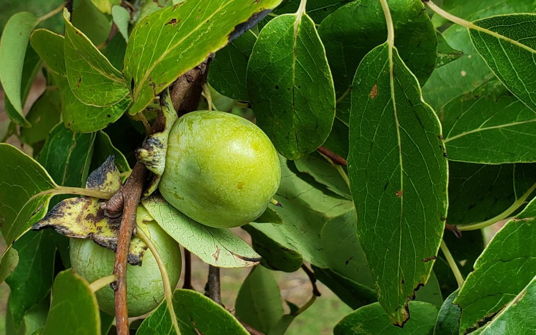
Protecting and promoting plants that produce soft mast, like this wild persimmon, can be a crucial step in improving wildlife habitat. Note: This time of year persimmons will be orange, the picture was taken earlier in the summer.
Photo Credit: Mark Mauldin
Landowners frequently prioritize wildlife abundance and diversity in their management goals. This is often related to a desired recreational activity (hunting, bird watching, etc.).
In order to successfully meet wildlife related management goals, landowners need to understand that animals frequent specific areas based largely on the quantity, quality and diversity of the food and cover resources available. Implementing management strategies that improve wildlife habitat will lead to greater wildlife abundance and diversity.
Herbivorous wildlife feed on plants, mostly in the form of forages and mast crops. All wildlife species have preferences in terms of habitat, especially food sources. Identifying these preferences and managing habitat to meet them will promote the abundance of the desired species.
Herbaceous plants, leaves, buds, etc. – serve as forages for many wildlife species. Promoting their growth and diversity is essential for improving wildlife habitat. Three common habitat management practices that promote forage growth include:
1) Create forest openings and edges; forested areas with multiple species and/or stand ages, areas left unforested allowing for increased herbaceous plant growth.
2) Thinning; open forest canopy allowing more light to hit the ground increasing herbaceous plant growth and diversity.
3) Prescribed fire; recycle nutrients, greatly improve the nutritional quality of herbage and browse, suppress woody understory growth.
Mast – the seeds and fruits of trees and shrubs – is often one of the most important wildlife food sources on a property.
Hard mast includes shelled seeds, like acorns and hickory nuts and is generally produced in the fall and serves as a wildlife food source during the winter.
Soft mast includes fruits, like blackberries and persimmons, and is generally produced in the warmer months, providing vital nutrition when wildlife species are reproducing and/or migrating.
Making management decisions that protect and promote mast producing trees will encourage wildlife populations.
Landowners can make supplemental plantings to increase the quantity and quality of the nutrition available to wildlife. These supplemental plantings (food plots/forage crops and mast producing trees) can be quite expensive and should be well planned to help maximize the return on investment.
Key points to remember to help ensure the success of supplemental wildlife plantings.
- Select species/varieties that are well adapted to the site.
- Take soil samples and make recommended soil amendments prior to planting.
- Make plantings in areas already frequented by wildlife (edges, openings, etc.).
- Food plots should be between 1 and 5 acres. Long, narrow designs that maximize proximity to cover are generally more effective.
Habitat management and other wildlife related topics are being featured this year in the UF/IFAS building at the Sunbelt Ag Expo. Make plans to attend “North America’s Premiere Farm Show” and stop by the UF/IFAS building, get some peanuts and orange juice and learn more about Florida’s Wildlife.
 If you have any questions about the topics mentioned above, contact your county’s UF/IFAS Extension Office or check out the additional articles listed on the page linked below.
EDIS – Wildlife Forages
A significant portion of this article was summarized from Establishing and Maintaining Wildlife Food Sources by Chris Demers et al.
by Carrie Stevenson | Sep 27, 2019
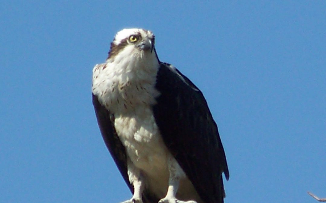
Ospreys, or fish hawks, build their nests from sticks atop dead trees. Photo credit: UF IFAS Extension
Big hurricanes like Dorian (Bahamas) and 2018’s Michael (central Florida Panhandle) were devastating to the communities they landed in. Flooding, wind, rain, loss of power and communications eventually made way for ad hoc clearing and cleanup, temporary shelters, and a slow walk to recovery. Among the most striking visual impacts of a hurricane are the tree losses, as there are unnatural openings in the canopy and light suddenly shines on areas that had been shaded for years. In northwest Florida, pines are particularly vulnerable. After any hurricane in the Panhandle, you can drive down Interstate 10 for miles and see endless pines blown to the ground or broken off at the top. During Hurricane Ivan 15 years ago, the coastal areas in Escambia and Santa Rosa lost thousands of trees not only due to wind, but also to tree roots inundated by saltwater for long periods.
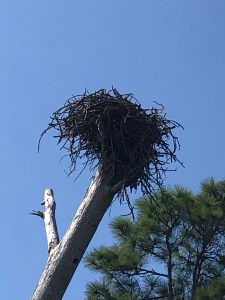
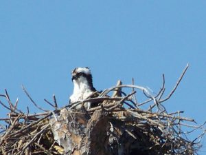
Dead trees left by hurricanes serve as ideal nesting ground for large birds like ospreys. Photo credit: Carrie Stevenson, UF IFAS Extension
Nature always finds a way, though. Because of all those dead (but still-standing) pines, our osprey (Pandion haliaetus) population is in great shape in the Pensacola area. How are these two things related? Well, ospreys build large stick nests in the tall branches/crooks of dead trees, known as snags. They particularly prefer those near the water bodies where they fish. When I first moved here 20 years ago, I rarely saw ospreys. Now, it’s uncommon not to see them near the bayous and bays, or to hear their high-pitched calls as they swoop and dive for fish.
If you are not familiar with ospreys, they can be distinguished by their call and their size (up to six foot wingspan). It is common to see them in their large nests atop those snags, flying, or diving for fish. I usually see them with mullet in their talons, although they also prey on catfish, spotted trout, and other smaller species. They have white underbellies, brown backs, and are smaller than eagles but larger than your average hawk. One of their more interesting physical adaptations (and identifying characteristics) is their ability to grip fish parallel to their bodies, making it more aerodynamic than the perpendicular method most birds use.
Ospreys mate for life, and cooperate to build nests and care for young. The species has overcome many complex threats—including DDT damage to eggs and habitat loss—but the sight of them flying is always inspiring to me. They are a living embodiment of resilience amidst adversity.

by Carrie Stevenson | Aug 16, 2019
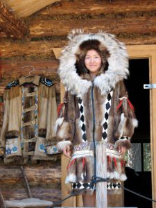
The indigenous people of Alaska have long adapted to freezing winters by relying on local wildlife for warm clothing. Photo credit: Carrie Stevenson, UF IFAS Extension
Human beings are an incredibly adaptable species. For countless generations, our ancestors have migrated to the far reaches of the planet to find food and territory. The Inuit people of Alaska adapted to months of freezing weather and darkness by developing techniques for harvesting fish through the ice and making furs from local wildlife. Meanwhile in the remote Andaman Islands, tribal people still subsist on fruit from the prolific rain forest and spearfishing in the Bay of Bengal.
Wildlife have behaved similarly throughout history. Before much of the United States was developed and crisscrossed with roads, large herds of bison grazed the entire mid and mountain west. Until the mid 1960’s, the upper Midwest and east coast experienced a tree-based squirrel migration of millions. Overhunting also impacted both of these species. According to the National Wildlife Foundation, monarch butterflies migrating for the winter from the United States to Mexico were down 15% last year due to hurricanes, warmer fall temperatures, and a lack of food sources along their routes. Overall, monarch numbers are down 90% from a peak population 20 years ago.
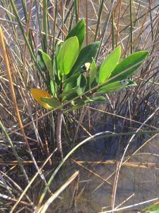
Worldwide, mangrove trees are moving from warmer climates into temperate habitats as climate changes. Photo credit: Carrie Stevenson, UF IFAS Extension
Recent changes in climate are also becoming a factor for human and wildlife behavior. I find myself “migrating” into the air conditioning more often in these dog days of August as 110°+ heat indices bear down. The European heat wave this summer resulted in record-breaking temperatures and at least 8 deaths. Many European countries have never needed air conditioning, so homes, public transportation, and vehicles provide no relief from the sweltering heat. Wildlife, by contrast, cannot move indoors. As the planet warms, some wildlife living in temperate regions may move because their homelands slowly turn subtropical. When this happens, history shows us that humans either “persecute, protect, or ignore” new species, which may result in great success or the downfall of species seeking new habitat. In addition, biologists have been observing and expecting many tropical species of plants and animals to expand into new, warmer territories, as formerly cold climates heat up and become more suitable for particular species to thrive. Mangroves, for example, are migrating beyond the equator worldwide, while the National Oceanic and Atmospheric Administration (NOAA) Arctic report card has shown that the melting of polar ice caps has literally broken up polar bear habitat, along with reducing populations of grazing herds of caribou and reindeer.
Keep in mind that neither one hot summer nor one cold winter define the pace of climate change. The issue at hand is the long-term change. We find ourselves, in August 2019, having just experienced the hottest July (globally) on record since worldwide recordkeeping began in 1880. Some may see this as a fluke, until we consider that NOAA and NASA data show that 17 of the 18 warmest years have occurred since 2001. The patterns are changing—and as always, we humans must adapt. It is important that our adaptation includes mitigation measures, which can range from reducing energy use to planting more trees. To learn more about changes in worldwide climate and what you can do to make a difference, visit the NOAA site https://www.climate.gov/
by Scott Jackson | Jun 21, 2019
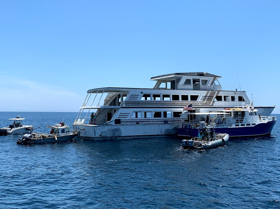
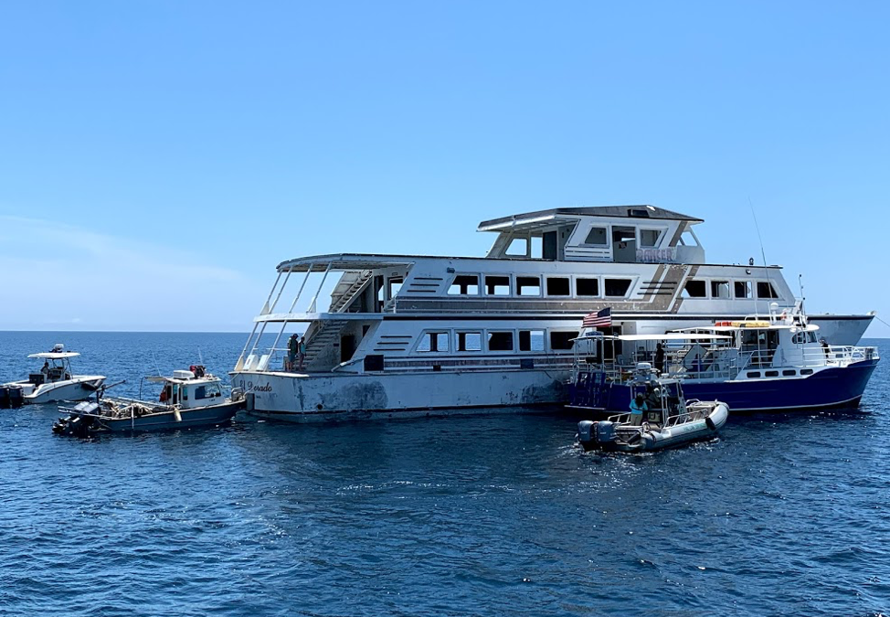
Panama City Dive Center’s Island Diver pulls alongside of the El Dorado supporting the vessel deployment by Hondo Enterprises. Florida Fish and Wildlife crews also are pictured and assisted with the project from recovery through deployment. The 144 foot El Dorado reef is located 12 nautical miles south of St Andrew Pass at 29° 58.568 N, 85° 50.487 W. Photo by L. Scott Jackson.
In the past month, Bay County worked with fishing and diving groups as well as numerous volunteers to deploy two artificial reef projects; the El Dorado and the first of the Natural Resources Damage Assessment (NRDA) reefs.
These sites are in Florida waters but additional opportunities for red snapper fishing are available this year to anglers that book for hire charters with captains holding federal licenses. Federal licensed Gulf of Mexico charters started Red Snapper season June 1st and continue through August 1st. Recreational Red Snapper fishing for other vessels in State and Federal waters is June 11th – July 12th. So booking a federally licensed charter can add a few extra fish to your catch this year.
The conversion of the El Dorado from a storm impacted vessel to prized artificial reef is compelling. Hurricane Michael left the vessel aground in shallow waters. This was in a highly visible location close to Carl Grey Park and the Hathaway Bridge. The Bay County Board of County Commissioners (BOCC) acquired the El Dorado, January 14, 2019 through negotiations with vessel owner and agencies responsible for recovery of storm impacted vessels post Hurricane Michael.
The El Dorado was righted and stabilized, then transported to Panama City’s St Andrews Marina by Global Diving with support from the Coast Guard and Florida Fish and Wildlife. Hondo Enterprises, was awarded a contract to complete the preparation and deployment of the vessel for use as an artificial reef.
Reefing the El Dorado provides new recreational opportunities for our residents and tourists. The new reef delivers support for Bay County’s fishing and diving charters continuing to recover after Hurricane Michael. Several local dive charter captains assisted in the towing and sinking of the El Dorado.
The El Dorado was deployed approximately 12 nm south of St. Andrew Bay near the DuPont Bridge Spans May 2, 2019. Ocean depth in this area is 102 feet, meaning the deployed vessel is accessible to divers at 60 feet below the surface.
The Bay County Board of County Commissioners continues to invest in the county’s artificial reef program just as before Hurricane Michael. Additional reef projects are planned for 2019 – 2020 utilizing Natural Resources Damage Assessment (NRDA) and Resources and Ecosystems Sustainability, Tourist Opportunities, and Revived Economies of the Gulf Coast States Act (RESTORE Act) funds. These additional projects total over 1.3 million dollars utilizing fines as a result of the Deepwater Horizon Oil Spill. Deployments will occur in state waters in sites located to both the east and west of St. Andrew Bay Pass.

Walter Marine deploys one of nine super reefs deployed in Bay County’s NRDA Phase I project located approximately 12 nautical miles southeast of the St. Andrew Pass. Each massive super reef weighs over 36,000 lbs and is 15 ft tall. Multiple modules deployed in tandem provides equivalent tonnage and structure similar to a medium to large sized scuttled vessel. Photo by Bob Cox, Mexico Beach Artificial Reef Association.
The first of these NRDA deployments for Bay County BOCC was completed May 21, 2019 in partnership with Mexico Beach Artificial Reef Association, Florida Fish and Wildlife Conservation Commission, and Florida Department of Environmental Protection using a $120,000 portion of the total funding. The deployment site in the Sherman Artificial Reef Permit Area is approximately 12 nm south east of St Andrew Bay Pass at a depth of 78 – 80ft.
| Patch Reef # |
Latitude |
Longitude |
| BC2018 Set 1
(6 Super Reefs and 4 Florida Specials) |
29° 55.384 N |
85° 40.202 W |
| BC2018 Set 2
(1 Super Reef and 4 Florida Specials) |
29° 55.384 N |
85° 39.739 W |
| BC2018 Set 3
(1 Super Reef and 4 Florida Specials) |
29° 55.384 N |
85° 39.273 W |
| BC2018 Set 4
(1 Super Reef and 4 Florida Specials) |
29° 55.384 N |
85° 38,787 W |
In 2014, Dr. Bill Huth from the University of West Florida, estimated in Bay County the total artificial reef related fishing and diving economic impact was 1,936 jobs, $131.98 million in economic output and provided $49.02 million in income. Bay County ranked #8 statewide in artificial reef jobs from fishing and diving. Bay County ranked #3 in scuba diving economy and scuba diving was 48.4 % of the total jobs related to artificial reefs. Dr. Huth also determine that large vessels were the preferred type of artificial reef for fishing and diving, with bridge spans and material the next most popular. Scuba diving and fishing on artificial reefs contributes significantly to the county’s economic health.
For more information and assistance, contact UF/IFAS Extension Bay County at 850-784-6105 or Bay@ifas.ufl.edu. Follow us on Facebook at http://faceboook.com/bayifas .
An Equal Opportunity Institution. UF/IFAS Extension, University of Florida, Institute of Food and Agricultural Sciences, Nick T. Place, Dean for UF/IFAS Extension. Single copies of UF/IFAS Extension publications (excluding 4-H and youth publications) are available free to Florida residents from county UF/IFAS Extension offices.
This article is also available through the the Panama City New Herald
by Erik Lovestrand | May 31, 2019
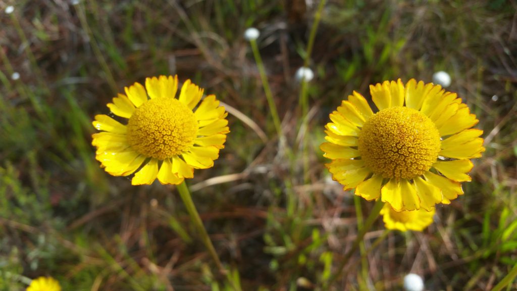
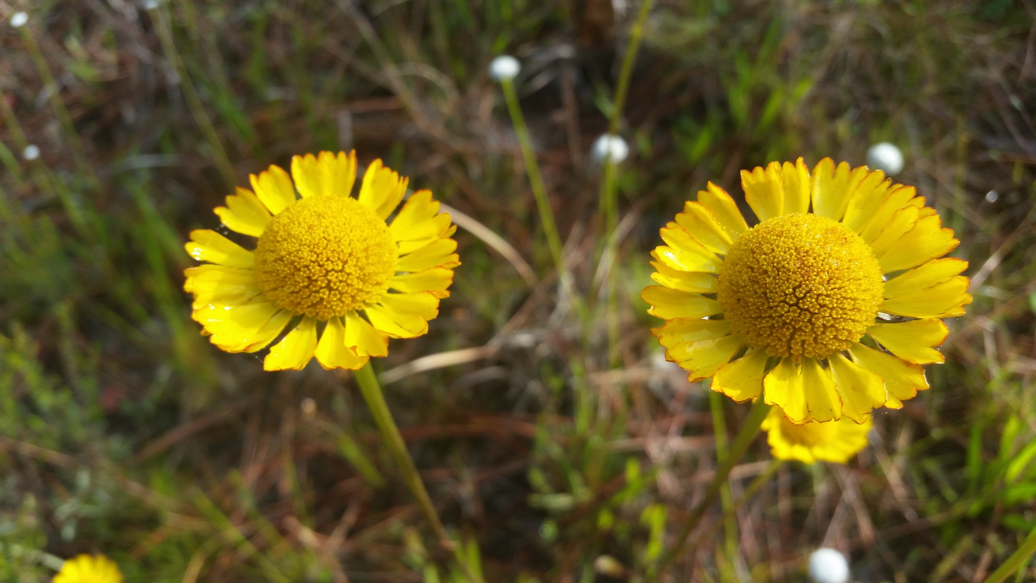
Yellow asters such as sneezeweed bloom profusely during summertime in the flatwoods.
Our coastal habitats are some of the most beautiful on the planet. Where else can you have the breathtaking, wide open vistas of our salt marshes, the incredible productivity of our nearshore bays, and the expansive pinelands in the adjacent uplands. Year-round opportunities abound to be outside and enjoy the natural resources we are blessed with. Just go prepared for the inevitable encounter with some of our bloodsucking flies and midges that are part of the package deal. A pair of binoculars, snacks, water and proper clothing provide the makings of a great day out, but I would also recommend a picture-taking device of some sort. I’ve basically given up on the heavier camera gear and the notion of getting long-distance close-ups. I now rely on my cell phone or a small digital camera; mainly for taking photos of flowers, bugs, and anything else that doesn’t require stealth and patience to shoot.
One of the best habitats to explore during this time of year for capturing memorable images is the upland pine flatwoods that is so abundant in the Florida Panhandle. There is no shortage of public lands that display some of the most well-managed pineland landscapes in the nation. Pineland ecosystems in the Southeast have been intimately linked with a natural fire regime, long before Europeans came on the scene. Successional cycles of increasing shrubby growth over time and the ability of the landscape to carry a fire after a lightning strike, have allowed these areas to develop with the “park-like” vista of a pine tree savanna in many cases. When fire is excluded by people, these ecosystems gradually convert to more hardwood species that tend to shade-out herbaceous growth on the ground and reduce the opportunity for new pine seedlings to become established. Professional land managers who work hard to mimic natural fire cycles on the lands they manage produce some astounding results. I can attest, as many of the areas where I hunt turkeys each spring are chosen more for the beauty of the landscape than the abundance of gobblers. Although fewer gobblers is not typically the ideal hunting scenario, the silver lining comes in the form of less competition with other hunters.
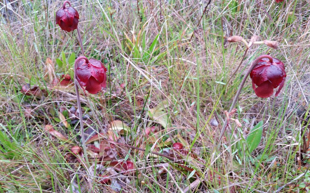
This spring I hunted in part of the St. Marks National Wildlife Refuge and had a nice mix of fairly recently burned pinelands to explore. Some were burned this spring, and was just starting to green-up with newly emerging grasses and forbs. Other areas were burned a year or two ago and you would never know it except for the charred bark on tree trunks. These areas recover to full greenery in a very short time. The foot-high wild blueberry bushes were loaded with green berries for summer wildlife feasts to come, and the photo opportunities for wildflowers abounded. Fire is so important in retaining a high species diversity in these habitats. Opening up the canopy allows sunlight to filter through to the forest floor and the recycling of nutrients in the ash supports many unique plants. There are several terrestrial orchids that bloom in the wetter soils (grass pink, colic root, lady’s tresses, etc.), and yellow flowers are prolific right now (St. John’s wort, sneeze weed, candy root and many more). I even saw some parrot pitcher plants in one wet spot, noticeable mainly by their tall maroon flowers. Fetterbush and staggerbush are also blooming with small flowers that look similar to blueberry blooms. The difference in scent of these two Lyonia shrubs is an easy way to tell them apart with fetterbush having a strong musky (not totally unpleasant) smell, while staggerbush (rusty Lyonia) has one of the sweetest, most pleasant smells of spring in the flatwoods.
So, while I did have the opportunity to chase around a gobbler this spring (who easily out-maneuvered me), I truly enjoyed my week of annual leave spent reconnecting with something that we too often take for granted. Take time to locate the state parks, national wildlife refuges, state forests and other public lands in your region. Then go outside. I mean it; none of us should miss the chance of a lifetime to see what we really have here.
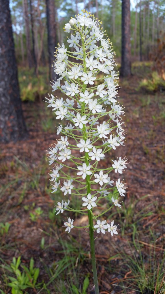
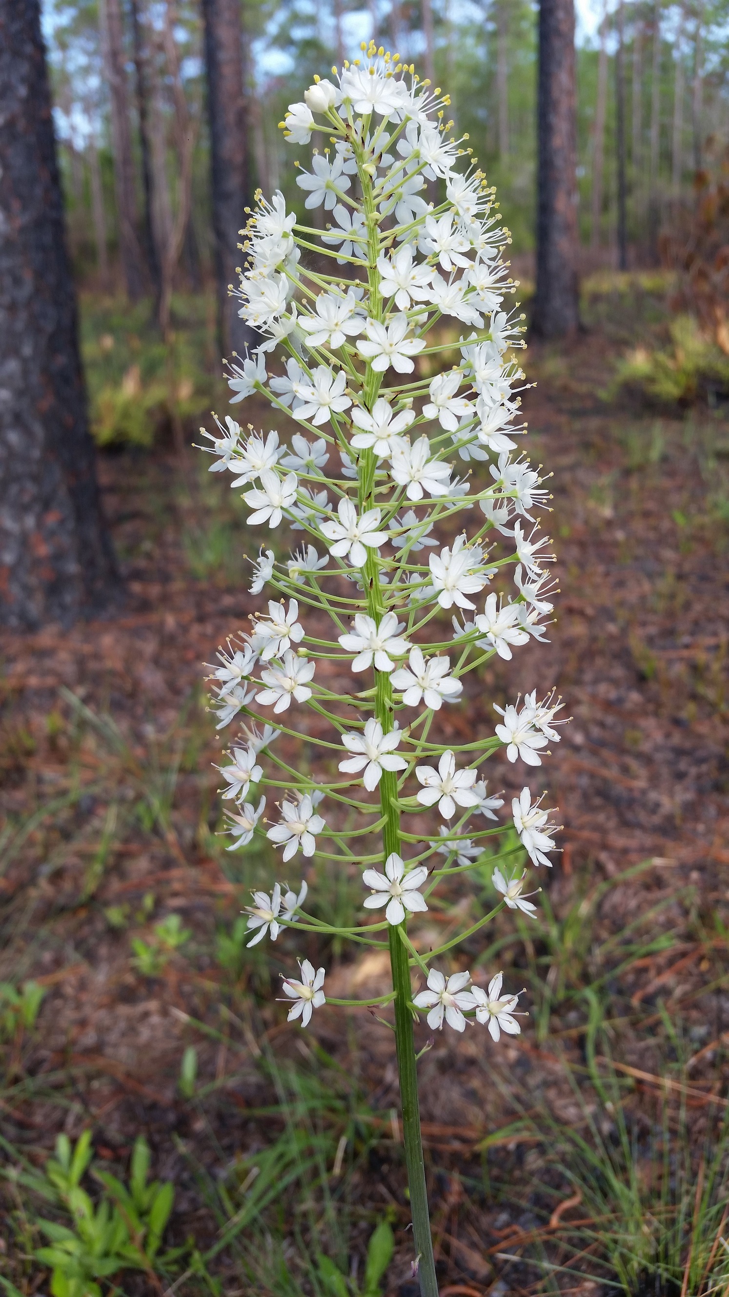
Crow poison, also know as Osceola’s plume shows up in wet flatwoods, most noticeably after a fire.
by Rick O'Connor | Apr 18, 2019
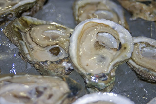
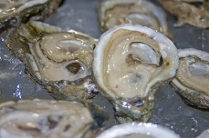
Oysters are like snakes… you either like them or you hate them. You rarely hear someone say – “yea, their okay”. It’s either I can’t get enough of them, or they are the most disgusting thing in the sea.
Courtesy of Florida Sea Grant
That said, they are part of our culture. Growing up here in the Florida panhandle, there were oyster houses everywhere. They are as common on menus as French fries or coleslaw. Some like them raw, some like them in gumbo or stews, others are fried oyster fans. But whether you eat them or not, you are aware of them. They are part of being in the northern Gulf of Mexico.
In recent decades the historic oyster beds that supported so many families over the years have declined in production. There are a variety of stressors triggering this. Increased sedimentation, decreased salinity, overharvesting, not returning old shell to produce new reefs, and many more. The capitol of northwest Florida’s oyster coast is Apalachicola. Many are aware of the decline of harvest there. Certainly, impacted by the “water wars” between our state and Georgia, there are other reasons why this fishery has declined. I had a recent conversation with a local in Apalachicola who mentioned they had one of their worst harvest on record this past year. Things are really bad there.
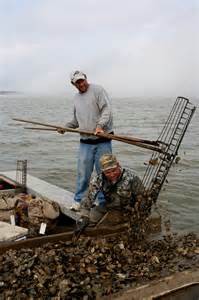
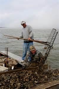
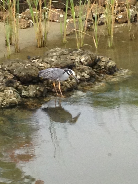
An oysterman uses his 11 foot long tongs to collect oysters from the bottom of Apalachicola Bay
Photo: Sea Grant
Despite the loss of oysters and oyster habitat, there has not been a decline in the demand for them at local restaurants. There have been efforts by Florida Sea Grant and others to help restore the historic beds, improve water quality, and assist some with the culture of oysters in the panhandle.
Enter the Bream Fisherman’s Association of Pensacola.
This group has been together for a long time and have worked hard to educate and monitor our local waterways. In 2018 they worked with a local oyster grower and the University of West Florida’s Center for Environmental Diagnostics and Bioremediation to develop an oyster garden project called Project Oyster Pensacola. Volunteers were recruited to purchase needed supplies and grow young oysters in cages hanging from their docks. Participants lived on Perdido, Blackwater, East, and Escambia Bays. Bayous Texar, and Grande. As well as Big Lagoon and Santa Rosa Sound. The small, young oysters (spat) were provided by the Pensacola Bay Oyster Company. The volunteers would measure spat growth over an eight-month period beginning in the spring of 2018. In addition, they collected data on temperature, salinity, and dissolved oxygen at their location.
After the first year, the data suggests where the salinity was higher, the oysters grew better. Actually, low salinity proved to be lethal to many of them. This is a bit concerning when considering the increase rainfall our community has witnessed over the last two years. Despite an interest in doing so, the volunteers were not allowed to keep their oysters for consumption. Permits required that the oysters be placed on permitted living shoreline projects throughout the Pensacola Bay area.
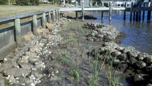
Oyster bags used in a bulkhead restoration project.
Photo: Florida Department of Environmental Protection
We all know how important oysters are to the commercial seafood industry, but it turns out they are as important to the overall health to the bays ecology. A single oyster has been reported to filter as much as 50 gallons of seawater an hour. This removes sediments and provides improved water clarity for the growth of seagrasses. It has been estimated that seagrasses are vital to at least 80% of the commercially important seafood species. It is well known that seagrasses and salt marshes are full of life. However, studies show that biodiversity and biological production are actually higher in oyster reefs. Again, supporting a booming local recreational fishing industry.
This project proved to be very interesting in it’s first year. BFA will be publishing a final report soon and plan to do a second round. For the oyster lovers in the area, increasing local oysters would be nothing short of wonderful.