by Carrie Stevenson | Feb 5, 2016
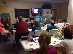
On “project day” students share their knowledge with the class. Photo credit: Carrie Stevenson
The Florida Master Naturalist Program is a 40-hour experiential learning course offered by UF IFAS Extension. While we spend time in class with presentations, by far everyone’s favorite aspects of the course are field trips and “project day.” As part of the course, each participant produces an educational tool—a display, presentation, skit, or lesson—that delves deeper into a topic of interest. The students and instructors are able to use these tools again and again to teach others.
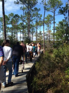
Master Naturalist students walk “The Way” boardwalk in Perdido Key. Photo credit: Carrie Stevenson
One example of a multi-year student project is “The Way” nature trail, located at Perdido Bay United Methodist Church. Master Naturalist Jerry Patee worked with volunteers from his church and community to design and permit a boardwalk and nature trail leading to Bayou Garcon. The unique trail is less than a mile, but traverses upland, freshwater wetland, and coastal habitats, making it a perfect ecological teaching tool. The trail is open to the public and maintained as a place of quiet contemplation. The project is ongoing, with educational signage planned, but it is an excellent new resource for the community.
“The Way” is just one of many positive contributions made by Master Naturalist students over the years. To enroll in a Florida Master Naturalist course near you, visit the FMNP page or talk with an instructor at your local county Extension office.
by Rick O'Connor | Feb 5, 2016
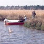
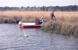
Fishermen fish the marshes of Weeks Bay while a pelican looks on. Photo: WeeksBay.org
Mobile Bay?… part of the Florida panhandle?… Really?…
Well… yes… during the colonial period “West Florida” extended west to the Biloxi area and besides, all western panhandlers know we are really “lower Alabama”; we hear it a million times a year… so YES, it’s part of the Florida panhandle! We’ll go with it.
The shallow, muddy, and productive waters of Mobile Bay as they pass the port city of Mobile AL.
Photo: Auburn University
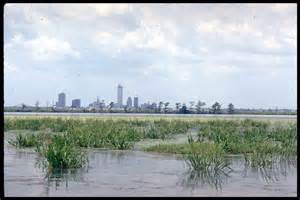
Approximately 35 miles long and 10 miles wide, Mobile Bay is one of the largest estuaries on the Gulf coast; draining close to 1/5th of the eastern United States. This wide, shallow, and muddy bay supports a variety of fresh and brackish water ecosystems. Wildlife from the Mississippi delta, the red hills of the Piedmont region, and the Florida panhandle all converge here making this one of the more biologically diverse areas in the country. It was home to both Dr. E.O. Wilson and Dr. Archie Carr who deeply loved the area and it has been a hub for estuarine research for decades. The rich abundance of wildlife supports commercial and recreational fishing and hunting as well as a growing ecotourism industry. Though the shallow bay must be dredged to support it, the Port of Mobile in one of the busiest in the Gulf region.
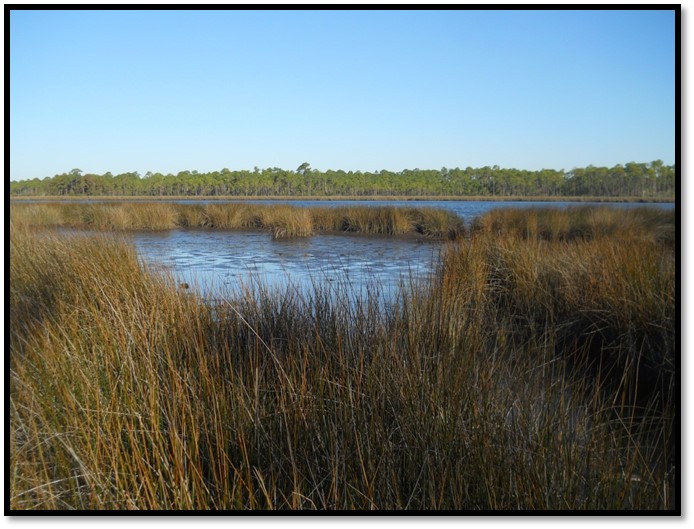
Weeks Bay is a small tributary to this bay system. Fed by the Fish and Magnolia Rivers on the southeastern shore of Mobile Bay, Weeks Bay discharges into Bon Secour, which supports a commercial fishing business. Lined with salt marshes, cypress swamps, and bogs, this area is great for wildlife viewing and fishing. It is also the area of Mobile Bay that experiences the famous crab jubilees; where levels of low dissolved oxygen on the bottom of the bay force benthic animals – such as crabs and flounder – to shallow water seeking oxygen. About 6,000 acres of this estuarine habitat is now part of NOAA’s National Estuarine Research Reserve system. At the reserve there are interactive exhibits, trails, and pontoon boat rides to explore and appreciate this special place.
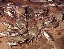
Crab jubilees occur along the eastern shore of Mobile Bay during very warm summer evenings.
Photo: NOAA
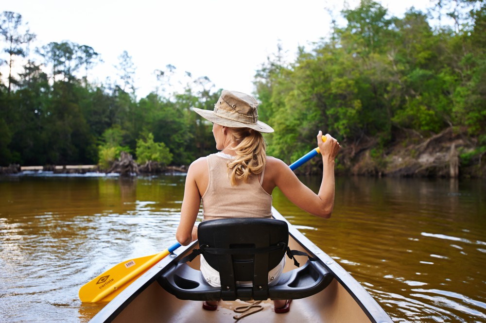
What better place to learn about the estuaries of the Gulf coast! The Panhandle Outdoor LIVE program will conduct one of our four 2016 watershed schools at this reserve. We will have lectures on estuarine ecology, the seafood industry in Mobile Bay – highlighting oyster farming, and on the mission of the Research Reserve itself. We will also have a local outfitter lead a kayak/canoe trip through the estuary as well an interpretive nature hike at the reserve’s visitor center. It will be set up as an overnight trip for those traveling and we will be staying at Camp Beckwith, which on Weeks Bay. Registration for this trip will open at the end of February. If you have questions about this watershed school you can contact Carrie Stevenson or Rick O’Connor at (850) 475-5230; or Chris Verlinde at (850) 623-3868.
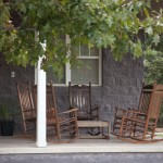
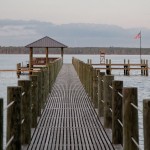
A relaxing spot at Camp Beckwith on Weeks Bay.
Photo: Camp Beckwith
by Carrie Stevenson | Jan 19, 2016
In 2014, five Extension agents involved with www.naturallyescarosa.com launched the first Gulf Coast Agritourism & Ecotourism Business Development Conference. Over sixty business owners and members of the hospitality industry met to discuss marketing, sustainable tourism, and how to handle insurance and liability in an industry that involves outdoor exploration.
 Back by popular demand, we have organized a second one to be held February 18-19 at the Gulf Power Building in Pensacola.
We have a dynamic group of speakers from all over the southeast to discuss the economic opportunities available in this line of work.
Due to partial grant funding, registration (includes meals and materials) is only $25!!! Anyone involved in the agriculture (U-pick operations, fresh produce markets, corn mazes, pumpkin patches, etc.), nature (paddling, camping, fishing, etc.) tourism or hospitality industry is encouraged to come.
Click Here and Buy Tickets today!
For more information on the 2016 Gulf Coast Agritourism & Ecotourism Business Development Conference, contact Chris Verlinde (850) 623-3868 or Carrie Stevenson (850) 475-5230
by Rick O'Connor | Nov 6, 2015
Hernando de Soto and his party crossed the Aucilla River sometime in October of 1539 and celebrated Christmas in what is now Tallahassee. Many things in Florida have changed since de Soto passed this way, but when the 2015 Panhandle Outdoors LIVE! tour hiked the Aucilla Sinks portion of the Florida Trail this September, many things had not.
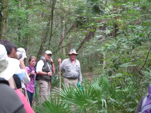
Panhandle residents explore the area of Aucilla Sinks with local guide David Ward.
Photo: Jed Dillard
Yes, the trail is maintained and marked by the Apalachee chapter of the Florida Trail Associations and there are bridges in spots, but the blood sucking bugs that bedeviled deSoto haven’t dissipated. More importantly, the spectacular and distinctive area provides a relatively easy hike that reveals the connections between geology and hydrology in an area with little disturbance by the settlers who followed the first Europeans into North Florida.
Hikers got up close and personal views of the Karst topography found in North Florida. This topography occurs as the tannic rivers and runoff dissolve the underlying limestone on their way to the aquifer. These connections and voids in the bedrock allow the Aucilla River to “come and go” above and below ground as it moves to the Gulf of Mexico as do all rivers in the Suwannee River Water Management District other than the Suwannee.
Native Jefferson county guide, David Ward pointed out the contrast between tannic water in the river channel and the clear water in caves near the river. “In those caves the water is crystal clear. You are looking at the water of the aquifer itself.”
Leon County agent Will Sheftall seized the opportunity to drive home how vulnerable Floridians are to ground water pollution and its effects on our water supply. “Here there’s little distance between the surface and the ground water. In these sandy soils, water moves quickly from the surface to the aquifer. Whatever is in that water can easily get into our ground water. Our personal activities and our public policies need to reflect that to ensure the future of Florida’s water quality.”
As we reached a slightly elevated area, Ward pointed out a longleaf pine/wiregrass community restored by reinstituting controlled burning. The open vegetation contrasts with the non-fire resistant species such as parsley hawthorn in wetter areas usually untouched by fire. “These pine savannahs were widespread when the Europeans arrived,” Ward noted. “Over my lifetime in these woods, I’ve seen appropriate management bring back these conditions closer to what we know it was like when the Europeans arrived.”

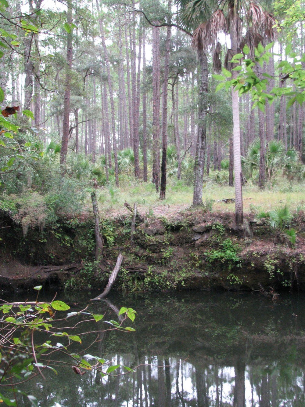
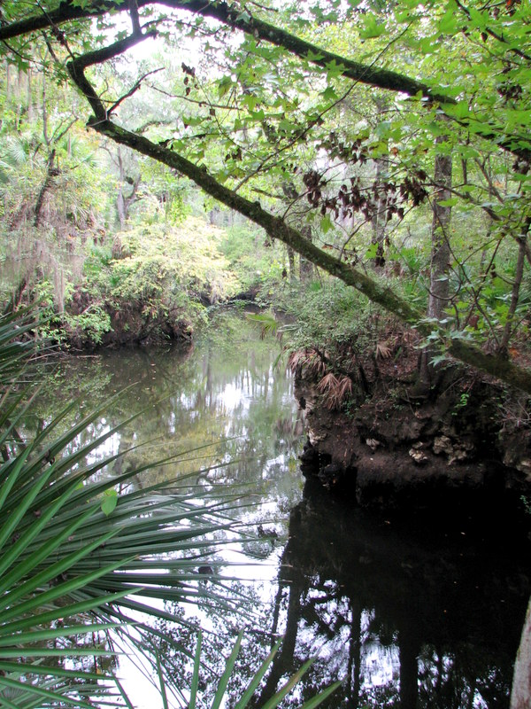
One of the many locations where the Aucilla River “rises from the limestone caverns beneath the earth.
Photo: Jed Dillard
Information on this section of the Florida Trail is available from the Apalachee Chapter of the Florida Trail Association, the Suwannee River Water Management District and Florida Fish and Wildlife Conservation Commission. Humidity never went below 80 percent during our late morning, early afternoon trip. November will likely provide less buggy and surely less muggy conditions. If you’d like to learn about this area from the comfort of your recliner or need some extra encouragement to strike out on the walk, check out this program previously broadcast by WFSU TV. http://wfsu.org/dimensions/viewvideo.php?num=184 Either way, you’ll know more about Florida’s spectacular natural world.
AUTHOR: Jed Dillard; Livestock and Forges Extension Agent; Jefferson County
by Carrie Stevenson | Oct 9, 2015

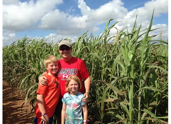
Corn and sorghum mazes are great family fun in October. Photo credit: Carrie Stevenson
October is a glorious time of year in northwest Florida. Temperatures are cooler, skies seem bluer, and the summer crowds have left the still-warm waters of the Gulf mostly to us locals. It is also the perfect time to explore the many local, state, and national parks nearby, or visit farms that share their harvest with the community. Santa Rosa County’s “Beaches to Woodlands” tour, now in its 12th year, is a perfect example of the many events and opportunities available to residents in our area. A schedule of 40 places and events over the next month can be found at the Beaches to Woodlands website.
As the summer heat fades, the weather is great for hiking! Photo credit: Abbie Seales
Escambia County will also host its annual Farm Tour this month, which highlights local growers of peanuts, cotton, and forestry. There are still spots available for this day-long tour of north Escambia County available online.
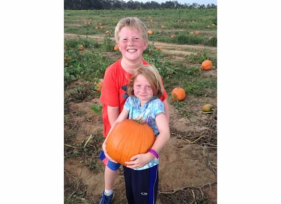
The newly released Naturally EscaRosa smartphone app, available free for iPhones (App Store) or Android (Google Play) lists 101 locations that provide outdoor adventure for every age and interest. From corn mazes and pumpkin patches to monarch migration and water sports, many local businesses provide services and products that are perfect for celebrating autumn in Florida.
Take the time this month to get outside, visit a farm, eat some locally produced food and explore the trails and wildlife in the area. You won’t regret it!
by Rick O'Connor | Sep 21, 2015
A portion of the Aucilla River flows through a landscape of dramatic and unusual geologic formations. Join us for this tour to see an amazing sequence of sinks and river rises, created as the river alternately disappears into the underlying karst and resurfaces. Fringed with moss-draped trees and native palms, the sinks are pools of black water easily viewed by walking the surrounding embankments along a 4.5 mile-segment of the Florida National Scenic Trail.
Your guides will cover the human history of this wildlife-rich Aucilla River landscape, which extends back 12,000 years to the Pleistocene epoc when mastodons, saber-tooth tigers and other large mammals roamed a landscape that resembled the African savannahs of today. The 1983 unearthing of a 12,000-year old mastodon tusk exhibiting cut marks— evidence of slaughter by humans — provides some of the earliest known evidence of man on this continent.
When: Wednesday, September 30th 2015 ● 10:00 am – 4:00 pm EDT
Where: meet at JR’s Aucilla River Store, 23485 US 98, Lamont, FL 32336 (east of the Aucilla River bridge, the boundary between Jefferson and Taylor counties)
Bring: comfortable hiking boots/shoes, weather-appropriate clothing, hiking stick or trekking pole, water bottle, bug spray, day pack; lunch prepared by Tupelo’s Bakery in Monticello will be provided
Cost: $25.00 per adult
Register at: http://uf-extension-pol-2015-aucilla-sinks-hike.eventbrite.com
Space is limited.
Please feel free to share this announcement and attached flyer with those you know who may be interested. And we hope you can join us for this trip if you’ve never seen this beautiful, mysterious place.
Will Sheftall, for Extension Natural Resource Agents in the Panhandle
sheftall@ufl.edu