by Laura Tiu | Apr 14, 2018
Spring has sprung and it is time to get outside and explore this great Florida Panhandle area. In neighboring Santa Rosa County, a terrific destination for a variety of outdoor activities is Blackwater River State Park. Visitors can canoe, kayak, tube, fish and swim the river. Hikers can enjoy trails through nearly 600 acres of undisturbed natural communities. Bring a picnic and hang out at one of several pavilions or white sand beaches that dot the river (restroom facilities available). Near the pavilions, stop and see one of the largest and oldest Atlantic white cedars, recognized as a Florida Champion tree in 1982. The park also offers 30 campsites for tents and RVs. Park entry is $4.00 per car, payable at the ranger station or via the honor system (bring exact change, please).
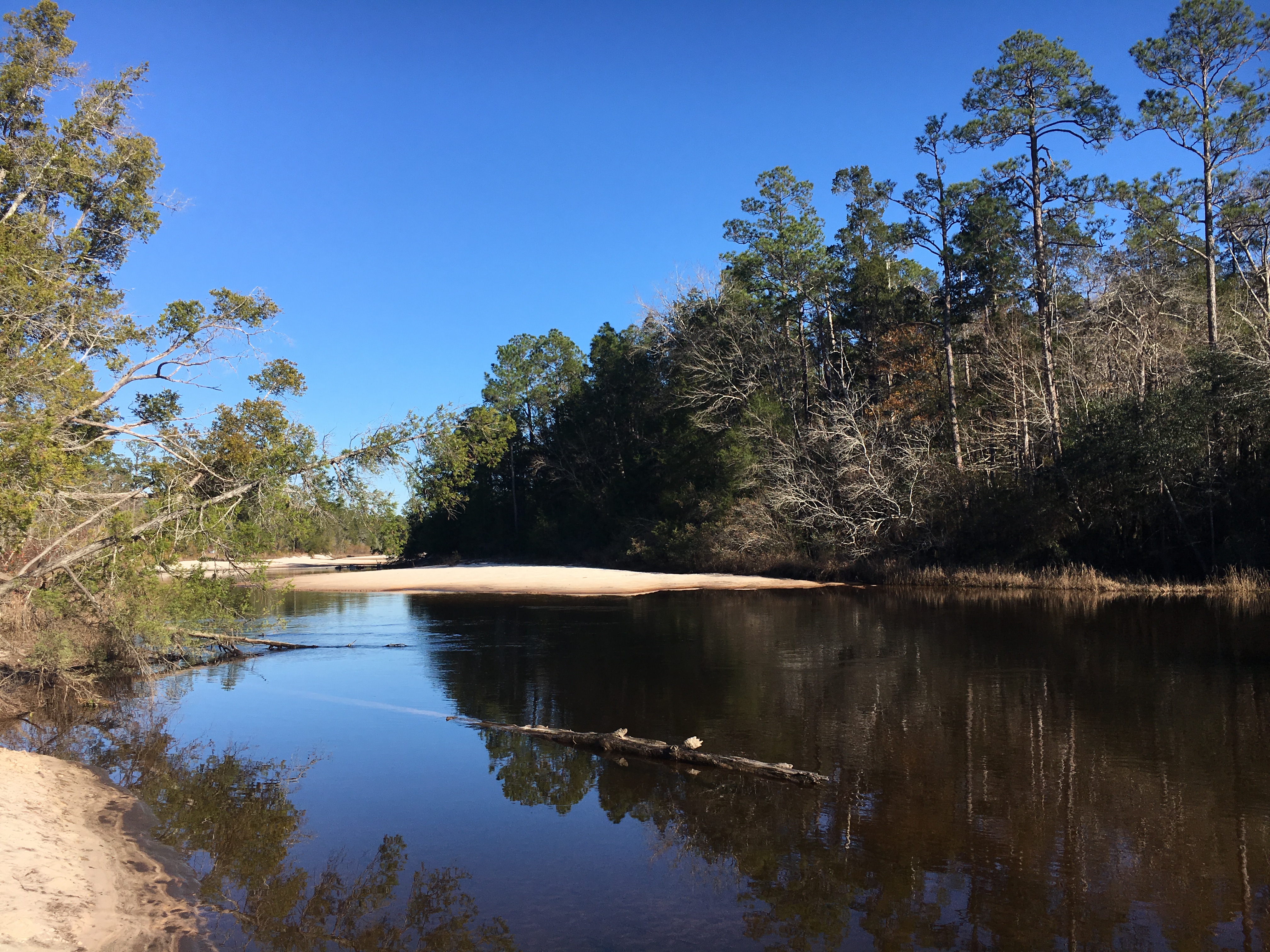
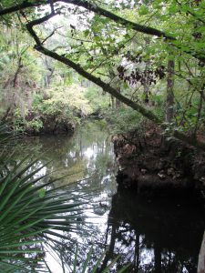
The Blackwater River is considered one of the purest and pristine sand-bottom rivers in the world. The water is tea-colored from the tannins and organic matter that color the water as it weaves through the predominantly pine forest. The river is shallow with a beautiful white sandy bottom, a nice feature for those tubing or paddling the trail. The river flows for over 50 miles and is designated as a Florida canoe trail. Multiple small sand beach areas line the river and provide plenty of space to hang out, picnic, or throw a Frisbee. Blackwater eventually flows into Pensacola Bay and the Gulf of Mexico bringing high quality freshwater into this important estuary.
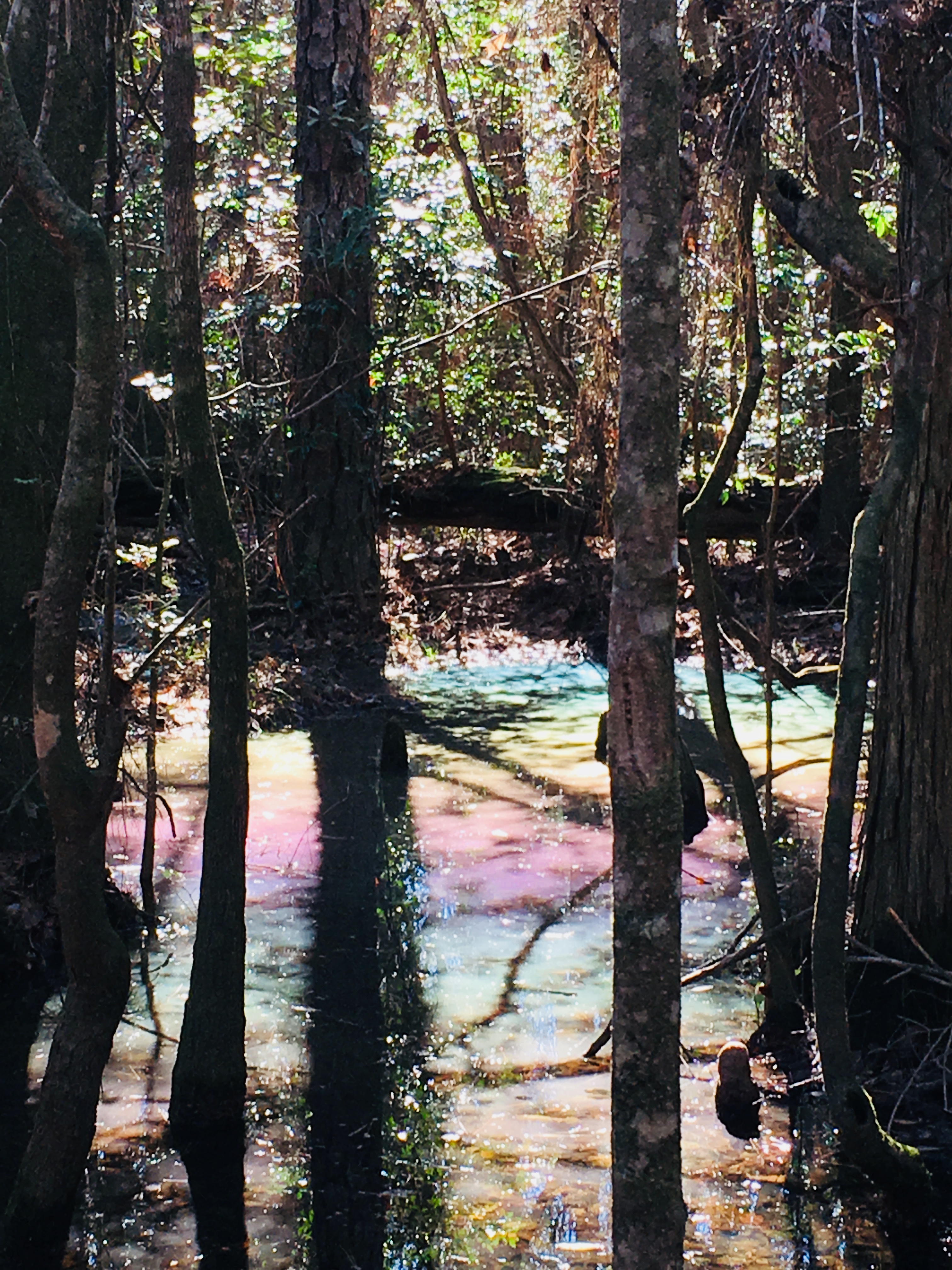
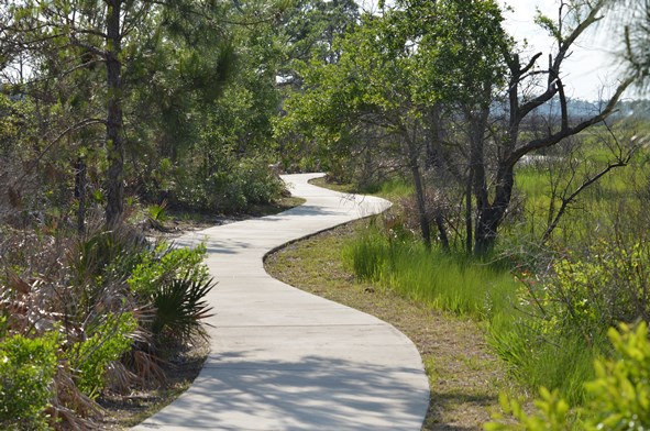
A favorite trail in the Park is the Chain of Lakes Nature Trail. Parking for this 1.75 mile loop trail is at South Bridge on Deaton Bridge Road. The trail head is well marked and has a boardwalk that leads into the floodplain forest. The trail winds through a chain of shallow oxbow lakes and swamp that dot the former route of the river. If you are lucky and it is a clear, blue-sky day, you may see a beautiful rainbow effect as the sun hits the water. We call this the pastel swamp rainbow effect. This is a result of the natural oils from the cypress cones settling on the surface of the water and associated trapped pollen.
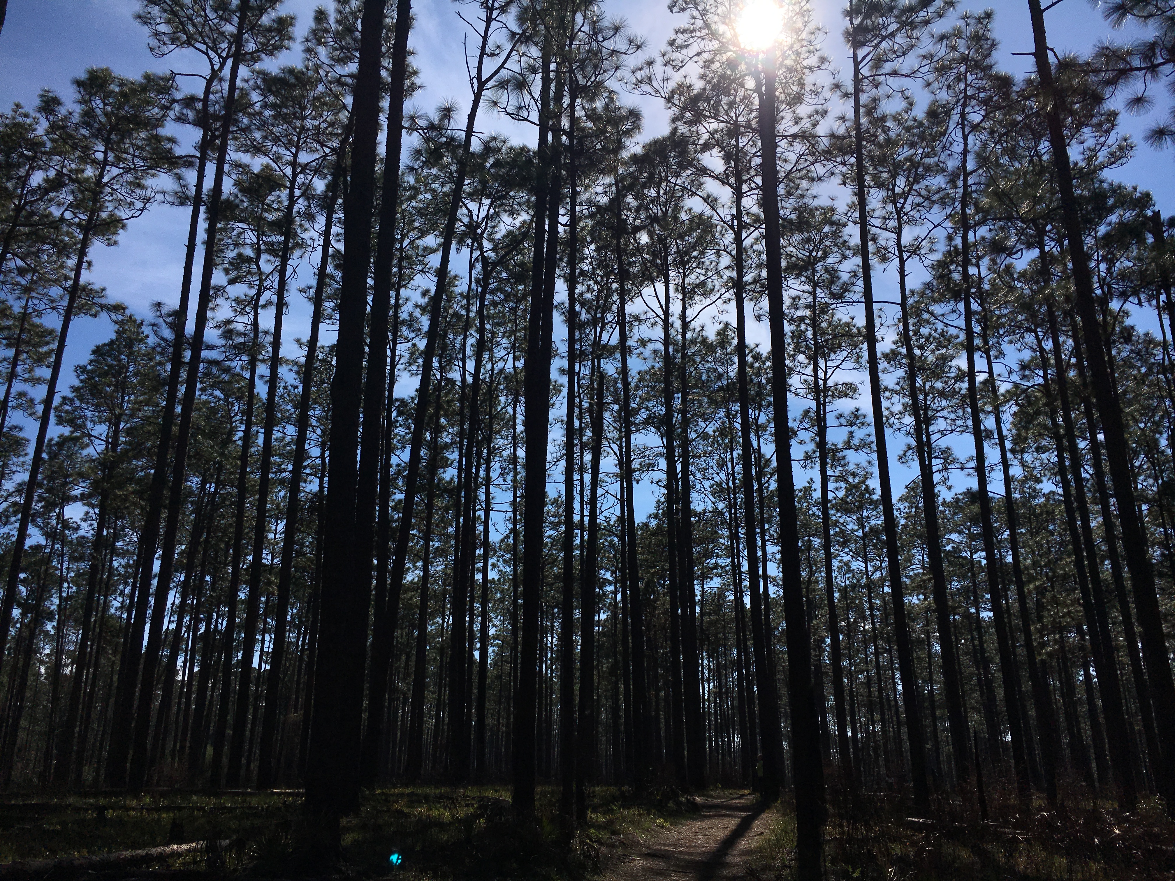
The trail then turns to sneak through the sandhill community in the park with giant longleaf pines, wiregrass and turkey oak. Evidence of prescribed burning shows management efforts to maintain the forest. Cinnamon ferns, bamboo and other natives appear in pockets along the trail. The trail in this section is blanketed with a mosaic of exposed root systems, so be careful as you step. Finally, pack some bug spray and a water bottle for this fun hike.
For more information, visit the park page: https://www.floridastateparks.org/park/Blackwater-River
Sandhill pine forest at Blackwater River State Park
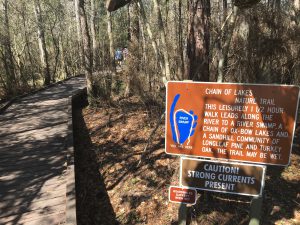
2737 – Chain of Lakes trailhead at Blackwater River State Park
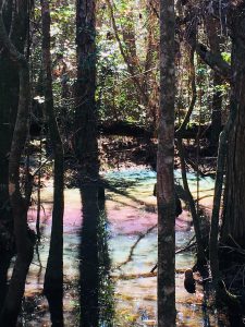
“Rainbow Swamp” on the Chain of Lakes trail at Blackwater River State Park
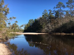
Beautiful sandy beaches along the Blackwater River in the State Park.
by Les Harrison | Dec 8, 2017
A great walk or ride is close at hand on this trail which once supported a critical 19th century transportation link.
The typical image of a state park is that of a place where visitors enter through a front gate and enjoy the wonders of nature or some historic structure. The Tallahassee-St. Marks Historic Railroad State Trail, which is run by The Florida Division of Recreation and Parks, is truly an exception to the typical model.
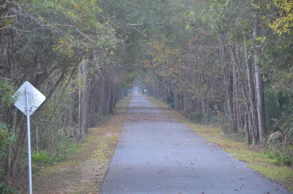
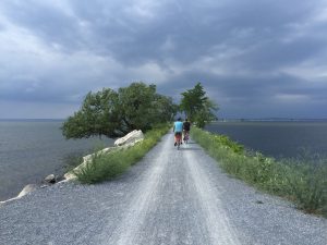
While many parks have trails, this one runs 20.5 miles from Tallahassee to the coastal community of St. Marks. This area is the first rail-trail in the Florida’s system of greenways and trails to be paved providing a scenic experience for running, walking, bicycling and skating.
Additionally, horseback riding occurs on the adjacent unpaved trail. Because of its outstanding qualities, this state trail has been selected as a National Recreation Trail.
The origins of this 21st century recreational site date back to before Florida was a state. The Tallahassee Railroad Company was approved in 1835 by the territorial legislative council and received the first federal land grant to a railroad for construction of the line.
Cotton and other commodities moved from the Tallahassee region to the port of St. Marks for shipment to the north east U.S. and to Great Brittan. Raw cotton was the major generator of foreign exchange during the antebellum years, so this railroad was a critical economic link in the area’s development.
Fast forward to 1983, that is when the Seaboard Coastline filed the papers to abandon the line and end service. After 147 years, the longest-operating railroad in Florida was deemed economically unfeasible to operate.
It was not out of service for long. In 1984 the corridor was purchased by the Florida Department of Transportation, and the rest is history.
Visitors can access the trail in multiple locations along the way. Parking areas are provided at many locations along the trail with mileage markers make available distance information and the trail corridor is lined with trees providing plenty of shade.
Restroom facilities are placed at intervals along the trail. There are picnic pavilions and a playground at the Wakulla Station Trailhead.
The trail is open from 8:00 a.m. until sundown, 365 days a year and there is no use fee required. Donations which aid with the promotion and upkeep are accepted.
For more information on the St. Marks Trail, contact the park office at (850) 487-7989 or Tallahassee-St. Marks Historic Railroad State Trail.
While the historic structures are gone, it is a great way to enjoy nature’s wonders close to the coast.
by Les Harrison | Jan 8, 2017
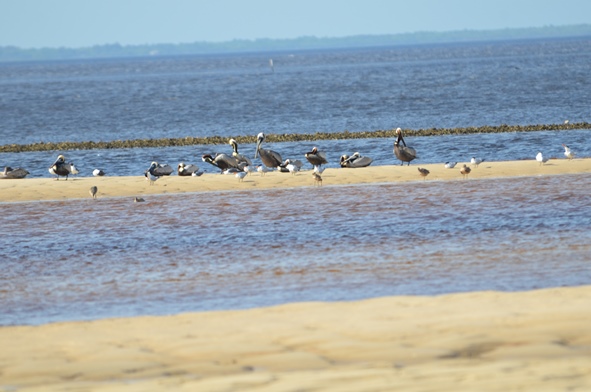
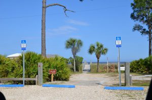
Some of the most picturesque and scenic natural areas along north Florida’s Gulf Coast are found in Bald Point State Park. The 4,065 acre park is located on Alligator Point, where Ochlockonee Bay meets Apalachee Bay.
Easy access to water activities at Bald Point State Park.
Photo: Les Harrison
Bald Point State Park offers a variety of land and water activities. Coastal marshes, pine flatwoods, and oak thickets foster a diversity of biological communities which make the park a popular destination for birding and wildlife viewing.
These include shorebirds along the beach, warblers in the maritime oak hammocks, wading birds, and birds of prey in and around the marsh areas. The boardwalk and observation deck overlook the marsh near the beach.
During autumn bald eagles and other migrating raptors, along with monarch butterflies are frequently viewed heading south to a warmer winter.
Bald Point offers access to two Apalachee Bay beaches for water sports and leisure activities, and these facilities include a fishing dock and picnic pavilions at Sunrise beach, North End beach and Maritime Hammock beach. Grills and restrooms are also available, but pets are prohibited on the beach.
Pre-Columbian pottery helped archaeologists identify the park’s oldest site, placing the earliest human activity 4,000 years ago. These early inhabitants hunted, fished, collected clams and oysters, and lived in relatively permanent settlements provided by the abundant resources of the coast and forests.
In the mid-1800s and late 1900s, fishermen established seineyards at Bald Point. These usually primitive campsites included racks to hang, dry and repair nets. Evidence of the 19th to 20th century turpentine industry is visible on larger pine trees cut with obvious scars.
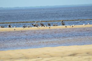
Bald Point is an excellent location for both wildlife viewing and birding.
Photo: Les Harrison
Among the varieties of saltwater fish found in the brackish tidal waterway are redfish, trout, flounder and mackerel.
Today’s visitors may fish on the bridge over tidal Chaires Creek off of Range Road, and in Tucker Lake, by canoe or kayak. Sea trout, red fish, flounder and sheepshead are common catches, and this is an excellent area to cast net for mullet or to catch blue crabs.
Bald Point State Park is open 8:00 a.m. to sunset daily, with a charge $4.00 per car with up to eight people, or $2.00 per pedestrian or bicycle
More information is available at the Florida State Park site.

There are numerous trails where the visitor and explore Florida.
Photo: Les Harrison.
by Will Sheftall | Oct 22, 2016
What do the Ochlockonee and Aucilla rivers have in common? Not much, it would seem, beyond the fact that both have headwaters in Georgia and flow through Florida to the Gulf of Mexico. These two rivers do share the distinction of being unusual, although they’re unusual in very different ways.

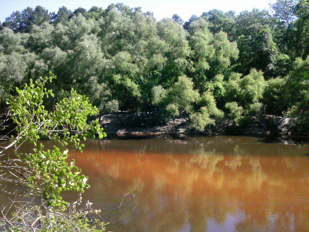
The Ochlockonee runs yellow-brown between Leon and Gadsden counties.
Photo: Rosalyn Kilcollins
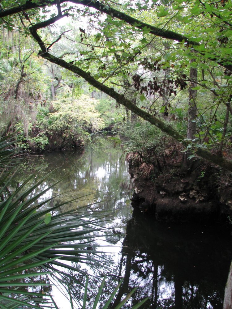
The Aucilla is a blackwater stream that goes underground and rises again before reaching the Gulf – a disappearing act that has fascinated early settlers, paddlers and naturalists alike. The Aucilla drains a smaller watershed, has lower flows, and features stream channel sediments that are predominantly sands and decaying organic material – the sediment signature of coastal plain streams with water stained dark brown, the color of tea.
In fact, blackwater rivers like the Aucilla get their color by steeping fallen and decaying tree leaves and twigs in slow-moving water, just as we steep shredded tea leaves or ground up coffee beans to dissolve their tannic acids into beverages. Blackwater steeping occurs in swamp forests up river tributaries, and in oxbow sloughs and other quiescent side channels of the downstream reaches. These form as a river “in flood” meanders and changes course within its floodplain.
The Ochlockonee is unusual among rivers originating in the Coastal Plain: in its upper reaches it has alluvial characteristics common to streams flowing from the Piedmont. The Ochlockonee drains soils rich in silt and clay that give it a yellowish brown color when those extremely fine sediments are suspended in the water. Land use activities such as paving roads and tilling farm fields elevate the fine sediment load when it rains by setting up larger volumes of fast-moving runoff. Higher rain runoff volume and velocity conspire to erode bare fields, construction sites and river banks, accentuating this river’s color.
But in spite of these differences, the Aucilla and Ochlockonee were once branches of the same river drainage system – the Paleo-Ochlockonee River. How could that possibly be? Well, sea level rise has drowned the lower reaches of this once mightier river, leaving its upper branches to empty into the Gulf separately, as smaller streams.
Sea level along Florida’s Big Bend coastline has been rising since the end of Earth’s last Ice Age – roughly 18,000 years ago. Our shallow, gently sloping underwater continental shelf was exposed during that last period of glaciation. As higher temperatures began melting ice sheets, not only did sea level rise, but more water evaporated and fell as rain. Southeastern rivers began carrying greater volumes of water.
Before annual rainfall reached today’s level during this prehistoric period of climate change, it is likely that the Aucilla from headwaters to Gulf was even more discontinuous than it is today. A current hypothesis is that the Aucilla was more like a string of sinkholes than a river, resembling its lower reaches today in a section known as the “Aucilla Sinks.”
The Aucilla is a tannic river. Thus not as yellow-brown but rather more “blackwater”.
Photo: Jed Dillard
But the nature of the Paleo-Aucilla is just one part of this intriguing story. Using sophisticated technology, scientists have discovered clues about the ancient route of the entire Paleo-Ochlockonee as it meandered across that more expansive, exposed Continental shelf to the Gulf.
In their 2008 publication Aucilla River, Tall Timbers Research Station & Land Conservancy reports that, “Ten thousand years ago, the Florida coastline was located 90 miles away from its present position. Scientists have discovered a buried river drainage system indicating that approximately 15 to 20 miles offshore from today’s coast — and now underwater — the Aucilla River combined with the Ochlockonee, St. Marks, Pinhook, and Econfina rivers to create what archeologists call the Paleo-Ochlockonee, which flowed another 70 miles before reaching the Gulf.”
“Well, I’ll be!” you say, “That’s all pretty cool to think about.” That was my reaction, too, until I remembered that this process of sea level rise continues still, albeit at an accelerating rate thanks to global warming. Which means our rivers that join forces today before emptying into the Gulf will one day be separated. Sea level rise eventually will dismember the Wakulla from the St. Marks, and the Sopchoppy from the Ochlockonee – but thankfully not in our lifetime.
True, that’s happened before, but long before humans were on the scene. Today and for many tomorrows to come, I am grateful that we and our children and grandchildren have a wonderful watery world patiently awaiting our exploration, not far beyond the urban bustle of Tallahassee.
We’re far removed in time from the first humans beckoned by these rivers. A pause in the rate of sea level rise 7,000 years ago enabled development of coastal marsh ecosystems and more successful human habitation – supported in part by the bounty of fish and shellfish that depend on salt marshes. Farther upstream and still inland today, the sinks and lower reaches of the Aucilla hold archaeological sites about twice that old, that are integral to our evolving understanding of very early prehistoric human habitation on the Gulf Coastal Plain.
If you’re intrigued by the myriad of fascinating rivers and wetlands of the Big Bend region – this globally significant biodiversity hotspot we live in, and want to experience some of them first-hand, you’re in luck. Several Panhandle counties offer Florida Master Naturalist courses on Freshwater Systems (and also courses on Upland Habitats and Coastal Systems). You can check the current course offerings at: http://conference.ifas.ufl.edu/fmnp/
You can also explore on your own. There are many public lands in our region (and across the Panhandle) that provide good access.
Go see the Aucilla’s remaining string of sinks by hiking a short segment of the Florida Trail through the Aucilla Wildlife Management Area in Taylor County. And the Ochlockonee’s floodplain of sloughs and swamps, bluffs and terraces by taking trails that follow old two-track roads “down to the river” through the Lake Talquin State Forest in Leon County.
Get some maps of your public lands, get some tips on trails, get outside, and go exploring!
by Carrie Stevenson | Sep 16, 2016
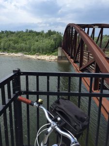
The bridge over the Winooski River was a scenic stop on our bicycle tour. Photo credit: Carrie Stevenson
If you told me earlier this summer that I would “accidentally” bike 18 miles one afternoon, I’d have laughed. I’ve always loved biking, but rarely have time for long distance rides. As part of the mobile workshops for an Extension professional development meeting in Burlington, Vermont, fifteen of us met up with the coordinator of Local Motion, a grassroots bike advocacy organization. Their mission is “to bring the joy of walking and biking within reach for all Vermonters by helping Vermont communities become great places to walk and bike.” The purpose of the tour was to get an on-the-ground lesson in community development and learn how the group has worked with residents to overcome challenges in implementing a successful project.
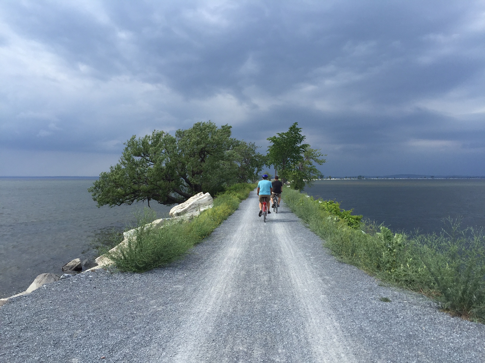
Burlington’s “Island Line Trail” is a classic rails-to-trails project–not unlike the Blackwater Heritage Trail in Santa Rosa County–that has resulted in significant economic development and increased use by area residents. The original rail service operated from 1899 to the early 1960’s. Since the 1990’s, 14 miles of railway has been converted to a biking/walking trail. Part of the Island Line’s charm is the diversity of scenery it encompasses.
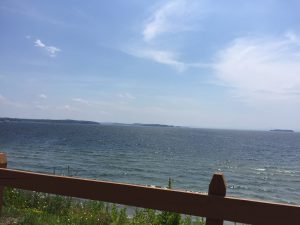
Sweeping views of Lake Champlain were part of what kept us riding far beyond our initial endpoint! Photo credit: Carrie Stevenson
Starting in the heart of downtown Burlington, there are museums, shops, and restaurants within blocks of the trail, many of which cater directly to and exist because of the trail users. The entire stretch runs adjacent to Lake Champlain, providing scenic views along the path. Throughout the trail there are residential areas (which are highly desired because of their proximity to the trail), public parks, and a community center. After crossing a bridge over the Winooski River, we embarked upon a 3-mile open causeway with sweeping views of Malletts Bay on both sides. The trail also includes one of the country’s few bike ferries, which is located where a swing bridge used to operate for the railway. It was the constantly changing scenery and surroundings that kept a handful of us going far beyond the initially planned 6-mile trip.
The causeway over Malletts Bay includes a bike ferry, one of the few in the country. Photo credit, Carrie Stevenson
In addition to providing a recreational trail for local residents and visitors, Local Motion is dedicated to promoting bicycle safety and education. Workshops for hesitant adult bikers interested in biking more attracted over 450 adults last year, while 7,300+ kids participated in bicycle safety camps and training. As a result of all of the activity, youth bike rentals increased by 43% in 2015 over the prior year.
Much of the success in Burlington is transferable to Florida. In the Panhandle, we are looking at connecting existing trails to create a large-scale multi-county, multi-state bicycle trail. The successes in Vermont were inspirational and instructional as we embark upon our new project and a design workshop in late September.
by Rick O'Connor | Feb 12, 2016
All Photos by Molly O’Connor
We began our series on Nature Tourism along the ICW at the Alabama state line on Perdido Key and discussed the ICW itself. This month we will continue in Escambia County with a visit to Pensacola Beach.

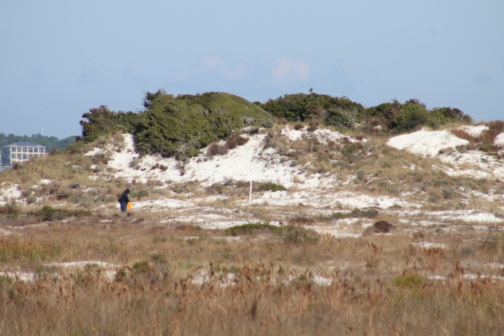
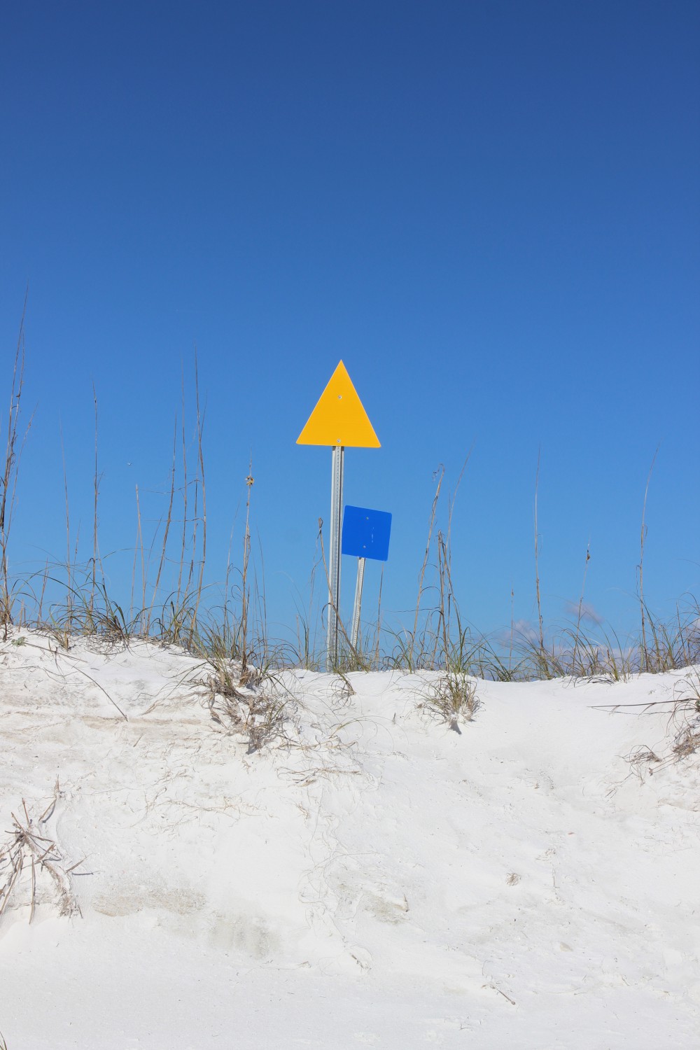
The dune fields of panhandle barrier islands are awesome – some reaching over 50 ft. in height. This one is near the Big Sabine hike (notice white PVC markers).

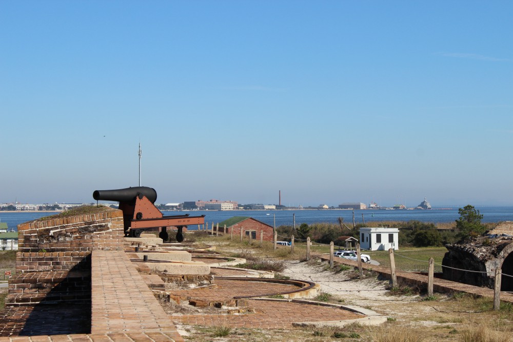
The cannons of Ft. Pickens protected the entrance into Pensacola Bay. The views of the western end of Santa Rosa Island are great from here. There is plenty of nature and history to be discovered at this park. Plan to stay the day.
BARRIER ISLANDS
Pensacola Beach is on Santa Rosa Island. The longest barrier island in the panhandle, Santa Rosa Island stretches 44 miles from Ft. Pickens, at Pensacola Pass, to Destin Pass in Okaloosa County. With miles of some of the whitest beaches in the world, these panhandle islands have a variety of ecosystems. The mineral that makes the beach so white is quartz, one of the minerals found in granite rock. Over eons weathering and erosion has released these minerals from the granite in the Appalachians and sent it downstream to the Gulf coast. The densities of the different minerals force it to settle out at different rates. Quartz, being one of the less dense minerals, reaches the Gulf of Mexico where it encounters longshore currents. In the panhandle these currents more often run east to west moving the quartz in that direction. This sand forms bars and shallows which made colonial navigation a problem and good hiding places for pirates. Some of the bars remain above sea level and form dune fields and plant communities, forming barrier islands. Many animals, such as shorebirds and sea turtles, seek these islands for nesting because of few predators. The xeric conditions favor reptiles and birds, but there are many mammals and insects as well. Freshwater ponds form on many of the islands and here amphibians and fish came claim territory. The high energy beach of the Gulf side supports a community of subterranean organisms which include the mole crab (sand flea) and coquina. The low energy bay side harbors salt marshes along the shoreline and seagrass meadows below the surface. These habitats support a rich variety of marine life, some of the most productive in the world.
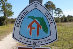
The Florida Trail extends (in sections) over 1,300 miles from Ft. Pickens to the Florida Everglades. It begins at this point.
PENSACOLA BEACH
There are many places on Pensacola Beach where visitors can enjoy these natural places. At the west end of the island is Ft. Pickens, part of the Gulf Islands National Seashore. Within the park you will find beaches to comb, piers to view wildlife and fish, jetties to fish or dive, fortifications to view the island, and a nice museum to educate you on both the natural and cultural history of the area. Here the Florida Trail begins. This trail is segmented and stretches from Ft. Pickens to the Everglades, but here it stops at Battery Langdon; it can be hiked or biked. Along the trail there are freshwater ponds and sections of maritime forest with a variety of wildlife viewing and photography. The multiple loop campground is found on this trail.
Between these pilings at Park West is one of the county snorkel reefs. Visibility is tough but the fish are there.
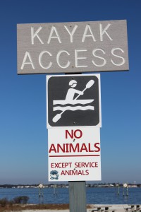
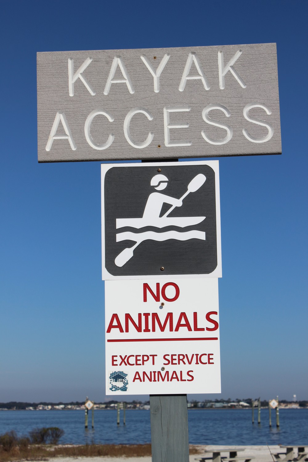
There is a kayak launch at Park West as well.
Just outside the entrance to the park is a county park named Park West. Here there is a kayak launch and nearshore snorkel reef on the bay side, with picnic area and beaches on the Gulf.
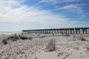
In Pensacola Beach proper there are several businesses that rent paddleboards for paddling the shallow seagrass filled Little Sabine. There are two marinas which offer sailing, fishing, and diving charters as well as dolphin tours. There are numerous artificial reefs off of Pensacola including the world’s largest – the U.S.S. Oriskany. On the Gulf side you will find the Pensacola Beach Fishing Pier where not only can you fish but, at times, see marine life. Sharks, sea turtles, dolphins, and large fish are often seen. The sunsets are great here. At the Visitors Center you can get a map to follow the Eco-Trail. This driving trail of 28 kiosks will take you to natural spots and the kiosks provide education about the area. There is a prize if you complete the trail.
Heading east from Pensacola Beach you once again pick up a portion of the Florida Trail. At this location there is a bike path, which can be walked or biked. Park East houses a popular nearshore snorkel reef. This snorkel reef is on the Gulf side and there are beach markers to help the diver locate it. On the bay side is Big Sabine. This area of high dunes and salt marsh has no formal trail but there are PVC pipes placed to help navigate your way in and out.

The paddleboard entry to Little Sabine can be found next to the Pensacola Beach Marina.
The Pensacola Beach Fishing Pier is not only a great spot to catch fish, it’s a great spot to see marine life – and great sunsets.
Further east you once again enter the Gulf Islands National Seashore. Escambia County is lucky to have almost 50% of their portion of the island within this national park. There are miles of natural beach to explore but you must use the public parking lots (no roadside parking) and watch your speed, this area supports several species of nesting shorebirds – some of which are listed as imperiled in the state of Florida.
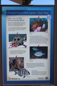
The Santa Rosa island Authority’s Eco-Trail has 28 kiosk to navigate and learn about the natural history of the island. It is a fun and educational car trip. You can get the map for this trail at the visitors center on Pensacola Beach.
To learn more about nature and farm tourism in Escambia County visit www.NaturallyEscaRosa.com and download the free app at the App Store or Google Play
Next month – Santa Rosa County.

Aligning these markers will assist the snorkeler/diver in locating the Gulf snorkel reef at Park East. The swim is a bit further than Park West but the visibility is much better.