PlayCleanGo Day 1: Hiking

Hiking: Watch Your Step and Clean Your Soles

The first of 5, this video created by Rick O’Connor and Carrie Stevenson discusses how residents can enjoy the outdoors and wildlife trails while still making sure to preserve the environment. Brushing and cleaning your shoes, bags, and clothing helps remove the seeds of invasive plants. By taking a few simple steps, you can help support our beautiful native plants and wildlife so that yourself and others can continue to enjoy it.

[youtube https://www.youtube.com/watch?v=kDEk7Xp1M8Y&w=560&h=315] 

PlayCleanGo Awareness Week 2022

PlayCleanGo is an educational campaign by the North American Invasive Species Management Association.  The goal is to stop the spread of invasive species as we recreate in our beautiful environment.  Each day we will feature a new video highlighting different recreational activities.

[youtube https://www.youtube.com/watch?v=qCAvPa9VjhY]

Day 1:  HikingPlayCleanGo Awareness Week Graphic

Day 2:  Horseback Riding

Day 3:  Watercraft and fishing

Day 4:  Camping and firewood

Day 5:  ATVs and Trailers
 

Why do we have so many springs in Florida?

Why do we have so many springs in Florida?

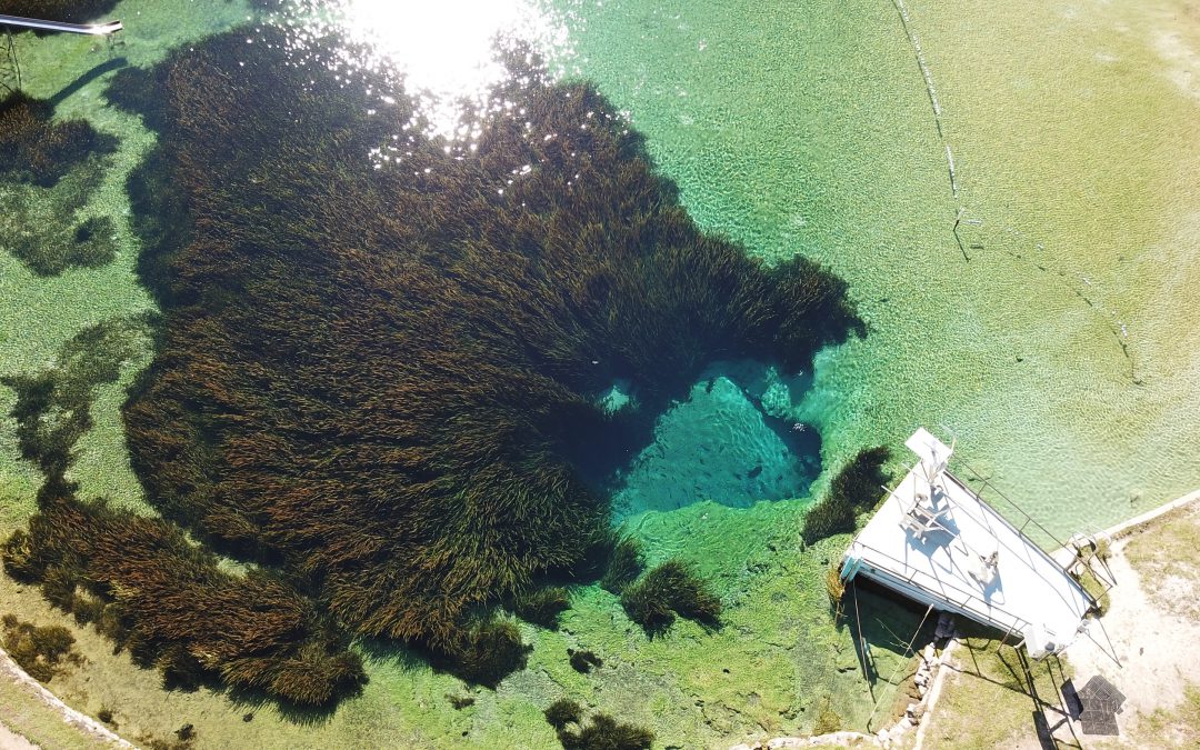
Jackson Blue Springs discharging from the Floridan Aquifer. Jackson County, FL. Image: Doug Mayo, UF/IFAS Extension.

Florida has one of the largest concentrations of freshwater springs in the world. More than 1000 have been identified statewide, and here in the Florida Panhandle, more than 250 have been found.  Not only are they an important source of potable water, springs have enormous recreational and cultural value in our state. There is nothing like taking a cool swim in the crystal-clear waters of these unique, beautiful systems.

How do springs form?

We have so many springs in Florida because of the state’s geology.  Florida is underlain by thick layers of limestone (calcium carbonate) and dolomite (calcium magnesium carbonate) that are easily dissolved by rainwater that percolates into the ground. Rainwater is naturally slightly acidic (with a pH of about 5 to 5.6), and as it moves through the limestone and dolomite, it dissolves the rock and forms fissures, conduits, and caves that can store water. In areas where the limestone is close to the surface, sinkholes and springs are common. Springs form when groundwater that is under pressure flows out through natural openings in the ground. Most of our springs are found in North and North-Central Florida, where the limestone and dolomite are found closest to the surface.
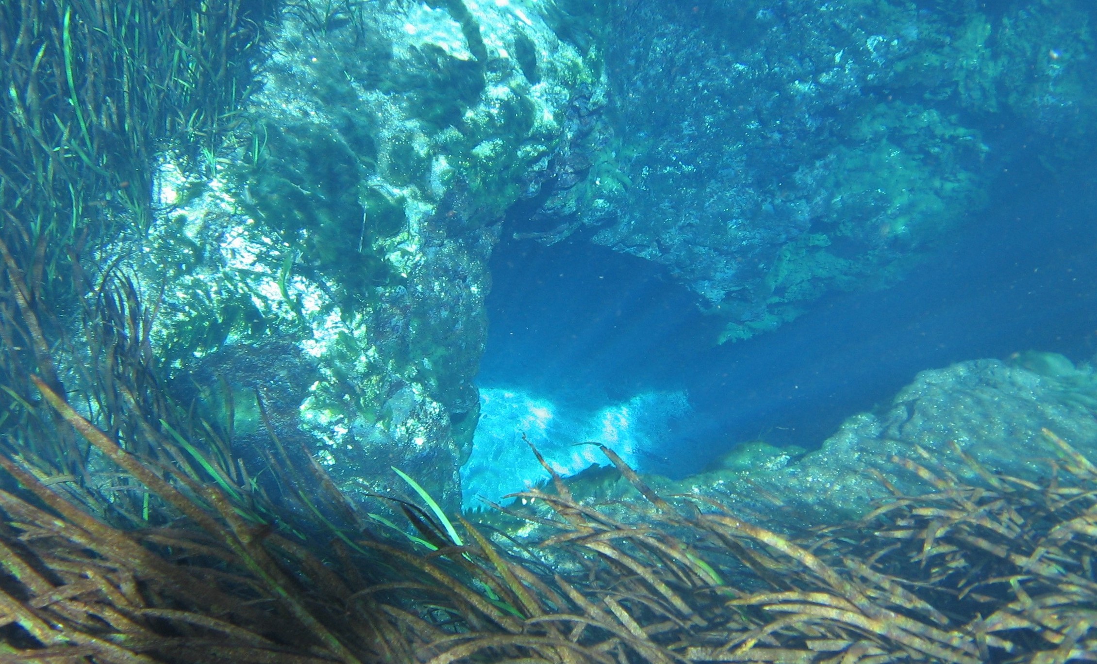
Springs are windows to the Floridan Aquifer, which supplies most of Florida’s drinking water. Image: Ichetucknee Blue Hole, A. Albertin.

These thick layers of limestone and dolomite that are below us, with pores, fissures, conduits, and caves that store water, make up the Floridan Aquifer. The Floridan Aquifer includes all of Florida and parts of Georgia, South Carolina, and Alabama. The thickness of the aquifer varies widely, ranging from 250 ft. thick in parts of Georgia, to about 3,000 ft. thick in South Florida. The Floridan is one of the most productive aquifer systems in the world.  It provides drinking water to about 11 million Floridians and is recharged by rainfall.

How are springs classified?

Springs are commonly classified by their discharge or flow rate, which is measured in cubic feet or cubic meters per second. First magnitude springs have a flow rate of 100 cubic feet or more per second, 2nd magnitude springs have a rate of 10-100 ft.3/sec., 3rd magnitude flows are 1-10 ft.3/sec. and so on. We have 33 first magnitude springs in the state, and the majority of these are found in state parks. These springs pump out massive amounts of water. A flow rate of 100 ft.3/sec. translates to 65 million gallons per day. Larger springs in Florida supply the base flow for many streams and rivers.

What affects spring flow?

Multiple factors can affect the amount of water that flows from springs. These include the amount of rainfall, size of caverns and conduits that the water is flowing through, water pressure in the aquifer, and the size of the spring’s recharge basin. A recharge basin is the land area that contributes water to the spring – surface water and rainwater that falls on this area can seep into the ground and end up as part of the spring’s discharge. Drought and activities such as groundwater withdrawals through pumping can reduce flow from springs systems.

If you haven’t experienced the beauty of a Florida Spring, there is really nothing quite like it. Here in the panhandle, springs such as Wakulla, Jackson Blue, Pitt, Williford, Morrison, Ponce de Leon, Vortex, and Cypress Springs are some of the areas that offer wonderful recreational opportunities. The Florida Department of Environmental Protection has a ‘springs finder’ web page with an interactive map that can help you locate these and many other springs throughout the state.

https://nwdistrict.ifas.ufl.edu/nat/2020/04/09/the-incredible-floridan-aquifer/

Good Teachers

Good Teachers

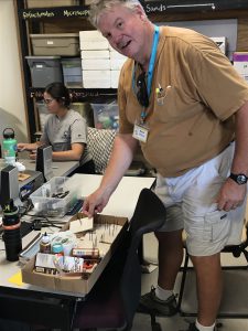
Florida Master Naturalist Student and Florida State Park Ranger, Bruce Williams, prepares for his snowy plover lesson.

There is an oft quoted proverb “those who can’t do, teach.”  It is meant to be humorous, but it couldn’t be farther from the truth.  Teachers of all kinds have enormous impacts on our lives.  For graduates of the Florida Master Naturalist Program (FMNP) there is a line in the mission statement that reads “The FMNP teaches those who teach others about Florida’s unique ecosystems and wildlife.”  In fact, to graduate, FMNP students must complete a project and present, or teach, it to the class.

A good teacher, like a good entertainer first must hold his audience’s attention, then he can teach his lesson (John Henrik Clarke).  In a recent coastal class, we had the good fortune of having a State Park Ranger as a student.  His job requires him to do interpretive education at the park, so he had quite a bit of experience under his belt.  His project, a craft project involving the assembly of a cute snowy plover chick, was his way of holding his audience’s attention while he talked of the importance of preserving and protecting habitat for shorebirds.

I thought the project and message was impressive and worthy of sharing. To all of you teachers out there who work to make our lives and world better, thank you, and here is another great activity to add to your quiver. If you would like more information on the Florida Master Naturalist Program go here: https://masternaturalist.ifas.ufl.edu.
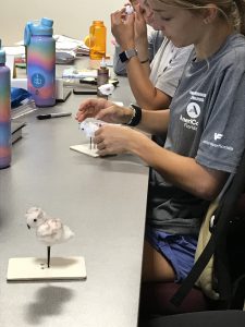
Making cotton ball snowy plover chicks

Group Project: Make a Snowy Plover Chick (Peipert, 2011)

This project is suitable for Elementary age through Middle school age children. It is recommended when doing project with a class or large group that some preparation is done ahead of time.

Supplies:

corrugated cardboard (disassembled brown packing box will do)

1 bag of cotton balls

1 container of black glass beads (sold at craft stores)

black sunflower seeds

1 container of wood toothpicks (kind with one end blunt)

1 can of black spray paint

several of each black, brown & gray markers

several bottles of quick dry tacky glue (sold at craft stores)
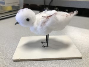
Cotton ball snowy plover chick craft

Preparation:

  • Using an exacto or carpet knife and T-square cut corrugated cardboard into 3”x3” squares for the # of stands needed. To complete stand preparation, write Snowy Plover chick on stand, draw a pair of feet in center of stand and pierce cardboard in center of feet. This step is a real time saver and recommended for young children.
  • Paint toothpicks with black spray paint for legs, easiest way to do this is by taking toothpicks and sticking them into a spare piece of cardboard upright them paint.

Instructions: (skip to instruction #3 if using stands with feet & holes premade)

  1. Draw a pair of bird feet on center of cardboard and if you want write” Snowy Plover chick” on cardboard.
  2. Use the pointed end of a toothpick to make a hole in the center of drawn feet. Then put the blunt end of toothpicks in the holes and put a heavy glob of glue around them. Don’t be shy with the glue, it will dry clear and will be better support.
  3. Take one of the cotton balls and roll around between hands to make it smaller. This will be the head. Next using all three or two markers make many dots on one side of both cotton balls creating a speckled pattern.
  4. Put a glob of glue at top of each toothpick and put larger cotton ball (the body) on top of toothpicks pushing down so the glue is covered by the cotton ball. Next put a glob of glue on the top of body and put white side of cotton ball (the head) on glue.
  5. To complete the chick put a small glob of glue on opposite sides of head then place glass beads on. Lastly put a glob of glue on side of head that the feet are facing forward and place sunflower seed on with the pointed end facing out.
  6. Let stand for at least 15 minutes to dry before handling.
  7. Enjoy your Snowy Plover chick creation!
The Changing Climate; Part 4 (the Florida Panhandle)

The Changing Climate; Part 4 (the Florida Panhandle)

In Part 2 and 3 of The Changing Climate we discussed some of the climate impacts of the last decade and some possible future ones.  But this was on a global scale, what about the Florida and the panhandle? How will all of this affect us near home?  We will take each of the issues mentioned and address them one by one.

The Gulf of Mexico as seen from Pensacola Beach.
Photo: Molly O’Connor


Extreme Weather Conditions

The western panhandle is considered one of the wetter locations in the United States – with a mean annual rainfall of 64.4 inches (mean for U.S. is 38.1 inches)1.  One of the climate predictions is that wet places will become wetter.  This appears to be the case for this area.  The table below shows the total rainfall for Pensacola FL over the last 14 years.  The mean annual rainfall for this period is 70.72 inches1.  Currently for 2021 Pensacola is at 84.46 inches and it is raining as I type this.  It will be another wet year.


Total Rainfall Pensacola FL

Year Inches of Rainfall
2007 57.76
2008 56.69
2009 88.33
2010 62.96
2011 48.68
2012 66.63
2013 74.61
2014 83.17
2015 75.69
2016 64.62
2017 91.91
2018 90.01
2019 52.56
2020 76.49
MEAN 70.72

NOAA National Weather Service


This increase in rainfall will bring an increase in stormwater issues for the area.  Much of the coastal areas of the panhandle are developed.  There are the dense urban areas of Pensacola, Gulf Breeze, Navarre, Ft. Walton, Destin, and Panama City.  There are the less dense, but growing areas of Port St. Joe, south Walton County, and the Highway 98 corridor between Ft. Walton and Gulf Breeze.


Because the development is dense along the coast, new development is looking northward.  There has been a lot of growth at, and north of, Interstate 10 across the panhandle.  The communities of Ensley, Cantonment, Milton, Pace, Crestview, Chipley, Bonifay, and Marianna are all expanding.


Much of this rainfall would percolate through the topsoil to the water table and aquifer below.  Some would meet hard soils and flow into creeks, streams, ponds, lakes, and rivers eventually making its way to the coastal estuaries.  But most of the development described above has/is using impervious building materials that disrupts the natural flow of this water.  The collecting rainwater, called stormwater, floods parking lots, yards, and streets forcing engineers to develop means of moving this stormwater off the developments and into holding ponds or discharging into one of the available streams, creeks, ponds, or rivers.

One of 39 stormwater drains into Bayou Texar.
Photo: Rick O’Connor


Despite these efforts, many of these developments are still experiencing flooding.  In some cases, the development was placed in a low-lying area where water would naturally flow, and flooding problems become more frequent.  In the last 10 years, with the increased rainfall we have seen, there has been a lot of talk about flooding issues with residents, businesses, and local governments.  If these climate models are correct, we can expect more of this.


One area of interest I have for Sea Grant Programming is how this increase in rainfall and stormwater will impact the salinity in the Pensacola Bay system.  Seagrass restoration, oyster restoration, oyster aquaculture, and fisheries are all sensitive to the salinity in the bay.  The hypothesis is that if rainfall is going to increase, then stormwater discharge from developments will increase, and the salinity of the bay system will decrease – at least at the surface (less saline water being less dense than higher saline water).  That said, much of the estuary is relatively shallow and an increase in rainfall and stormwater could impact much of the water column.  Benthic species, such as seagrass, oysters, and even possible scallop restoration could be negatively impacted by decreasing salinities.


There are species of seagrass that can tolerate lower salinities, but can they support the fisheries that many locals are interested in (such as spotted sea trout and scallops)?  Sea Grant currently works with the University of West Florida using community science volunteers to monitor patches of seagrass in the bay area.  Not only are we interested in density of the grass, but the species composition.

Shoal grass. One of the common seagrasses in Florida.
Photo: Leroy Creswell


Shoal grass (Halodule wrightii) and turtle grass (Thalassia testudinum) are species that once dominated much of the lower portion of the Pensacola Bay system (Santa Rosa Sound and Big Lagoon).  Both require higher salinities – a mean of at least 20 ppt.  Widgeon grass (Ruppia maritima) is a local seagrass that can tolerate lower salinities and is more common in the upper portions of the estuary.  Our volunteers are currently monitoring whether the grass density is increasing over time but also looking at whether there is a species composition shift from Shoal-Turtle grass to more Widgeon grass.  This could happen if salinities are decreasing and could impact fish diversity as well.  It is known that the bay scallop (Argopecten irradians) is strongly associated with turtle grass and also requires the salinity to be at, or above, 20 ppt.  These species that prefer higher salinities can tolerate short periods of low salinity – that is the nature of estuaries – but it is not known whether they can tolerate prolonged periods of low salinity, or a complete shift to a lower salinity bay.  Most are sure they cannot.  Sea Grant now has a team of community science volunteers who are monitoring salinity near the shoreline around the bay system to see how/if this salinity shift is happening with the increasing rainfall.


The increase stormwater will bring much more than just lower salinity.  It brings sediment from the development mentioned above which can smother benthic life, like oysters, and lower water clarity negatively impacting seagrass growth.  Stormwater also brings fecal bacteria, those bacteria associated with mammalian and avian digestive systems.  The fecal bacteria concentration in the bay is an indicator of possible other pathogenic organisms associated with sewage.  Heavy rainfall can initiate leaking and flooding of both septic systems and sanitary sewage overflows increasing the bacteria load in the water and requiring health advisories to be issued.  This is a reoccurring issue in most of our estuaries.  And let’s not forget the other organic and inorganic compounds we place in the environment.  Pesticides and fertilizers on our lawns, oil and gas from our vehicles, cleaning compounds, and more.  All are washed off the landscape and into local waterways during heavy rains.


Excessive rain not only increases stormwater, and the associated issues mentioned, it can be devastating to local agriculture.  One would think that rain is good for crops, and it is.  But too much of anything can be bad.  Libbie Johnson (UF IFAS Extension Agriculture Agent in Escambia County) explained how the excessive rain has impacted the cotton fields of the Florida panhandle this year.  She mentions from the highway much of the cotton looks green and healthy, but when you walk in the fields you will see they are green because the bolls are not there – so the nutrients needed for seed production are moved to the leaves.  A closer look shows foliage on the ground.  The plants are suffering from hard lock and boll rot – diseases caused by both fungi and bacteria.  It typically occurs but in wetter conditions it is worse.  Some fields are not as bad as others, and some cotton may be picked this year, but the heavy rains late into the season will be a big problem for this industry2.


Record Temperatures

High temperatures reported by Current Results; weather and science facts3 suggest that our annual high temperatures in the summer have not changed much since 1949.  They range from 93°F in 1967 to 106°F in 1980.  Over that 71-year period, 17 (24%) the high temperature for the year was over 100°F.  Interestingly between 1950 and 1954 Pensacola experienced annual high temperatures over 100°F each year – a heat wave.  But what about the annual temperatures over the course of the year?  Are the winter temperatures changing?

The spring equinox sunrise over Santa Rosa Island, March 21


A website entitled ClimateSpy4 reviews conditions from the weather station onboard NAS Pensacola.  According to their data on the warmest and coldest months of the year at NAS, the warm temperatures range between 90-100°F between 1950 and 2020 – the warmest day being 106°F on Aug 29, 2000.  The cold temperatures are all around 35°F and reported from the 1970s.  As a kid in the 1970s, I do remember school being closed due to snow and they asked us to drive home… which I thought was amazing because no one knew how to drive in the snow.  And sure enough, many ended up in ditches along the side of the roads from sliding.  I also remember as a kid in the 1960s heavy frost on the ground during winter on many days, something I do not see much anymore.


In August 2016 the U.S. EPA developed a two paged fact sheet on the impacts of climate on the state of Florida.  They state that5

  1. The peninsula of Florida has warmed 1°F over the past century.
  2. The sea is rising about one inch each decade.
  3. Heavy rainstorms are becoming more severe.
  4. They expect the temperatures to continue to rise producing more hot days and less freezing for agriculture.

They provide a graphic that shows the mean temperatures have increased over much of the country, including south Florida.  But the panhandle is more stable, some areas even cooling.  This is most likely due to the increase rain events this region is experiencing.


Tropicalization

Yes… we have seen evidence of this in the Florida panhandle.

The first evidence I have witnessed was the increased number of growing mangroves in this area.  Red mangroves (Rhizophora mangle) and black mangroves (Avicennia germinans) are both salt tolerant tropical trees that dominant the estuaries of central and south Florida.  Their current north range extends to Cedar Key Florida (29.14°N).  However, both species have been found in recent years during surveys in the Florida panhandle including – Apalachicola (29.72°N), Port St. Joe (29.81°N), Panama City (30.16°N), Pensacola (30.42°N), Horn Island MS (30.24°N), and the Chandeleur Island in LA (29.84°N).

Red mangrove growing among black needlerush in Perdido Key. Photo credit: Carrie Stevenson, UF IFAS Extension


Interestingly there are records of these trees in these areas back as far as the 1940s6.  This suggests that the seeds (propagules) of mangroves often drift north to the panhandle.  During warmer periods they germinate and may form saplings.  However, a hard freeze eventually happens, and the plants die.  Snyder et.al.6 report the thermal minimum for the black mangrove is 20°F; numbers we do not see often in the panhandle, but they do occur.  But Snyder also reports mangroves in the panhandle reaching heights of 20 feet or so.  Suggesting that the hard freezes are not as frequent and allowing a natural range shift of these plants northward.  Sea Grant and the Marine Science Academy at Washington High School in Pensacola monitored a red mangrove that was found in 2009 and was about three feet tall at that time until a hard freeze killed it in 2018.  It survived nine years, developing prop roots, but never growing much taller.  Partnering with Dauphin Island Sea Lab and the National Estuarine Research Reserves, Sea Grant continues to monitor for the presence of this tropical tree in the northern Gulf.


The historic range of the Florida manatee (Trichechus manatus latirostris) included the entire Gulf of Mexico portions of the northern Caribbean, and the Atlantic coast as far north as Massachusetts7.  It is true that during the colder months of the year this animal would migrate to the warm water refuges of Florida.  So, seeing this animal in the northern panhandle should not be unusual.  But in the 1970s their populations were very low, and the animal was placed of the federal endangered species list.  Sightings throughout their range, other than peninsula Florida, became rare.  During the 1980s and 1990s it was not unusual to hear reports of a few manatees, maybe two or three, entering the Pensacola Bay region.


But in 2018 one of our community science volunteers monitoring seagrass in Big Lagoon saw at the end of her dock.  She reported it to me.  I responded by letting her know that one-off sightings of manatees are not unusual in our area.  But then she began to see more, reporting as many as five at one time.  Others began to let me know about sightings they had.  One reported nine individuals together near Kees Bayou in the Intracoastal Waterway near the Alabama line.  This was unusual.

Manatee swimming in Big Lagoon near Pensacola.
Photo: Marsha Stanton


It turned out that the Dauphin Island Sea Lab in Alabama had been tracking manatees for about 10 years after they began to see an increase in numbers over their way.  Sea Grant partnered with them to develop a Pensacola Bay Area Watch and report our sightings to their network.  In 2019 we logged 66 sightings.  This was definitely an increase in what this area had experienced in the last two decades.  The team is now partnering with the Pensacola-Perdido Bay Estuary Program to report sightings.  The program extends to Choctawhatchee Bay to our east and in 2021 a pod of 23 manatees was seen near Destin.  All of this data is logged within the Dauphin Island Sea Lab’s program.


The question now is the cause of this increase.  We know that manatee populations have increased in the last few decades.  Is this the reason?  Or are the conditions in the northern Gulf becoming more conducive to the manatees’ needs?  Maybe it is both.  There is now a resident population in Wakulla Springs of about 44 animals.  We will continue to monitor the sightings and see if they over winter here.  The need for warm water winter sites (waters where the temperatures are at, or above, 70°F) are still in the peninsula part of Florida.  So, it is believed they will not overwinter here.  Monitoring continues.


Then there are the snook…

Snook (Centropomus undecimalis) is a popular game fish sought by anglers in central and south Florida.  Along with the tarpon (Megalops atlanticus) were one of the reasons the huge tourism industry kicked off in the early 20th century.  People loved to come to Florida trying their luck catching them.  And you had to come to Florida to catch them, they are a warm water species.


Like manatees, their historic range includes the Gulf of Mexico and the Atlantic coast as far north as New York8, but the fish is not common in the colder parts of their range.  They are considered transients, summer visitors when waters are warmer.  But warmer water temperatures maybe extending their resident range further north in the Gulf of Mexico.

This snook was captured near Cedar Key. These tropical fish are becoming more common in the northern Gulf of Mexico.
Photo: UF IFAS


Purtlebaugh et.al9 report an increase in snook catches in and around Cedar Key FL since 2007.  Their studies found snook of all age classes between 2016 and 2018 suggesting that reproduction was occurring there, further suggesting that snook are expanding their range into north Florida.  There have been reports of the fish in both Apalachicola and Pensacola, though no evidence that they are reproducing here – winters are still too cold for that.


Invasive Species

North Florida has its share of invasive species.  But due to our cold winters, many we hear and read about in south Florida are not a threat to us… yet.


Most of the invasive species we hear about in our neck of the woods are plants.  Chinese tallow, Japanese climbing fern, Chinese privet, and cogongrass to name a few.  But we have had issues with some animals.  Red fire ants, feral hogs, and nutria have all been problematic in this part of the Gulf.


But recently there have been increased sightings of new species historically found in peninsula Florida.  The brown anole (Anolis sagrei) is a small lizard from the Caribbean, specifically the region of Cuba (hence the other common name – Cuban Anole).  I first heard reports of this non-native in and around the Perdido Key area.  They are now abundant there and appear to be abundant in the Gulf Breeze area, East Hill and downtown areas of Pensacola, and… all along the panhandle.  I visited a wholesale nursery east of here that had one greenhouse invested with them.  I have seen them at every rest area on I-10 between Pensacola and I-75.  They appear to be everywhere now.

This Cuban Anole was photographed on a public hiking trail near Perdido Key.
Photo: Jerry Patee


It is believed they arrived here as hitchhikers on ornamental plants grown in nurseries in south Florida.  At one time, you did not have to worry about such hitchhikers because our winter freezes would end the invasion.  But those freezes are not occurring as frequently and these populations, just as the mangroves, are hanging on longer.  Some may believe that when a good hard freeze does occur, we will no longer have to worry about them.  But that may not be the case.


Laura Rubio’s master thesis looked the thermal minimum for both the native green anole (Anolis carolinesis) and the invasive brown anole.  She looked at populations along the range of peninsula Florida up to Georgia.  In Georgia she found that the native green anole dealt with cold winters better than the brown anoles, and the males handled it better than the females in both species.  But as her work continued, she noticed that the brown anoles did acclimate to the colder climate10.


There are studies showing that the invasive Argentine Black and White Tegu (Salvator merianae) can do the same.  This is a large lizard, reaching lengths of up to three feet.  They are from South America but have at least three breeding populations in central and south Florida.  However, there have been reports of the animals in Georgia, South Carolina, and the Florida panhandle.  Can they handle our winters?


A study conducted by Scott Goetz et. al.11 suggest yes.  The study was conducted at Auburn University.  They were trying to determine whether this animal could adjust to our winter temperatures.  Nine of the 12 animals in the study emerged from their first winter just fine and seven made it over one year.  Suggesting that these tropical reptiles could survive if they made their way to our part of the Gulf.  Whether this is because the annual winter temperatures in north Florida and Alabama have warmed, or whether they are due to acclimating reptiles was not specifically addressed in the study, but the reduction of frost/freezing days could play a part.

The Argentine Black and White Tegu.
Photo: EDDMapS.org


One final note on invasive species.  The Brazilian Peppertree (Schinus terebinthifolia) has been a huge problem in south Florida for decades.  This aggressive invasive plant has taken over many areas of the state.  Native to Brazil, it has covered much of the peninsula part of the state but not the Florida panhandle or into Georgia.  A few years ago, one was found on St. George Island in Franklin County FL near Apalachicola.  This year one was found in Niceville FL near Destin in Okaloosa County.  Like the mangrove, one would suspect that a hard freeze would do their populations in.  But we will have to see if such freezes occur.


Growth Zones

Growth zones are geographic zones extending east and west with a similar climate and help horticulturists select which plants will do best.  The higher the number, the more tropical.

Planting zones are shifting towards the poles.


Historically the Florida panhandle was in Zone 8.  But now we are in Zone 9… it has warmed12.  These climate shifts are occurring with elevation as well.  The big difference within these zones is how cold it now gets during winter.  In our area, winter is warmer than it was a few decades ago allowing some subtropical and tropical to overwinter and thrive during the warmer months.  This connects with the invasion of some invasive species and plants like mangroves.


Sea Level Rise

According to the 2021 IPCC Assessment Report 6 not only is sea level rising, it appears even with a dramatic reduction in greenhouse gasses, that trend will not turn around for at least a century – the sea will rise.  So, how does this effect Florida?


In paper published by Thomas Ruppert (Florida Sea Grant) in 2013, our state can expect a rise of about 1.5 to 4.5 feet by 210013.  One must remember that vertical rise of one foot could equal a couple of feet of horizontal flooding.  The King tides of the Atlantic coast of the state have been in the news for years.  These rising waters impact drainage, groundwater levels, enhance saltwater intrusion in drinking and agriculture sources.  Monroe County reported impacts of SLR to include having to replace vehicles due to sitting in salt water.  You can also include a rise in storm surge during tropical storms to the list of impacts.


Many coastal communities are already dealing with increased flooding due to excessive rainfall.  Adding a rising sea will make these issues worse.  Natural systems, like barrier islands and salt marshes, will natural “roll” inland as the sea rises but if there is development in the way (and there is), they cannot.  So, the loss of the systems, the commercial and recreational economic importance, and the ecosystem services they provide will be lost.


All of these are very real, and many are occurring as this is being typed.  The obvious next question is what can we do about it?  That will be the focus for our last segment in this series – Part 5 (Solutions).


References


1 National Weather Service. Temperature and Precipitation Graph for Pensacola FL. https://www.weather.gov/mob/climate_kpns.


2 Johnson, L. 2021. 2021 Cotton Production Issues in the Western Panhandle.  University of Florida IFAS Extension. https://nwdistrict.ifas.ufl.edu/phag/2021/10/01/2021-cotton-production-issues-in-the-western-panhandle/.


3 Current Results; Weather and Science Facts. https://www.currentresults.com/index.php.


4 ClimateSpy. https://www.climatespy.com/climate/summary/united-states/florida/pensacola-nas.


5 What Climate Change Means for Florida.  2016. U.S. Environmental Protection Agency.  EPA 430-F-16-011. https://www.epa.gov/sites/default/files/2016-08/documents/climate-change-fl.pdf.


6 Snyder, C.M., L.C. Feher, M.J. Osland, C.J. Miller, A.R. Hughes, K.L. Cummins. 2021. The Distribution and Structure of Mangroves (Avicennia germinans and Rhizophora mangle) Near Rapidly Changing Range Limit in the Northern Gulf of Mexico.  Estuaries and Coast. https://doi.org/10.1007/s12237-021-00951-0.


7 Florida Manatee (Trichechus manatus latirostris). 2017. Crystal River National Wildlife Refuge. U.S. Fish and Wildlife Service. https://www.fws.gov/refuge/Crystal_River/wildlife_and_habitat/Florida_Manatee.html.


8 Common Snook. Centropomus undecimalis. 2017. The Florida Museum of Natural History. Discover Fishes. https://www.floridamuseum.ufl.edu/discover-fish/species-profiles/centropomus-undecimalis/.


9 Purtlebaugh C.H., C.W. Martin, M.S. Allen. 2020. Poleward expansion of common snook Centropomus undecimalis in the northeastern Gulf of Mexico and future research needs. https://doi.org/10.1371/journal.pone.0234083.


10 Rubio, Laura Carolina Maria, “Geographic Variation in the Lower Temperature Tolerance in the Invasive Brown Anole, Anolis sagrei and the Native Green Anole, Anolis carolinensis (Sauria: Polychrotidae). ” Master’s Thesis, University of Tennessee, 2012. https://trace.tennessee.edu/utk_gradthes/1400


11 Goetz SM, Steen DA, Miller MA, Guyer C, Kottwitz J, Roberts JF, et al. (2021) Argentine Black and White Tegu (Salvator merianae) can survive the winter under semi-natural conditions well beyond their current invasive range. PLoS ONE 16(3): e0245877. https://doi.org/10.1371/journal.pone.0245877.


12 Planting an Earth Day Garden? Consider Climate’s “New Normal”.  2017. National Oceanic and Atmospheric Administration. Climate.gov: Science and Information for a Climate Smart Nation.  https://www.climate.gov/news-features/featured-images/planting-earth-day-garden-consider-climate%E2%80%99s-%E2%80%98new-normal%E2%80%99.


13 Ruppert, T. 2013. Sea-Level Rise in Florida – the Facts and Science.  Florida Sea Grant College Program. University of Florida IFAS Extension.  https://www.flseagrant.org/wp-content/uploads/2012/02/SLR-Fact-Sheet_dual-column-letterhead_8.2.13_pdf.pdf.

The Changing Climate – Part 2 (2010-2020)

The Changing Climate – Part 2 (2010-2020)

In Part 1 we looked at the history, and the science, behind the climate change issue.  That post discussed everything said during the early periods up to about 2010.  In this post, we will look at what has happened since 2010 and will look at how the early prediction models are working.  We will begin with how CO2 levels have changed over the last decade.


CO2 concentrations since 2007

It was mentioned in Part 1 that at the beginning of the industrial revolution the CO2 concentration in the atmosphere was at 280 ppm and had reached 384 ppm by 2007.  It was also mentioned that many considered the “tipping point” for CO concentration was at 450 ppm11.  What has happened since 2007?  NOAA reports that the CO2 levels have reached 409.8 ppm (±1.0 ppm) in 2019.  This is the highest recorded CO2 value in the last 800,000 years4.  This suggests that greenhouse admissions do continue to climb at a rate of about 2 ppm/year.  At this rate, we will pass the potential “tipping point” of 450 ppm by 2050.  For obvious reasons, this is concerning.

Changes in carbon dioxide levels up to 2019.
Image: NOAA


What about extreme weather conditions?

Everyone has noticed the extreme weather conditions posted on the evening news each day.  Fires out west, droughts in the southwest, floods in the Mississippi Valley, hurricanes along the Gulf coast, and blizzards/floods/and even tornados in the northeast.  There have been catastrophic floods in Europe, and extreme droughts in equatorial Africa.  These things have always happened, but they now seem to be more frequent, and more concerning to residents in these areas where they continually occur.  They certainly match the pattern predicted by the climate models of the early 1980s and it is hard to argue when in 2020 the named tropical storms went through the entire alphabet and into the Greek alphabet before the storm season was over.  Are these becoming more common? Or do they appear to be more common?


A 2021 NOAA publication on sea level rise suggest it is likely that tropical storm frequencies will increase.  They work from what is called the power dissipation index (PDI).  This index measures storm activity, frequency, duration, and intensity.  Correlating the annual index against the annual sea surface temperatures (SSTs) of the Atlantic suggest, at medium to high confidence, the intensity of future tropical storms will increase.  But they point out the frequency of storms prior to 1965 was based on ship observations at sea.  Numerous storms form over the Atlantic Ocean but only last for a few days and may not make landfall.  They argue that some of these could have been missed using the ship observation methods of the early 20th century.  One study made a correction for this in their calculations which suggested that the frequency of todays storms may not be that significantly different from those of the earlier 20th century and that the increase could be due to better monitoring today6,7.  Either way, it has become custom along the northern Gulf of Mexico to prepare for hurricanes each season, and possibly more than one.  As I am writing this, it is early September, and we are currently on storm “N” – Nicholas – the 14th named storm of the season.  This is certainly something that warrants continued monitoring.

Hurricanes seem to becoming more frequent bringing more frequent damage.
Photo: Dr. Pete Vergot


Record temperatures

At one point during the summer of 2021 there were triple digit air temperatures all over the country.  For Arizona, Texas, and Florida it is not unusual to see these high temperatures.  But Oregon, North Dakota, and New England it was unusual.  It seems we are breaking records on high temperatures each year, and sometimes multiple times a year for some locations.  Does the science support what appears to be happening?


Yes…

The data shows the most intense period of warming has occurred in the last 40 years and the seven most recent years are the warmest on record.  This publication from NASA also states that 2016 and 2020 tied for the highest record warm days since they began collecting this data, and not only are the records highs increasing – the low temperatures reported from around the country having been increasing since 1950.  It is getting warmer3.

Image: NOAA


The models developed in the 1980s suggested the wet areas of the country will become wetter, and the dry areas will become drier… is this happening?

It appears so…

In the image below published by NOAA you see a series of national maps divided by 30-year periods.  The colors indicate wet and dry periods as compared to 20th century averages for those areas.  The reds and browns indicate below average rainfall, the greens and blue-greens above average rainfall.  You can see at the beginning of the century most of the country was near the century mean.  Over the first 50 years there was dry period, which included the famous “dust bowl”.  The southwest United States experienced a very dry period in the middle of the century.  Beginning in the 1970s it became wetter, with the midwest and northeast become very wet since that time, and the southwest is returning to the dry periods they saw earlier in the century.

Image: NOAA


At least some of the wetness relative to the 20th century averages is linked to the warming of the atmosphere.  Rising temperatures have enhanced evaporation since the 1970s and increased atmospheric moisture and humidity across the middle and eastern portion of the country8.


In a 2021 publication looking at changes in hurricanes and tropical storms, NOAA discusses what are termed “normals”.  These are 30-year averages of key atmospheric and climate observations from weather stations across the country.  They can be used by climatologists to assess how both the weather and climate compare to “normal” over time.


Tropicalization

This is an interesting phenomena that is occurring, and one we are watching along the northern Gulf of Mexico.  The idea is basically tropical climate of the lower latitudes is moving northward across the northern hemisphere, and southward in the southern.  It suggests that a warming plant is making temperate areas of the earth more tropical.

A young red mangrove growing near Pensacola FL.
Photo: Carrie Stevenson


Locally in the Pensacola area, there have been reports of mangroves growing in some estuaries.  Mangroves are coastal salt tolerant trees that do not do well in colder temperatures.  Historically, these plants dominated the estuarine coastlines of south Florida and Keys reaching as far north as Tampa Bay area along the Gulf coast, and Indian River area on the east.  Over the last few decades there has been a migration of mangroves northward.  They are now established in Cedar Key on the Gulf coast and reaching the Jacksonville area along the Atlantic.  But even more interesting are the reports of small groups, or individuals of mangroves even further north into Georgia, and along the northern Gulf coast including Pensacola.  Working with the Pensacola-Perdido Estuary Program, Sea Grant from Mississippi-Alabama and Florida, and NOAAs National Estuarine Research Reserves along the northern Gulf, we have been conducting annual surveys for these trees since 2019.  Individual plants have been reported from the barrier islands of Mississippi, coastal inlets in Pensacola and Panama City, and numerous plants in the St. Joe Bay area.  Black mangroves (Avicennia germinans) are more tolerant of cold than the other species of mangroves, and they have been found across the northern Gulf.  What is interesting is that the red mangrove (Rhizophora mangle) has also been found.  During the mangrove surveys we have conducted here in Pensacola Bay, the nine records we have were all red mangroves.  These have not become established here, as a matter of fact all nine plants died during a hard freeze in 2018, but the fact that all reached a height of about 20 inches suggested that winter seasons are warm enough, for long enough, to allow them to grow for a period of time.  One red mangrove growing within Big Sabine survived for almost 10 years, reaching a height of about a meter and developing prop roots, before the hard freeze of 2018 killed it.  In addition to this survey project, others have reported the expansion of these plants into the northern Gulf2, 9.

Manatee swimming in Big Lagoon near Pensacola.
Photo: Marsha Stanton


But mangroves are only one tropical species suggesting a climate shift.  Manatees are animals that have historically migrated into the northern Gulf region over the years.  Having lived in Pensacola all of my life, it was not unusual to hear about 1-2 sightings each year.  Most were in the summer months but some were during the winter.  They were often seen near the jetties at Ft. Pickens, near Palafox Pier downtown, and in Bayou Texar.  However, in recent years the number of sightings seemed to be increasing.  Some of citizen science volunteers were reporting them in Big Lagoon, and many times multiple individuals at one time, one report had nine individuals at the end of a private dock – which was unusual.  In 2019 Sea Grant, working with Dauphin Island Sea Lab, decided to begin a tracking/reporting project to determine how frequent these encounters were.  Dauphin Island Sea Lab had been conducting a “manatee watch” for almost 10 years at that time due to an increase in encounters in the Mobile Bay area.  In 2019 we logged 66 records in the Pensacola Bay area.  Based on time of day and location, we could determine that at least five of these were the same individuals reported by different people.  Records came from the shoreline of the Gulf of Mexico, Santa Rosa Sound, Big Lagoon, NAS Pensacola, Tarkiln Bayou, Bayou Chico, Bayou Texar, and even up in Blackwater Bay near Bagdad.  There were numerous manatees exploring all over the bay.  This was different.  The Manatee Watch program continues with a new reporting location on the Pensacola-Perdido Bay Estuary Program’s website – www.panhandlemanatee.org – and we continue to track this.

This snook was captured near Cedar Key. These tropical fish are becoming more common in the northern Gulf of Mexico.
Photo: UF IFAS


Now there are reports of snook (Centropomus undecimalis) and tarpon (Megalops atlanticus) roaming the northern Gulf.  These are popular game fish found in south Florida associated with mangrove swamps and are a big draw for tourism in that part of the state.  There have been reports of tarpon in the Pensacola Bay area for a number of years, but they seem to pass through seasonally and anglers reported that they would not strike any type of bait (live, dead, or artificial) thrown at them.  However, in recent years there have been reports of anglers catching them.


Snook are more tropical and reports of them dispersing north are more recent.  They are now reported in the Cedar Key area and enough to consider including them as a charter fishing target.  Other reports from the Apalachicola area and even in Pensacola – Mobile Bay areas, suggest they are visiting us – albeit in small numbers.


But researchers have been following the “tropicalization” trend not only in the Gulf of Mexico but across the planet.  Much of this is due to a reduction of the number of below freezing days during the winter period.  One study showed that San Francisco CA has seen a reduction of sub-freezing days.  Prior to 1980 most winters had sub-freezing days.  In 1949 they had a total of 17 days below freezing.  However, between 1981-2020 there were only 14 days below freezing, they have only had one since 1999, and have not had any since 20089.  This same report looked at Tucson AZ, New Orleans LA, and Tampa FL.  Tucson has experienced a slow warming over the century.  New Orleans had relatively few sub-freezing days between 1940-1950, with an increase in freezing days between 1960-1980, and over the past 30 years a reduction in those freezing days.  Between 1961-1990 there were 480 days below freezing.  Since 1991 there have only been 165 days below freezing.  The data from Tampa FL mimics what occurred in New Orleans9.


Along with the northern expansion of tropical species there has been a shift in the traditional “planting zones” used by agriculture and horticulturists.  These are zones developed to let people know which plants will do best in your climate, and when to plant them.  All of these zones are shifting north8.


And then there are coral reefs…

Long associated with the tropics, many species are now being found in the northern Gulf of Mexico and one scientific team predicts that as reefs continue to struggle with increasing water temperatures and ocean acidification, they will expand northward into the Big Bend region of Florida1.


Invasive Species

Everyone has heard of invasive species and are aware of the potential problems they can cause.  With all of the media about Burmese Pythons, Brazilian Pepper, and Green Iguanas, it seems south Florida is under constant attack by these creatures.  It’s understandable that Miami would be ground zero for such invasions.  With the heavy international traffic and warm tropical climate creatures that are either intentionally, or accidentally, brought there and escape do well.

The Burmese python.
Photo: University of Florida


But most are not fond of the colder winters found in the northern Gulf of Mexico.  Temperatures reaching, and sometimes exceeding, the freezing point are not unheard of.  This has actually helped impede the dispersal of these tropical invasive species into the Florida panhandle.


That could be changing.


With over all milder winters we are seeing not only the tropicalization of the northern Gulf by native flora and fauna, but by non-native as well.  Brazilian Pepper (Schinus terebinthifolius) has been reported on St. George Island near Apalachicola.  The national database EDDMapS12 reports 18 records of the Cuban Treefrog (Osteopilus septentrionalis) in the Florida panhandle and there is reason to believe one population near Panama City may be breeding.  There are 10 records of the Argentine Black and White Tegu (Salvator meriana) in the Florida panhandle and another 11 further north in the state of Georgia12.

A recent study looking at the cold tolerance of the Burmese Python (Python molurus) may be greater than we thought, that specific cold tolerant genes are becoming more common in the population, and the winters are getting milder9.  All of this spells problems as these once south Florida issues begin to disperse northward.

The types of plants and planting zones are moving northward.
Photo: UF IFAS


Growth Zones

Also, along the lines of tropicalization, is the northward movement of growth zones.  These zones are commonly used by horticulturalists when recommending plants for certain geographic areas.  For example, much of our area of the northern Gulf is in zone 8.  Zone 9 (warmer climate) can be found in other portions of the northern Gulf and in peninsula Florida.  There is evidence to suggest that these growth zones are migrating northward with latitude and altitude with the changing climate8.  This will be important for those in the nursery and gardening industry as they select species for markets in different parts of the country.  These changes will also impact what time of year people choose to plant.

Coral reefs are struggling along the Florida Reef Track.
Photo: Indiana University


Corals, the Oceans, and Acidification – how have the oceans held up over the last decade?

For corals and ocean acidification, the answer is not so good.

NOAA reports that the oceans have absorbed enough CO2 to lower the pH by 0.1 – a 30% increase in acidity4.  Mollusk shells, coral skeletons, etc. are made of calcium carbonate (CaCO­3) which dissolves in acid.  Obviously having a shell made of limestone (CaCO3) is not a good idea in an ocean that is becoming more acidic.  The coral reef track has been dealing with life threatening diseases for many decades now.  The increase ocean temperatures stress them, and the symbiotic microscopic plants known as zooxanthalle they rely on.  This increase stress has made it easier for pathogens to attack them.  There is currently a serious stony coral tissue disease spreading through the Florida reef tract that is also life threatening.  The last decade has not been good for corals.


Sea Level Rise

Miami’s famous king tides…

Sea level is rising everywhere but some locations seem to be having larger issues than others.  One such location is Miami FL.  High tide occurs there twice a day.  Twice each month, when the moon-earth-sun are all aligned during the full and new moons, the tides are larger than normal – spring tides.  During certain times of the year these tides are stronger still – king tides.  King tides are now covering portions of A1A in downtown Miami.  These are not storm events causing flooding, they are natural high tides, just reaching higher levels because sea level is higher.

Flooding like you see along this street in Key Largo is becoming more frequent.
Photo: Florida Sea Grant


NASA reports that sea levels have risen eight inches over the past century and that the rate of that increase has doubled3.  NOAA reports similar numbers and connects this rise to melting glaciers and expanding ocean volume due to warming.  NOAA also connects the melting glaciers and expanding oceans to human activities since 19715, 7.   In addition to Miami FL, there have been stories on impacts to London and Venice.  Many coastal areas are beginning to see increased flooding due to both rising seas, sinking land, and increased rain events.


Data provided over the last decade do not suggest that the impacts of a changing climate have varied much from what the earlier climate models suggested.  Some changes have occurred by impacts have not been noticed yet.  More manatees and snook in the northern Gulf, growing/planting seasons shifting, mangroves moving north.  Others have been impactful.  Movement of invasive species, increased flooding, and the continued decline of our coral reefs.  And we circle back to the original comment… “everyone is talking about the climate – but is anyone doing anything about it?”


In Part 3 we will review the recent report from the International Panel on Climate Change (IPCC) – Assessment Report #6 (AP6).  What are the climate scientists saying about the current state of things and what are the models suggesting for the next decade.


References


1 Furman, B.T., B.J. Peterson, K.L. Heck Jr. 2020. Will the Florida Big Bend Area Become the Next Gulf of Mexico Reef Tract? Opinion Article. Frontiers in Marine Science. https://doi.org/10.3389/fmars.2020.00334.


2 Macy, A., S. Sharma, E. L. Sparks, J. Goff, K.L. Heck, M.W. Johnson, P. Harper, J. Cebrian.  2019.  Tropicalization of the barrier islands of the northern Gulf of Mexico: A Comparison of herbivory and decomposition rates between smooth cordgrass (Spartina alternifloria) and black mangrove (Avicennia germinans).  PLOS One.  14(1): e0210144. https://journals.plos.org/plosone/article?id=10.1371/journal.pone.0210144.


3 NASA. 2021. Global Climate Change: Vital Signs of the Planet. https://climate.nasa.gov/vital-signs/carbon-dioxide/.


4 NOAA. 2021. Climate.gov. Science and Information for a Climate Smart Nation. Climate Change and the 1991-2020 U.S. Climate Normals.  https://www.climate.gov/news-features/understanding-climate/climate-change-and-1991-2020-us-climate-normals.


5 NOAA. 2021. Climate.gov. Science and Information for a Climate-Smart Nation. Carbon Emissions. https://www.climate.gov/news-features/understanding-climate/climate-change-atmospheric-carbon-dioxide.


6 NOAA. 2021. Climate.gov. Science and Information for a Climate Smart Nation. Sea Level Rise. https://www.climate.gov/news-features/understanding-climate/climate-change-global-sea-level.


7 NOAA. 2021. Geophysical Fluid Dynamics Laboratory. Global Warming and Hurricanes. https://www.gfdl.noaa.gov/global-warming-and-hurricanes/

8 NOAA. 2021. Geophysical Fluid Dynamics Laboratory. Historic Changes in Atlantic Hurricanes and Tropical Storms.  https://www.gfdl.noaa.gov/historical-atlantic-hurricane-and-tropical-storm-records/

9 Osland, M.J., P.W. Stevens, M.M. Lamont, R.C. Brusca, K.M. Hart, J.H. Waddle, C.A. Langtimm, C.M. Williams, B.D. Keim, A.J. Terando, E. A. Reyier, K.E. Marshall, M.E. Loik, R.E. Boucek, A.B. Lewis, J.A. Seminoff. 2021. Tropicalization of Temperate Ecosystems in North America: The Northward Range Expansion of Tropical Organisms in Response to Warming Winter Temperatures.  Global Change Biology. Wiley. DOI: 10.1111/gcb.1556.


10 Verges, A., C. Doropoulos, H.A. Malcom, M. Skye, M. Garcia-Piza. 2016. Long-Term Empirical Evidence of Ocean Warming Leading to Tropicalization of Fish Communities, Increased Herbivory, and Loss of Kelp.  Proceedings of the National Academy of Sciences of the United States of Amercia. 113 (48) 13791-13796. https://doi.org/10.1073/pnas.1610725113.


11 Miller, G.T., S.E. Spoolman. 2011. Living in the Environment: Concepts, Connections, and Solutions.  Brooks and Cole Publishing, Belmont CA.  pp. 659.


12 Early Detection Distribution Mapping System (EDDMapS).  2021.  https://www.eddmaps.org/.