by Laura Tiu | Mar 26, 2021
I am a curious person by nature. When I first moved to the Emerald Coast, I had many questions about the area. For example, why do they call this the Emerald Coast? To help answer my questions, I turned to the Destin History and Fishing Museum in Destin, FL. If you haven’t yet visited the museum, I highly recommend it for locals and visitors alike.
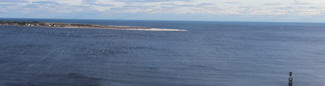
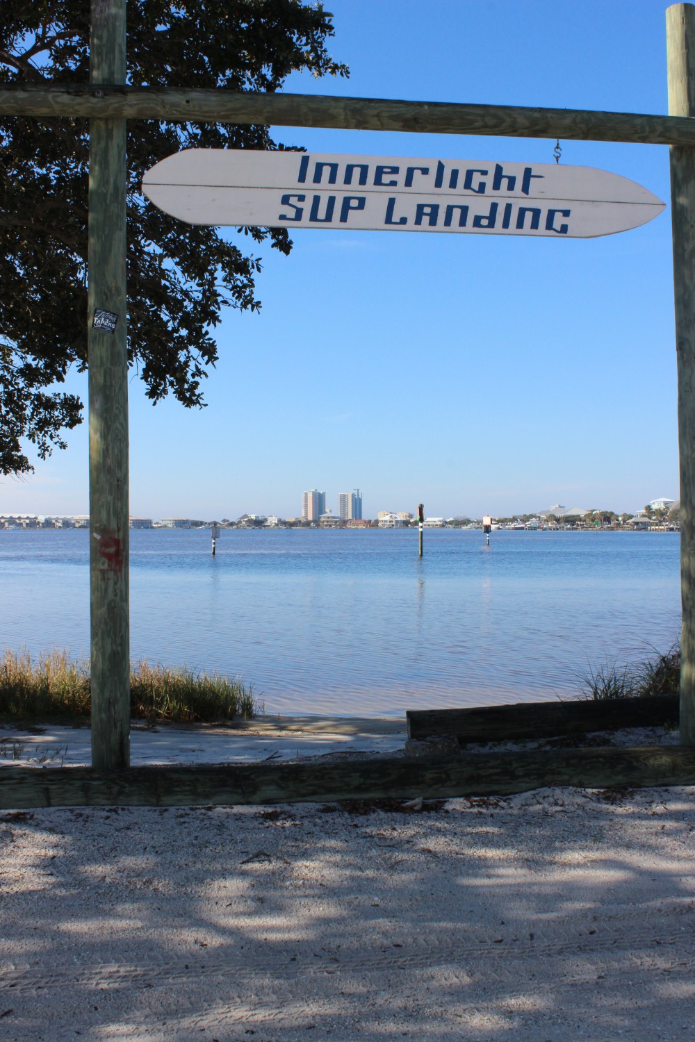
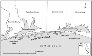
It was easy to see why they call this the Emerald Coast once one lays eyes on the beautiful emerald color water. Other questions weren’t so easily explained. For example, I wanted to know why the pass out of Destin Harbor is called the East Pass, when it is clearly on the west side of Choctawhatchee Bay? In fact, in the early 1900’s, the only outlet from the Bay to the Gulf was about 1.5 miles east of where the current pass resides and was called Old Pass Channel. In 1929, a storm sealed off Old Pass Channel and a heavy dose of spring rain raised Choctawhatchee Bay five feet. The threat of flooding inspired four local fishermen to take matters into their own hands and they dug a small trench across Santa Rosa Island to let the water out of the Bay. By the next morning, the trench had significantly widened into the East Pass we have today, connecting Choctawhatchee Bay to the Gulf of Mexico.
However, that still didn’t explain the East Pass moniker. To explain, we need to look west. Choctawhatchee Bay is connected to Pensacola Bay by the Santa Rosa Sound. This narrow passageway is the space between the Santa Rosa Island, a barrier island, and the mainland. In the early 1900’s, many of the goods and services traded between inhabitants in Okaloosa and Walton counties traveled on ships from Choctawhatchee Bay, through the Santa Rosa Sound, and over to Pensacola Bay, instead of going out into the Gulf. The opening between the Sound and Pensacola Bay is the West Pass, and hence the opening between the Sound and Choctawhatchee Bay is the East Pass. Another mystery solved.
If you are interested in knowing more about the history of this area, the Destin History and Fishing Museum is the place to go.
Citation: Morang, A. . A study of geological and hydraulic processes at East Pass, Destin, FL. Accessed: https://apps.dtic.mil/dtic/tr/fulltext/u2/a253890.pdf
“Foundation for a Gator Nation”
by Rick O'Connor | Dec 3, 2020
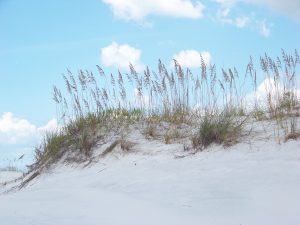
Along the northern Gulf coast is a string of long-thin sand bar islands we call barrier islands. They are called this because they serve as a barrier to the mainland from open water storms. These long sandy islands are very dynamic and constantly shift and move with the tides, currents, and waves. They can shift as far as 300 feet after a strong hurricane.
The white quartz sand beaches of the barrier island in the northern Gulf of Mexico.
Photo: Molly O’Connor
Life on these islands can be very tough. In addition to the constantly moving sand, there is salt spray in the wind, intense sunlight much of the year, high winds at times, and little rainfall to provide freshwater. Even though our area can receive as much as 60 inches of rain a year, much of this falls in the northern end of the counties, and not on the beaches. That said, there are freshwater ponds on some the islands and even larger dune lakes in Walton County – there life is not as hard.
As you cross a barrier island from the Gulf to the bay, you will cross distinct environmental zones. These zones are defined by the abiotic factors wind and salt spray and are named by their dominant plant forms having distinct animal life associated with them.
The beach zone seems life-less but it is not. Look beneath the sand.
Photo: Molly O’Connor
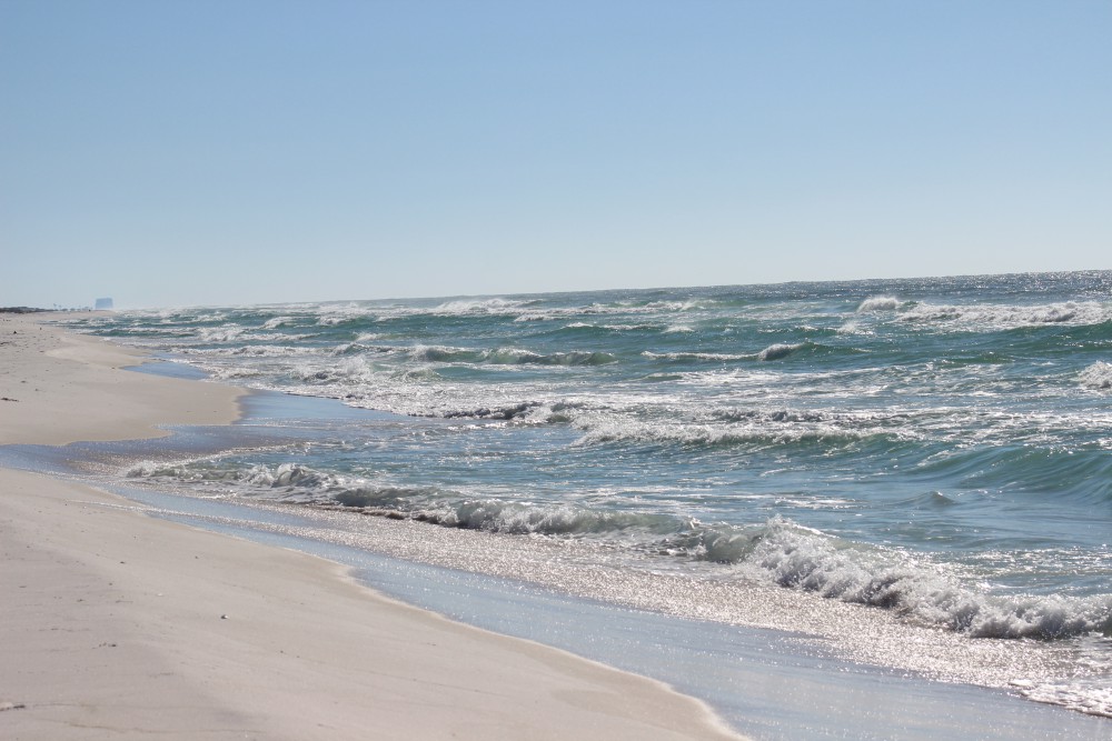
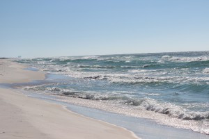
The beach is barren. This is the section of sand that extends from the water line of the Gulf to the first line of dunes. Few, if any plants can grow here. The high wave energy will not allow plants to grow along the shoreline, nor in the water itself. The wind and salt spray are high and the sand ever changing. All of the animal life here lives beneath the sand. They emerge when the wind and waves have slowed and scavenge on what they can find for food. Their primary production comes from the decomposition of the strands of seagrass and seaweed that line the shore – what we call wrack. Many will filter phytoplankton from the water as the waves wash in and seabirds are constant predators. When conditions get a little too much, they migrate a little offshore in deeper water to wait it out. But here fish and larger invertebrates become predators – so, they may not stay long.
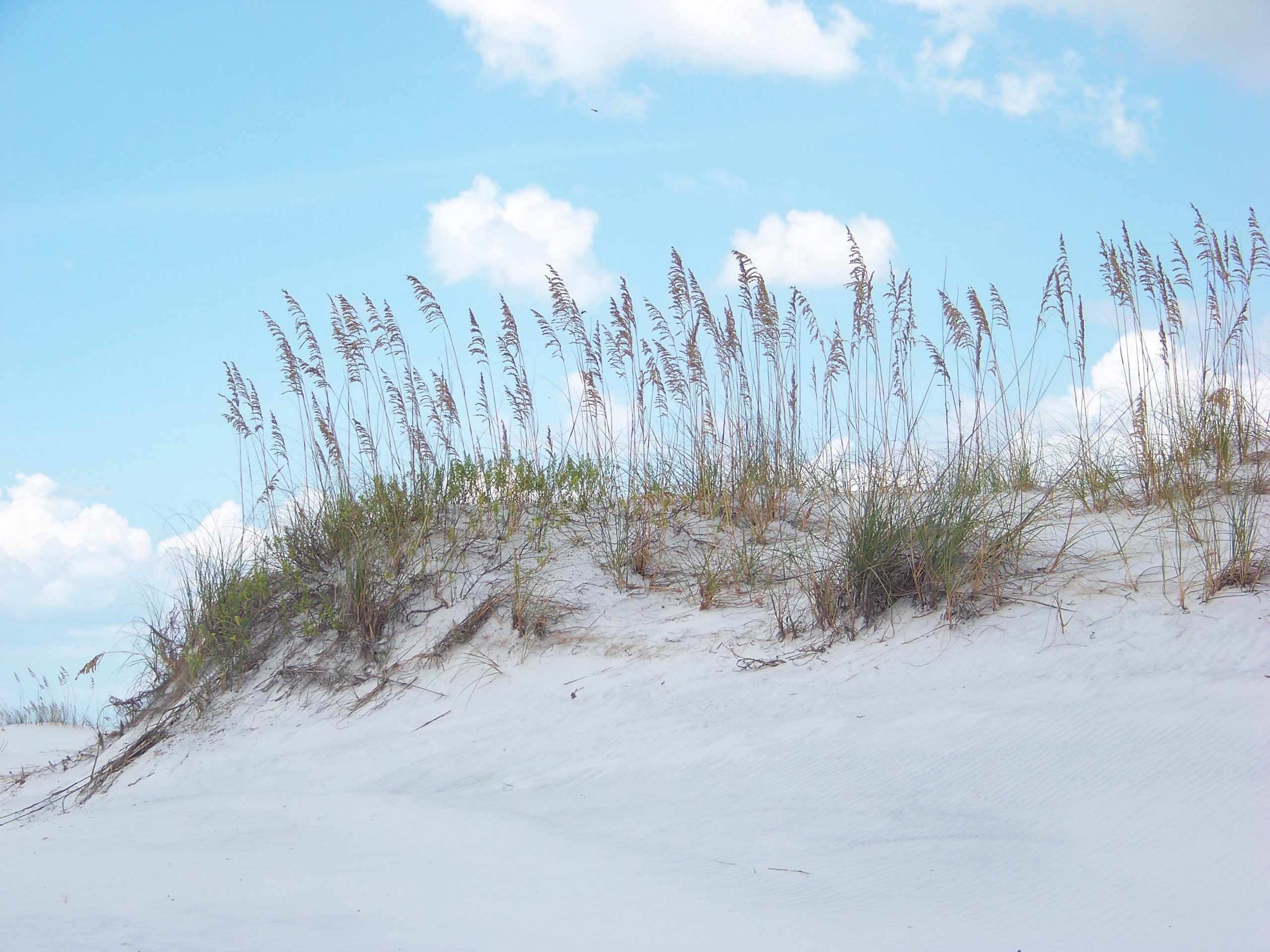
The primary dune is dominated by salt tolerant grasses like this sea oat.
Inland of the beach is the first dune line – the primary dune. This dune field is dominated by grasses because woody plants cannot tolerate the high wind. Most of these herbaceous plants have fibrous root systems that trap blowing sand and form dunes. The dominant grasses found here would include panic grass, beach elder, and the sea oat. The seeds of these plants provide food for creatures like the beach mice and some birds. Ghost crab burrows are often found here seeking shelter from the high energy environment of the beach. And, as you would expect, predators visit. Snakes, coyotes, and fox seeking the small mice.
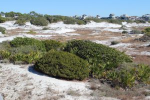
Small round shrubs and brown grasses within the swales are characteristic of the secondary dune field.
Photo: Rick O’Connor
This primary dune line blocks some of the wind and salt spray from the Gulf and allows small woody shrubs to grow. These shrubs will form a secondary dune system, which may grow slightly higher than the primary dunes. Shrubs like seaside rosemary, goldenrod, and false rosemary can be found here and give the dunes color when they are in bloom. The grasses found in the primary dune can also be found here. Beach mice and ghost crabs can work their way to this environment but because the wind is blocked by the primary dune other animals can be found here including: armadillos, opossum, a variety of snakes, and maybe even a gopher tortoise. Within the secondary dune field there are low areas that, at times, fill with rainwater. These are called swales and have their own unique wildlife. Grasses like broomsedge, needlerush, and bull rush can be found here. Along the edge you may find carnivorous plants such as the sundew. Freshwater attracts all wildlife, but the tenants could include a variety of amphibians, reptiles, and even some hardy species of fish.

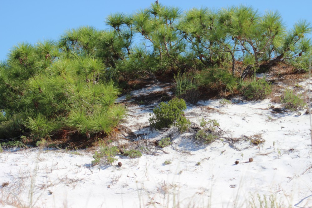
The top of a pine tree within a tertiary dune.
Photo: Molly O’Connor
On the back side of the island are some of the largest dunes. These are held in place by salt tolerant trees such as live oak, pine, and even magnolia. However, these trees look different than the ones that grow in our yards. They are the same species, but their growth seems stunted and often they look like the wind has blown their growth northward. This is known as wind sculpting and all of it is caused by the salt spray coming from the Gulf. These trees form a maritime forest where a variety of wildlife species do well. Deer, armadillo, opossum, skunks, coyote, fox, raccoon, hawks, owls, eagles, all sorts of snakes and woodland birds can be found here. In these xeric conditions, it is not uncommon to find a lot of cactus. Most of these creatures are hiding during the day, but at sunset they begin to move.
During these colder winter months, we encourage you to explore these beach habitats.
by Chris Verlinde | May 1, 2020
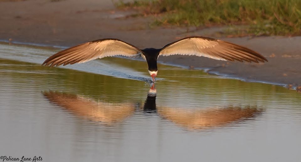
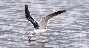
Black Skimmers foraging for fish. Photo Credit: Jan Trzepacz, Pelican Lane Arts.
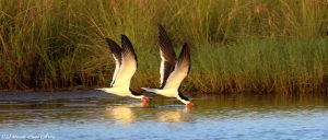
Black Skimmers and Least Terns, state listed species of seabirds, have returned along the coastal areas of the northern Gulf of Mexico! These colorful, dynamic birds are fun to watch, which can be done without disturbing the them.
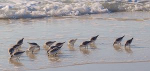
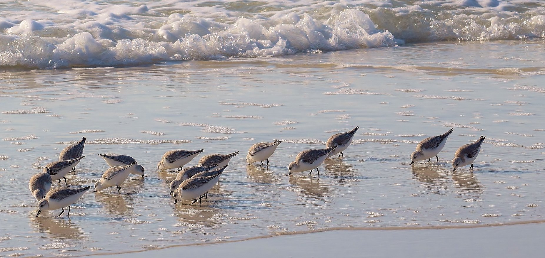
Shorebirds foraging. Photo Credit: Jan Trzepacz, Pelican Lane Arts.
Black Skimmer with a fish. Photo Credit: Jan Trzepacz, Pelican Lane Arts.
What is the difference between a seabird and shorebird?
Among other behaviors, their foraging habits are the easiest way to distinguish between the two. The seabirds depend on the open water to forage on fish and small invertebrates. The shorebirds are the camouflaged birds that can found along the shore, using their specialized beaks to poke in the sandy areas to forage for invertebrates.
Both seabirds and shorebirds nest on our local beaches, spoil islands, and artificial habitats such as gravel rooftops. Many of these birds are listed as endangered or threatened species by state and federal agencies.
Juvenile Black Skimmer learning to forage. Photo Credit: Jan Trzepacz, Pelican Lane Arts.
Adult black skimmers are easily identified by their long, black and orange bills, black upper body and white underside. They are most active in the early morning and evening while feeding. You can watch them swoop and skim along the water at many locations along the Gulf Coast. Watch for their tell-tale skimming as they skim the surface of the water with their beaks open, foraging for small fish and invertebrates. The lower mandible (beak) is longer than the upper mandible, this adaptation allows these birds to be efficient at catching their prey.

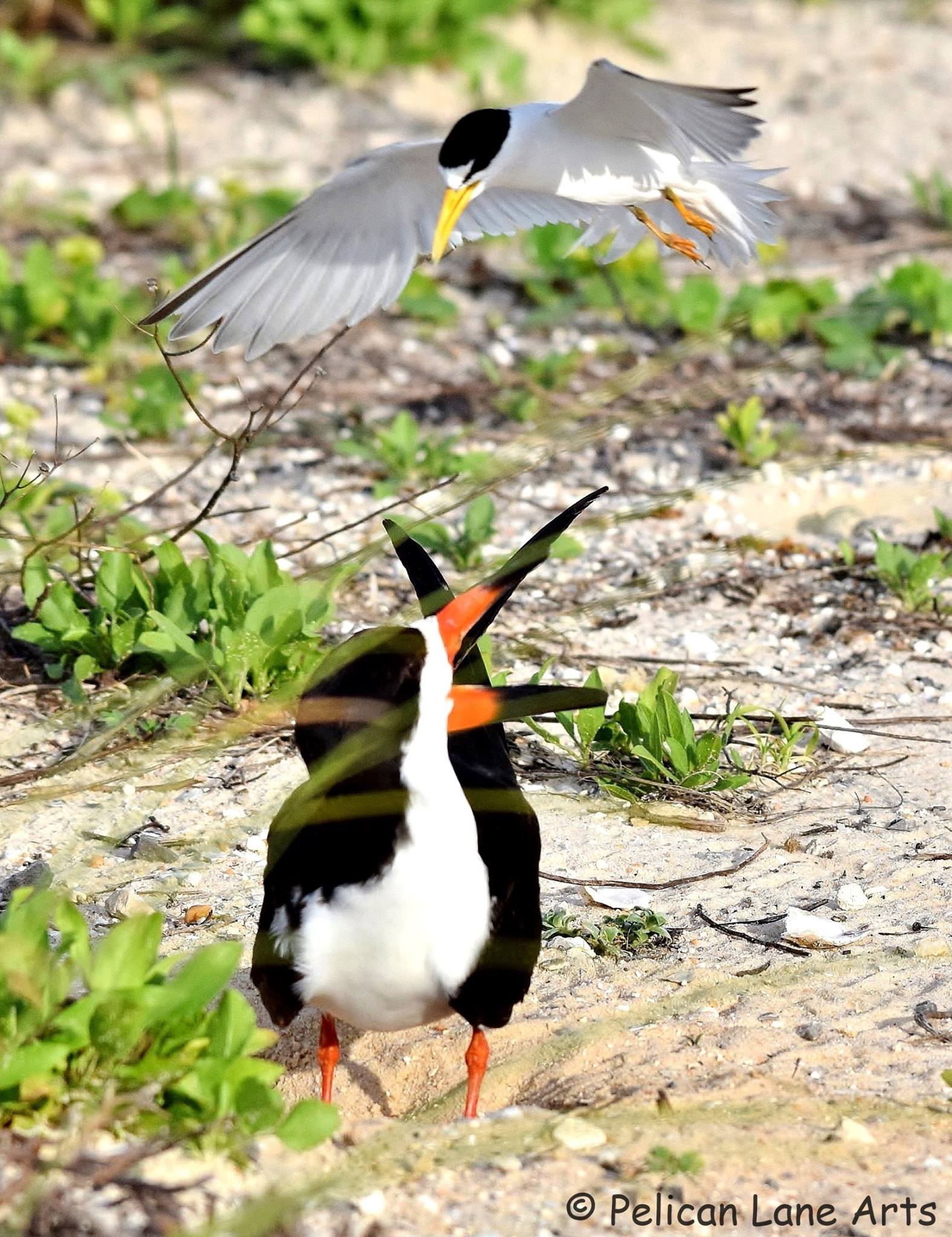
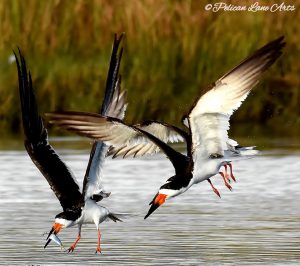
Least Tern “dive bombing” a Black Skimmer that is too close to the Least Tern nest. Photo Credit: Jan Trzepacz, Pelican Lane Arts.
Adult breeding least terns are much smaller birds with a white underside and a grey-upper body. Their bill is yellow, they have a white forehead and a black stripe across their eyes. Just above the tail feathers, there are two dark primary feathers that appear to look like a black tip at the back end of the bird. Terns feed by diving down to the water to grab their prey. They also use this “dive-bombing” technique to ward off predators, pets and humans from their nests, eggs and chicks.

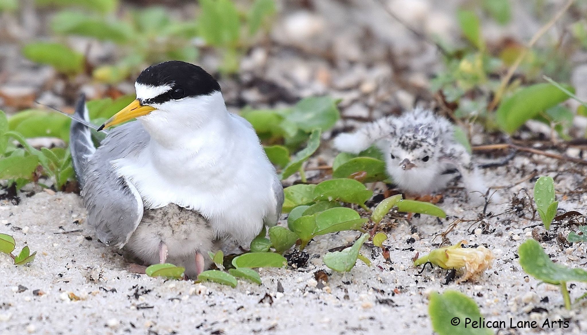
Least Tern with chicks. Photo Credit: Jan Trzepacz, Pelican Lane Arts.
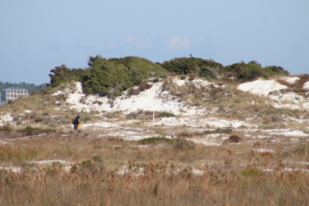
Both Black Skimmers and Least Terns nest in colonies, which means they nest with many other birds. Black skimmers and Least Terns nest in sandy areas along the beach. They create a “scrape” in the sand. The birds lay their eggs in the shallow depression, the eggs blend into the beach sand and are very hard to see by humans and predators. In order to avoid disturbing the birds when they are sitting on their nests, known nesting areas are temporarily roped off by Audubon and/or Florida Fish and Wildlife Conservation Commission (FWC) representatives. This is done to protect the birds while they are nesting, caring for the babies and as the babies begin to learn to fly and forage for themselves.
Threats to these beautiful acrobats include loss of habitat, which means less space for the birds to rest, nest and forage. Disturbances from human caused activities such as:
- walking through nesting grounds
- allowing pets to run off-leash in nesting areas
- feral cats and other predators
- litter
- driving on the beach
- fireworks and other loud noises
Audubon and FWC rope-off nesting areas to protect the birds, their eggs and chicks. These nesting areas have signage asking visitors to stay out of nesting zones, so the chicks have a better chance of surviving. When a bird is disturbed off their nest, there is increased vulnerability to predators, heat and the parents may not return to the nest.
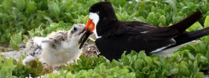
Black Skimmer feeding a chick. Photo Credit: Jan Trzepacz, Pelican Lane Arts.
To observe these birds, stay a safe distance away, zoom in with a telescope, phone, camera or binoculars, you may see a fluffy little chick! Let’s all work to give the birds some space.
Special thanks to Jan Trzepacz of Pelican Lane Arts for the use of these beautiful photos.
To learn about the Audubon Shorebird program on Navarre Beach, FL check out the Relax on Navarre Beach Facebook webinar presentation by Caroline Stahala, Audubon Western Florida Panhandle Shorebird Program Coordinator:
In some areas these birds nest close to the road. These areas have temporarily reduced speed limits, please drive the speed limit to avoid hitting a chick. If you are interested in receiving a “chick magnet” for your car, 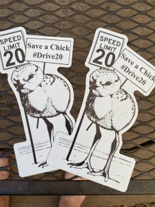 to show you support bird conservation, please send an email to: chrismv@ufl.edu, Please put “chick magnet” in the subject line. Please allow 2 weeks to receive your magnet in the mail. Limited quantities available.

by Rick O'Connor | Nov 8, 2019
Over the last two years I have been surveying snakes in a local community on Perdido Key. The residents were concerned about the number of cottonmouths they were seeing and wanted some advice on how to handle the situation. Many are surprised by the number of cottonmouths living on barrier islands, we think of them as “swamp” residents. But they are here, along with several other species, some of which are venomous. Let’s look at some that have been reported over the years.

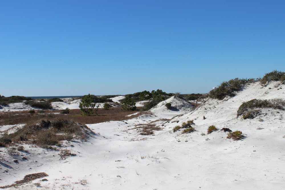
The dune fields of panhandle barrier islands are awesome – so reaching over 50 ft. in height. This one is near the Big Sabine hike (notice white PVC markers).
In the classic text Handbook of Reptiles and Amphibians of Florida; Part One – Snakes (published in 1981), Ray and Patricia Ashton mention nine species found on coastal dunes or marshes. They did not consider any of them common and listed the cottonmouth as rare – they seem to be more common today. In a more recent publication (Snakes of the Southeast, 2005) Whit Gibbons and Michael Dorcas echo what the Ashton’s published but did add a few more species, many of which I have found as well. Their list brings the total to 15 species. I have frequently seen four other species in Gulf Breeze and Big Lagoon State Park that neither publication included, but I will since they are close to the islands – this brings the total 19 species that residents could encounter.
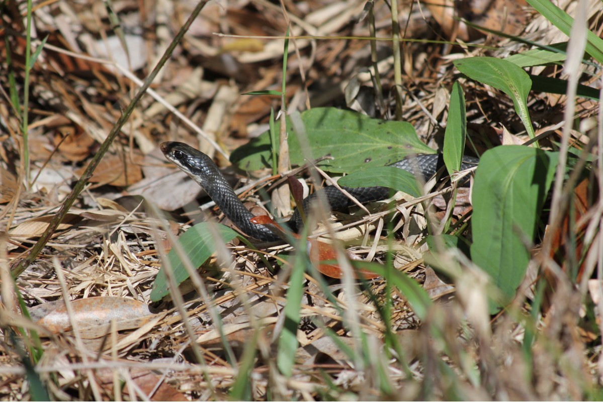
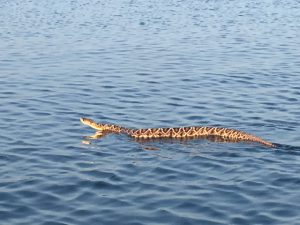
Leading us off is the one most are concerned about – the Eastern Cottonmouth (Agkistrodon piscivorous). Though listed as “rare” by the Ashton’s, encounters on both Pensacola Beach and Perdido Key are becoming common. There is more than one subspecies of this snake – the eastern cottonmouth is the local one – and that the water moccasin and cottonmouth are one in the same snake. This snake can reach 74 inches in length (6ft). They are often confused with their cousin the copperhead (Agkistrodon contorix). Both begin life in a “copper” color phase and with a luminescent green-tipped tail. But at they grow, the cottonmouth becomes darker in color (sometimes becoming completely black) while the copperhead remains “copper”. The cottonmouth also has a “mask” across its eyes that the copperhead lacks. Believe it or not, the cottonmouth is not inclined to bite. When disturbed they will vibrate their tail, open their mouth showing the “cottonmouth” and displaying their fangs, and swiveling their head warning you to back off. Attacking, or chasing, rarely happens. I find them basking in the open in the mornings and seeking cover the rest of the day. Turning over boards (using a rake – do not use your hand) I find them coiled trying to hide. MOST of the ones I find are juveniles. These are opportunistic feeders – eating almost any animal but preferring fish. They hunt at night. Breeding takes place in spring and fall. The females give live birth in summer. As mentioned earlier, they seem to be becoming more common on our islands.
Eastern Cottonmouth with distinct “mask” and flattened body trying to intimidate.
Photo: Rick O’Connor
This year, while surveying for cottonmouths, I encountered numerous Eastern Coachwhips (Masticophis flagellum). These long slender snakes can reach lengths of 102” (8ft.), move very fast across the ground – often with their heads raised like a cobra – and, even though nonvenomous, will bite aggressively. They get their name from their coloration. They have a dark brown head and neck and a tan colored body – resemble an old coachwhip. They like dune environments and are excellent climbers. They consume lizards, small birds and mammals, and even other small snakes. They are most active during the daylight, but I usually find them beneath boards and other debris hiding. They have always been on the islands but encountered more often this past year. They lay eggs and do so in summer.
Their close cousin, the Southern Black Racer (Coluber constricta) is very similar but a beautiful dark black color. They can reach lengths of 70” (6ft.) and are also very fast. Like their cousin, they are nonvenomous but bite aggressively – often vibrating their tail like cottonmouths warning you to stay back. They are beneficial controlling amphibian, reptile, and mammalian animals. They are also summer egg layers.
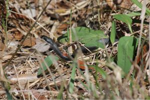
The southern black racer differs from otehr black snakes in its brillant white chin and thin sleek body.
Photo: Jacqui Berger.
There are a few freshwater snakes that, like the cottonmouth do not like saltwater, but could be found on the islands. These are in the genus Nerodia and are nonvenomous. There are two species (the Midland and Banded water snakes) that could be found here. They resemble cottonmouths in size and color and are often confused with them. They differ in that they have vertical dark stripes running across their jaws and have a round pupil. Though nonvenomous, they will bite aggressively. One member of the Nerodia group is the Gulf Coast Salt Marsh Snake (Nerodia clarkii clarkii). This snake does like saltwater and is found in the brackish salt marshes on the island. It is dark in color with four longitudinal stripes, two are yellow and two are a dull brown color. It only reaches a length of 36” (3ft.), is nocturnal, and feeds on estuarine fish and invertebrates.
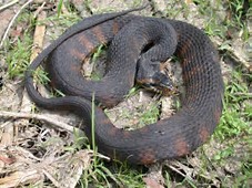
This banded water snake is often confused with the cottonmouth. This animal has the vertical stripes extending from the lower jaw, which is lacking in the cottonmouth.
Photo: University of Georgia
Other species that the guides mention, or I have seen, are the small Crowned Snake, Southern Hognose, Pine Snake, Pine Woods Snake, and the Rough Green Snake. I will mention here species I have seen in either Gulf Breeze or Big Lagoon State Park that COULD be found on the island: Eastern Coral Snake, Eastern Garter Snake, Pigmy Rattlesnake, Eastern Hognose, and the Corn Snake (also called the Red Rat Snake). Only two of these (Eastern Coral and Pigmy) are venomous.
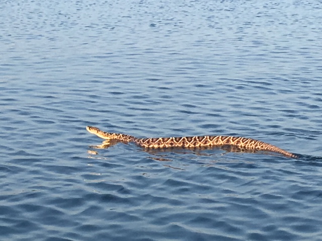
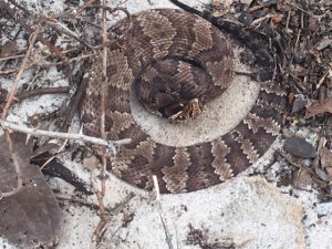
Last, but not least, is the Eastern Diamondback Rattlesnake (Crotolus adamateus). This is the largest venomous snake in the United States, reaching 96” (8ft.). It is a diurnal hunter consuming primarily small mammals, though large ones can take rabbits. They prefer the dry areas of the island where cover is good. Palmettos, Pine trees, and along the edge of wetlands are their favorite haunts. Despite their preference for dry sandy environments, they – like all snakes – are good swimmers and large rattlesnakes have been seen swimming across Santa Rosa Sound and Big Lagoon. They tend to rattle before you get too close and you should yield to this animal. The have an impressive strike range, 33% of their body length, you should give these guys a wide berth. I have come across several that never rattled, I just happen to see them. Again, give them plenty of room when walking by.
Eastern diamondback rattlesnake swimming in intracoastal waterway near Ft. McRee in Pensacola.
Photo: Sue Saffron
It is understandable that people are nervous about snakes being in popular vacation spots, but honestly… they really do not like to be around people. We are trouble for them and they know it. Most encounters are in the more natural areas of the islands. Staying on marked trails and open areas, where you can see them – and be sure to look down while walking, you should see them and avoid trouble. For more questions on local snakes, contact me at the county extension office.
References
Ashton, R.E., P.S. Ashton. 1981. Handbook of Reptiles and Amphibians of Florida; Part One – Snakes. Windward Publishing, Miami FL. Pp.176.
Gibbons, W., M. Dorcas. 2005. Snakes of the Southeast. University of Georgia Press, Athens GA. Pp. 253.
by Rick O'Connor | Feb 12, 2016
All Photos by Molly O’Connor
We began our series on Nature Tourism along the ICW at the Alabama state line on Perdido Key and discussed the ICW itself. This month we will continue in Escambia County with a visit to Pensacola Beach.
The dune fields of panhandle barrier islands are awesome – some reaching over 50 ft. in height. This one is near the Big Sabine hike (notice white PVC markers).

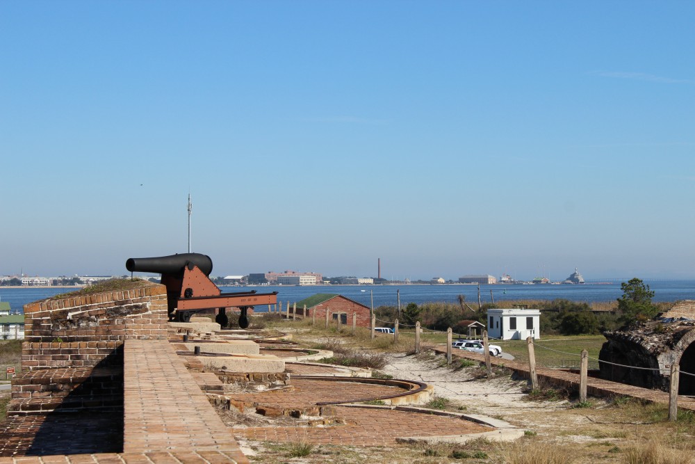
The cannons of Ft. Pickens protected the entrance into Pensacola Bay. The views of the western end of Santa Rosa Island are great from here. There is plenty of nature and history to be discovered at this park. Plan to stay the day.
BARRIER ISLANDS
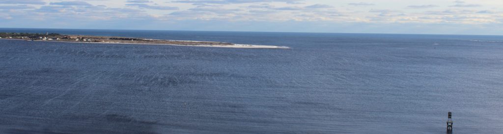
Pensacola Beach is on Santa Rosa Island. The longest barrier island in the panhandle, Santa Rosa Island stretches 44 miles from Ft. Pickens, at Pensacola Pass, to Destin Pass in Okaloosa County. With miles of some of the whitest beaches in the world, these panhandle islands have a variety of ecosystems. The mineral that makes the beach so white is quartz, one of the minerals found in granite rock. Over eons weathering and erosion has released these minerals from the granite in the Appalachians and sent it downstream to the Gulf coast. The densities of the different minerals force it to settle out at different rates. Quartz, being one of the less dense minerals, reaches the Gulf of Mexico where it encounters longshore currents. In the panhandle these currents more often run east to west moving the quartz in that direction. This sand forms bars and shallows which made colonial navigation a problem and good hiding places for pirates. Some of the bars remain above sea level and form dune fields and plant communities, forming barrier islands. Many animals, such as shorebirds and sea turtles, seek these islands for nesting because of few predators. The xeric conditions favor reptiles and birds, but there are many mammals and insects as well. Freshwater ponds form on many of the islands and here amphibians and fish came claim territory. The high energy beach of the Gulf side supports a community of subterranean organisms which include the mole crab (sand flea) and coquina. The low energy bay side harbors salt marshes along the shoreline and seagrass meadows below the surface. These habitats support a rich variety of marine life, some of the most productive in the world.
The Florida Trail extends (in sections) over 1,300 miles from Ft. Pickens to the Florida Everglades. It begins at this point.
PENSACOLA BEACH
There are many places on Pensacola Beach where visitors can enjoy these natural places. At the west end of the island is Ft. Pickens, part of the Gulf Islands National Seashore. Within the park you will find beaches to comb, piers to view wildlife and fish, jetties to fish or dive, fortifications to view the island, and a nice museum to educate you on both the natural and cultural history of the area. Here the Florida Trail begins. This trail is segmented and stretches from Ft. Pickens to the Everglades, but here it stops at Battery Langdon; it can be hiked or biked. Along the trail there are freshwater ponds and sections of maritime forest with a variety of wildlife viewing and photography. The multiple loop campground is found on this trail.
Between these pilings at Park West is one of the county snorkel reefs. Visibility is tough but the fish are there.
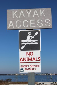
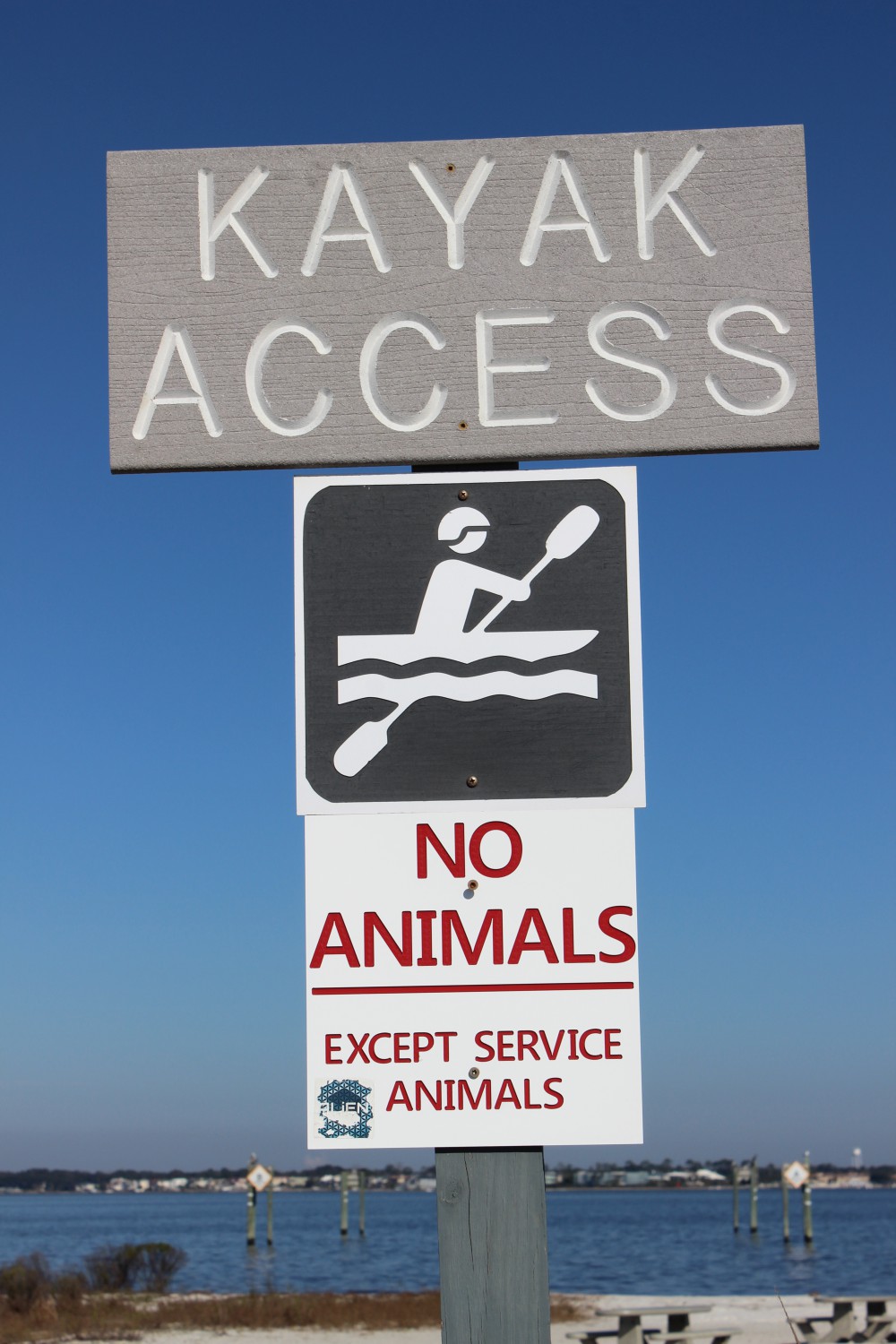
There is a kayak launch at Park West as well.
Just outside the entrance to the park is a county park named Park West. Here there is a kayak launch and nearshore snorkel reef on the bay side, with picnic area and beaches on the Gulf.
In Pensacola Beach proper there are several businesses that rent paddleboards for paddling the shallow seagrass filled Little Sabine. There are two marinas which offer sailing, fishing, and diving charters as well as dolphin tours. There are numerous artificial reefs off of Pensacola including the world’s largest – the U.S.S. Oriskany. On the Gulf side you will find the Pensacola Beach Fishing Pier where not only can you fish but, at times, see marine life. Sharks, sea turtles, dolphins, and large fish are often seen. The sunsets are great here. At the Visitors Center you can get a map to follow the Eco-Trail. This driving trail of 28 kiosks will take you to natural spots and the kiosks provide education about the area. There is a prize if you complete the trail.
Heading east from Pensacola Beach you once again pick up a portion of the Florida Trail. At this location there is a bike path, which can be walked or biked. Park East houses a popular nearshore snorkel reef. This snorkel reef is on the Gulf side and there are beach markers to help the diver locate it. On the bay side is Big Sabine. This area of high dunes and salt marsh has no formal trail but there are PVC pipes placed to help navigate your way in and out.

The paddleboard entry to Little Sabine can be found next to the Pensacola Beach Marina.
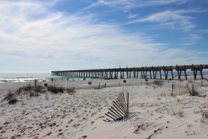
The Pensacola Beach Fishing Pier is not only a great spot to catch fish, it’s a great spot to see marine life – and great sunsets.
Further east you once again enter the Gulf Islands National Seashore. Escambia County is lucky to have almost 50% of their portion of the island within this national park. There are miles of natural beach to explore but you must use the public parking lots (no roadside parking) and watch your speed, this area supports several species of nesting shorebirds – some of which are listed as imperiled in the state of Florida.
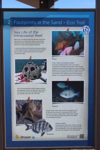
The Santa Rosa island Authority’s Eco-Trail has 28 kiosk to navigate and learn about the natural history of the island. It is a fun and educational car trip. You can get the map for this trail at the visitors center on Pensacola Beach.
To learn more about nature and farm tourism in Escambia County visit www.NaturallyEscaRosa.com and download the free app at the App Store or Google Play
Next month – Santa Rosa County.

Aligning these markers will assist the snorkeler/diver in locating the Gulf snorkel reef at Park East. The swim is a bit further than Park West but the visibility is much better.