Diamondback terrapins are the only resident turtle within brackish water and estuarine systems. Their range extends from Massachusetts to Texas but, prior to 2005, their existence in the Florida panhandle was undocumented. The Panhandle Terrapin Project was developed to first determine whether terrapins exist in the panhandle (Phase I) and, if so, what is their status (Phase II and III).
The project began at the Marine Science Academy at Washington High School (in Pensacola) in 2005. Between 2005 and 2010 the team was able to verify at least one record in each of the panhandle counties. For Phase II we used what we called the “Mann Method” to determine the relative abundance of terrapins in each area. To do this we needed to conduct assessments of nesting activity in each county. In 2012 the project moved from Washington High School to Florida Sea Grant. At that time, we developed a citizen science program to conduct Phase II of this project. Effort first focused on Escambia and Santa Rosa counties, but in recent years has included Okaloosa County. Florida Sea Grant now partners with the U.S. Geological Survey (based out of Gulf County) to assist with Phase II and lead Phase III, which is estimating populations using mark-recapture methods, as well as satellite tagging to better understand movements and habitat use. The focus of Phase III has been Gulf County, but tagging has occurred in Okaloosa and Escambia counties.
Over the years we have trained 271 volunteers who have conducted thousands of hours of nesting surveys and helped obtain a better picture of the status of diamondback terrapins in the Florida panhandle. Here are the 2023 project results.
Results from 2023
We trained 67 volunteers; 35 (52%) of which participated in at least one nesting survey.
The volunteers conducted 196 surveys logging 212 hours.
During those surveys terrapins (or terrapin sign) were encountered 43 times; a Frequency of Encounter (FOE) of 22%.
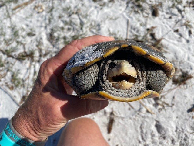
Three terrapins were tagged. Two from Okaloosa and one from Escambia. All but two of the nine primary survey beaches saw nesting activity (78%). One new nesting beach was discovered.
Escambia County
Two nesting beaches. 47 surveys. 7 encounters (FOE = 15%).
The Mann Method assumes the sex ratio is 1:1 (male: female) but recent studies suggest the ratio may be as high as 5:1 (male: female). Based on these two rations the number of terrapins estimated to be using these beaches ranged from 4-36.
One terrapin (“Dollie”) was tagged. Fire ants and torpedo grass were reported on some beaches.
Santa RosaCounty
Three nesting beaches. 68 Surveys. 14 encounters (FOE = 21%).
The number of terrapins estimated to be using these beaches ranged from 6-30.
No terrapins were captured, though one was seen nesting. No invasive species were reported from the nesting beaches.
OkaloosaCounty
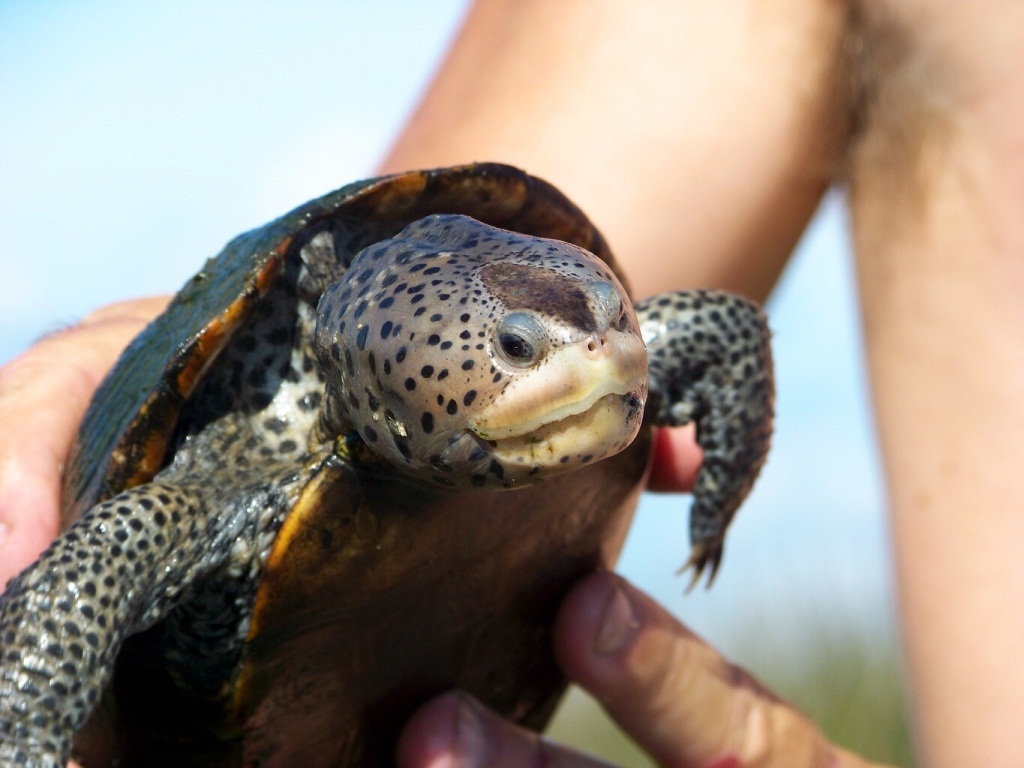
Four nesting beaches. 67 surveys. 21 encounters (FOE = 31%).
The number of terrapins estimated to be using these beaches ranged from 2-66.
Two terrapins were tagged (“Kennedy” and “Molly”). Phragmites were reported from all beaches.
Walton County
Walton county currently does not have a volunteer coordinator and surveys are not occurring at this time. We are working with an individual who may take the lead on this.
BayCounty
This team is just beginning and currently there are no primary beaches. The team focused on five beaches encountering terrapin nesting activity on one of them. They conducted a total of 14 surveys encountering terrapin tracks on 1 of those (FOE = 7%). The estimated number of terrapins using this beach ranged from 4-12.
Baldwin County Alabama
Due to the proximity of terrapin habitat and nesting beaches at the Alabama/Florida line, and the possibility of terrapins using habitat in both states, a team was developed in Baldwin County Alabama this year. The team began conducting Phase I surveys and encountered one deceased terrapin. No nesting beaches have been identified at this time.
Summary
The results of this year’s surveys suggest that, based on the number of nesting beaches we know of, there are anywhere from 2-66 terrapins utilizing them. Again, two of the primary beaches did not have nesting activity this year. USGS tagging studies will provide better population estimates and a better understanding of how these animals are utilizing these habitats. The current population estimate for Gulf County is a little over 1000 individuals and most are showing relatively small range of habitat utilization, although two individuals in the western panhandle moved from one county to the neighboring one.
Training for volunteers occurs in March of each year. If you are interested in participating, contact Rick O’Connor – roc1@ufl.edu.
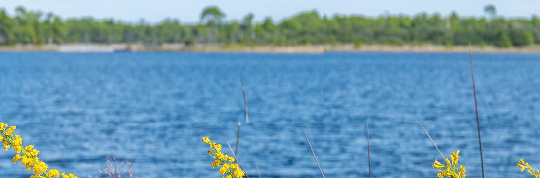
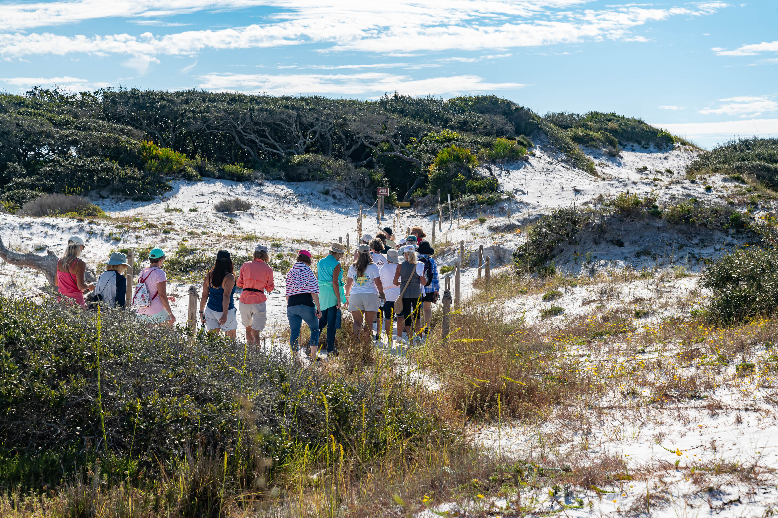
October is Dune Lake Awareness month and as part of the celebration, Walton and Okaloosa County UF/IFAS Extension Agents are joining together to host a Coastal Dune Lake Tour at Western Lake in Grayton Beach State Park. This free event will include a brief lecture and guided tour of the nature trail surrounding the lake. Laura Tiu, Marine Science Agent, will start the tour with a history of the lakes, the unique ecology and some of the local protections. Sheila Dunning, Horticulture Agent, will share information on the unique flora in the dunes including which plants have been used by native Americans and pioneers for food and medicine and the trees we find in the dune landscape surrounding the dune lakes and their adaptations to this sometimes-harsh environment. If you have an interest in our local dune lakes or the tour, you may visit the Walton County Dune Lake website at https://www.co.walton.fl.us/97/Coastal-Dune-Lakes. If you would like to register for this free tour go to https://www.eventbrite.com/e/panhandle-outdoor-live-2023-coastal-dune-lake-lecture-and-trail-tour-tickets-722764316527?aff=oddtdtcreator or use our Facebook event link https://www.facebook.com/events/811943803961304. Feel free to call our office, 850-892-8172, with any questions.
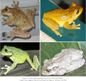
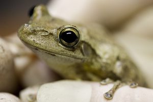
Discover the fascinating world of Cuban Treefrogs and join us for an exciting workshop aimed at effectively managing their invasion. Led by Dr. Steve Johnson, an expert on Cuban Treefrogs from UF/IFAS Extension, this workshop will provide you with valuable insights on recognizing these invasive frogs and exploring management options. In addition, attendees will have the opportunity to learn how to monitor and report data on Cuban Treefrog populations. Together, let’s take action to address the challenges posed by the invasion of Cuban Treefrogs! The Workshop will be held September 28th 9am – 3pm CDT at 2728 E14th St, Panama City, FL 32401Register Here
The Invasion of Cuban Treefrogs:
Originating from Cuba and introduced unintentionally to Florida in the 1920s, the Cuban Treefrog has rapidly established itself across various states, including Georgia and Louisiana. Believed to have arrived as stowaways in shipping crates, these non-native frogs have become a cause for concern due to their impacts on native treefrog and toad populations.
Understanding the Threat:
Cuban Treefrog adults and their tadpoles are known predators of native treefrogs and toads. Their presence poses a significant threat to the delicate balance of our ecosystems. Therefore, it is crucial to develop effective management strategies to curb their invasion and minimize their impact on our native species.
Workshop Highlights:
During the workshop, Dr. Steve Johnson, an esteemed authority on Cuban Treefrogs, will guide participants through the identification and management of these invasive frogs. Attendees will gain valuable knowledge and practical skills to recognize Cuban Treefrogs and explore options for effectively managing their populations. Participants will also build and take home their own treefrog house (refugia) made with PVC.
Contributing to Research:
In addition to learning about identification and management, workshop attendees will have the opportunity to play an active role in monitoring and reporting data on Cuban Treefrog populations. By actively participating in data collection efforts, you will contribute to scientific research and provide crucial insights into the distribution and behavior of these invasive frogs.
Join the Cause:
The invasion of Cuban Treefrogs is a pressing environmental issue that requires collective action. By attending our workshop, you can become an agent of change in addressing this invasive species. Let’s work together to protect our native treefrogs and toads by effectively managing the population of Cuban Treefrogs.
Don’t miss out on this unique opportunity to join Dr. Steve Johnson and fellow nature enthusiasts in our workshop focused on managing the invasion of Cuban Treefrogs. By acquiring knowledge, developing practical skills, and contributing to data collection efforts, you can actively participate in protecting our native species and preserving the delicate balance of our ecosystems. Together, let’s make a difference and tackle the challenges posed by the Cuban Treefrog invasion. Register now and be a part of this important environmental initiative!
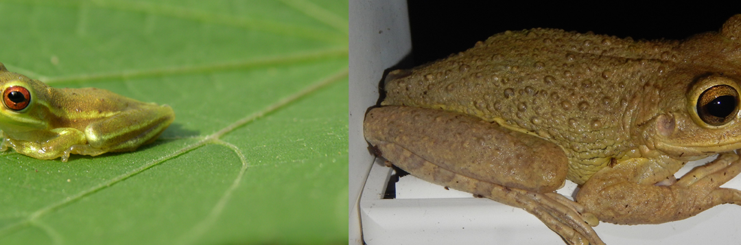
An invasive Cuban Tree Frog specimen. Invasive species, amphibians and reptiles. frogs, pests. UF/IFAS Photo by Tyler Jones.
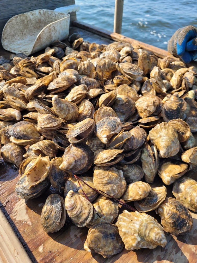
There is a term that all oyster farmers dislike, it is almost like that one villain from a famous book/movie series where they shouldn’t say his name. That term is “unexplained spring/summer mortality” and it has been a growing issue along with the expansion of oyster farming throughout the southeast. While the art of oyster farming has been around since the time of the Romans, it is a relatively new venture here in the Gulf of Mexico, and Florida is home to over one hundred oyster farms. These farms are meticulously cared for by the oyster farm crew, with many different anti-fouling techniques and biosecurity measures in practice to provide the customer with a safe, clean product that you can consume even in the months without an R (another article on that coming later). Each year, farm managers can expect a 10-30% mortality event during the transition from winter into spring/summer, hence the term “unexplained spring/summer mortality.” Researchers and scientists from all over the southeast have been actively working to find a cause for this phenomenon, but the answer has been hard to find.
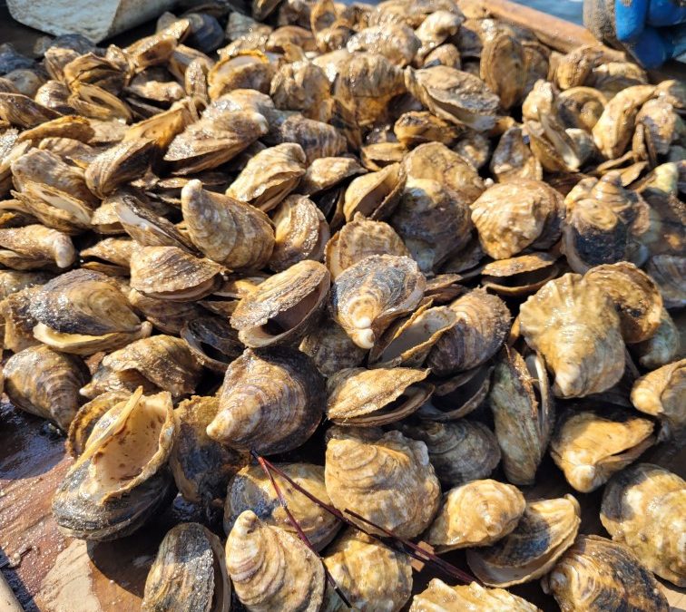
Dead, market ready oysters from one bag. Cause of death, “Unexplained Mortality Event 2022” Photo by: Thomas Derbes II
Our Pensacola Bay has been a hotbed for oysters lately; The Nature Conservancy recently constructed 33 oyster beds along Escribano Point in East Bay, the establishment of the Pensacola & Perdido Bay Estuary Program, acquisition of a $23 million restoration grant with $ 10 million towards 1,482 acres of oyster restoration, and the establishment of oyster farms and hatcheries. In Pensacola Bay, there are currently 5 oyster farms in operation, one of those farms being a family-owned and operated Grayson Bay Oyster Company. Brandon Smith has been managing the business and farm for over 4 years now and has experienced mortality events during those prime spring/summer months. In recent years, they have experienced mortality events ranging from minimal to what many would consider “catastrophic,” and reports from around Florida and the Southeast convey a similar message. Concerned for not only the future of his family farm, but other oyster farms in the Southeast, he has been working with the most experienced institutions and groups in 2022 to possibly get an answer on his and other local “unexplained mortality events.” Each road led to the same answer of “we aren’t quite sure,” but this didn’t deter Smith or other the farmers who are dealing with similar issues.
In 2023, Smith was invited to participate in a Florida-Wide program to track water quality on their farm. This project, led by Florida Sea Grant’s Leslie Sturmer from the Nature Coast Biological Station in Cedar Key, Florida, hopes to shed some light on the changes in water quality during the transition from winter to spring and spring to summer. Water samples have also been taken weekly to preserve plankton abundance and the presence of any harmful algae if a mortality event does occur. With the hottest July on record occurring in 2023, temperature could play a role in mortality events, and now researchers are equipped with the right tools and open lines of communication to possibly find a solution to the problem.
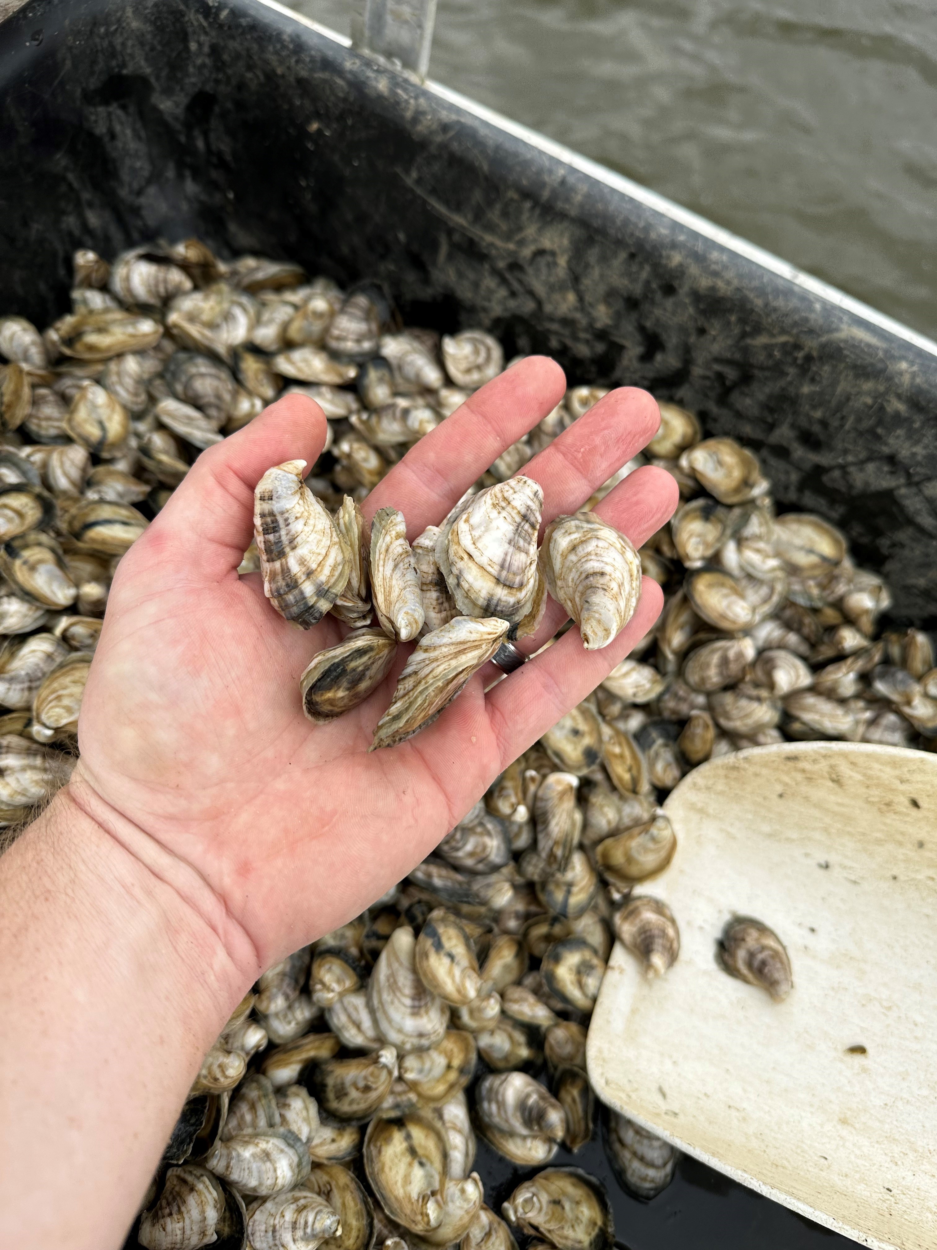
3-month-old seed being deployed out on Grayson Bay Oyster Company’s farm in Pensacola, Florida (2023). Photo by: Thomas Derbes II
As with traditional farming on land, oyster farming takes a mentally strong individual with an incredible work ethic and the ability to adapt to change. The Southeast has a resilient system of oyster farmers who display these traits and continue to put their noses down and “plant” seed every year for the continuation of a growing yet small industry, even through the hardest of trials and tribulations. Through collaboration with local and state institutions, stakeholders, programs, and citizens, oyster farmers are hopeful that they can solve this “unexplained mortality event” and help develop resilient farming techniques. An important message is local farms that have environmental and economic impacts cannot exist without the support of their community.
If you’re interested in tracking water quality on select farms, including Grayson Bay Oyster Company, the website is https://shellfish.ifas.ufl.edu/farms-2023/ and it is updated monthly.
Florida has a great variety of turtles. Actually, the species richness here is higher than any other state – though Alabama may argue. Many are familiar to us. If we have not seen them, we have at least heard of them. But that may not be the case with map turtles.
Map turtles are in the same family as many of the common ponds turtles but are in the genus Graptemys. The patterns on their shells and skin are beautiful and they have raised scutes along the midline of their shells giving them a “sawback” or “dinosaur” look. They are associated with alluvial rivers due to their diet of shellfish, which cannot be found in the low pH waters of tannic rivers. To our west, in Alabama and Mississippi, there are several species of them. And as you move up into the Mississippi valley and into the Midwest, there are even more. But here in Florida there are only two. Let’s meet them.
The Barbour’s Map Turtle (Graptemys barbouri) is associated with the Apalachicola River system. First discovered in the Chipola River, it has now been found in the Chattahoochee, Flint, and Apalachicola River systems, as well as the Choctawhatchee and Pea Rivers. It may have been introduced to the Ochlockonee and Wacissa.
Barbour’s Map Turtle.
Photo: Rome Etheridge
Female map turtles are much larger than the males, and the female Barbour’s Map is the largest of all map turtles – with a carapace length of 33cm (13 in.). She has a very broad head (8cm, 3in. wide) to crush the shells of her favorite prey – snails. The males only reach 13cm (5in.) carapace length and their heads are much narrower. Barbour’s Maps prefer flowing rivers with limestone outcrops. These outcrops support the snails they like to eat. That said, they have been found in high numbers within the silty channels of these rivers.
Females take many years to mature, possibly as long as 14. Males mature in 3-4 years. Breeding begins in the spring and nesting begins in late April but will continue into August. Like most turtles, they seek out sandy beaches where they will lay multiple clutches of 7-10 eggs over the span of the nesting season.
Fallen trees (snags) are important basking areas and map turtles use them frequently. During the cooler months, and low water periods along the river, they will hide in deep pockets within the limestone rock. Their home range along the rivers are between 250 and 1500 meters (74 and 441 feet), with males having a larger range. Other than nesting, activity on land is not common.
Their populations seem to be stable, though they are protected by FWC and possession without a permit is illegal. Harvest does still happen, and the activity known as “plinking” (shooting them off their basking logs) occurs as well. Nest depredation, and the killing of adults, by raccoons is common. Crows are another threat.
The Escambia Map Turtle (Graptemys ernsti) is associated with the Escambia River. With the Florida section of this river only being 54 miles long, it has the most restricted range of any turtle in the state. That said, along these stretches of river, it is one of the more abundant turtles. Paddling a lower section of the Escambia I counted an average of 11 individuals per basking log. It has been found in the Yellow and Shoal Rivers as well. But due to the lower pH and lack of mollusks, they are not found in the nearby Blackwater and Perdido Rivers.
The Escambia Map Turtle is only found in the Escambia, Yellow, and Shoal Rivers.
Photo: Molly O’Connor
Like all map turtles, it has beautiful markings on the shell and head. Like all map turtles, it has the characteristic “sawback” appearance down the middle of the carapace. Like all map turtles, the females are much larger than the males. However, the female of this species is not as large as the female Barbour’s Map – with a carapace length of 28cm (11in.).
The males of this species feed on a variety of insects but the females stay with the characteristic molluscan diet. The introduced Asiatic clam (Corbicula fluminea) is a particular favorite. Breeding occurs in the spring and nesting area are sandbars found along the river’s edge. These turtles are having problems with ATVs using such nesting areas, the removal of snag basking trees, and plinking. There are also concerns with the building of dams along the Alabama portion of the river. They are protected by FWC, and you cannot possess them without a permit.
With only two species of map turtles in the entire state, and both only found in the panhandle, these are unique species to the rich variety of turtles found here.