It’s no secret that fall, October specifically, is the best month for wildflower watching in the Panhandle. From the abundant vibrant yellow-gold display of various Sunflowers, Asters, and Goldenrods to the cosmopolitan bright pinks and purples of Mistflower, Blazing Star, and False Foxglove, local native landscapes light up each year around this time. However, if you’re lucky and know where to look, you can also spot two species, Azure Blue Sage (Salvia azurea) and Forked Bluecurls (Trichostema dichotomum) that sport that rarest of wildflower hues – vivid blue.
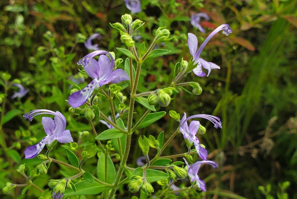
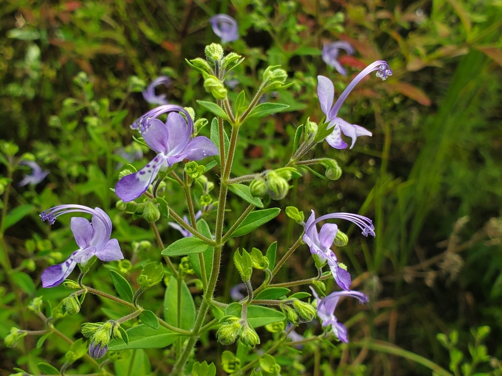
Forked Bluecurls begins its flower show in late summer, picking up steam in fall, and reaching its peak now as nights get cool and the days grow short. The species’ flowers are easily among the most unique around. Each flower has two distinct “lips” – the lower lip is white and dotted with blue specks, while the top is distinctly pure blue – with characteristically curled blue stamens rising to preside over the rest of the flower below. Though individual flowers are very small and only bloom in the morning, disappearing by afternoon, they appear by the hundreds and are very striking taken together. Various pollinators, especially bees, also find Forked Bluecurls flowers very attractive and frequent them on cool fall mornings. Though the flowers are obviously the highlight, the rest of the plant is attractive as well, growing to 3’ in height and possessing small, light-green fuzzy leaves. Forked Bluecurls, while not exceedingly common, can be found in sunny, sandy natural areas throughout the Panhandle, including well-drained flatwoods, sandhills, and open, disturbed areas.
Forked Bluecurls blooming in an open natural area in Calhoun County. Photo courtesy of Daniel Leonard.
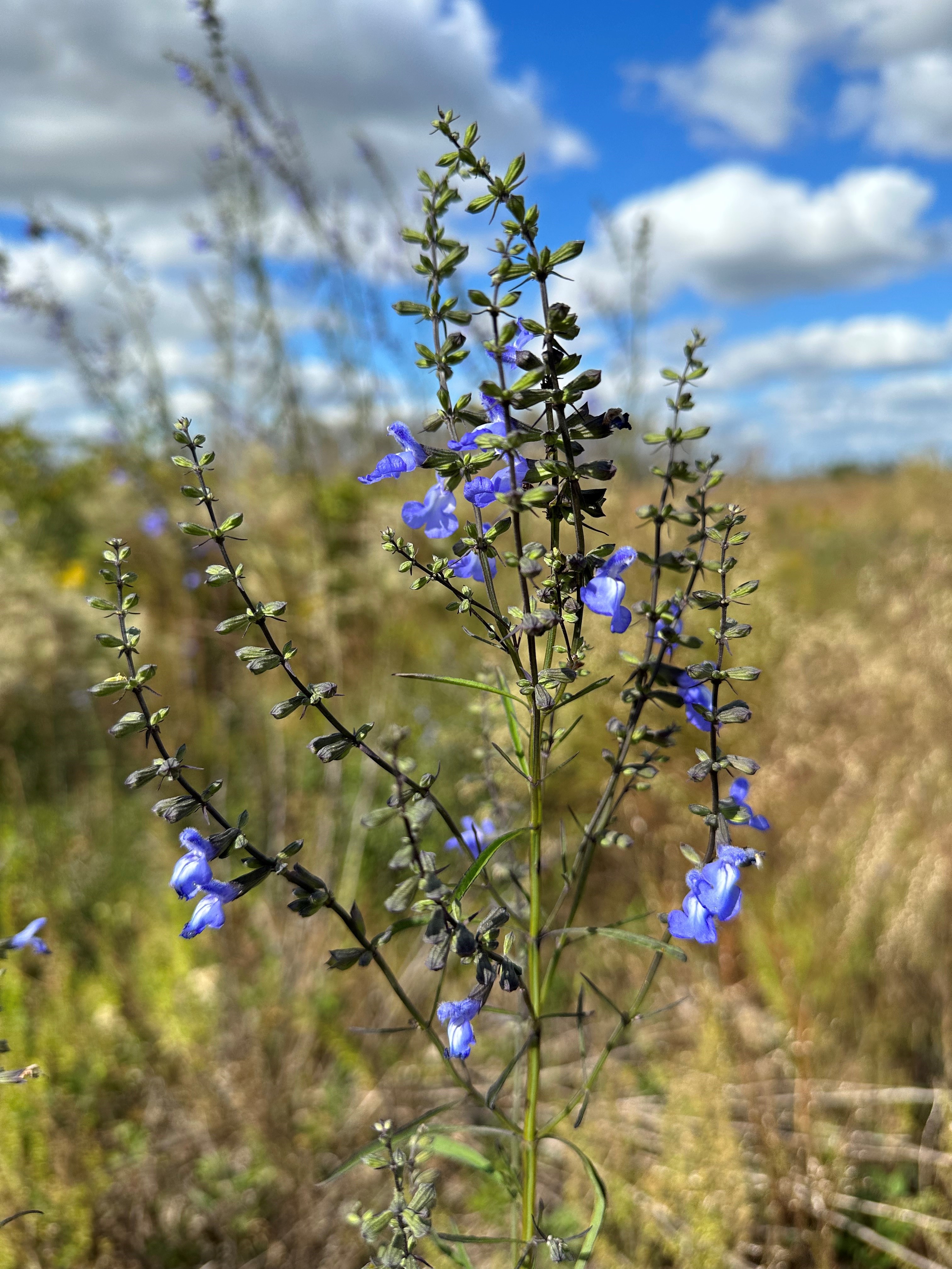
The second blue bloomer, Azure Blue Sage, is possibly even more striking in flower than Forked Bluecurls. Aptly named and blooming around the same time as Forked Blue Curls, Azure Blue Sage is a much larger plant (often 4-6’ in height) and holds its abundant sky-blue flowers high above the surrounding landscape. Because of their height and their propensity to occur in bunches, Azure Blue Sage’s brilliant tubular flowers are immediately noticeable to passersby and the myriad bee and butterfly pollinators that visit. Beyond its flowers, Azure Blue Sage is a very unusual looking perennial plant, tall and spindly with dark green, narrow leaves held tightly to square stems, a giveaway of its lineage in the Mint family. The species can be found in similar areas to Forked Bluecurls – natural areas in the Panhandle that possess abundant sunshine and very sandy, well-drained soil.
Azure blue sage blooming in a recently replanted pine forest in Calhoun County. Photo courtesy of Daniel Leonard.
Both species would make excellent additions to mixed perennial landscapes where the soil and sun conditions were right, as they are exceedingly low-maintenance and have the propensity to reseed themselves from year to year. Unfortunately, they are rarer in the nursery trade than they are in the wild and can only be found occasionally at nurseries specializing in Florida native plants. (Visit PlantRealFlorida.org to find native nurseries in your area!) However, even if you are unable to source a plant for your home, both these somewhat rare, blue-blooming fall beauties, Forked Bluecurls and Azure Blue Sage, are worth searching out in the many State Parks and public natural areas across the Panhandle! For more information about Forked Bluecurls and Azure Blue sage or any other natural resource, horticultural, or agricultural topic, contact your local UF/IFAS County Extension Office. Happy fall wildflower watching!
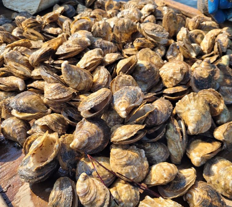
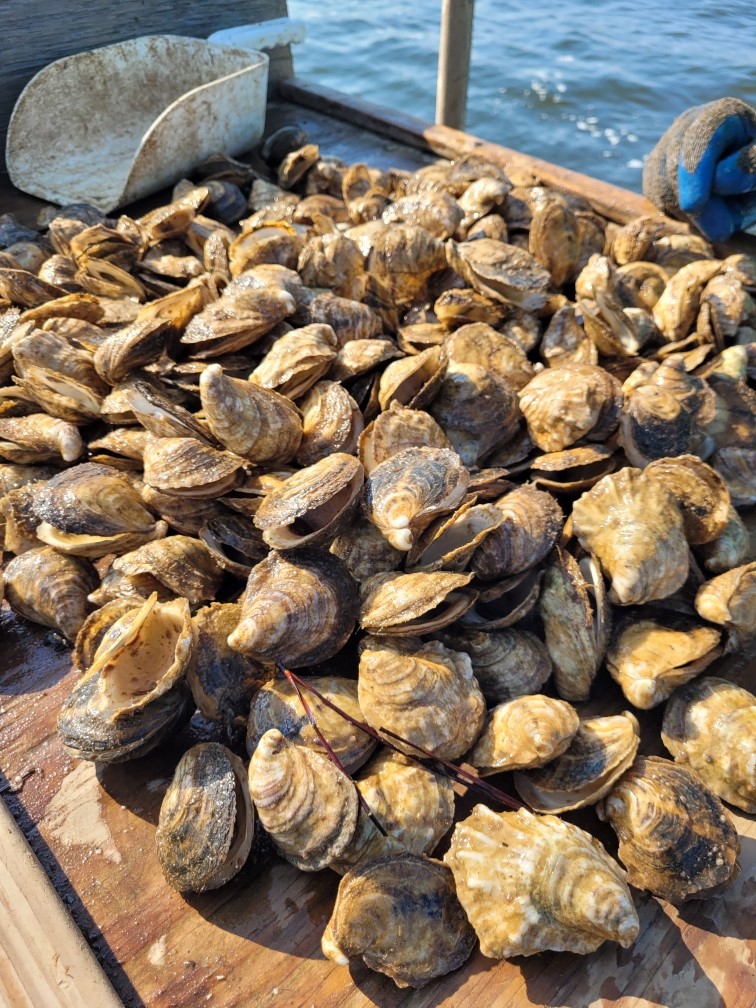
Bay scallops (Argopecten irradians) have been an important part of the economy of many gulf coast communities within the Florida Big Bend for decades. It was once abundant in all gulf coast counties of the state but beginning in the 1960s populations in many bays began to decline to levels where they are all but nonexistent. The cause of this decline has been associated with many factors including a decline in water quality, a decline in suitable habitat (sea turtle grass beds – Thalassia), and overharvesting. Most likely the cause included all of these. Since the collapse of both the commercial and recreational fishery, Gulf coast communities have been trying to address all three of the stressors above. Multiple monitoring projects are ongoing in the Pensacola Bay area and one of those is the Great Scallop Search.
The Great Scallop Search was developed by Sea Grant Agents in Southwest Florida and expanded, through Florida Sea Grant, to Northwest Florida. In each location volunteers snorkel a 50-meter transect line searching for live bay scallops, as well as monitoring the status of the seagrass habitat. Since 2015 317 volunteers have logged 634 hours surveying 407 50-meter transects in 106 grids in Big Lagoon or Santa Rosa Sound. In that time 4 live scallops have been logged, though we hear anecdotal reports of additional scallops being found in these bodies of water.
Survey Method
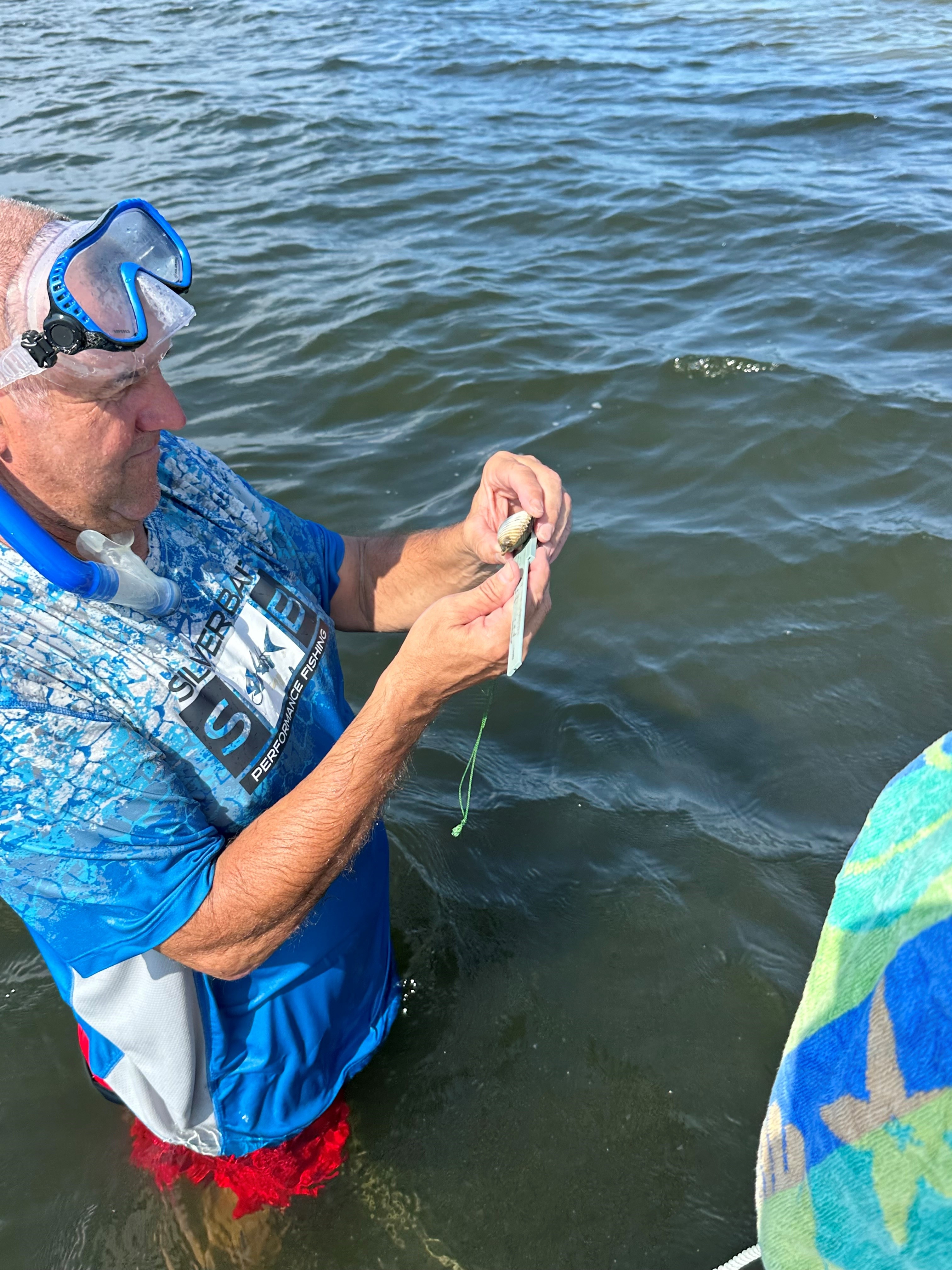
Volunteers select and survey one of 11 grids in Big Lagoon, or one of 55 grids in Santa Rosa Sound. Once on site, the volunteers anchor and record preliminary information on the data sheet provided. Two snorkelers enter the water and swim on opposite sides of a 50-meter transect line searching for live scallops. Any live scallop found is measured and returned. The species and density of the seagrass is recorded as well as the presence/absence of macroalgae on that seagrass. Four such transects are surveyed in each grid.
2023 Results
2023
SRS
BL
Total
Other
# of volunteers
72
No significant difference between 2022 and 2023
# of grids surveyed
8
8
16
Slight decrease from 2022. 16 of the 66 grids (24%) were surveyed.
# of transects surveyed
26
51
77
A decrease from 2022. More surveys were conducted in Big Lagoon than Santa Rosa Sound.
Area surveyed (m2)
2600
5100
7700
1.9 acres
# of scallop found
2
2
4
Four live scallops are a record for this project. It equals the sum of all other live scallops since the project began.
Scallop Size (cm)
4.5, 5.0
4.0, 4.5
Surveys with Seagrass
Halodule
5
12
17
17/21 surveys – 81%
Thalassia
8
11
19
19/21 surveys – 90%
Syringodium
0
2
2
2/21 surveys – 10%
Grass Density
100% grass
3
9
12
12/21 surveys (57%) were 100% grass
90%
1
0
1
Note: Volunteers typically select area for transects
75%
3
1
4
with a lot of grass.
70%
1
0
1
50%
3
9
12
5%
1
0
1
Macroalgae
Present
4
4
8
Absent
2
10
12
12/21 surveys (57%) had no macroalgae.
Abundant
2
2
4
Sediment Type
Mud
0
1
1
Sand
7
8
15
15/21 surveys (71%) were sandy.
Mixed
1
4
5
21 surveys were conducted covering 16 grids. 8 grids were surveyed in each body of water.
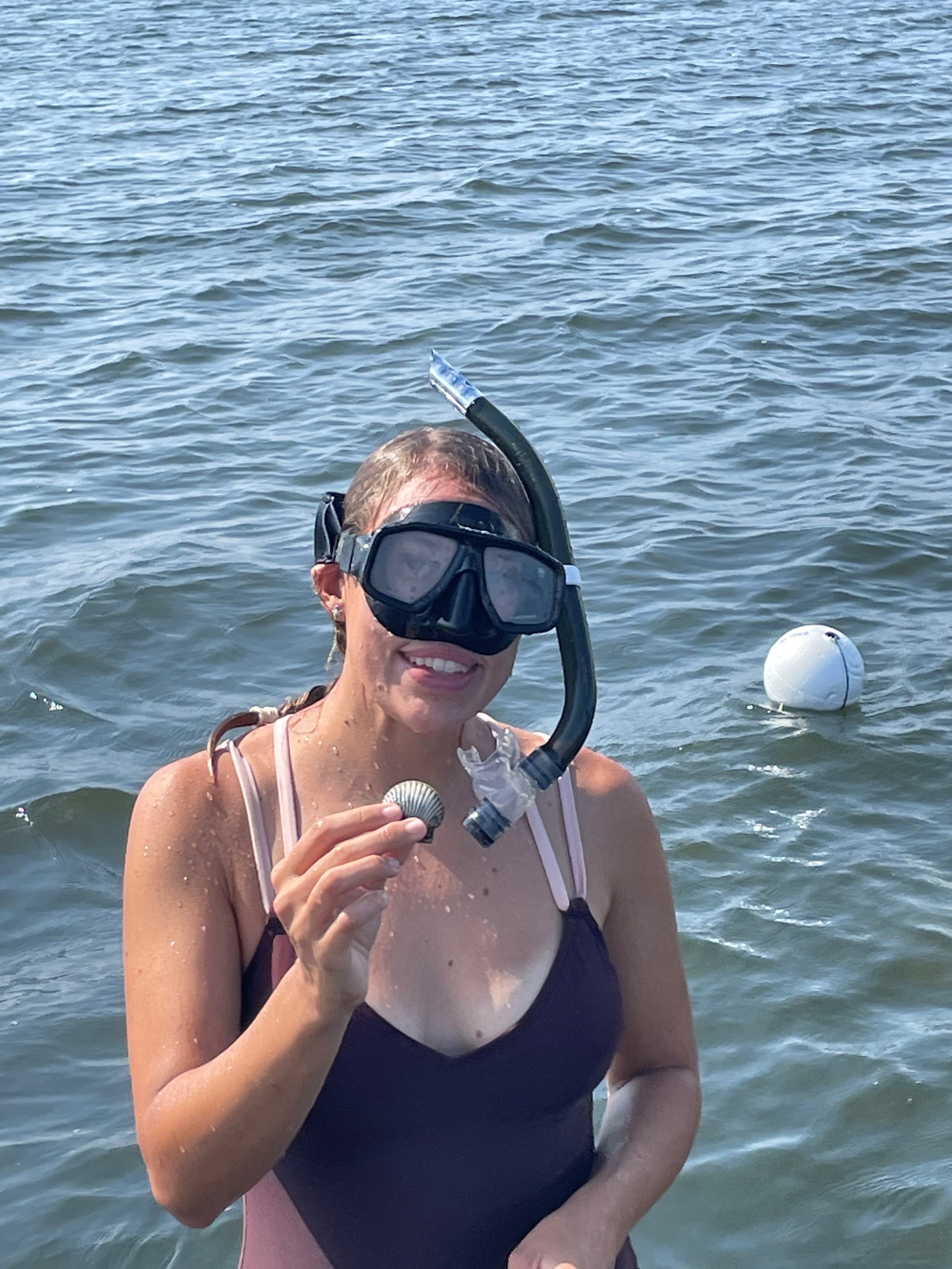
A total of 77 transects were conducted covering 7,700 m2 and four live scallops were found.
Two of the scallops were found in Big Lagoon and two in Santa Rosa Sound.
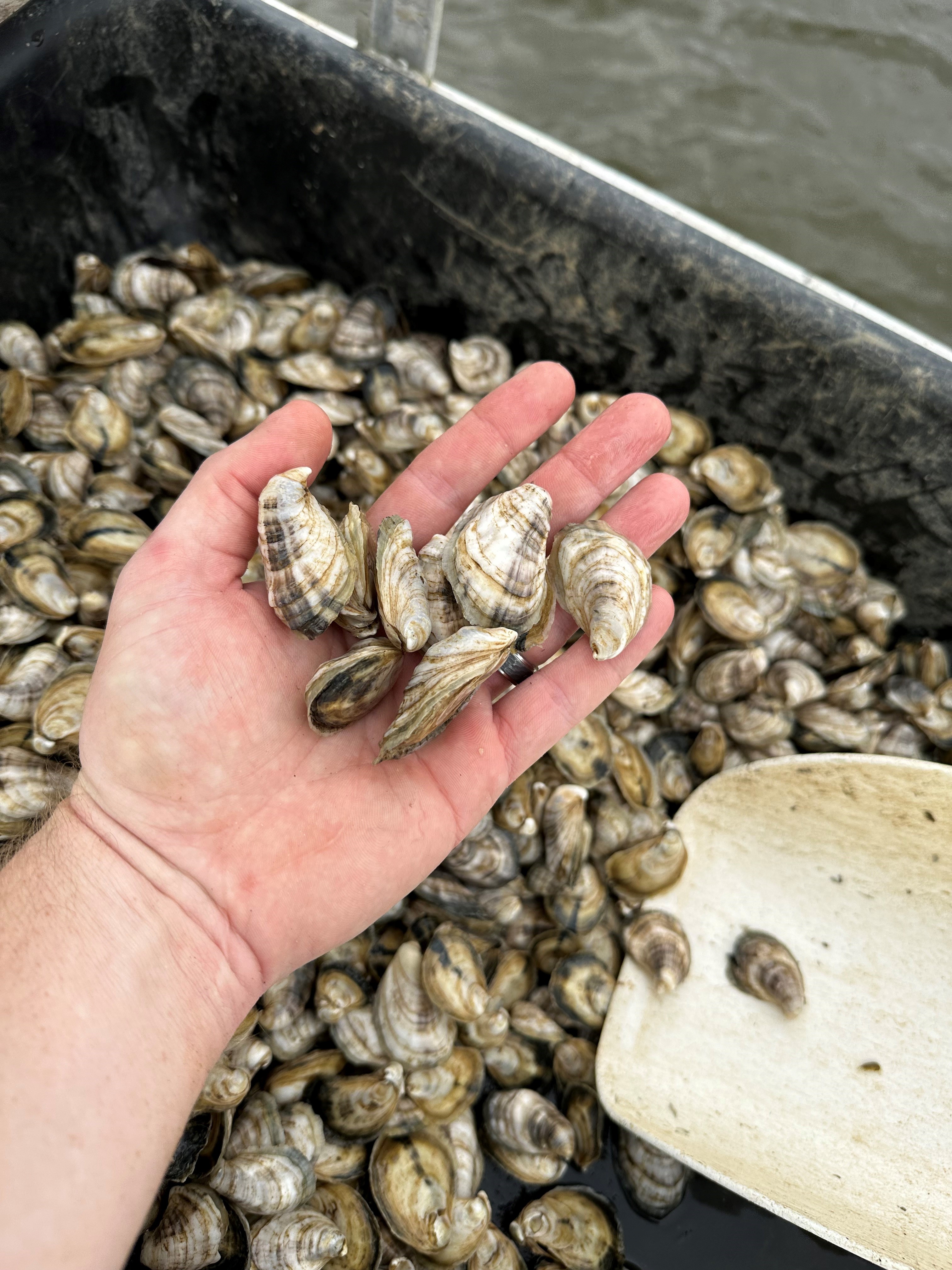
All scallops measured between 4-5cm (1.6-2”).
The number of live scallops found this year equaled the total number found over the last eight years.
Most of the transects included a mix of Halodule and Thalassia seagrass ranging from 100% coverage to 5%. The majority of the transects were between 50-100% grass. Four transects had 100% Thalassia. Three of those were in Santa Rosa Sound, one was in Big Lagoon. The diving depth of the volunteers ranged from 0 meters (0 feet) to 2.4 meters (8 feet). Macroalgae was present in 8 of the 21 surveys (38%) but was not abundant in most.
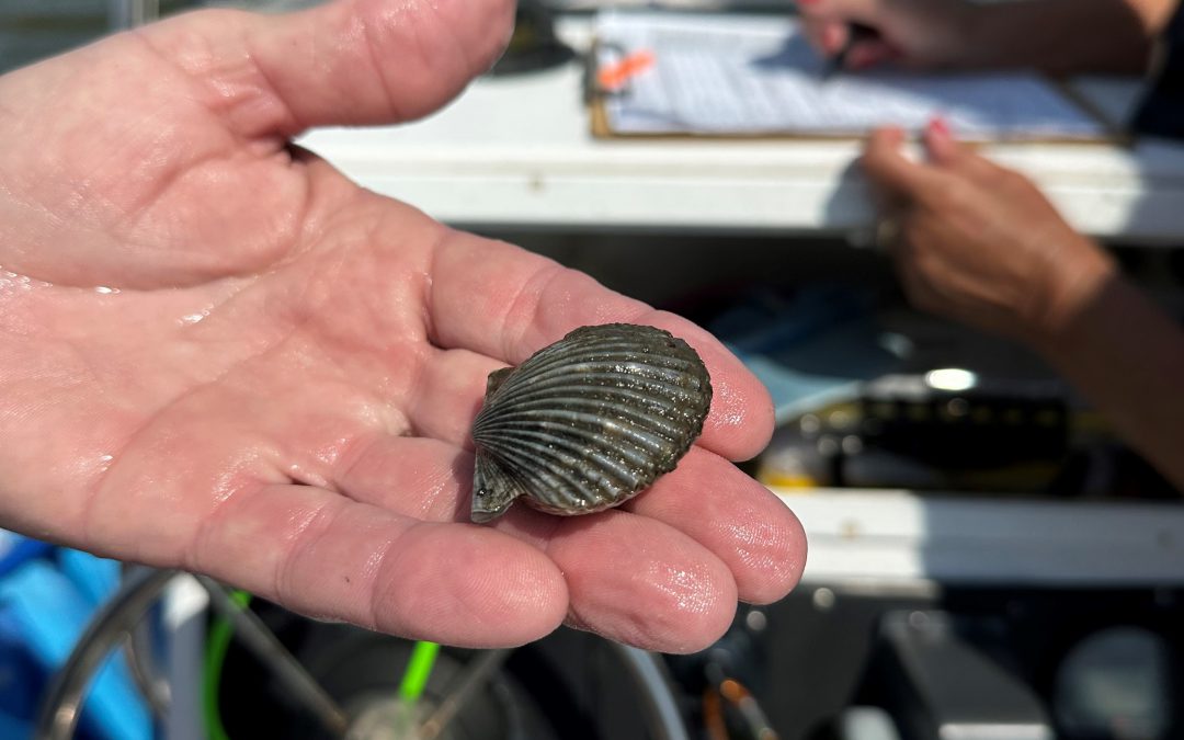
Volunteer measuring one of the four collected bay scallops in 2023 from Pensacola Bay.
Photo: Gina Hertz.
Summary of Project
Year
Volunteer
Grids Surveyed
Transects Surveyed
Live Scallops Found
2015
87
28
101
0
2016
96
31
111
1
2017
5
4
16
0
2018
20
7
32
0
2019
13
6
20
0
2020
5
2
16
1
2021
17
6
24
0
2022
74
22
87
2
2023
72
16
77
4
TOTAL
317
407
8
MEAN
35
14
45
0.4
To date we are averaging 35 volunteers each event, surveying 14 of the 55 possible grids (25%). We are averaging 45 transects each year (4500 m2), have logged 407 transects (40,700 m2) and have recorded 8 live scallops (< than one a year).
Discussion
Based on the results since 2016 this year was a record year for live scallops. Whether they are coming back on their own is still to be seen. Being mass spawners, bay scallop need high densities in order to reproduce successfully, and these numbers do not support that. The data, and comments from volunteers, suggest that the grasses look good and dense. Thalassia, a favorite of the bay scallop, appear to be becoming more abundant. This is a good sign.
Though small and few, bay scallops are trying to hold on in Pensacola Bay.
Photo: Gina Hertz
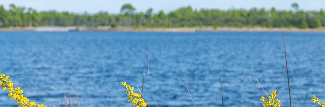
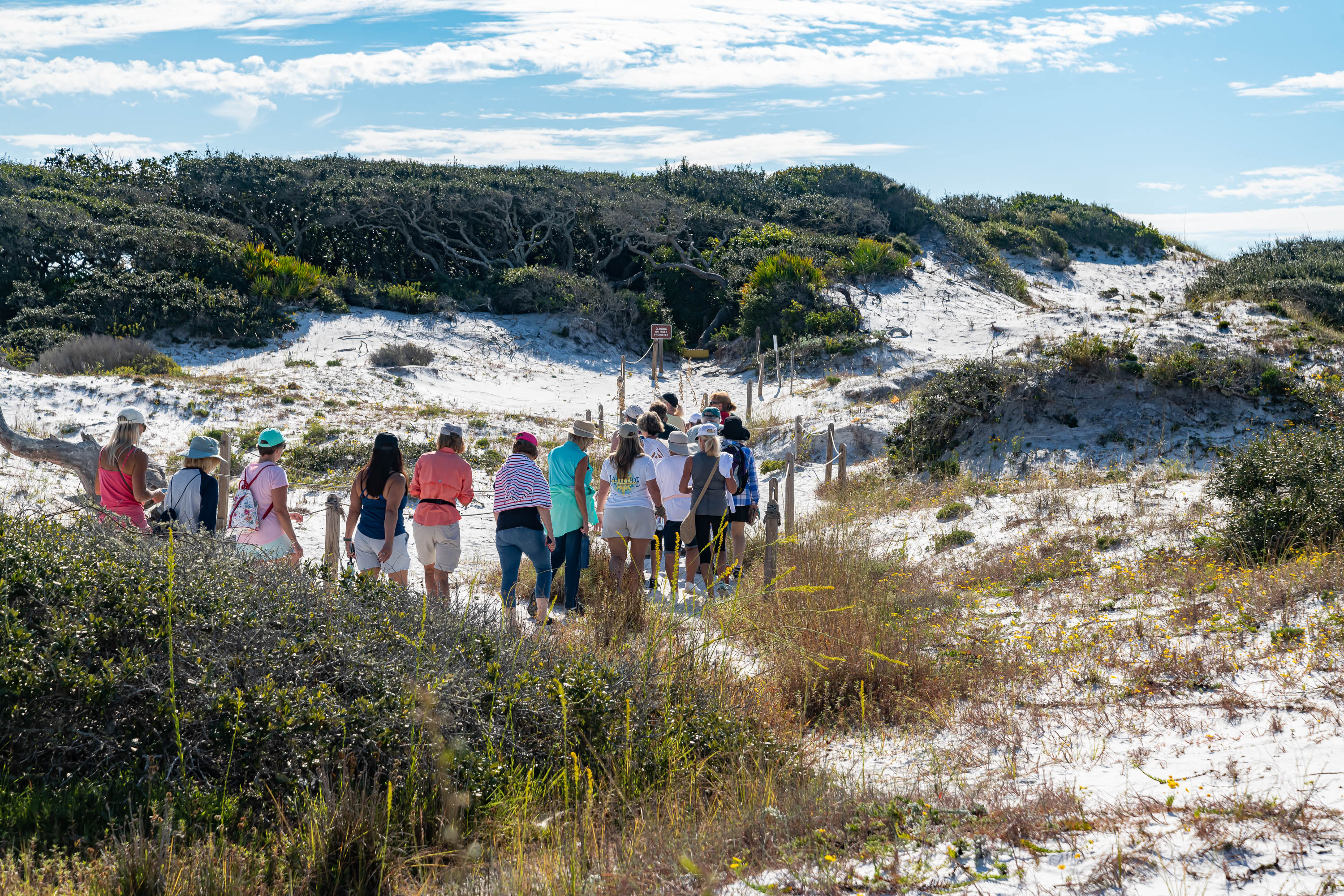
October is Dune Lake Awareness month and as part of the celebration, Walton and Okaloosa County UF/IFAS Extension Agents are joining together to host a Coastal Dune Lake Tour at Western Lake in Grayton Beach State Park. This free event will include a brief lecture and guided tour of the nature trail surrounding the lake. Laura Tiu, Marine Science Agent, will start the tour with a history of the lakes, the unique ecology and some of the local protections. Sheila Dunning, Horticulture Agent, will share information on the unique flora in the dunes including which plants have been used by native Americans and pioneers for food and medicine and the trees we find in the dune landscape surrounding the dune lakes and their adaptations to this sometimes-harsh environment. If you have an interest in our local dune lakes or the tour, you may visit the Walton County Dune Lake website at https://www.co.walton.fl.us/97/Coastal-Dune-Lakes. If you would like to register for this free tour go to https://www.eventbrite.com/e/panhandle-outdoor-live-2023-coastal-dune-lake-lecture-and-trail-tour-tickets-722764316527?aff=oddtdtcreator or use our Facebook event link https://www.facebook.com/events/811943803961304. Feel free to call our office, 850-892-8172, with any questions.
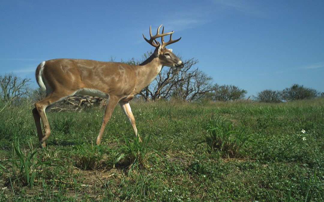
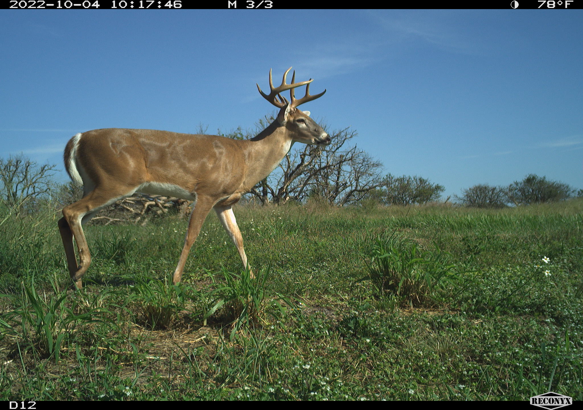
A deer darting across a path, a bobwhite calling at sunrise, or the tracks of a coyote in the mud are all fascinating examples of how we enjoy our natural areas. Have you ever wished you could watch wildlife all day to understand the intricate relationships they have with one another? What if you could learn more about their behavior? And their habitat and daily activities?
Deer captured on a digital game camera.
Image: Dr. Carolina Barzzui.
Dr. Carolina Baruzzi at the UF/IFAS North Florida Research and Education Center and Dr. Corey Callaghan at the UF/IFAS Fort Lauderdale Research and Education Center are launching “ConservationCam”, a new extension program to help you monitor wildlife on your property using camera traps.
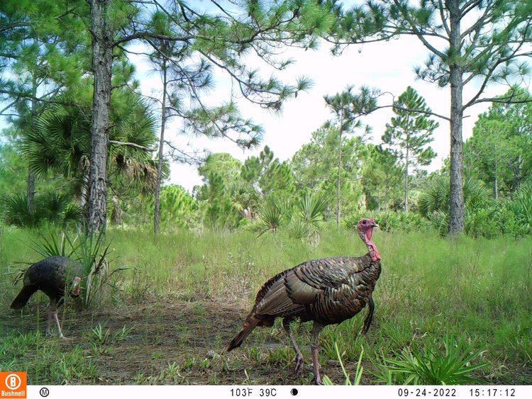
Camera traps are a valuable tool for wildlife monitoring. When an animal moves in front of a camera, they trigger a motion sensor to take a picture or video. Camera traps can be set up in multiple ways to target a species or habitat of interest, such as a forest opening or a wildlife burrow. Thanks to their versatility and relative low cost, camera traps are being used in a variety of contexts, for example, understanding the effects of wildlife or habitat management on target species.
Images of turkeys captured on a digital game cam.
Image: Dr. Carolina Barzzui.
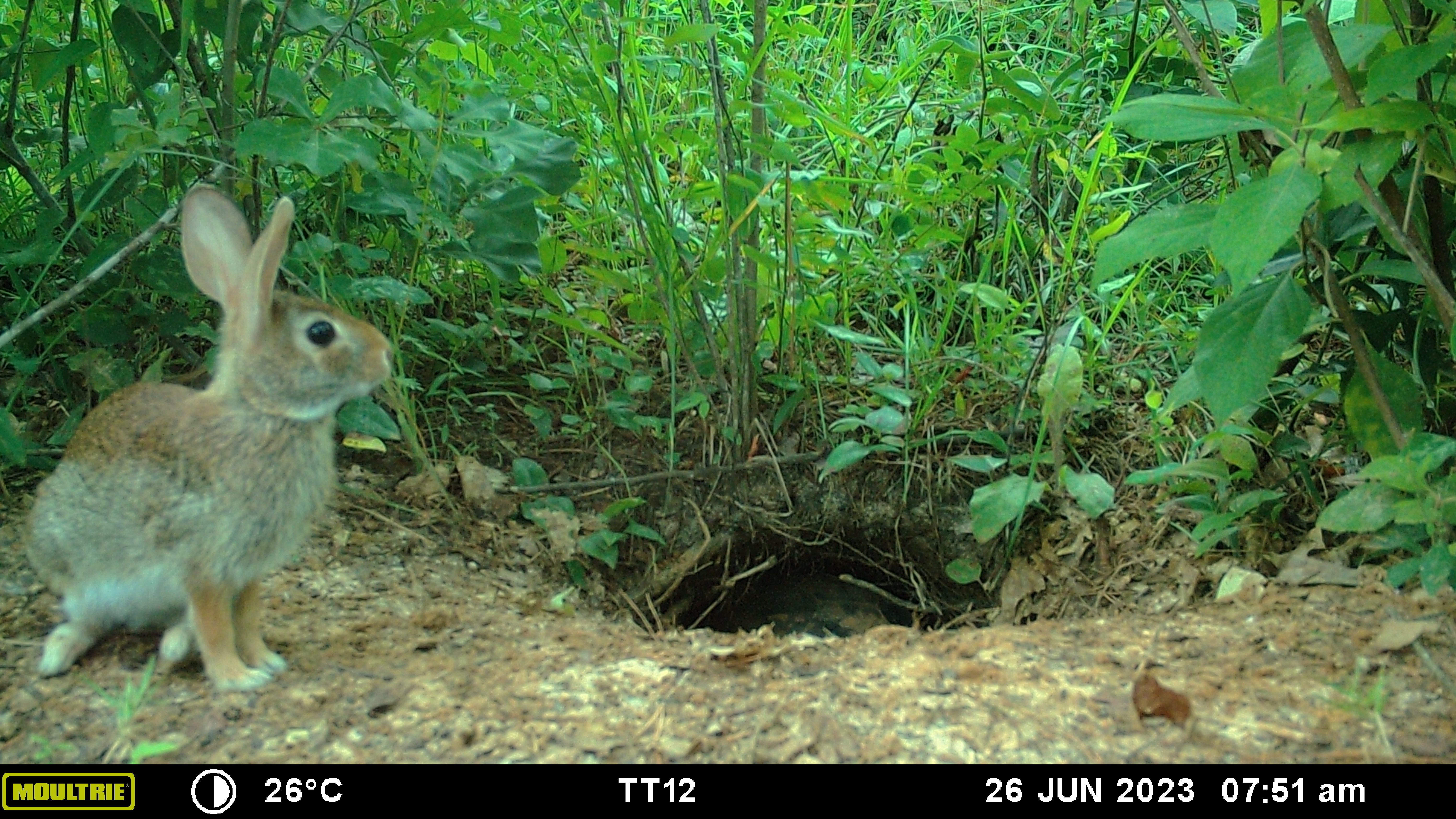
The primary goal of ConservationCam is to provide private landowners with access to camera traps, and expert guidance about monitoring wildlife and managing natural resources for biodiversity based on camera trap observations. Armed with this knowledge, landowners can make informed decisions about land management practices that positively impact biodiversity on their property. If you live in the Florida Panhandle, and are interested in using camera traps to monitor wildlife on your property, while learning how to answer different ecological questions, we are gathering expressions of interest through this online form.
Rabbit near a burrow on a digital game came.
Image: Dr. Carolina Barzzui.
There is a term that all oyster farmers dislike, it is almost like that one villain from a famous book/movie series where they shouldn’t say his name. That term is “unexplained spring/summer mortality” and it has been a growing issue along with the expansion of oyster farming throughout the southeast. While the art of oyster farming has been around since the time of the Romans, it is a relatively new venture here in the Gulf of Mexico, and Florida is home to over one hundred oyster farms. These farms are meticulously cared for by the oyster farm crew, with many different anti-fouling techniques and biosecurity measures in practice to provide the customer with a safe, clean product that you can consume even in the months without an R (another article on that coming later). Each year, farm managers can expect a 10-30% mortality event during the transition from winter into spring/summer, hence the term “unexplained spring/summer mortality.” Researchers and scientists from all over the southeast have been actively working to find a cause for this phenomenon, but the answer has been hard to find.
Dead, market ready oysters from one bag. Cause of death, “Unexplained Mortality Event 2022” Photo by: Thomas Derbes II
Our Pensacola Bay has been a hotbed for oysters lately; The Nature Conservancy recently constructed 33 oyster beds along Escribano Point in East Bay, the establishment of the Pensacola & Perdido Bay Estuary Program, acquisition of a $23 million restoration grant with $ 10 million towards 1,482 acres of oyster restoration, and the establishment of oyster farms and hatcheries. In Pensacola Bay, there are currently 5 oyster farms in operation, one of those farms being a family-owned and operated Grayson Bay Oyster Company. Brandon Smith has been managing the business and farm for over 4 years now and has experienced mortality events during those prime spring/summer months. In recent years, they have experienced mortality events ranging from minimal to what many would consider “catastrophic,” and reports from around Florida and the Southeast convey a similar message. Concerned for not only the future of his family farm, but other oyster farms in the Southeast, he has been working with the most experienced institutions and groups in 2022 to possibly get an answer on his and other local “unexplained mortality events.” Each road led to the same answer of “we aren’t quite sure,” but this didn’t deter Smith or other the farmers who are dealing with similar issues.
In 2023, Smith was invited to participate in a Florida-Wide program to track water quality on their farm. This project, led by Florida Sea Grant’s Leslie Sturmer from the Nature Coast Biological Station in Cedar Key, Florida, hopes to shed some light on the changes in water quality during the transition from winter to spring and spring to summer. Water samples have also been taken weekly to preserve plankton abundance and the presence of any harmful algae if a mortality event does occur. With the hottest July on record occurring in 2023, temperature could play a role in mortality events, and now researchers are equipped with the right tools and open lines of communication to possibly find a solution to the problem.
3-month-old seed being deployed out on Grayson Bay Oyster Company’s farm in Pensacola, Florida (2023). Photo by: Thomas Derbes II
As with traditional farming on land, oyster farming takes a mentally strong individual with an incredible work ethic and the ability to adapt to change. The Southeast has a resilient system of oyster farmers who display these traits and continue to put their noses down and “plant” seed every year for the continuation of a growing yet small industry, even through the hardest of trials and tribulations. Through collaboration with local and state institutions, stakeholders, programs, and citizens, oyster farmers are hopeful that they can solve this “unexplained mortality event” and help develop resilient farming techniques. An important message is local farms that have environmental and economic impacts cannot exist without the support of their community.
If you’re interested in tracking water quality on select farms, including Grayson Bay Oyster Company, the website is https://shellfish.ifas.ufl.edu/farms-2023/ and it is updated monthly.
Summertime always makes me think of the supermarket. At least one time each of the past few summers, I clearly remember being at the supermarket during a rainstorm and watching the water wash over the parking lot, talking with all the other people debating whether to run to their car with a buggy full of food. Supermarkets, home goods stores, medical facilities, libraries, and shopping centers all provide important services that we depend on for our everyday life, but their development has altered the natural processes that control the movement of water from the landscape to creeks and ultimately to the bays and bayous around us (collectively referred to as receiving waters). Concrete, asphalt, and building roof surfaces are impervious, meaning that water cannot pass through them. As a result, more water washes off the rooftops, parking lots, driveways, and roads than before the area was developed. Less water sinks into the ground to move slowly toward receiving waters and to recharge aquifers. More impervious surface leads to more runoff to receiving waters, resulting in greater erosion and higher levels of pollutants like nitrogen, phosphorus, and silt in these waterways. These extra pollutants from the landscape and from eroding stream banks have harmful effects many types of organisms that call these waterways home.
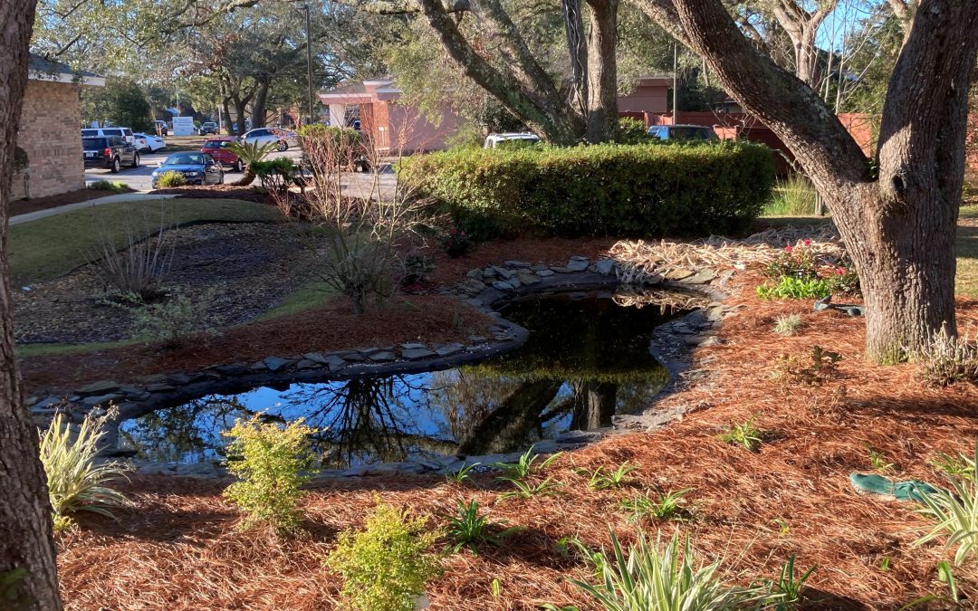
New development in Florida is required to include features that “treat” a fraction of the surface water that runs off impervious surfaces before flowing into receiving waters. Treating surface water runoff means holding it back and preventing it from running quickly off the developed landscape; as it is held back, some pollutants may settle out or be consumed by plants. Treatment is commonly accomplished through features like dry retention basins or wet detention ponds, where water is stored and then slowly moves through soil pathways toward receiving waters. These features are common parts of our developed landscape: the big pond behind the supermarket or in front of the new truck stop, or the grassy pit next to the gas station. While these satisfy regulations, they occupy a considerable amount of land, typically are aesthetically lacking, and may not actually reduce pollutant runoff or stormwater volume as intended. They also can be neglected and become a nuisance in the landscape.
Nature-based stormwater infrastructure projects can play an important role in protecting communities in northwest Florida from the effects of heavy rainfall that occurs periodically in the region. Nature-based stormwater projects are designed primarily to incorporate the natural processes of infiltration that occur in undeveloped areas in the developed landscape, treating stormwater by reducing volumes of surface runoff and concentrations of pollution that could otherwise flow directly into receiving waters. Depending on their design, these features can also provide aesthetic enhancements that can increase the value of properties and the overall wellbeing of the communities where they are implemented. When used in coordination, nature-based projects such as roadside treatment swales, bioretention cells, rain gardens, green roofs, and porous pavement can provide similar levels of stormwater treatment as dry retention basins and detention ponds while also enhancing the aesthetic, recreational, or functional potential of the landscape.
Local government and extension staff across northwest Florida are working to introduce more nature-based stormwater projects into the panhandle landscape. To learn more about recent demonstration projects that have been implemented in our region, visit the WebGIS project https://arcg.is/1SWXTm0.
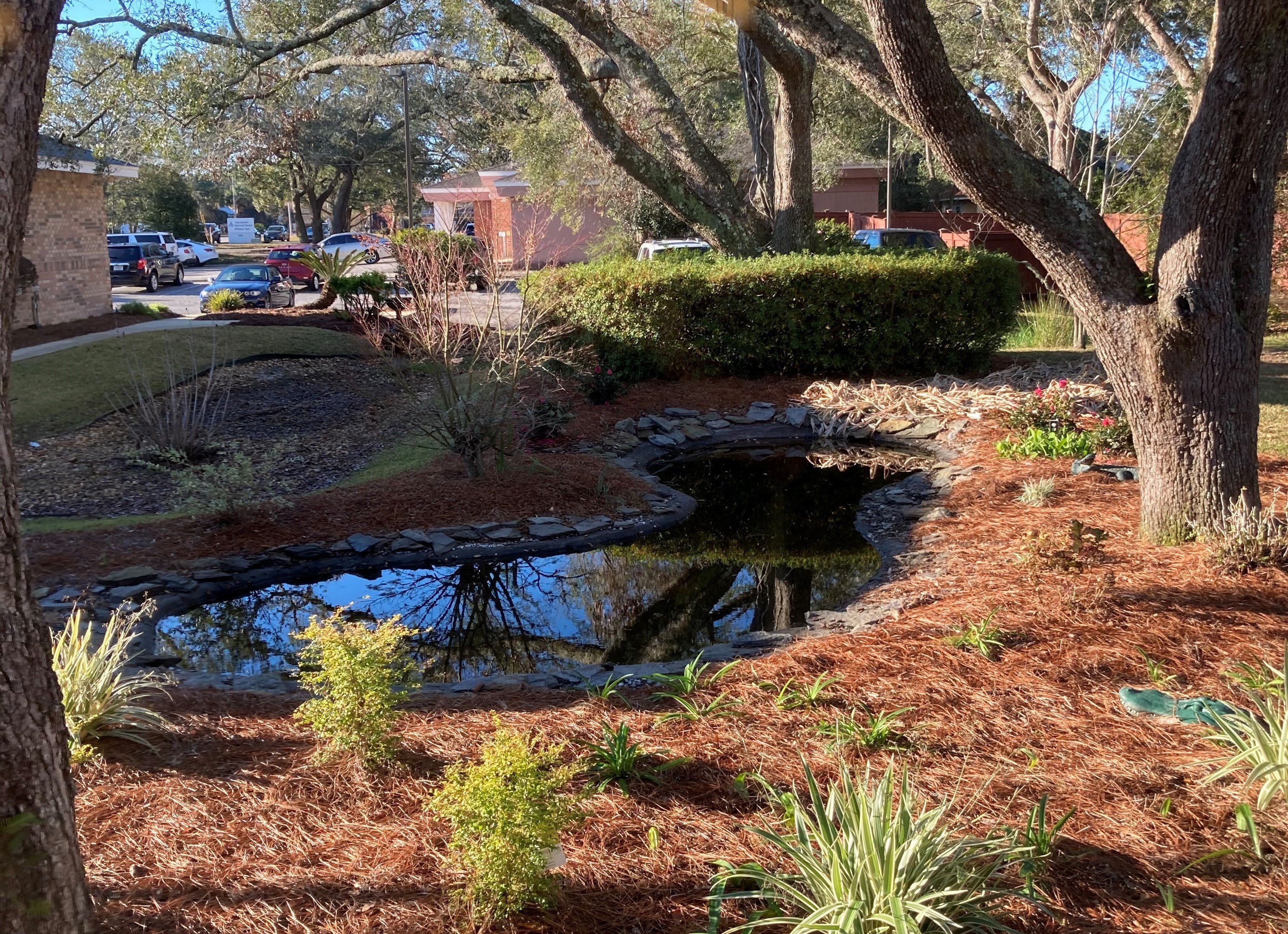
Rain garden/biofiltration cell at a medical office in Pensacola, Florida.