¿Está interesado en hacer algo que beneficie a su comunidad marina local? ¡Disfruta de días al sol, como un “Scallop Sitter” (cuidador de las vieiras)!
“Scallop Sitters” (cuidador de vieiras) es uno de nuestros programas de voluntariado cooperativo con Pesca y Vida Silvestre de Florida (FWC, por sus siglas en inglés). Históricamente, las poblaciones de vieiras de la bahía eran muy numerosas y podían sustentar las pesquerías en muchas bahías del norte de Florida, incluidas la bahía de San Andrés, la bahía de San Juan y el Puerto de los Caimanes (Condado de Franklin). Años consecutivos de malas condiciones ambientales, pérdida de hábitat y “mala suerte” en general resultaron en una escasa producción anual y provocaron el cierre de la pesquería de vieiras. La vieira de la bahía es una especie de corta vida que pasa de ser una cría a adultos que desovan y muere en un año aproximadamente. Las poblaciones de vieiras pueden recuperarse rápidamente cuando las condiciones de crecimiento son buenas y pueden disminuir drásticamente cuando las condiciones de crecimiento son malas.
En 2011 se presentó la oportunidad de poner en marcha la restauración de las vieiras de la bahía del norte de Florida. Con la financiación del derrame de petróleo de Deepwater Horizon, se propuso un programa de restauración de vieiras en varios condados, que finalmente se estableció en 2016. Los científicos de Pesca y Vida Silvestre de Florida (FWC, por sus siglas en inglés) utilizan vieiras criadas en criaderos, obtenidos a partir de progenitores o reproductores de las bahías locales, para cultivarlas en masa y aumentar el número de adultos reproductores cerca del hábitat crítico de las praderas marinas.
La Pesca y Vida Silvestre de Florida (FWC, por sus siglas en inglés) también creó otro programa en el que los voluntarios pueden ayudar con la restauración llamado “Scallop Sitters” en 2018 e invitó a UF/IFAS Extension a ayudar a dirigir la parte de voluntarios del programa en 2019, lo que llevó a esfuerzos específicos en los condados del Golfo y la Bahía.
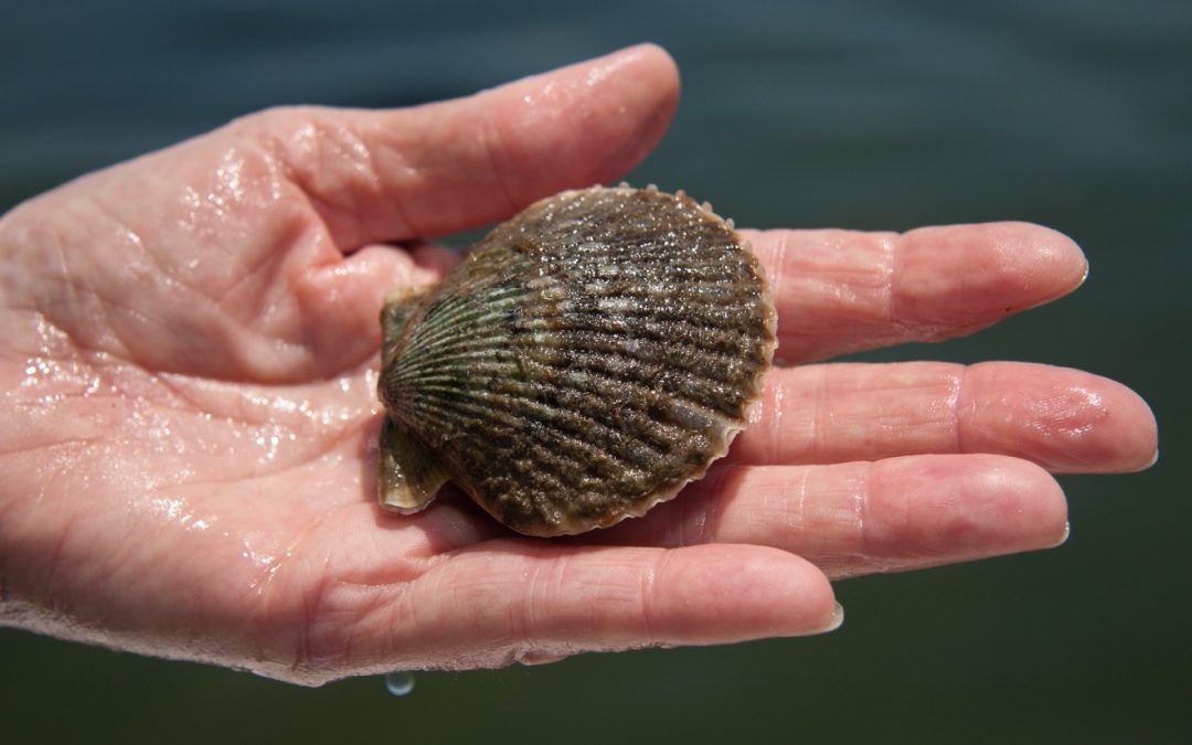
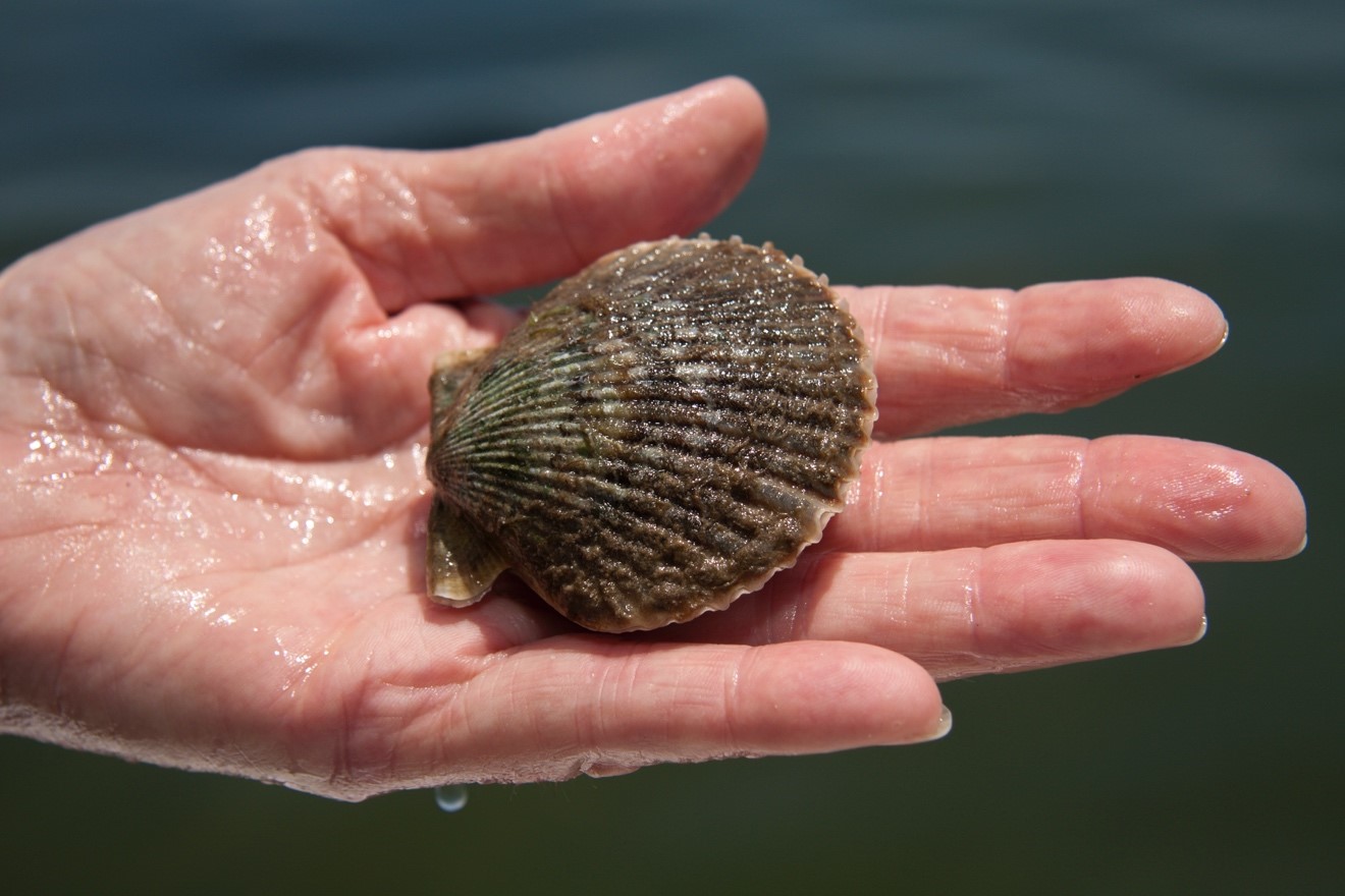
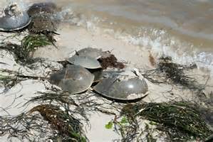
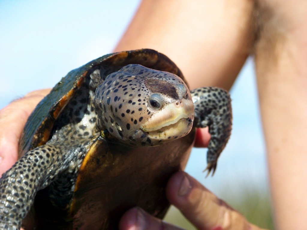
Para ayudar a las vieiras, los “Scallop Sitters” trabajan con UF/IFAS Extension, Florida Sea Grant y los científicos de restauración de la Pesca y Vida Silvestre de Florida (FWC, por sus siglas en inglés) limpiando las vieiras y comprobando la salinidad una vez al mes desde junio hasta enero. Foto de Tyler Jones, UF/IFAS Extension y Florida Sea Grant.
Después del hiato de 2020 debido a COVID-19, el programa presumió de casi 100 voluntarios para la campaña de 2021. UF/IFAS Extension se asocia de nuevo con Pesca y Vida Silvestre de Florida (FWC, por sus siglas en inglés) en los Condados de Bahía y Golfo y Franklin. A pesar de los retos que suponen las lluvias, la escorrentía de las aguas pluviales y la baja salinidad, nuestros voluntarios de Scallop Sitter han proporcionado información valiosa a los investigadores y a los esfuerzos de restauración, especialmente en estos primeros años de nuestro programa. Los “Scallop Sitters” recogen información útil sobre la salinidad en las bahías de destino. Pero la mayor parte del impacto se produce al observar de cerca sus vieiras. Las vieiras que mantienen sus cuidadores tienen más posibilidades de desovar con éxito cuando sea el momento adecuado.
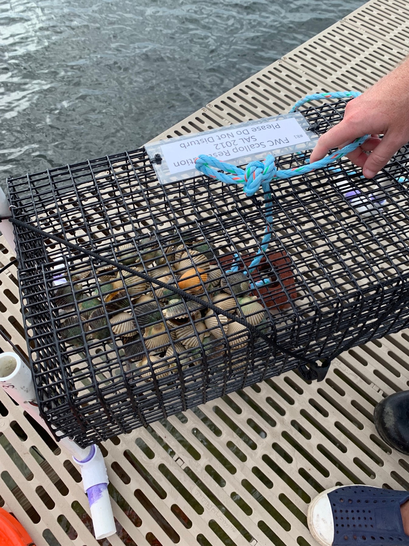
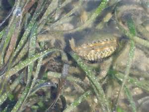
Una jaula “Scallop Sitter” lista para ser colocada cerca de las praderas marinas. Las jaulas son herramientas de restauración utilizadas para producir crías de vieira durante el ciclo anual de crecimiento. Foto de L. Scott Jackson.
¿Qué hace un cuidador de vieiras? Los voluntarios dirigen jaulas de exclusión de depredadores de vieiras, que quedan colocadas en la bahía o junto a un muelle. Los “Scallop Sitters” (cuidador de vieiras) vigilan la tasa de mortalidad y recogen datos sobre la salinidad que ayudan a determinar los objetivos de restauración y el éxito en las zonas seleccionadas.
¡Está invitado! ¡Cómo convertirse un “Scallop Sitter” (cuidador de vieiras)!
Las fechas de entrenamiento para 2023 se anunciarán en breve. Por favor, envíenos un correo electrónico si está interesado en ser voluntario o en recibir información adicional. Chantille Gooding, Coordinadora de Recursos Costeros del Condado de la Bahía. c.gooding@ufl.edu
Una institución con igualdad de oportunidades. UF/IFAS Extension, Universidad de Florida, Instituto de Ciencias Alimentarias y Agrícolas, Andra Johnson, Decana de UF/IFAS Extension. Las copias individuales de las publicaciones de UF/IFAS Extension (excluyendo las publicaciones de 4-H y de los jóvenes) están disponibles gratuitamente para los residentes de Florida en las oficinas de UF/IFAS Extension del condado.
We all know how important oxygen is to all life. It is an element with the atomic number of 8, meaning it has eight protons and eight electrons. It has an atomic mass of 16 indicating that it also has eight neutrons. Oxygen is a gas at room temperature indicating that 70°F is VERY hot for this element. It is a diatomic molecule, meaning that it likes to combine with other elements and will combine with itself if need be. Oxygen is not actually O, it is O2 in nature. There is a triatomic form of this element, O3, which is called ozone – but that is another story.
Again, we know oxygen is much needed by living organisms. Well… by most living organisms – there are some microbes that can survive with little or no oxygen, but for the majority of the creatures we are familiar with, it is a must.
I have asked students why oxygen was so important to life. I usually get the answer “that we will die without it”. I respond by asking again – “but WHY do we need it? What does it DO?” And the response usually does not change – “we must have it or we will die”. There is no doubt that it is important. Being in an atmosphere with little or no oxygen sends our bodies into a “stress mode” gasping – but what DOES the element actually do for us?
Life is abundant on this planet due to the presence of oxygen.
Photo: Rick O’Connor
Oxygen is needed to complete the reaction we call respiration. For most, the term respiration means “breathing” and this would be correct – but it is more than that. It is an oxygen demanding reaction we all need to remain alive. In this reaction the sugar molecule glucose (C6H12O6) is oxidized to produce Adenosine triphosphate (ATP – C10H13N5O13P3). ATP is the “energy” molecule needed for cells to function – our gasoline. It fuels all metabolic reactions needed to sustain life. ATP cannot be consumed in food, it must be made in the cell and, as the reaction below shows, it requires sugar (which we get from food) and oxygen (which we inhale from the atmosphere) to work.
C6H12O6 + O2 –> CO2 + H2O + ATP
This reaction will produce 36 of the much-needed molecules of ATP with each cycle. It is known that in anaerobic respiration (the break down of glucose without oxygen) it will also produce ATP but not as much – only 2 molecules of it instead of 36. So, for most creatures’ aerobic respiration (with oxygen) is preferred and needed.
The primary source of oxygen on our planet is plants. This suggest that before plants existed there may have been little, or no, oxygen on in our atmosphere and scientists believe this was the case. When you look at the fossil records it suggests that prior to plants existence there was life (anaerobic life) but after plants the diversity and abundance of life exploded. Aerobic respiration seems to be the way to go.
As most know, plants produce oxygen in the process known as photosynthesis. This chemical reaction is used by the plants to produce the other needed respiration molecule glucose. Plants produce their own glucose and so are called producers, while other creatures, including animals, are consumers – consuming glucose in their food. The reaction for photosynthesis is –
CO2 + H2O –> C6H12O6 + O2
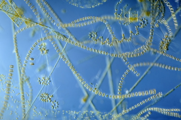
The excess oxygen produced in this reaction is released into the atmosphere by the plants. It makes up 20% of our atmosphere and this allows life as we know it to exist. Note… almost 50% of the oxygen in our atmosphere comes from single celled algae called phytoplankton that grow and exist at the surface of our oceans.
Single celled algae are the “grasses of the sea” and provide the base of most marine food chains.
Photo: University of New Hampshire
But what about aquatic creatures who do not breath the atmosphere you and I do? How do they obtain this much needed oxygen drifting in our atmosphere?
The answer is in dissolved oxygen. Oxygen, being a gas, is released into the atmosphere. Even the oxygen produced by submerged aquatic plants, like seagrasses and algae, release their oxygen as a bubble of gas which floats to the surface, pops, and is released to the atmosphere. To get that back to the creatures in the water who need it as much as we do, you have to “dissolve” it into the water.
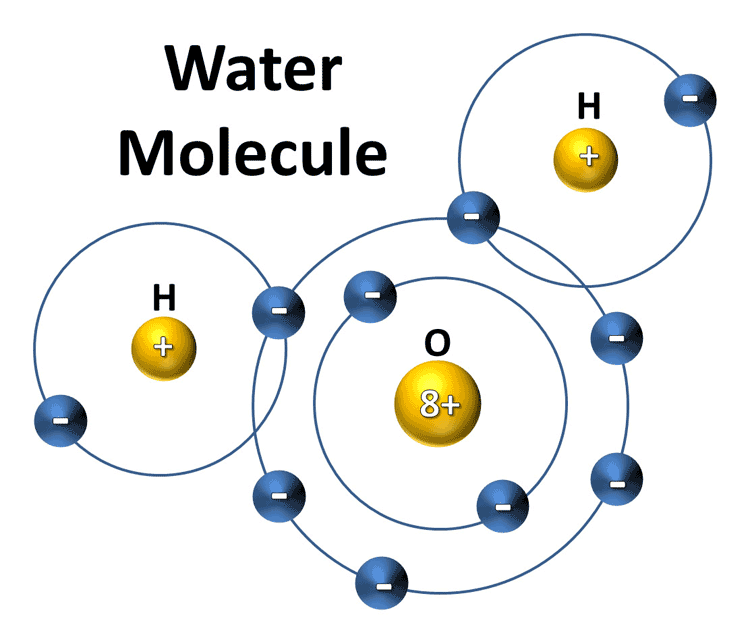
To do this you must break the hydrogen bonds that connect water molecules to each other. Water is a polar molecule, and each molecule connects to each other like magnets using hydrogen bonds. These hydrogen bonds are weak and easy to break, but you must MOVE the water in order to do this.
The water molecule.
Image: Florida Atlantic University
Water movement, such as waves, currents, and tides, will do it. The more movement you have the more oxygen will dissolve into it. Waterways such as the rapids of mountain rivers and waterfalls will have high concentrations of dissolved oxygen – usually over 10 µg/L. For some creatures this could be too high – like an oxygen rush to the head – but for others, like brook trout, it is perfect. They do not do well in water with dissolved oxygen (DO) concentrations less than 10.
For most waterways the DO concentrations run between 4 and 10 µg/L. Most systems run between 5-7. Waterways with a DO concentration less that 4 µg/L are termed hypoxic – oxygen deprived – and many creatures cannot live at these levels. They are literally gasping for air. I have seen fish at the surface of our local waterways when the DOs are low gasping for much needed oxygen through the atmosphere. It is also the primary reason the great crab jubilees of Mobile Bay occurs. Low levels of DO in the bay will trigger many creatures to leave seeking higher DO in the open Gulf. But for some benthic creatures – like stingray, flounder, and blue crabs – they will literally run onto the beach gasping for oxygen. The fish known as menhaden are particularly sensitive to low DOs and are one of the first to die when concentrations begin to dip below 4. When you see the surface of a waterway littered with dead menhaden it typically means there is a DO problem.
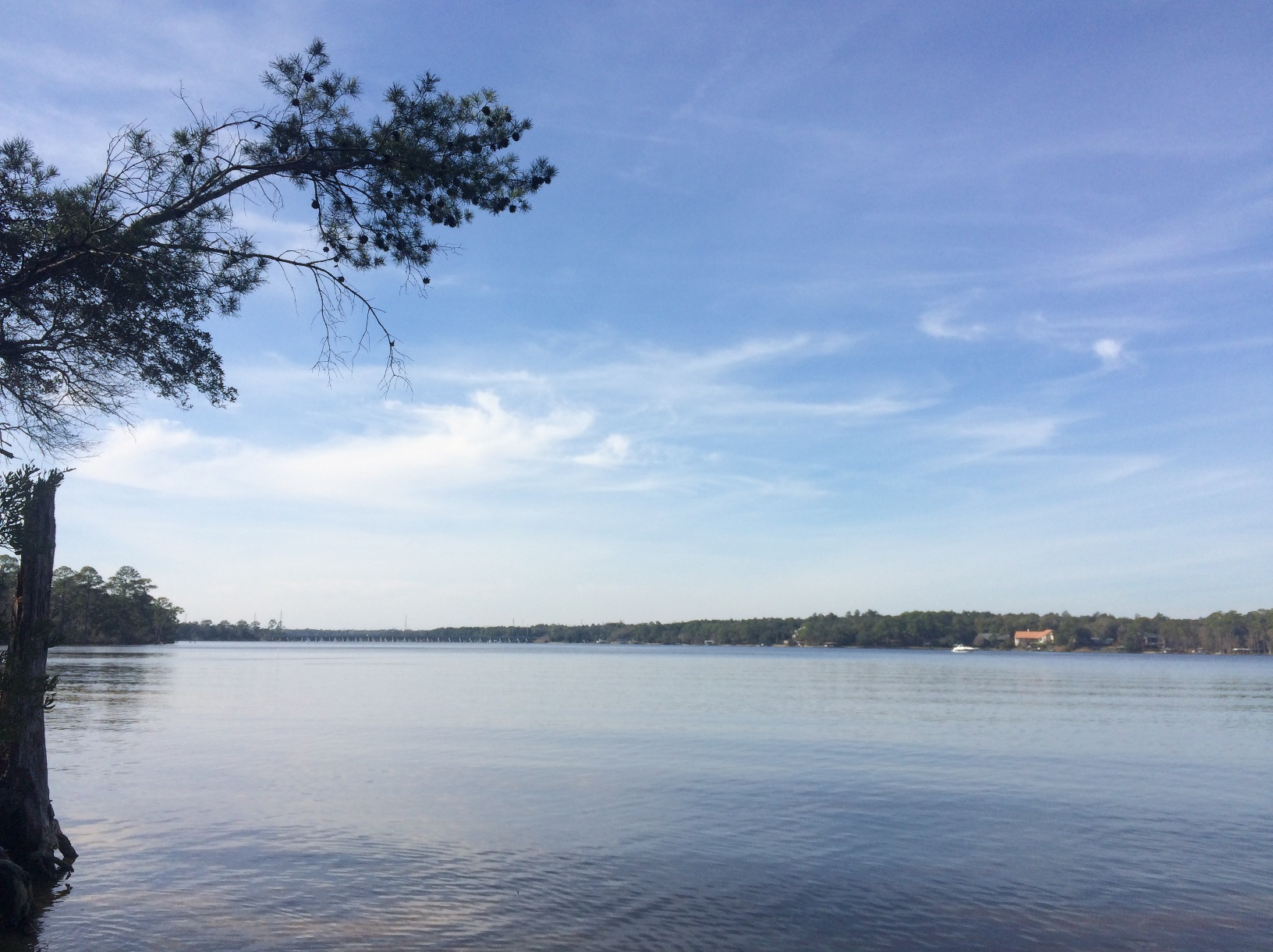
Slick calm water diffuses/dissolves less oxygen.
Photo: Molly O’Connor
That said, some creatures, like catfish, can tolerate this and do not become stressed until the concentrations get below 2 µg/L. If they ever reach 0 µg/L (and I have seen this twice – once in Mobile Bay and once in Bayou Texar) the waterway is termed anoxic – NO oxygen. This is obviously not good. Some are familiar with the “Louisiana Dead Zone”. An area of the open Gulf of Mexico south of the Mississippi River where DO levels decline in the summer to levels where most benthic species, particularly shrimp, are hard to find. It seems “dead” – void of marine life. This is also a DO issue.
How – or why – do dissolved oxygen levels get that low?
There are three basic reasons to this answer.
The surface is still, and little atmosphere oxygen is being “dissolved”. We have all seen calm days when the water is as slick as glass. On days like these, less oxygen is being dissolved into the system and the DO concentrations begin to drop. But how low will they go?
The water is warm. Higher water temperatures hold less oxygen. As the water warms the oxygen “evaporates” and the DO concentrations begin to decline. If it is a warm calm day (like those during a high-pressure system in summer) you have both working against you and the DO may drop too low. Most fish kills due to DO concentrations occur during the hot calm summer days.
What is called biological oxygen demand. All creatures within the system demand oxygen and remove it from the water column. However, in most cases, atmospheric dissolved oxygen will replace for a net loss of zero (or close to it). But when creatures die and sink to the bottom the microbes that decompose their bodies also demand oxygen. If there is a lot of dead organic material on the bottom of the waterway that needs to be broken down, the oxygen demanding microbes can significantly decrease the DO concentrations. This dead organic material is not restricted to fish and crabs that die but would include plant material like leaves and grass clippings from our yards, organic waste like feces, food waste, the carcasses of cleaned fish, any organic material that can be broken down can trigger this process.
Now picture the perfect storm. A hot summer day with no wind and high humidity over a body of water that has heavy organic loads of leaves, dead fish carcasses, and waste. BAM – hypoxia… – low DO… fish kill… which would trigger more oxygen demanding decomposition and – more dead fish – a vicious cycle.
You have probably gathered that low dissolved oxygen concentrations can occur naturally – and this is true – but they can also be enhanced by our activity. Allowing organic material from our yards (grass clippings, leaves, and pet waste) to enter a body of water will certainly enhance the chance of a hypoxic condition and a possible fish kill – which would in turn fuel lower DO and poor water quality state for that body of water. The release of human waste (food and garbage, sewage, etc.) will also trigger this. And throwing fish carcasses after cleaning at the boat dock will too.
But there is another process that more people are becoming familiar with that has been a problem for some time. The process of eutrophication. Eutrophic indicates the waterway is nutrient rich. These nutrients are needed by the plants in order to grow – and they do. Particularly the single celled algae known as phytoplankton. These phytoplankton begin to grow in huge numbers. So, abundant that they can color the water – make it darker. As mentioned above, they produce a lot of oxygen, but at night they consume it, and with SO much phytoplankton in the water they can consume a large amount of DO. The DOs begin to drop as the evening wears on and before sunrise may reach concentrations low enough to trigger a fish kill. These phytoplankton will eventually die and with the large mass of organic matter sinking to the bottom, the oxygen demand to decompose them can trigger larger fish kills. These fish kills in turn demand more oxygen to decompose and the process of eutrophication can create a waterway with very poor water quality and a habitat unsuitable for many aquatic creatures. It is not good. This is the process that causes the Louisiana Dead Zone each summer. The nutrients are coming from the Mississippi River.
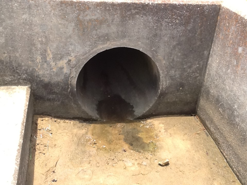
One of 39 stormwater drains into Bayou Texar that can introduce a variety of organic compounds that can fuel eutrophication.
Photo: Rick O’Connor
So, is there anything we can do to help reduce this from happening?
Well, remember some hypoxic conditions are natural and they will happen. But there are things we can do to not enhance them or trigger them in waterways that would otherwise not have them.
When raking your yard, place all leaves in paper bags for pick up. This keeps the leaves from washing into the street during rain events (and we are getting plenty of those) and eventually into a local waterway. The problem with using plastic bags is that the local utility who collects them can no longer compose this into mulch. You might consider using your leaves and grass clippings for landscaping yourself.
Watch fertilization of your yard. Many over fertilize their yards and the unused fertilizer is washed into the street and eventually into the local waterway. These fertilizers will do to phytoplankton what they were designed to do with your lawn – make them grow. Of course, not fertilizing your yard would be best, but if you must place only the amount, and type, your lawn needs. Your extension office can help you determine what that would be.
Pick up pet waste when you take your pets out to go to the bathroom.
If you have a septic tank – maintain it. You can also look into converting to a sewer system.
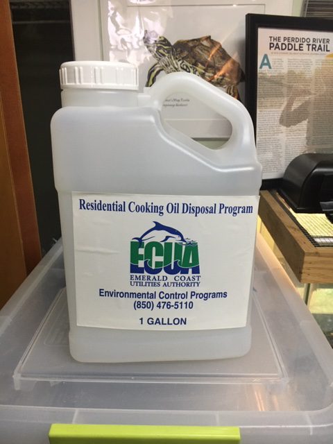
If you are on sewer – watch what you pour down the drain. Many products – such as fats, oils, and grease – can create clogs that cause sanitary sewage overflows when we have heavy rains (and we will have heavy rains). Our local utility in the Pensacola area offers the FOG program (Fats, Oils, and Grease). In this program you can pick up a clean 1-gallon plastic container to pour your fats, oils, and grease into. Once full, you bring it back and switch for a clean empty. To find where these containers bins are located near you visit the ECUA website – https://ecua.fl.gov/live-green/fats-oils-grease.
1-gallon container provided free to dispose of your oil and grease.
Photo: Rick O’Connor
Dissolved oxygen concentrations naturally go up and down, and sometimes low enough to trigger a natural fish kill but following some of the suggestions above can help reduce how frequently these happen and can help to make our estuary healthier.
When I joined Florida Sea Grant in 2012 my advisory committee told me water quality was one of their major concerns. Makes sense really. Some members were from the tourism and boating industry. Some were from commercial and recreational fishing. Others were homeowners. ALL had concerns. ALL depended on clean water for the success of their business and for the quality of their own lives. It is a big concern.
Since that time, we have been training volunteers to monitor nutrients and salinity. We just recently added harmful algae monitoring and we report fecal bacteria data collect by the Department of Health. All to (a) get people out there so they can see what is happening themselves, and (b) provide information we share with the members of the community.
Local bayous in the Pensacola Bay area have experienced fish kills due excessive nutrients in the past. The Lakewatch Program trains volunteers to monitor nutrients in these waterways today.
Photo: Rick O’Connor
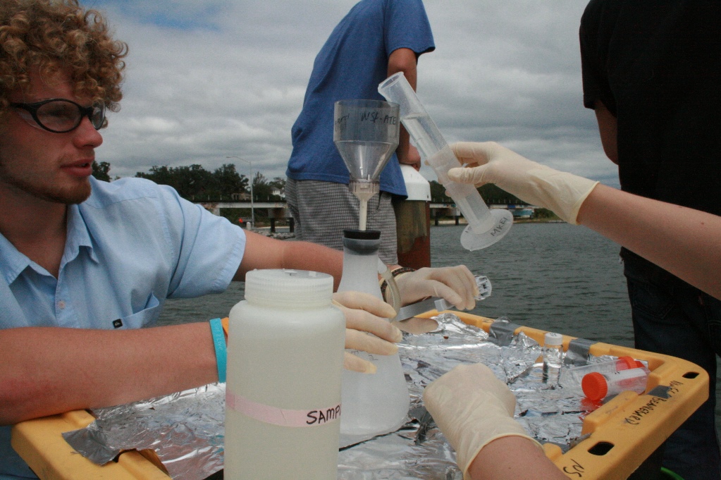
Lakewatch is a program where volunteers use their boats to monitor nutrients at three locations in a particular waterway within the bay system. Excessive nitrogen and phosphorus can lead to agal blooms, which in themselves can be a problem, just ask the folks in south Florida. But when these organisms die, they form dense mats of organic matter that sink and decay. The decaying process is oxygen demanding and the dissolved oxygen in the system decreases to levels where fish kills can happen. Many may remember the large fish kills our bayous experienced in the 1960s and 1970s.
Their samples are analyzed by the Lakewatch lab in Gainesville for total nitrogen, total phosphorus, and total chlorophyll a (which is a proxy for phytoplankton in the water column – algae). The volunteers also measure the water clarity using a secchi disk. Water clarity decreases with increase algal blooms and this can be a problem for submerged seagrasses. The lab provides us with the salinity when they analyze the samples.
Below is a table of data since sampling began in 2007. However, some locations are JUST getting started.
Table 1. Nutrients in the Pensacola Bay Area
All values are the geometric means.
Body of Water
Total Phosphorus (µg/L)
Total Nitrogen (µg/L)
Total Chlorophyll a(µg/L)
Water Clarity (Feet)
Salinity (parts per thousand)
Pensacola Bay
Station 1
Station 2
15
275
5
7.3
Station 3
Bayou Texar
Station 1
17
803
6
3.5
8
Station 2
18
673
8
3.8
10
Station 3
17
592
8
3.8
10
Bayou Chico
Station 1
29
533
16
3.2
7
Station 2
27
548
13
1.0
7
Station 3
22
353
8
4.1
7
Bayou Grande
Station 1
15
311
4
4.5
14
Station 2
15
290
4
5.5
15
Station 3
17
312
5
5.4
16
Big Lagoon
Station 1
13
252
3
8.9
18
Station 2
Station 3
12
213
2
10.0
8
Lower Perdido Bay
Station 1
15
327
5
6.4
15
Station 2
15
324
5
5.4
15
Station 3
15
328
5
5.8
15
Pensacola Bay was only sampled for one year (2019-2020). These three stations extend from the near the mouth of Bayou Texar, along the east side of the 3-Mile Bridge to the middle where the “hill” is in the bridge. This site is open and in need a volunteer. If interested, contact me. You will notice as you glance at the data table there is very little information on this location. The data provided in this table is the geometric means over the period of monitoring. Only data from station #2 was enough to report on and the values for nutrients are on the lower side. The water clarity is one of the better locations at 7.3 feet and there is insufficient data to report on the salinity.
Again, this site was not monitored for long and there is not enough to see short- or long-term trends here. But based on the little information provided, there does not appear to be nutrient issue here.
Bayou Texar has been monitored the longest in this Lakewatch program. One volunteer monitored from 2000-2002 before stopping. A second volunteer began in 2007 and monitored until 2013 when a third volunteer took on these sites. There is a current need for a new volunteer to continue monitoring this location beginning in 2023 – contact me if interested. The Lakewatch data is provided in two sections, one covering the 2000-2002 monitoring period, and the other the 2007-present. The data provided in this report are those collected between 2007-present. The sample stations run north to south with #3 being closest to the mouth near Cervantes Bridge.
A quick glance at the data shows significantly high nitrogen values, particularly at station #1 (near the 12th Avenue Bridge). Most bodies of water monitored in this project have nitrogen values running between 200-400 µg/L (Bayou Chico being an exception – more on that next). The total nitrogen in Bayou Texar runs between 600-800 µg/L – MUCH higher than the others. Though the total nitrogen is higher, the total phosphorus and chlorophyll numbers are not much above other locations (again, Bayou Chico is an exception). Water clarity, between 3-4 feet, is low for most locations. The salinity is also lower than most.
Since 2007 there have been significant improvements in total phosphorus at stations #2 and #3 – meaning improvements as you go from the 12th Avenue Bridge to the Cervantes Street Bridge. Water clarity has significantly improved at all locations. This is all good news. However, the total nitrogen numbers have not changed significantly over that time and are much higher than other bodies of water sampled. When you look at the number of health advisories issued for Bayou Texar it tends to be around 30% of the samples collected. Much better than Bayou Chico but higher than other bodies of water monitored by the Health Department.
Bayou Texar does have a total nitrogen problem and the closer you get to the 12th Avenue Bridge, the worse it becomes. Sources of nitrogen can come from leaf litter, fertilizers, animal waste, and leaky septic tanks, or sanitary sewage overflows. Identifing which source is the problem will be difficult. Some suggest the issues may be coming further upstream in Carpenters Creek. It is recommended that local residents and businesses along the creek and bayou use some of the management practices listed at the end of this report to help reduce this problem. There is a large effort currently to try and improve conditions in and around Carpenters Creek. Many of the properties along the bayou might consider the BMPs listed at the end of the report. Based on the chlorophyll data, Bayou Texar is border lined eutrophic (excessive nutrients). Reduction of nitrogen would help.
There are records of seagrass growing in Bayou Texar as well as active ospreys, dolphins, and even manatee sightings.
Bayou Chico has been sampled since 2014. The stations run from west to east with station 3 being the closest to the mouth of the bayou (near the bridge). As you glance across the numbers you will notice the nutrient data is slightly higher than the other bodies of water. The other bodies of water have total phosphorus between 10-20 µg/L. However, Bayou Chico has the highest values running between 20-30 µg/L. Other than Bayou Texar, the total nitrogen values are between 200-400 µg/L. Though lower than Bayou Texar, Bayou Chico is high running between 300-600 µg/L. The same is true for the third nutrient parameter chlorophyll. At most locations, excluding again Bayou Texar, the chlorophyll values are less than 5 µg/L. Bayou Chico has the highest values running between 8-16 µg/L. Along with Bayou Texar it has the lowest water clarity between 3-4 feet and has the freshest water in our sample locations with salinities running at 7 ppt.
Though most parameters have improved slightly since 2014, there have been no significant changes in water quality. There has been a slight increase in nitrogen at two stations – but again, not significant.
These values do classify Bayou Chico as eutrophic (nutrient excessive). The lower water clarity and salinity suggest more freshwater input – possibly from stormwater runoff. The low water clarity could be from small algal blooms but could also be attributed to shore-based sediments entering the system via stormwater runoff. These excessive nutrients could be linked to the excessive health advisories issued here due to fecal bacteria entering the waters. Based on data from the Department of Health, over the years Bayou Chico has required a health advisory be issued 50-60% of the time they sampled – significantly more than the other bodies of water monitored. Since 2010, this is the only body of water currently being monitored that has experienced a large fish kill – though this fish kill was attributed excessive warm water (which, like algal blooms, is oxygen demanding). It is a body of water that has seen problems for decades and is the only body of water in our area that requires a state Basin Area Management Plan (BMAP).
There are records of seagrass growing in Bayou Chico – and this is good news. There are also reports of ospreys, dolphins, and manatee sightings here as well. The state has deployed oyster reefs to help remove nutrients. There is an invasive species present (giant salvinia – Salvinia molesta) that is of concern. The state is currently managing this plant. It prefers high nutrient, low energy (calm) freshwater water. The salinities of the other bayous may be too high for this plant, but we are trying to education residents about the situation and help monitor/remove it if it appears. You can contact the county extension office for more information on this plant if interested.
Bayou Grande has been monitored since 2012. The stations also run west to east with station #3 closest to the mouth near NAS main side bridge. As you glance across the numbers you will notice values at, or below, average for the areas sampled. Total phosphorus runs close to 15 µg/L. Total nitrogen values run close to 300 µg/L. Total chlorophylls are some of the lowest running close to 4 µg/L. Water clarity is the clearest of all three of the bayous running between 4.5-6 feet and is also the saltiest with salinities running around 15 ppt.
All though all parameters have shown improvement in water quality since 2012, most are not significant improvements. The one exception is water clarity at station #1 – it has shown significant improvement during this time.
In general Bayou Grande is in the best shape of the three bayous and compares well with the open bay stations being monitored. It is classified as mesotrophic – meaning nutrients are middle range (where you expect an estuary to be). The health advisory reports are usually between 20-30% of the samples taken and fish kills have not occurred here since we began monitoring. There have been improvements on septic to sewage conversions in these communities, as well as efforts to build living shorelines (which can help reduce nutrient runoff to the bayou coming directly from properties in lieu of storm drainpipes). It is also a larger bayou (hence its name) with less development along the southern shoreline. There are more efforts planned to try and improve sewage issues and in planting living shorelines using filter feeding oysters. Residents along Bayou Grande could also incorporate Florida Friendly Landscaping principals to help reduce nutrients further as well as incorporate clean boating practices. Information on these programs can be found at your county extension office.
Big Lagoon has only been monitored since 2020. Thus, there are gaps in the data table where there are insufficient data to calculate a geometric mean. The sample stations run from east to west with #1 being closest to Ft. McRee and the mouth of the Pensacola Bay system itself. Glancing at the data where a geometric mean was able to be determined you will see that nutrient values are some of the lowest in the bay area. The total phosphorus runs between 12-13 µg/L, total nitrogen between 200-250 µg/L, and the total chlorophyll between 2-3 µg/L. The water clarity data are the clearest in the bay area, running from 9-10 feet. The salinity is interesting. At station #1 (near Ft. McRee) the geometric mean for salinity is 18 ppt, but at station #3 (near Big Lagoon State Park) it is only 8 ppt.
Since sampling only began two years ago, it has not been long enough to determine any long-term trends.
The chlorophyll numbers are actually low enough to classify Big Lagoon as oligotrophic (nutrient poor). This is unusual for an estuary, which are typically bodies of water with moderate amounts of nutrients due to natural runoff. But remember (a) Big Lagoon does not have a lot of natural runoff and (b) we have only been collecting samples there for two years.
The interesting thing about the salinity is how low it is. Station #3 (near Ft. McRee) is 18 ppt and being so close to the mouth of Pensacola Bay, and the Gulf of Mexico, you would expect this to be higher – maybe between 25-30 ppt. The fact that there are thick beds of turtle grass (Thalassia testdidnium) suggest that the actual mean is probably higher than the 18 ppt reported here. The opposite side of Big Lagoon is interesting as well. Station #3 reports a geometric mean of 8 ppt. This is equivalent to the upper end of Bayou Texar (near the 12th Avenue Bridge) and most of Bayou Chico. This too seems very low for this body of water. The Department of Health samples for fecal bacteria near Big Lagoon State Park and it does, at times, get high enough (> 70 colonies/100ml) for a high bacteria reading. DOH usually takes a second sample to confirm the reading and most often the second reading is lower, and a moderate classification is given for that week. That said health advisories have been given in this region, albeit less than 10% of the samples taken. All of this suggest that there may be some runoff issues at the west end of the Lagoon. Obviously more sampling is needed.
This body of water does support plenty of seagrass, ospreys, dolphins, and an increase in manatee reports. There are diamondback terrapins and horseshoe crabs both reported here as well. But it was also a location where bay scallops once thrived and no longer do. Scallop searches have been ongoing here for six years and only one live animal has been found. There are several possible reasons for their decline, decrease in salinity maybe one of them. Monitoring will continue. It is also a location where the state has measured a decline in seagrass – also concerning. Sea Grant is currently partnering with the University of West Florida to monitor both seagrass abundance and water quality within Big Lagoon.
Lower Perdido Bay has been monitored since 2014. The three stations run from south to north. Station #1 is near Innerarity Point and station #3 is near Tarkiln Bayou. Glancing across the numbers of the lower Perdido you will see that they are similar to most of the other bodies of water being monitored. The total phosphorus is 15 µg/L. The total nitrogen is between 320-330 µg/L. And the total chlorophyll is 5 µg/L classifying this area of Perdido Bay as mesotrophic. Being an open bay, the water clarity is higher, running between 5-6 feet, and the salinity is reported at 15 ppt. As with Big Lagoon, the salinity seems lower than one would expect but historic records suggest that Perdido Bay in general may have been lower than most other open bays. Historically the mouth of the bayou open and closed frequently giving the Spanish the reason to name it Perdido (“Lost Bay”). This closer may have made it more of a freshwater system – similar to the dune lakes of Walton County and the historic Choctawhatchee Bay – and may play a role in the lower salinity of Big Lagoon.
The trends over time show that most parameters have improved but not significantly. The one exception is total nitrogen. The total nitrogen in lower Perdido Bay has significantly decreased over the period Lakewatch has been monitoring – and this is good news.
Perdido Bay has had a history of poor water quality, but this is due more to industrial compounds being released through the tributary creeks. These compounds did cause other problems, including some species of fish altering sex, and whether these are still an issue cannot be determined by these data – this project is monitoring for nutrients. The nutrient driven algal blooms and fish kills found in the bayous 50 years ago were not as common in this body of water and these data suggest that the system is mesotrophic as most estuaries are. As with most of the other bodies of water, ospreys, dolphins, and manatees have all been recorded here. Seagrasses are present but being a less saline system than Big Lagoon and Santa Rosa Sound, the species composition is different and abundance is less. There have been efforts to survey for bay scallops in the lower portions of Pensacola Bay, but no efforts have been made in the lower Perdido due to salinities currently, and historically, not being high enough. Again, the lower salinity is thought to be more natural than from heavy development and urban runoff.
Summary
In summary, these data suggest that the nutrient problems area waterways experienced in 1960s and 1970s have improved. Algal blooms and fish kills are no longer common. But there still could be dissolved oxygen (DO) issues at the bottom of our bays and bayous that reduce biodiversity. This is not monitored by Lakewatch and we are not aware of any long term monitoring of DO to know how things have changed in the last 50 years.
Anecdotal reports suggest the coverage of seagrasses in these systems are improving. Though there are seagrasses in Big Lagoon, some reports suggest there has been a decline in recent decades. There is a current citizen science project entitled Eyes on Seagrass where Sea Grant and the University of West Florida train volunteers to monitor both coverage and species composition. Data from this project will presented in a separate report later in the year. There are also separate citizen science efforts monitoring the presence of bay scallops, horseshoe crabs, and diamondback terrapins in the bay area. Horseshoe crabs are being encountered more often, as are terrapins, but bay scallops seem to still be missing. As with the seagrass monitoring, these reports will be coming later this year.
There are still concerns with both Bayou Chico and Bayou Texar – these being the only two nutrient eutrophic systems in this monitoring project (based on chlorophyll data). Efforts to better understand the sources of nutrients, and enact better management practices, should be considered for these waterways. Things such as reducing fertilizer use, mitigating fertilizer runoff with living shorelines, converting from septic to sewers, better maintenance of septic systems, and reduction of sanitary sewage overflows are all actions that citizens can take now to help improve these waterways. For information on how to do these, contact your county extension office and we will be glad to assist.
Lakewatch is a citizen science volunteer supported by the University of Florida IFAS
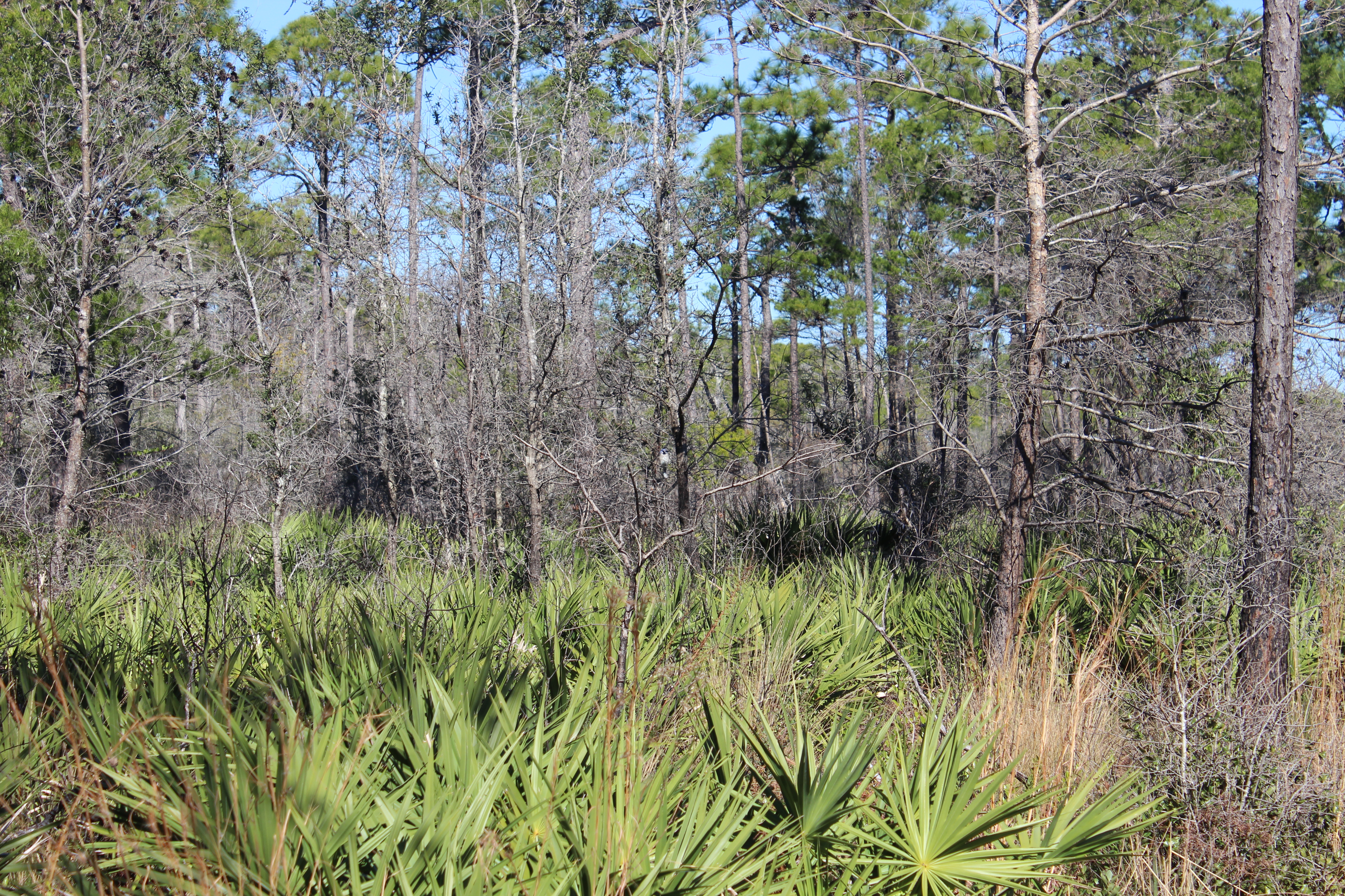
Mangroves in the northern Gulf of Mexico are a relatively new thing for most coastal counties. Some residents are aware they are arriving and are not concerned. Some are aware and are actually excited about it. Some are aware and are concerned. Some are not aware. And others have no idea what a mangrove is. Let’s start with that group.
Black mangroves growing near St. George Island in Franklin County. Photo: Joshua Hodson.
Mangroves are salt tolerant trees that are found all around the globe within the tropics. They grow along the shorelines in areas where they are protected from ocean wind and waves – they like estuaries. There are several species and their location along the shore depends on how long they can be submerged in water. There is a definite zonation of these trees.
The red mangrove with their distinct prop roots. Photo: University of Florida
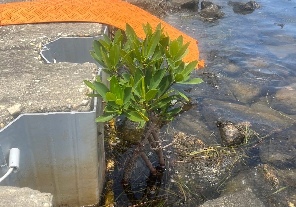
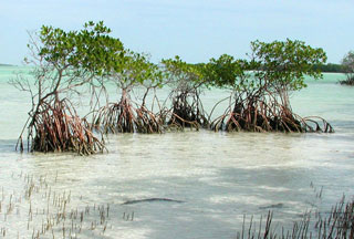
The red mangrove (Rhizophora mangle) is found closest to the waters edge. They can be identified by their prop roots which are designed to keep it standing when the water is moving and shifting the sediment below it. These prop roots also useful during tropical storms when the wave energy increases. The have distinct looking propagules, which are elongated floating seeds which allows the plant to disperse their offspring using the currents and tides. The propagules often wash ashore on northern Gulf beaches but usually in locations not conducive to growth, or they do not survive the winters. These plants can tolerate temperatures in the 30sF for a night or two, but when it drops into the 20sF, and certainly into the 10sF, they will not survive. Despite not being cold tolerant, they have been found growing in the northern Gulf of Mexico. All the mangroves found in the Pensacola area have been of this species.
Black mangroves with their pneumatophores. Photo: University of Florida
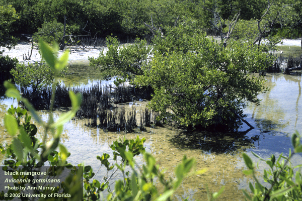
The black mangrove (Avicennia germinans) is found higher in the intertidal zone. It lacks the prop roots of the red but rather has what are called pneumatophores, which resemble the knees of the cypress trees. These pneumatophores have structures that help increase the oxygen uptake for the plant, being that the sediments they live in are quite hypoxic. The seeds of the black mangrove are not elongated but rather resemble a bean. These trees are more tolerant of cold weather than the red mangrove and it is they that have led the march north. There are large stands of these trees in the Apalachicola area as well as barrier islands in Mississippi, Louisiana, and Texas. We have not found a black mangrove growing in Pensacola as of yet.
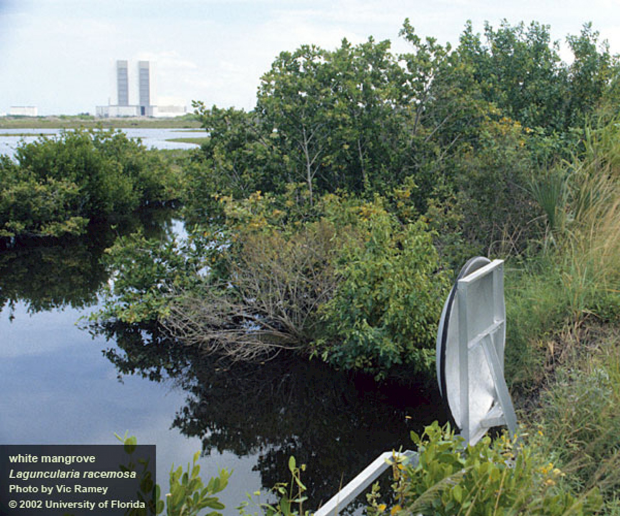
The larger white mangrove. Photo: University of Florida
White mangroves (Laguncularia racemosa) grow more inland than the other two. This species can grow into a large tree (up to 40 feet). Their leaves can excrete salt allowing them to live in saltier conditions. There are no records of this tree in the northern Gulf of Mexico to my knowledge.
Why would anyone be concerned about mangroves dispersing into the northern Gulf?
Those who are concerned are aware that is a shoreline tree that will grow and possibly block their view of the water. They also are aware that this tree is protected by the state, and they are not allowed to remove or trim the tree without a permit. In south Florida trimming mangroves is allowed in some counties during certain times of the year and only by certified arborist. Those concerned are not excited about potentially loosing their water view.
A red mangrove growing near the pass of Pensacola Bay. Photo: Whitney Scheffel.
Why would anyone be excited about mangroves dispersing into the northern Gulf?
Folks who are excited about the possible coming of the mangroves are so because they have spent time snorkeling and fishing in and around them in more southern locations. The prop roots of the red mangrove create an underwater wonderland of marine life. Small fish, crabs, anemones, starfish, mollusk and more find the large openings formed by the roots as great habitat. These in turn attract larger fish like snook, tarpon, rays, and flounder. Many species of larger fish are popular targets for anglers. Manatees are often found in mangrove swamps grazing on the algae and seagrasses growing nearby and enjoying the relatively calm water. Those who have experienced this in south Florida are excited they may have it here in the north.
How many mangroves, and which species, have dispersed into the northern Gulf is still being studied. Florida Sea Grant has partnered with Mississippi-Alabama Sea Grant and three of the National Estuarine Research Preserves to survey for mangroves in our panhandle counties and along coastal Mississippi and Alabama. Ten transects have identified in each that are surveyed once a year by volunteers using paddle craft. The presence of a mangrove is documented, measured, photographed and shared with the team, which is overseen by Whitney Scheffel of the Pensacola-Perdido Bay Estuary Program. If you are interested in participating in a survey, contact your county Sea Grant Extension Agent.
The University of Florida/IFAS Extension faculty are reintroducing their acclaimed “Panhandle Outdoors LIVE!” series. Conservation lands and aquatic systems have vulnerabilities and face future threats to their ecological integrity. Come learn about the important role of these ecosystems.
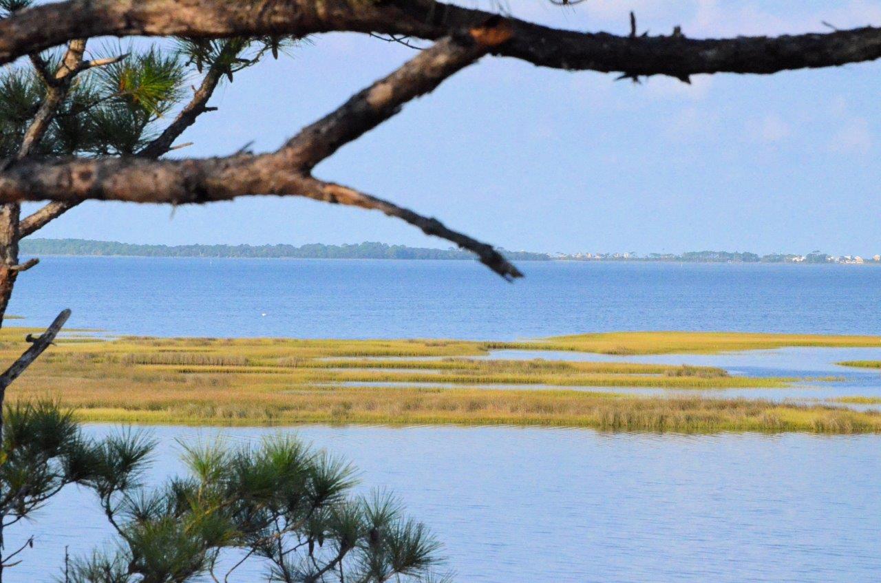
The St. Joseph Bay and Buffer Preserve Ecosystems are home to some of the one richest concentrations of flora and fauna along the Northern Gulf Coast. This area supports an amazing diversity of fish, aquatic invertebrates, turtles, salt marshes and pine flatwoods uplands.
This one-day educational adventure is based at the St. Joseph Bay State Buffer Preserve near the coastal town of Port. St. Joe, Florida. It includes field tours of the unique coastal uplands and shoreline as well as presentations by area Extension Agents.
Details:
Registration fee is $45.
Meals: breakfast, lunch, drinks & snacks provided (you may bring your own)
Attire: outdoor wear, water shoes, bug spray and sun screen
*if afternoon rain is in forecast, outdoor activities may be switched to the morning schedule
Space is limited! Register now! See below.
Tentative schedule:
All Times Eastern
8:00 – 8:30 am Welcome! Breakfast & Overview with Ray Bodrey, Gulf County Extension
8:30 – 9:35 am Diamondback Terrapin Ecology, with Rick O’Connor, Escambia County Extension
9:35 – 9:45 am Q&A
9:45- 10:20 am The Bay Scallop & Habitat, with Ray Bodrey, Gulf County Extension
10:20 – 10:30 am Q&A
10:30 – 10:45 am Break
10:45 – 11:20 am The Hard Structures: Artificial Reefs & Marine Debris, with Scott Jackson, Bay County Extension
11:20 – 11:30 am Q&A
11:30 – 12:05 am The Apalachicola Oyster, Then, Now and What’s Next, with Erik Lovestrand, Franklin County Extension
12:05 – 12:15 pm Q&A
12:15 – 1:00 pm Lunch
1:00 – 2:30 pm Tram Tour of the Buffer Preserve (St. Joseph Bay State Buffer Preserve Staff)
2:30 – 2:40 pm Break
2:40 – 3:20 pm A Walk Among the Black Mangroves (All Extension Agents)
3:20 – 3:30 pm Wrap Up
To attend, you must register for the event at this site:
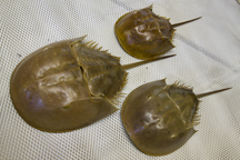
One of the programs I focus on as a Sea Grant Extension Agent in Escambia County is restoring the health of our estuary. One of the projects in that program is increasing the encounters with estuarine animals that were once common. Currently I am focused on horseshoe crabs, diamondback terrapins, and bay scallops. Horseshoe crabs and bay scallops were more common here 50 years ago. We are not sure how common diamondback terrapins were. We know they were once very common near Dauphin Island and are often found in the Big Bend area, but along the emerald coast we are not sure. That said, we would like to see all of them encountered more often.
Horseshoe crabs breeding on the beach. Photo: Florida Sea Grant
There are a variety of reasons why species decline in numbers, but habitat loss is one of the most common. Water quality declined significantly 50 years ago and certainly played a role in the decline of suitable habitat. The loss of seagrass certainly played a role in the decline of bay scallops, but overharvesting was an issue as well. In the Big Bend region to our east, horseshoe crabs are also common in seagrass beds and the decline of that habitat locally may have played a role in the decline of that animal in our bay system.
Salt marshes are what terrapins prefer. We have lost a lot of marsh due to coastal development. Unfortunately, marshes often exist where we would like houses, marinas, and restaurants. If the decline of these creatures in our bay is a sign of the declining health of the system, their return could be a sign that things are getting better.
Seagrass beds have declined over the last half century. Photo: Rick O’Connor
Salt marshes have declined due to impacts from coastal development. Photo: Molly O’Connor
For over 10 years we have been conducting citizen science monitoring programs to monitor the frequency of encounters of these creatures. All three are here but the increase in encounters has been slow. An interesting note was the fact that many locals had not heard of two of them. Very few knew what a horseshoe crab was when I began this project and even fewer had heard of a terrapin. Scallops are well known from the frequent trips locals make to the Big Bend area to harvest them (the only place in the state where it is legal to do so), but many of those were not aware that they were once harvested here.
I am encouraged when locals send me photos of either horseshoe crabs or their molts. It gives me hope that the animal is on the increase. Our citizen science project focuses on locating their nesting beaches, which we have not found yet, but it is still encouraging.
Volunteers surveying terrapin nesting beaches do find the turtles and most often sign that they have been nesting. The 2022 nesting season was particularly busy and, again, a good sign.
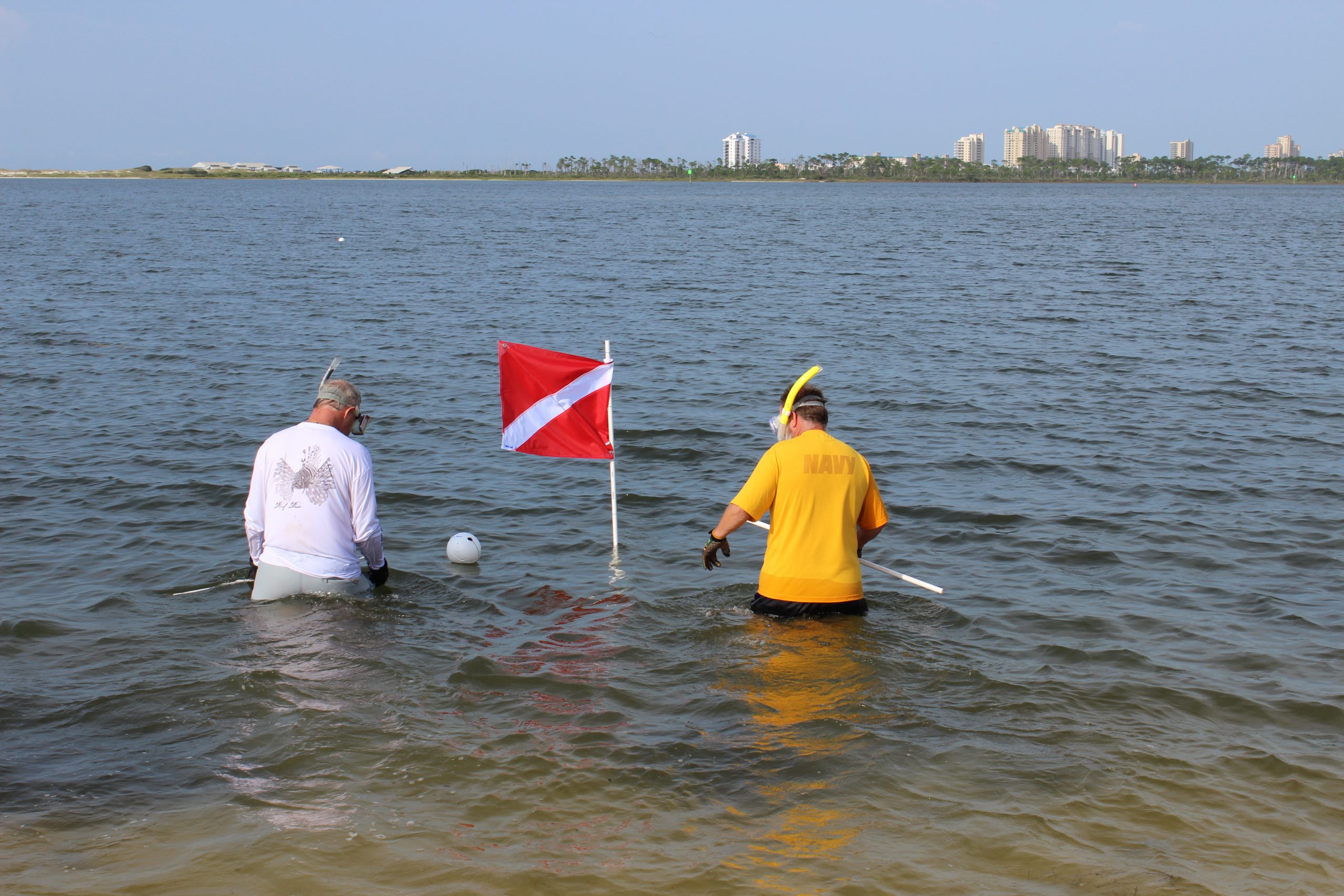
It is now time to do our annual Scallop Search. Each year we solicit volunteers to survey a search grid within either Big Lagoon or Santa Rosa Sound. Over the years the results of these surveys have not been as positive as the other two, but we do find them, and we will continue to search. If you are interested in participating in this year’s search, we will be conducting them during the last week of July. You can contact me at the Escambia County Extension Office (850-475-5230 ext.1111) or email roc1@ufl.edu or Chris Verlinde at the Santa Rosa County Extension Office (850-623-3868) or email chrismv@ufl.edu and we can set you up.
Bay scallops need turtle grass to survive. Photo: UF IFAS
Volunteers participating in the Great Scallop Search. Photo: Molly O’Connor
Final note…
Each June I camp out west somewhere and each year I look for those hard-to-find animals. After 10 years of looking for a mountain lion, I saw one this year. Finding these creatures can happen. Let’s hope encounters with all three become more common in our bay.