by Rick O'Connor | May 20, 2022
Imagine…
It is 1922 and you are rowing your wooden skiff from a small beach house near what will become the town of Gulf Breeze Florida across Santa Rosa Sound on your way to Santa Rosa Island. The water is 10-15 feet deep, and you can see the bottom. It is covered with a lush garden of seagrasses with numerous silver fish jutting in and out of the blades. Most are there only for a moment before they are lost again. You notice a brown colored puffer fish hovering over the grass as you past by. Maybe a small sea turtle grazing, or a tannish colored stingray flying over the meadow. As you get closer to the island, which is covered with sand dunes reaching 20-40 feet in height and shrubby live oak and magnolia trees, you begin to see Florida conchs and horseshoe crabs, maybe fields of bay scallops littering the grass in every direction.
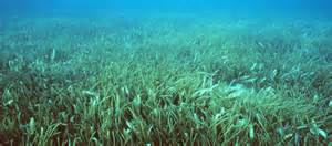
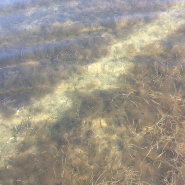
An amazing meadow of underwater grass.
Photo: Virginia Sea Grant
Sounds amazing, doesn’t it? And it was actually like this once.
What changed?
I asked this question of some ole timers who grew up on Bayou Texar in Pensacola decades ago. You might be surprised to learn that Bayou Texar resembled this scene. They described water that was between 10-15 feet deep, had sand and seagrass on the bottom, and you could catch shrimp the size of your hand by tossing out a cast net. But Bayou Texar no longer looks like this.
Most told me the first thing they remember was a change in the water clarity. The water became more and more turbid. Then the shrimp went away, then some of the fish. They mentioned several species of fish that no longer exist there. The cause of the turbid water? … Development. They were developing all around the Bayou after World War II and that was when things began to change. They mentioned the road going in on the east side of the bayou as the point when turbidity issues began. The houses came later.
With little rain over the last few days the water clarity was excellent and you could see the seagrass very well.
The city of Gulf Breeze was founded in 1935 and was originally called Casablanca because of a white house there that could be seen from Pensacola. As the community grew the waters became more turbid as well, and the amazing underwater garden declined. But this was not just happening in Gulf Breeze and Bayou Texar, it was happening everywhere.
But it was bound to happen. As the human population grows more space is needed for homes, businesses, and schools. More roads are needed to reach these locations and a bridge was placed to reach Santa Rosa Island, so you no longer had to paddle a skiff to reach it. Once on the island, growth continued. More homes, roads, and businesses. With more run-off, turbidity, and the garden continued to decline.
Shoal grass. One of the common seagrasses in Florida.
Photo: Leroy Creswell
The thing was we did not know at the time that (a) we were causing this decline and (b) how much we really wanted that garden there. I often hear the question “what happened to all of the blue crabs?” I think they know the answer, but they remember a time when blue crabs were more abundant, can you imagine what it probably was like for our friend paddling across in 1922. And there has been a noticeable difference in crab numbers in their life. There are folks, including myself, who remember bay scallops in the Sound and horseshoe crabs on what they called “Horseshoe Crab Island” in Little Sabine. This is one of the amazing things about this story – how fast the decline was. Now we better understand how important these underwater meadows were to the function of a healthy estuary and there is interest in restoring them.
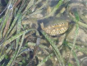
Bay scallops need turtle grass to survive.
Photo: UF IFAS
To restore seagrass, you first have to understand, and mitigate, what is causing the decline. Seagrasses are vascular plants that possess roots, stems, and leaves. They produce flowers and sexually reproduce using seed. This is not the case with seaweeds, which are nonvascular and lack the above, but they often mistakenly called seaweeds. There are three species that dominate our seagrass meadows in the Florida panhandle and a fourth one that is not as common. The uncommon one has a round blade like a pine needle and is called manatee grass (Syringodium filiforme).
The three common species all have flat blades. Widgeon grass (Ruppia maritima) has blades that branch. It tolerates a wide range of salinity and is more abundant in the upper regions of our estuaries. Shoal grass (Halodule wrightii) has a single flat, non-branching, blade that is very narrow (< 3mm) and resembles human hair. Turtle grass (Thalassia testudinum) is also flat, non-branching, but wide (>3mm) and resembles St. Augustine grass.
Like other grasses, these plants require sunlight and nutrients to survive. They also need to grow in the low energy locations of our estuaries. Sunlight, of course, is key for photosynthesis and clear water is the key to getting enough of it. 15-25% of the sunlight reaching the surface of the water must also reach the bottom where the grasses are. Nutrients can be obtained through the water column and sediments. The stems run horizontal beneath the sand and are called rhizomes. They help hold sediments in place increasing the much-needed water clarity as well as reduce shoreline erosion. The blades extend from the substrate up into the water column bathing in the sunlight. They are covered by microscopic plants and animals that resemble scum when you run fingers over them but provide mush of the food for the creatures that live there.
And live there they do.
It has been estimated that it least 80% of the commercial and recreational important shell and finfish spend at least part of their lives in the seagrass meadows. Ducks, manatees, and sea turtles are some of the grazers on these plants and sea horses, pipefish, and pinfish are abundant.
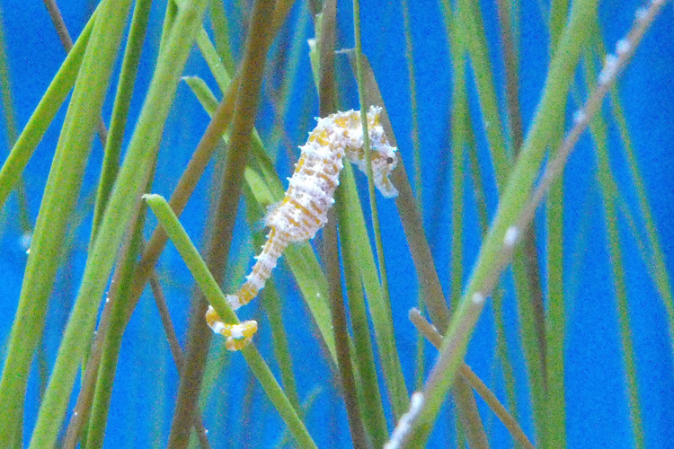
Photo: NOAA
When humans began developing around the Sound in the 1940s and 1950s the sediment run-off decreased water clarity, cutting off the much-needed sunlight, and in some locations covered the grasses. Excessive nutrients from our fertilizers, and detergents increased phytoplankton growth which in turn decreased water clarity more and enhanced the growth of macroalgae which smothered the meadow like a blanket. Hot water discharges from industrial processing along the shores stressed the grasses as did prop and anchor scars from power boat plowing through and anchoring in them. These same boats and jet skis increase wave energy with their wake, as do seawalls when waves reflect off of them. Marinas, bridges, and docks all required dredging in the meadow which not only removed the grasses but increased turbidity even further. All of this triggered the decline of these amazing gardens. And with them the decline of the cherished fisheries as well.
The scarring of seagrass but a propeller.
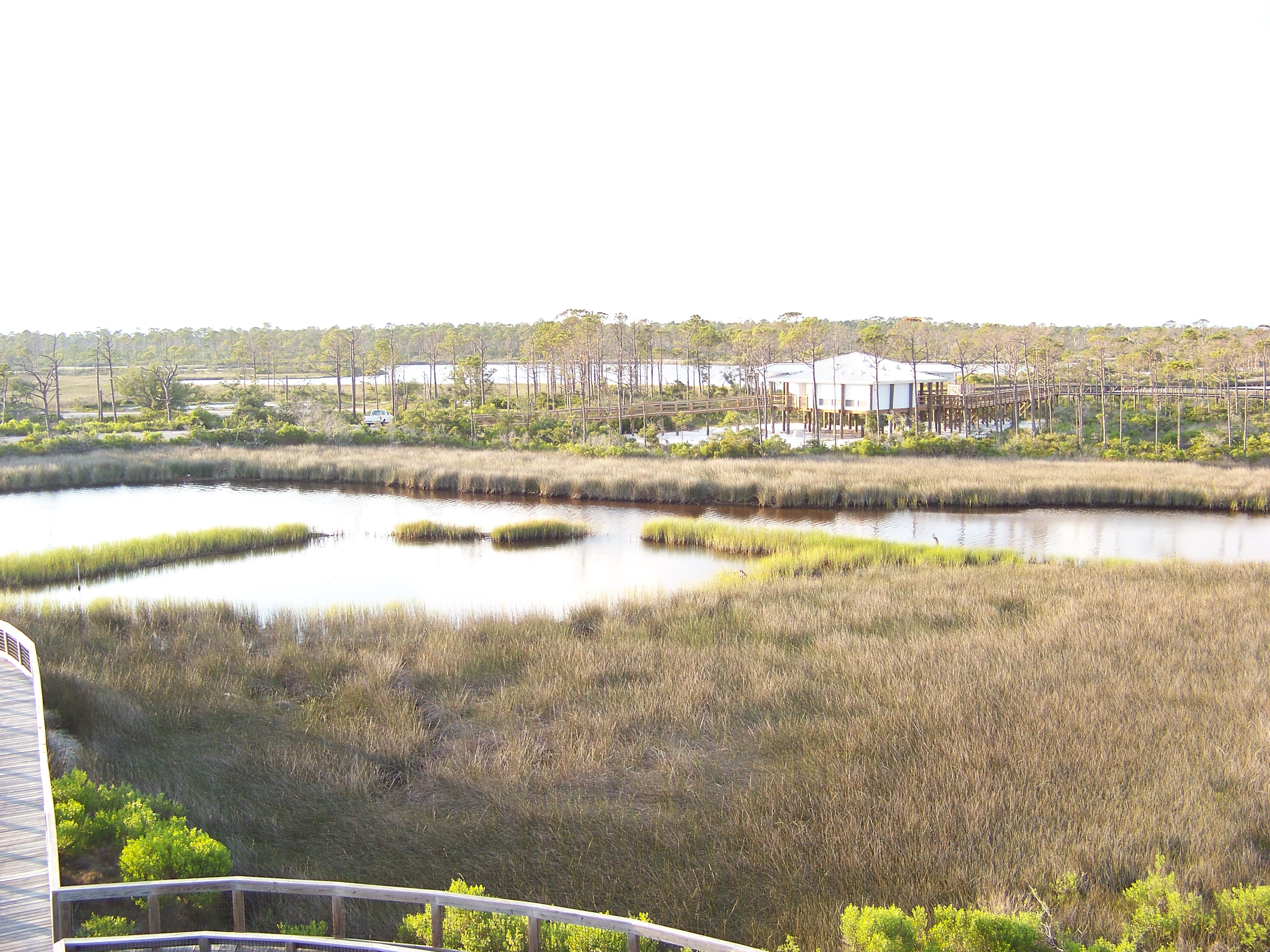
In recent years the Florida Fish and Wildlife Conservation Commission (FWC) conducted surveys across the state to assess the status of our seagrass beds. They estimated that there was a little over 2 million acres of seagrasses in Florida waters, 39,000 in the western panhandle. Though much of these beds appeared to be stable, or even increasing acreage, those in the panhandle were still in decline and all of Florida’s seagrass gardens were less than the acreage in the 1950s.
In this study they found the Perdido Bay had primarily shoal grass. Big Lagoon and Santa Rosa Sound were a mix of shoal and turtle grass, with some manatee grass reported from Santa Rosa Sound. Aerial imagery found –
Perdido Bay had 642 acres of seagrass in 1987; 125 acres in 2002 for a net loss of 5.4% / year
Pensacola Bay had 892 acres in 1992; 511 acres in 2003 for a net loss of 3.9% / year
Big Lagoon had 538 acres in 1992; 544 acres in 2003 for a net gain of 0.1% / year
Santa Rosa Sound had 2,760 acres in 1992; 3,032 acres in 2003 for a net gain of 0.9% / year
The numbers in the lower portion of the bay are encouraging and suggest some behavior changes we made in recent decades have helped. Both development and monitoring continue. We will see.
What can be done to help restore the garden?
- First, reduce run-off into the bay. This can be done by engineering designs with green infrastructure methods but can also be done by the private homeowner as well. Using native plants in your landscape reduces the need to irrigate your property and landscape designs which include rain gardens and rain barrels will also help reduce run-off.
- The reduction of nutrients begins with the reduction of fertilizers on the landscape. Using Florida Friendly Landscaping principals can lead to a beautiful landscape that does not require fertilizers. If you choose to use nonnative plants that do require fertilizers, use only what the plant needs – do not over do it.
- If you live along the waterfront, you can further reduce nutrients by planting a living shoreline. The plants used in living shorelines are known to remove nutrients from run-off from your property, as well as reduce erosion and provide more habitat for fisheries. One living shoreline project in Bayou Grande has seen an increase in shoal grass beds since they planted it.
- When boating, be aware where seagrasses exist. Lift your motor when moving through them to avoid prop scarring and anchor in open sandy locations. You can also follow the principals of a Florida Clean Boater to reduce your impact on water quality that could impact the seagrasses.
With a little effort on our part, we can enhance some of the positive numbers we have seen in seagrass assessments and hopefully turn the current negative trends into positives. Maybe the garden will return. For more information on how you can apply any of these principals contact your county Extension office.
by Rick O'Connor | Mar 24, 2022
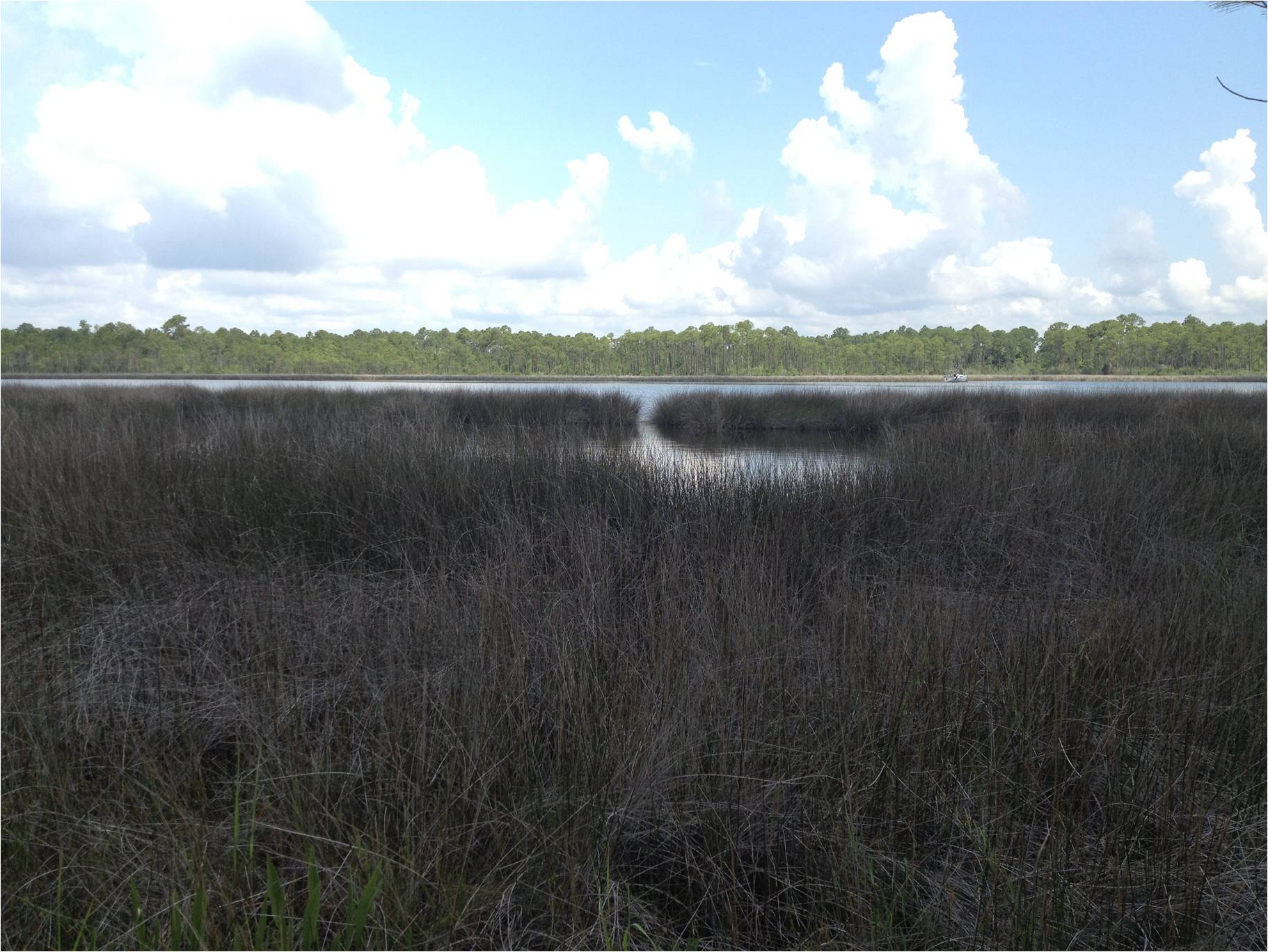
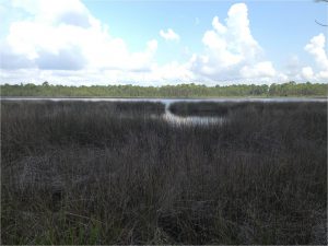
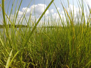
When exploring local coastal environments, the salt marsh is one not frequently visited by residents. When first seen, the large field of grass appears inviting. But when you reach it appears impenetrable, full of bugs and snakes, and there must be an easier way around.
The Salt Marsh – the land of the wet and Muddy
Photo: Molly O’Connor
There are three ways to access a salt marsh. One, to just begin walking into the field of grass, pushing your way through like a boat on the ocean. Second, using a trail cut but someone else, that meanders its way to the high ground or open water. And third, from the open water following a creek. This can be done on foot or by a paddle craft.
Entering the salt marsh can be tricky.
Photo: Rick O’Connor
If entering by foot into the field of grass, the explorer is first met with a tall grass with a pointed end – black needlerush. This rather stiff, thin, cylinder-shaped grass has a good name, the pointed end is sharp and hurts as you begin to move it out of the way with your forearms. When in college I was told “you might want to wear jeans”. I did not see wearing jeans in the summer heat as a good idea so, chose not to, but understood quickly why they recommended it. Honestly, I am not sure it would have helped anyway. Needlerush pokes your arms, legs, and care must be taken and avoid bending over to pick something up, else you will get a poke in the face or eye.
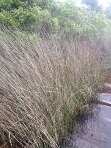
Black Needlerush is one of the two dominant plants of our salt marshes. Photo: Rick O’Connor
After quickly meeting black needlerush you meet the mud. They do not call it the land of the wet and muddy for nothing. They mud is like pudding and some sections feel like there is no solid ground. This mud is a slate gray color, smells like rotten eggs, and you can sink into it up to your knees in places. Shoe selection in a place like this is important. Many an explorer has placed their shoe covered foot into the mud only to bring up a shoeless foot the next step. Shoes that can tied or synched to the foot are best. They need a good thick bottom to protect the foot from shells, like oysters. I will tell you “crocs” are not what you want.
The sediment in a marsh is not always as solid as it looks.
Photo: Rick O’Connor
The rotten egg smell is the gas hydrogen sulfide, produced by bacteria breaking down organic material trapped within the marsh. And much becomes trapped here. By definition a marsh is a wetland that is dominated by grasses rather than trees. Being a wetland, it is low in elevation and holds water either from rainwater run-off or from the incoming tide. As the water recedes, leaf litter, animal carcasses, and other debris become trapped in the marsh. In fact, the ability of the marsh to hold this decaying layer of mud plays an important role in keeping the open water clear.
As you labor your way across the marsh, pulling each footstep through the mud while moving the sharp grass, you may see signs of life. Most animals have trouble walking through the grass and mud as well and choose another route. But the density and biomass of the open marsh is impressive. Trying to count the blades of grass would be like trying to count the stars in the sky. It is a very biologically productive place. One creature you may encounter is the bird known as the clapper rail. This brownish bird blends in well in the sea of grass and often builds their nest here. When you come upon them, they will let out a loud squawking sound that will honestly terrify you at first. Sometimes they fly, sometimes they move to a new location, sometimes they hold their position and continue to try and scare you away.
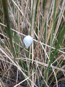
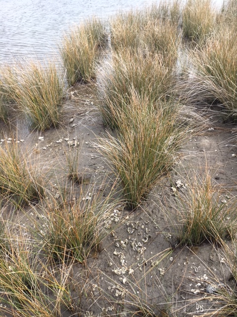
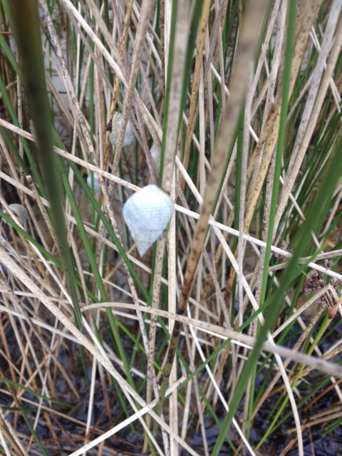
The marsh periwinkle is one of the more common mollusk found in our salt marsh. Photo: Rick O’Connor
Another common creature seen is the marsh periwinkle. This small white snail is often seen on the blades of needlerush. As the tides rises, so does the periwinkle, crawling up the grass to avoid predators like the blue crab and diamondback terrapin. At low tide they are on the surface of the organic mud feeding on bits of decaying material. Again, caution if you are going to bend over to look for them. You may get a needlerush in the eye!
There are times as you are crossing you will come to an open area with little or no grass. These are known as salt pans and are areas with lower elevation that the surrounding marsh. Saltwater lies here during high tide and low. As the pool of water evaporates the salinity of the remaining water increases and becomes too salty for most plants to grow. It becomes a “dead zone” within the marsh. There are a few salt tolerant plants that do grow here. You may see the tracks of other creatures exploring, like raccoons, but otherwise it is a break for you from the constant shoving of needlerush and you step in there.
Occasionally you will cross the opposite in elevation. A high ridge of quartz sand where small shrubs like salt bush or even a small oak can be found. These little oasis’s can be places where other travelers of the marsh will rest. Fiddler crabs, cactus, and maybe even a basking snake could be found here.
A finger of a salt marsh on Santa Rosa Island. The water here is saline, particularly during high tide. Photo: Rick O’Connor
There are times when you will cross a creek. These creeks meander their way through the marsh and to the open water. Many travelers, for obvious reasons, choose to follow these routes. Some creeks are shallow and full of mud where you may sink above your knee. Others are a bit deeper and have more solid bottoms of sand. Walking through the water can give some relief from the needlerush. Here you will see several species of fish. Most are killifish or mullet, but as you get closer to the open water you might find redfish or flounder. It is much easier to see the periwinkles here. You will also notice the ribbed mussels anchored near the base of the needlerush. There are oyster clumps scattered here and there and huge colonies of fiddler crabs. The creeks are good hunting grounds for the stilted legged birds such as the great blue heron and American egret. Clapper rails often nest along the creek edges and there is a lot of sign of raccoons and sometimes otters.

The “snorkel” is called a siphon and is used by the snail to draw water into the mantle cavity. Here it can extract oxygen and detect the scent of prey.
Photo: Franklin County Extension
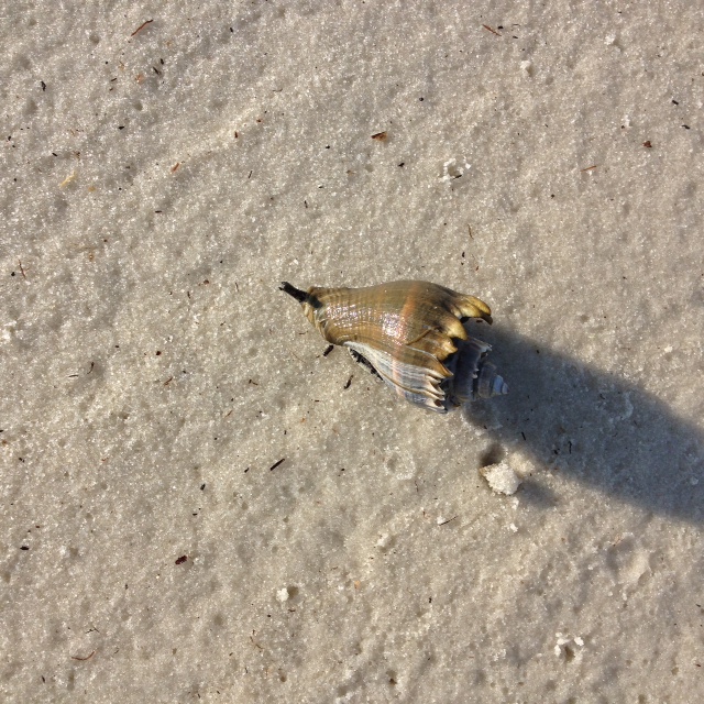
The crown conch is a frequent visitor to the creeks. This predatory snail moves slowly across the sand and mud seeking other mollusks to feed on. Often you will find their shells not inhabited by them but rather the striped hermit crab, a scavenger in this world.
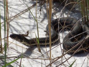
The nonvenomous Gulf Salt marsh Snake.
Photo: Molly O’Connor
Many fear the marsh due to its reptile community. Over the years of leading hikes here I have heard “are there any snakes here?”. There is only one resident of the salt marsh – the Gulf salt marsh snake. This is a nonvenomous member of the watersnake group known as Neroidia and are more nocturnal in habit. That said, the venomous cottonmouth has been seen here. They are most often seen on one of the high sandy banks, coiled and waiting for potential prey to swim by.
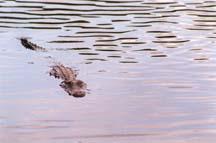
Alligator
Photo: Molly O’Connor
Alligators will venture into salt marshes, but I have only seen few in my years of exploring them in the Pensacola area. They tend to be afraid of people and want to avoid us. Once I saw one in a sandy area before I entered the marsh. It was pointing left with one foot off the ground and not moving – it was frozen in space. I had learned that animals tend to go through what I call the “3 Fs” when they detect a predator. Freeze – Flight – Fight. This one was at F1 – freeze. It thought I was a predator and just as well. If I tried to approach it, theoretically it would have moved to F2 – flight, and would have made a hasty escape. But I chose not to test that.
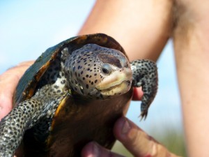
Mississippi Diamondback Terrapin (photo: Molly O’Connor)
There is a resident turtle here known as the diamondback terrapin. However, it is very elusive and difficult to find. It is the only resident brackish water turtle in North America. Though I have seen terrapins in the water, and more rarely on the beach, I do find evidence of their presence by tracks on the beach and nests that have been predated by raccoons. I did once see one basking on a log.
Smooth cordgrass
Photo: FDEP
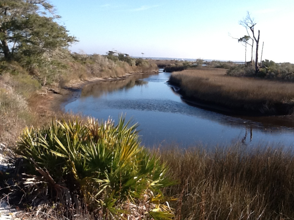
If you follow the creek, you will eventually reach open water. Here the marsh converts from a sea of black needlerush to a zone of shorter, greener, more flexible smooth cordgrass. The cordgrass is home to many of the creatures we have mentioned. Killifish, crabs, and snails are abundant. The silt birds frequently this zone hunting for their prey, and you might find additional clams and snails. You might find more open water species as well, like gulls, sand pipers and plovers, and maybe a horseshoe crab.
Though the road is tough, the experience is unique and worth the trip. Many prefer to enter the marsh using a known trail or a paddle craft in the creek. There is a lot less needlerush to poke and mud to sink in doing it this way. However you visit, it is an amazing place. The land of the wet and muddy.
by Rick O'Connor | Feb 3, 2022
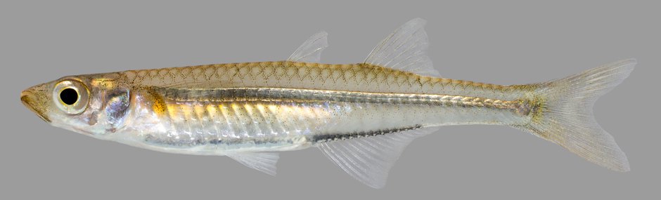
Based on our seine surveys along the beaches of most estuaries in the Florida panhandle, this is one of the most abundant fish in our bays. No matter the time of year, or the location, estuarine seining usually includes numerous individuals of this group. It is very apparent the importance they play in the food web of our local bays.
The silverside, or “glass” minnow.
Photo: U.S. Geological Survey
Those visiting and recreating in our waters probably are not aware of the numerous individuals of this fish schooling all around them. They are almost transparent and are often called “glass minnows” because of this. So, you do not really see them – even if you are snorkeling. But take a small hand net or a seine net and you will quickly discover they are there – and a lot of them.
They are small three-inch fish that are long, and tube shaped with forked (lunate) tails. Their bodies have a slight yellow-green appearance on the dorsal side, but much is a whiteish in color or transparent all together. They do have a broad silver stripe that runs laterally along their body and is where they get their common name “silversides”. Anchovies also have this “silverside” and are found in the same locations but differ from the silversides in that they have a more “shark looking snout” and only one dorsal fin, compared to the two dorsal fins found on the silversides.
It is apparent this whiteish, transparent color and silver stripe are effective in avoiding predation. Again, you and I do not see them while we are snorkeling. But is also apparent that many are consumed due to the large number you find in their schools. I have found from my seining surveys this fish is often collected on days when no other species are. The heat of summer, the cool of winter, during and after storms, high humidity, it does not matter – I always captured them. I have captured them over sandy beaches, over seagrasses, near jetties, and in the muck and mire of salt marshes. They are literally everywhere. I also capture them more frequently than I do anchovies, suggesting their importance to the health of the estuarine food web. It is one of the first fish my students learned to identify because of how frequently we caught them.
In the northern Gulf, there are two species found in local estuaries – the rough silverside and the tidewater silverside. Hoese and Moore1 do report a third species similar to the tidewater silverside that is more tolerant of saltwater.
The Rough Silverside (Membras martinica) is called so because their body scales are serrated and are “rough to the touch”. This is when you slide your fingers from the back towards the head, your fingers will feel the serrations and it is rough to the touch.
The Tidewater Silverside (Menidia beryllina) is smooth to the touch because their scales lack serrations. Other than that, these two fish look very similar. Tidewater silversides seem to be restricted to the shorelines and do not venture to the extended grassbeds off the beach. The third species mentioned M. peninsulae, is reported to prefer salinities at and above 19 ppt, where the tidewater prefers lower salinities. There is little else mentioned to distinguish these two, but I have seen both names reported in the scientific literature from researchers sampling our bay.
Both species of silversides have a large biogeographic distribution. Ranging from the colder waters of New York, all along the eastern seaboard, and the entire Gulf of Mexico.
You may not see them often, but know they are an important part of the estuarine ecology.
Reference
Hoese, H.D., Moore, R. H. 1977. Fishes of the Gulf of Mexico; Texas, Louisiana, and Adjacent Waters. Texas A&M Press, College Station TX. Pp. 327.
by Rick O'Connor | Jan 27, 2022
Members of the family Poeciliidae are what many call “livebearers”. Live bearing meaning they do lay eggs as most fish do, but rather give birth to live young. But this is not to be confused with live-bearing you find in mammals – which is different.
Most fish lay eggs. The females and males typically have a courtship ritual that ends with the female’s eggs (roe) being laid on some substrate, or released into the water column, and the male’s sperm (milt) are released over them. Once fertilized the gelatinous covered eggs begin to develop.
Everything the developing young need to survive is provide within the egg. The embryo is suspended in a semi-gelatinous fluid called the amnion. Oxygen and carbon dioxide gas exchange occurs through this amnion and through the gelatinous covering of the egg itself. Food is provided in the form of yolk, which is found in a sac attached to the embryo. There is a second sac, the allantois, where waste is deposited. When the yolk is low and the allantois full – it is time to hatch. This usually occurs in just a few days and often the baby fish (fry) are born with the yolk sac still attached. Parental care is rare, they are usually on their own.
With “livebearers” in the family Poecillidae it is different.
The males have a modified anal fin called a gonopodium. They fertilize the roe not externally but rather internally – more like mammals. The fertilized eggs develop the same as those of other fish. There is a yolk sac and allantois, and the embryo is covered in amnion within the gelatinous egg covering. But these eggs are held WITHIN the female, not laid on the substrate or released into the water column. When they hatch the live fry swim from the mother into the bright new world – hence the term “livebearer”.
There are advantages to this method. The eggs are protected inside the mother, and she obviously provides parental care to her offspring. However, this does make her much slower and an easier target for predators. There is some give and take.
This differs from the “live-bearing” of most mammals in that there is still an egg. Mammals do still have a yolk sac but feeding and removing waste is done THROUGH THE MOTHER. Meaning the embryo is attached to the mother via an umbilical cord where the mother provides food and removes waste trough her placenta. There is no classic egg in this case. I say most mammals because there are two who live in Australia that still do lay eggs – the platypus and the spiny anteater, and the marsupials (kangaroos and opossums) are a little different as well – but marsupials do no lay eggs.
Biologists have terms for these. Oviparous are vertebrates that lay eggs – such as fish, frogs, turtles, and birds. Ovoviviparous are vertebrates that produce eggs but keep them within the mother where they hatch – such as some sharks, some snakes, and the live bearing fish we are talking about here. Then there are the viviparous vertebrates that do not have an egg but rather the embryo is attached, and fed by, the mother herself – like most mammals.
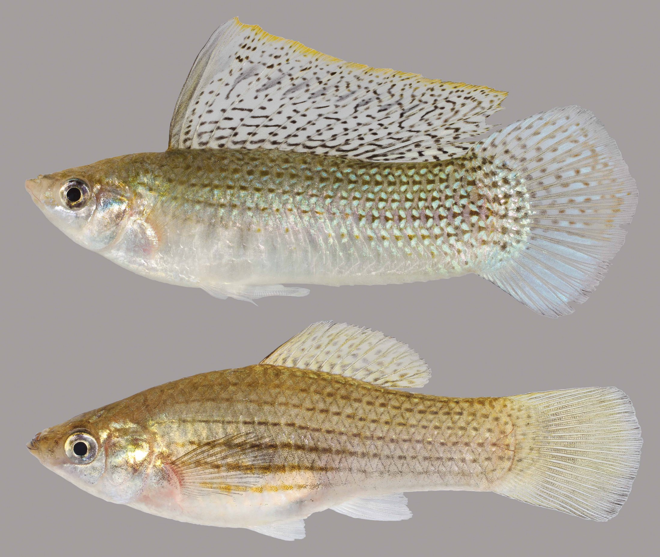
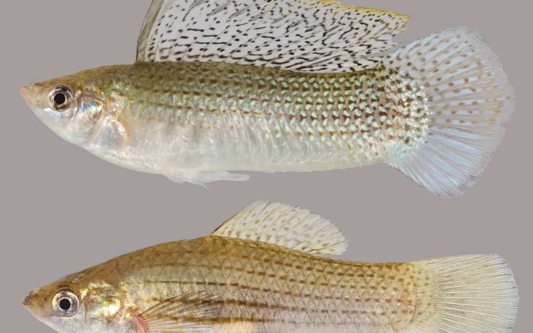
Sailfin Molly. The male is the fish above with the large “sailfin”. Note the gonopodium on his ventral side.
Photo: University of Florida
The livebearers of the family Poeciliidae are ovoviviparous. They are primarily small freshwater fish that are very popular in the aquarium trade. But there are two species that can tolerate saltwater and enter the estuaries of the northern Gulf of Mexico: the sailfin molly and the mosquitofish.
The Sailfin Molly (Poecilia latipinna) is the same fish sold in aquarium stores as the black molly. The black phase is quite common in freshwater habitats, but in the estuarine marshes the fish is more of a gray color with lateral stripes that is made up of a series of dots. They are short-stout bodied fish and the males possess the large sail-like dorsal fin from which the species gets its common name. The females resemble the males albeit no large sailfin and most found are usually round and full of developing eggs. They are very common in local salt marshes and often found in isolated pools within these habitats. The biogeographic range of this species is restricted to the southern United States, reported from South Carolina throughout the Gulf of Mexico. One would guess temperature may be a barrier to their dispersal further north along the Atlantic seaboard.
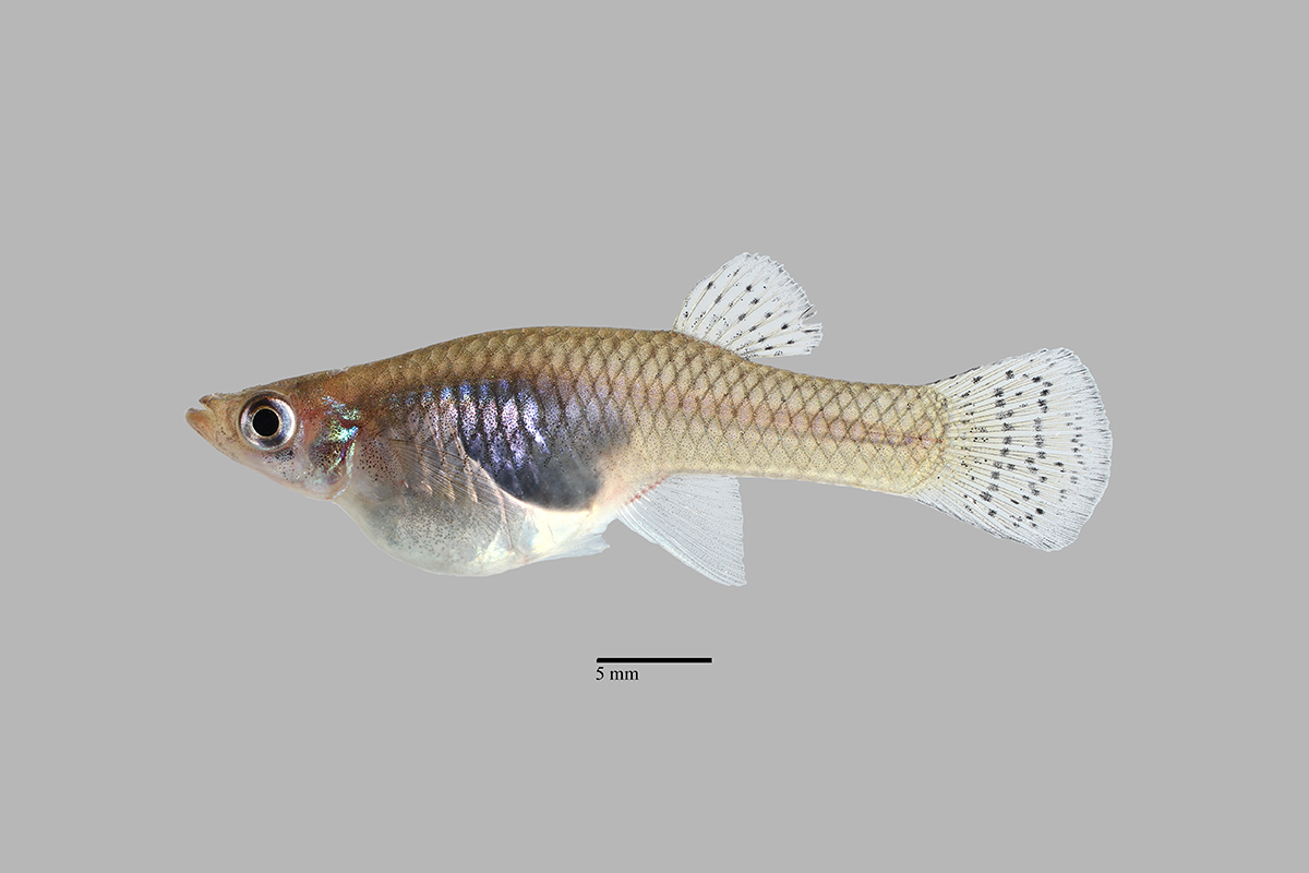
The mosquitofish.
Photo: University of Florida
The Mosquitofish (Gambusia affinis) is familiar to many people whether they know it or not. Those who know the fish know they are famous for the habit of consuming mosquito larva and some, including our county mosquito control unit, use them to control these unwanted flying insects. For those who may they are not familiar with it, this is the fish frequently seen in roadside ditches, ephemeral ponds that show up after rainstorms, retention ponds, and other scattered bodies of freshwater within the community. Most who see them call them “minnows”. There is always the question as to “where did they come from?” You have a vacant lot – it rains one day – these small fish show up – where did they come from? The same can be said for community retention ponds. The county comes in a digs a hole – it rains one day, and the retention pond fills – and there are fish in it. One explanation to their source is the movement of fish by wading birds, where the fish incidentally become attached to their feet. Again, they are often released intentionally to help control local mosquito populations. This fish is found in our coastal estuaries but does not seem to like saltwater as well as the sailfin molly. It is found in cooler water ranging throughout the Gulf and as far north as New Jersey.
Both of these fish make excellent aquarium pets, and the sailfin molly in particular can be beautiful to watch.
Reference
Hoese, H.D., Moore, R.H. 1977. Fishes of the Gulf of Mexico; Texas, Louisiana, and Adjacent Waters. Texas A&M Press, College Station TX. Pp. 327.
by Chris Verlinde | Nov 19, 2021
Photo: Chris Verlinde
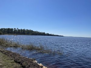
Photo: Chris Verlinde
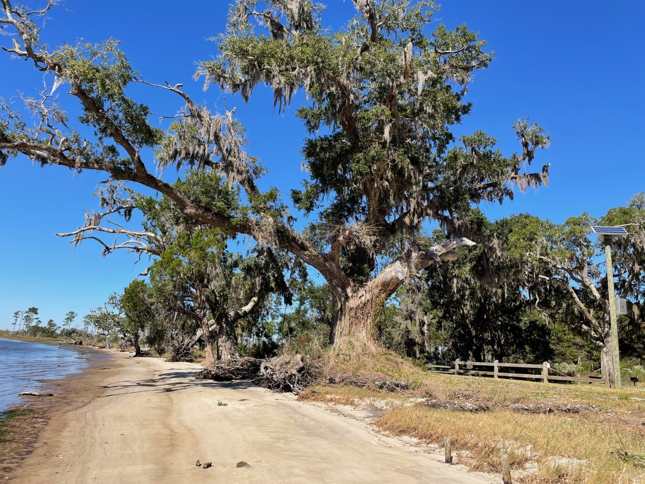
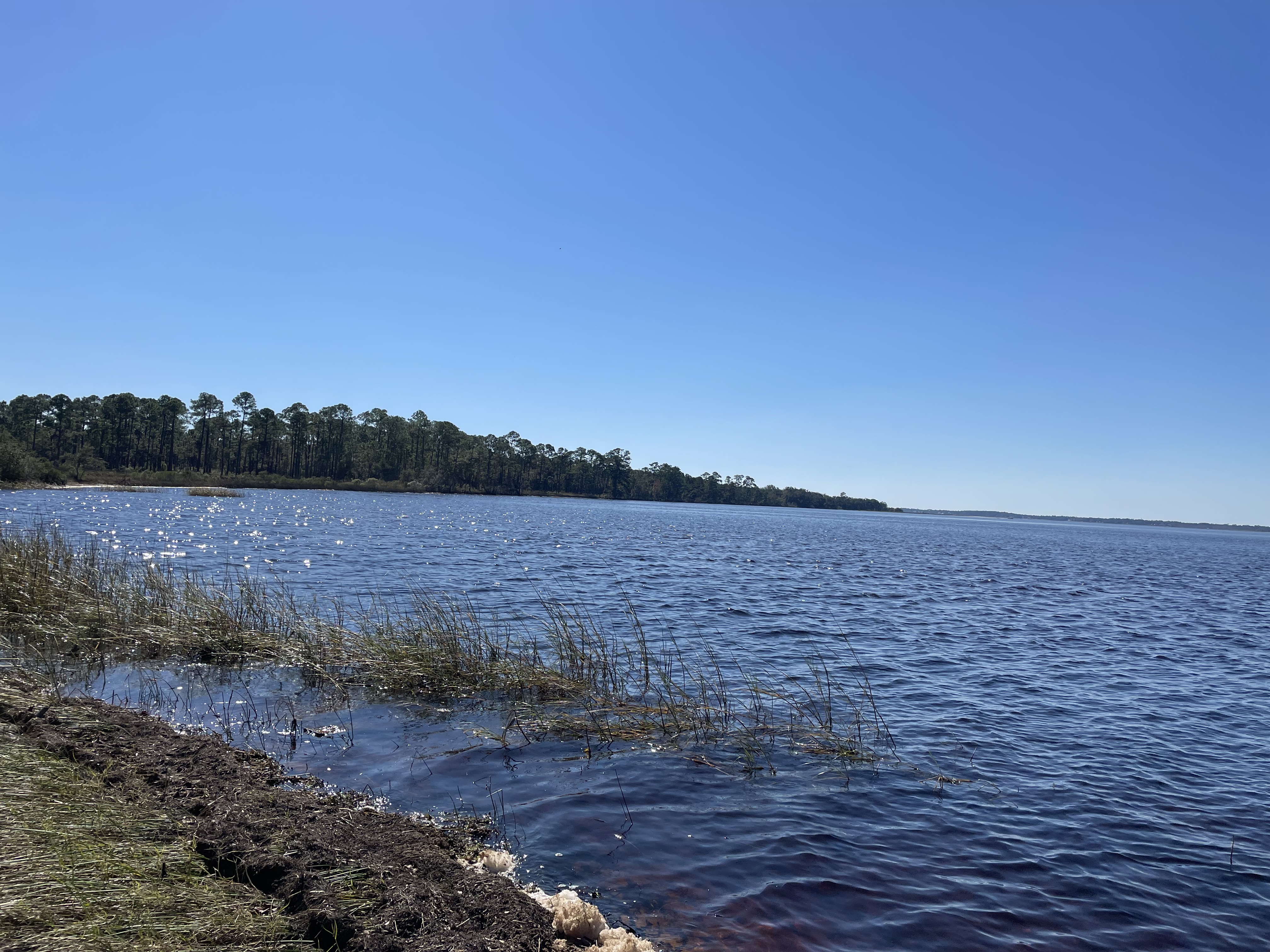
The diversity and natural beauty of the Escribano Point Wildlife Management area is breathtaking. These six square miles of conservation lands provides many types of outdoor recreation including: birdwatching, kayaking, camping, swimming, fishing and hiking. The bays, estuaries, river swamps and other coastal habitats are managed to preserve native plants and animals. Visit Escribano Point Wildlife Management Area (WMA) soon and discover this piece of old Florida.
The Escribano Point WMA is part of state-owned conservation lands that provide habitat for rare plants and animals and promote water quality in Blackwater Bay, East Bay and the Yellow River. The diverse habitats found in Escribano Point WMA provide home to many types of wildlife including, deer, turkey, Florida Black Bears, birds, reptiles amphibians and fish.
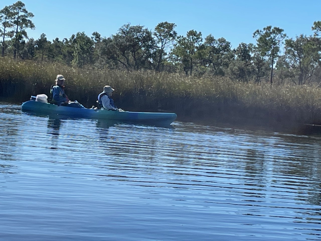
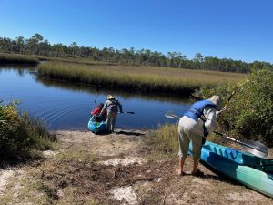 As part of the Florida Master Naturalist Program’s 20th Anniversary, a small but mighty group hit the water just as the air temperature broke 60 degrees on Saturday. We kayaked up Fundy Bayou and out to Fundy Cove located along the southeast side of Blackwater Bay in Santa Rosa County, Fl.
We traveled through freshwater and saltwater marshes, along scrubby flat woods, beach and mesic hammock habitats. Ospreys, a kingfisher, and red-headed woodpecker entertained the group. The air temperature warmed as we paddled. When we arrived at the junction of Fundy Creek and Blackwater Bay, Blackwater Bay was rough. We paddled to the campground for lunch and enjoyed the peaceful beauty around us.
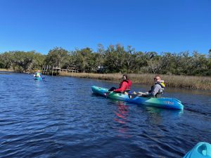
Thanks to Kayak Dave, one member of the group checked an action on her bucket list to paddle again.
Escribano Point WMA is a treasure located in Santa Rosa County, FL., approximately 20 south of Milton, FL . Take some and visit for a day or two, there are 2 campgrounds located at this WMA. Enjoy!
by Rick O'Connor | Oct 21, 2021
Catfish…
There are a lot of fish found along the Florida panhandle that many are not aware of, but catfish are not one of them. Whether a saltwater angler who captures one of those slimy hardhead catfish to a lover of freshwater fried catfish – this is a creature most have encountered and are well aware of.
Growing up fishing along the Gulf of Mexico, the “catfish” was one of our nemesis. Slinging your cut-bait out on a line, if you were fishing near the bottom, you were likely to catch one of these. Reeling in a slimy barb-invested creature, they would swallow your bait well beyond the lip of their mouths and it would begin a long ordeal on how to de-hooked this bottom feeder that was too greasy to eat. Many surf fishermen would toss their bodies up on the beach with the idea that removing it would somehow reduce their population. Obviously, that plan did not work but ghost crabs will drag their carcasses over to their burrows where they would consume them and leave the head skull that gives this species of catfish it’s common name “hardhead” catfish, or “steelhead” catfish. This hard skull has bones whose shape remind you of Jesus being crucified and was sold in novelty stores as the “crucifix fish”.
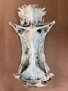
The bones in the skull of the hardhead catfish resemble the crucifixion of Christ and are sold as “crucifix fish”.
Photo: Rick O’Connor
When I attended college in southeast Alabama a group of friends wanted to go out for fried catfish. I, knowing the above about saltwater catfish, replied “why?… no…, you don’t eat catfish”. They assured me you did and so off we went to a local restaurant who sold them. Fried catfish quickly became one of my favorites. A fried catfish sandwich with slaw and beans is something I always look forward to. At that time, I was not aware of the freshwater catfish, nor the catfish farms that produce much of the fish for my sandwiches. I now have also become aware of the method of catching freshwater catfish called “noodling” – which is not something I plan to take up.
Worldwide, there are 36 families and about 3000 species of what are called catfish1. Most are bottom feeders with flatten heads to burrow through the substrate gulping their prey instead of biting it. Most possess “whiskers” – called barbels, which are appendages that can detect chemicals in the environment (smell or taste) helping them to detect prey that is buried or hard to find in murky waters. These barbels resemble whiskers and give them their common name “catfish”.
The serrated spines and large barbels of the sea catfish. Image: Louisiana Sea Grant
They lack scales, giving them the slimy feel when removing them from your hook, and also have a reduced swim bladder causing them to sink in the water – thus they spend much of their time on the bottom. The mucous of their skin helps in absorbing dissolved oxygen through the skin allowing them to live in water where dissolved oxygen may be too low for other types of fish1.
They are also famous for their serrated spines. Usually found on the dorsal and pectoral fins, these spines can be quite painful if stepped on, or handled incorrectly. Some species can produce a venom introduced when these spines penetrate a potential predator which have put some folks in the hospital1.
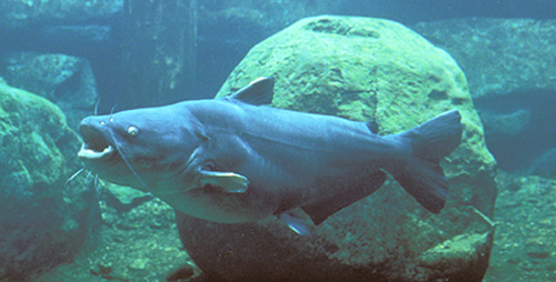
The size range of catfish is large; from about five inches to almost six feet. In North America, the largest captured was a blue catfish (Ictalurus furcatus) at 130 pounds. The largest flathead catfish (Pylodictis olivaris) was 123 pounds. But the monster of this group is the Mekong catfish of southeast Asia weighing in at over 600 pounds.
The Florida Fish and Wildlife Conservation Commission lists six species of catfish in the Florida panhandle area. However, they are focusing on species that people like to catch2.
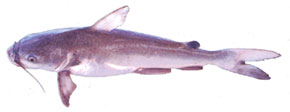
The Blue Catfish
Photo: University of Florida
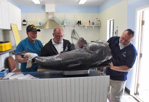
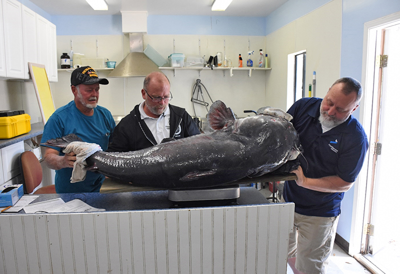
This large blue catfish is being weighed by FWC researchers. Photo: Florida Fish and Wildlife Conservation Commission
The Channel Catfish (Ictalurus punctatus) is found throughout Florida and also in many river systems of the eastern United States. It has found few barriers dispersing through these river systems. They are not typically bottom feeders having a more carnivorous diet.
The Flathead Catfish (Pylodictis olivaris) are relatively new to Florida and are currently reported in the Escambia and Apalachicola rivers. They prefer these slow-moving alluvial rivers.
The Blue Catfish (Ictalurus furcatus) were first reported in the Escambia and Yellow Rivers, there are now records of them in the Apalachicola. These catfish prefer faster moving rivers with sand/gravel bottoms and seem to concentrate towards the lower ends of major tributaries.
The White Catfish (Amerius catus) is found in rivers and streams statewide, and even in some brackish systems.
The Yellow Bullhead (Amerius natalis) are most often found in slow moving heavily vegetated systems like ponds, lakes, and reservoirs. It is reported to be more tolerant of poor water conditions.
The Brown Bullhead (Amerius nebulosus) live in similar conditions to the Yellow Bullhead.
The dispersal of freshwater catfish is interesting. How do they get from the Escambia to the Apalachicola Rivers without swimming into the Gulf and up new rivers? The answer most probably comes from small tributaries further upstream that can, eventually, connect them to a new river system. Scientists know that eggs deposited on the bottom can be moved by birds who feed in each of the systems carrying the eggs with them as they do. And you cannot rule out movement by humans, whether intentionally or accidentally.
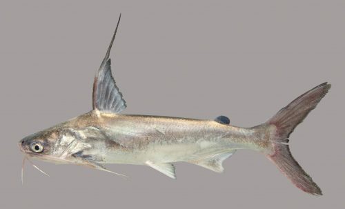
On the saltwater side of things, there are two species – though the blue catfish has been reported in the upper portions of some estuaries in low salinities in the western Gulf of Mexico. The marine species are the hardhead catfish (Arius felis), sometimes known as the “steelhead” or the “sea catfish” – and the gafftop (Bagre marinus), also known as the gafftopsail catfish3.
The hardhead catfish is very familiar with anglers along the Gulf coast. This is the one I was referring to at the beginning of this article. It is considered inedible and a nuisance by most. They are common in estuaries and the shallow portions of the open sea from Massachusetts to Mexico. They are reported to have an average length of two feet, though most I have captured are smaller. Like many catfish, they possess serrated spines on their dorsal and pectoral fins. Their distribution seems to be limited by salinity.
The gafftop is also reported to have a mean length of two feet, and most that I have captured are closer to that. At one point in time, we were longlining for juvenile sharks in Pensacola Bay and caught numerous of these thinking they were small bull sharks as we pulled the lines in, until we saw the long barbels extending from them. I remember this being a very slimy fish, covered with mucous, and not fun to take off the hooks. It is reported to have good food value, though I have not eaten one. They differ from the hardheads mainly in their extended rays from the dorsal and pectoral fins. The habitat and range are similar to hardheads, though they have been reported as far south as Panama.
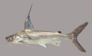
The extended rays of the gafftop catfish.
Photo: University of Florida.
The diversity of freshwater catfish in the U.S. goes beyond what has been reported here. This group has been found on most continents and have been very successful. There are plenty of local catfish farms where you can try your luck, have them cleaned, and enjoy a good meal.
References
1 Catfish. Wikipedia. https://en.wikipedia.org/wiki/Catfish.
2 Catfish. Florida Fish and Wildlife Conservation Commission. https://myfwc.com/fishing/freshwater/sites-forecasts/catfish/.
3 Hoese, H.D., R.H. Moore. 1977. Fishes of the Gulf of Mexico; Texas, Louisiana, and Adjacent Waters. Texas A&M Press. College Station TX. Pp. 327.