I am going to end 2023 with an article on a project I hope to conduct in 2024. It will focus on insular cottonmouths and will focus on the western panhandle, though those in the eastern panhandle might be interested and could help. For obvious reasons, conducting this project as a citizen science one is not the best idea. Cottonmouths are venomous snakes and can be dangerous, but there could be opportunities where citizens could be of help (a road killed snake for example).
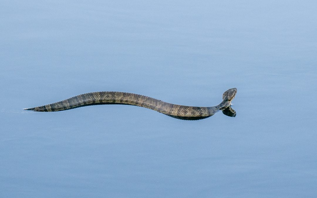
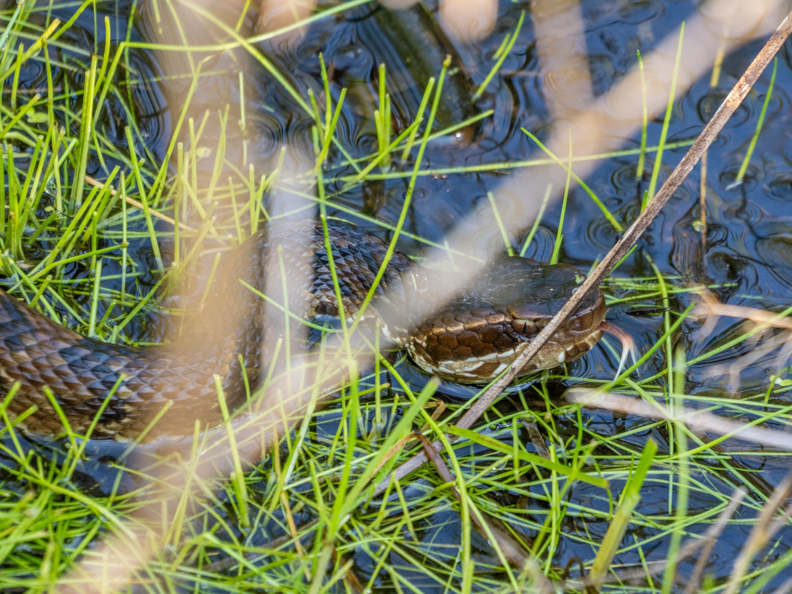
The cottonmouth is one of the more commonly encountered snakes in the western panhandle.
Photo: Bob Jackson
The story is quite interesting. Most books and articles on cottonmouths indicate they inhabit freshwater habitats where water flow is slower. Though found in the back waters of rivers, they are not as common within the rivers themselves. Golf courses, ponds, lakes, and reservoirs are other places they frequent. There are records of them on coastal barrier islands and in the upper Florida Keys. Swimming across saltwater is not surprising but existing on a xeric, sandy barrier island would not fit the typical habitat of this snake. Most of the accounts on barrier islands are in the Big Bend region and many know that there are freshwater habitats on some of these islands. If a cottonmouth could reach the island, there could be a suitable habitat for them. But you could argue that these habitats are not large enough to support a large population. The carry capacity of a population is determined by the amount of space and resources available. Cottonmouths are opportunistic feeders – so, finding food would not be a big issue – but with limited acreage of needed freshwater the carrying capacity would be lower, and populations of cottonmouths lower as well. Then there is Seahorse Key.
Seahorse Key
Photo: Courtesy of flicker
Seahorse Key is 3 miles southwest of Cedar Key and can only be accessed by boat. It is said that the density of cottonmouths is higher there than anywhere in the state. Dr. Coleman Sheehy (University of Florida) stated they typically encountered 30 snakes while conducting beach walk surveys and they estimated about 600 cottonmouths on the island. The fact that cottonmouths were there was not surprising, but the high density – in a habitat not really suitable for such – was.
Depending on which source you use, there are up to three subspecies of cottonmouths found in the U.S. The Florida cottonmouth (Agkistrodon piscivorous conanti) is the one found on Seahorse Key, the rest of peninsula Florida, and in the panhandle as far west as Gulf County. The eastern cottonmouth (A.p. piscivorous) is found from Bay County west to Escambia County on the Florida/Alabama line, and north into the coastal plains of Alabama and Georgia. The western cottonmouth (A.p. leucostoma) is found from the Alabama/Florida line west to Texas and north to Arkansas. Dr. Harvey Lillywhite (University of Florida), and others, were curious as to whether the Florida cottonmouth was adapting to saltwater. An interesting question and, again, how these snakes are surviving and thriving on Seahorse Key is a part of understanding this story. In recent years there has been a push to declare the Florida cottonmouth its own species – Agkistrodon conanti. The Florida Museum of Natural History’s history article1 on cottonmouths list as such. Dr. Steve Johnson’s article2 lists the snake as Agkistrodon piscivorous and leaves it there, not dividing into subspecies. Many current researchers agree with the identification of A. conanti for the Florida cottonmouth – the one found on the islands of the Big Bend – and the one of interest in whether it is adapting to saltwater environments. That brings me back to the project we are planning to begin in 2024 in the western panhandle.
Cottonmouths definitely exist on the barrier islands in Escambia County. We have two islands – Santa Rosa Island and Perdido Key. There are freshwater sources on both islands and suitable habitat for cottonmouths. The swim from the mainland to reach these islands is much shorter than for those at Seahorse Key. At Perdido Key a swim of 600 feet would allow a snake to reach the island – easy. The swim from Perdido Key to Santa Rosa Island is less than a mile (about 4000 feet) but the currents in Pensacola Pass are strong and the likelihood of a cottonmouth accessing Santa Rosa Island this way would be low. However, there are many locations along Santa Rosa Island where the swim would be no more than a mile from the mainland and some, in Okaloosa County, the trip could be made in about 800 feet. Island access is easy.
As the Escambia County Extension Agent, I handle the snake calls that come to our office – and there are a lot of them. In recent years there has been concern from some Perdido Key residents with the number of cottonmouths they are encountering. One of their questions was whether this was an unusually high encounter rate – Seahorse Key all over. Conducting surveys in their neighborhood in 2019 I encountered cottonmouths 70% of the time – all of them were juveniles or subadults. I recommended some landscape changes to deter the snakes from their yards and in 2020 the encounter rate dropped to about 40% of the surveys. However, it did not rain as much in 2020 and this could have affected the snakes as much, if not more, than the landscaping changes. The freshwater ponds in the neighborhood used by the snakes were small and ephemeral – they did not have water unless rainfall was present. So, we did another survey in 2021, it rained more, and encounters increased to 50% of the surveys. The landscaping may have helped some. In 2021 I also conducted surveys in the nearby state park and found no significant difference in snake encounters (50%) but the time of day for encounters was different and I did find adult snakes in the state park.
Note here… I get very few calls on cottonmouths from Santa Rosa Island. Rather their calls are about eastern diamondback rattlesnakes, which are not encountered as much on Perdido Key. The question we have on the table now is whether the cottonmouths found on Perdido Key are the Florida cottonmouth (A. conanti) – the one some believe may be adapting to saltwater conditions. According to Whit Gibbons and Mike Dorcas’s Snakes of the Southeast3 Escambia County Florida is the border between the eastern and the western cottonmouth. This same guide suggests that the Florida cottonmouth does not exist here.
So here is the project… which species/subspecies of cottonmouths exist on our barrier islands in the western Florida panhandle?
How do you tell them apart?
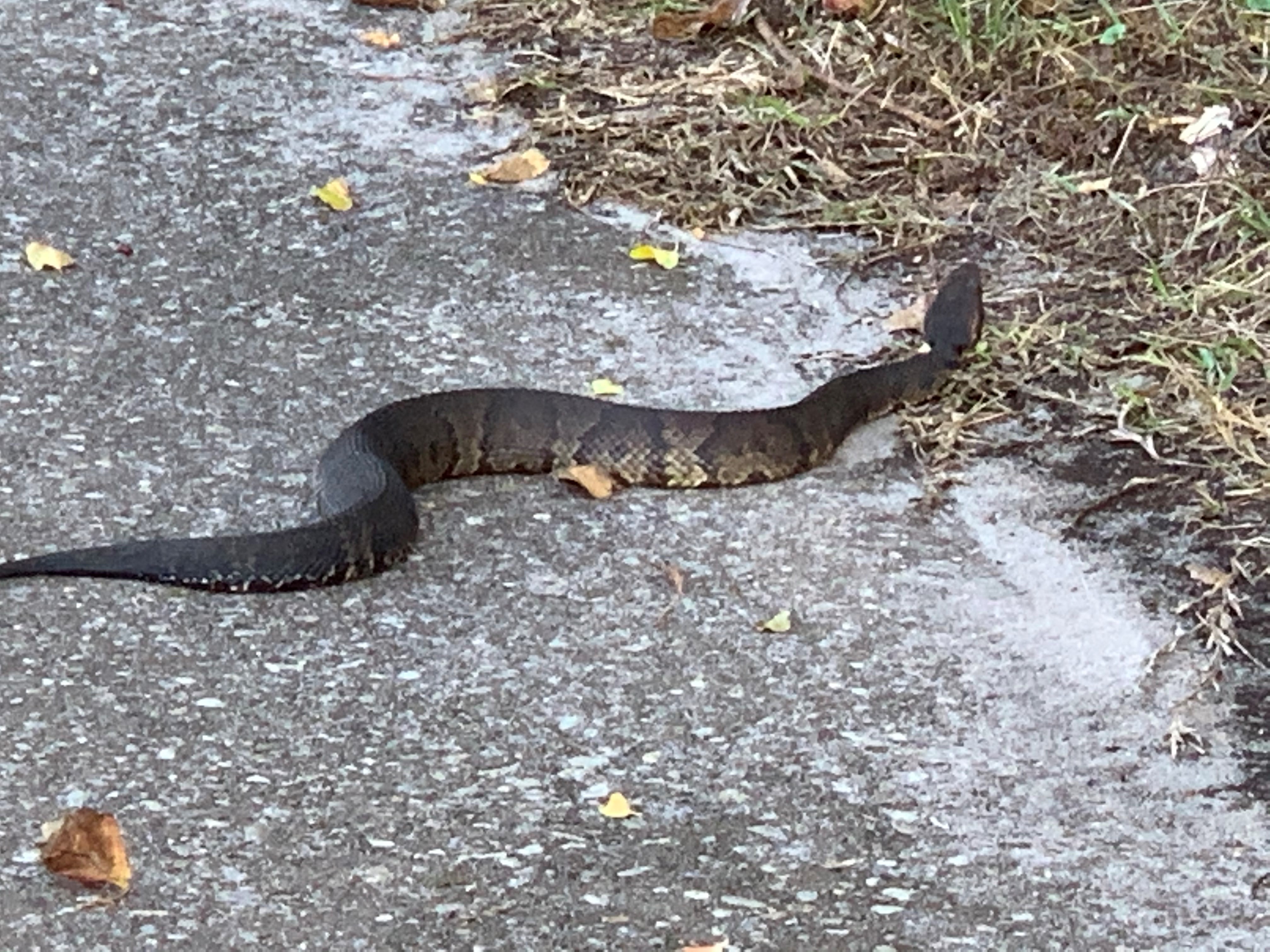
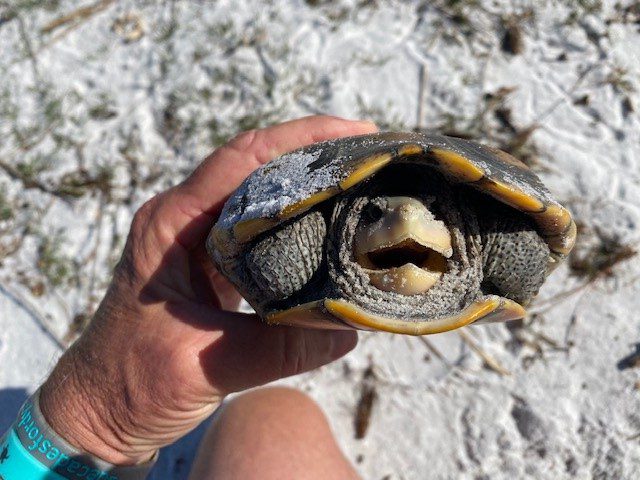
The difference between the Florida cottonmouth and the eastern/western are very minor. This makes identification in the field hard and dangerous. The Florida cottonmouth will have two distinct stripes running vertically across the front of its snout. The eastern/western cottonmouth will not have these. To determine whether these stripes exist requires getting much closer to the snake than is recommended. THIS IS A DANGEROUS SNAKE AND CLOSE ENCOUNTERS ARE NOT RECOMMENDED. However, a road killed snake can be examined using a stick at least 12” long. NOTE: SNAKES, EVEN RECENTLY KILLED, HAVE BEEN KNOWN TO BITE. DO NOT HANDLE A DEAD SNAKE UNLESS YOU ARE SURE IT IS DEAD. You may have a camera that can get a good photo of the snout FROM A SAFE DISTANCE (cottonmouths like to rest with their head tilted upwards at a good angle for such a photo).
You can see the light vertical bands on the snout of this snake indicating it is the Florida cottonmouth.
Photo: University of Florida. Notice the light bands across the snout of this Florida Cottonmouth.
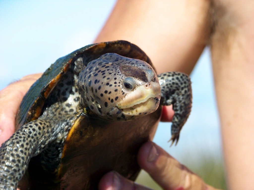
Photo: Kristen Grace. This cottonmouth has a uniform coloration across the snout – indicating that it is an eastern cottonmouth.
Photo: Ricky Stackhouse.
We are planning a program on this project in early April for Escambia and Santa Rosa Counties. If you are in Okaloosa, Walton, or Bay counties and would like the program presented there – let me know.
Based on an annual evaluation recent competed, and feedback from my advisory committee, water quality issues are the number one natural resource concern for those who follow my extension programs. It makes sense. Poor water quality can negatively impact businesses who depend on clean water, waterfront property values, tourism, and the untold numbers of Florida panhandle residents who recreate in our estuaries and bays. The water quality issues I provided education on in 2023 are focused on the Pensacola Bay system, but these issues are probably similar across the Florida panhandle. Those issues include excessive nutrients, fecal bacteria (and other microbes), and salinity. We also wrote one article on the increasing water temperatures occurring in the summer.
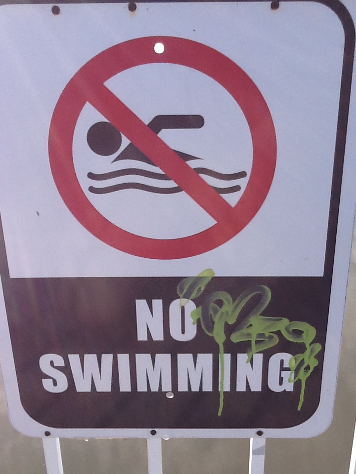
Let’s begin with the fecal bacteria issue. In the Pensacola Bay area, it may be our number one concern. The Florida Department of Health posts local health advisories each week and some bodies of water are issued advisories for over 30% of the samples that are taken. Frequently Bayou Chico (in Pensacola Bay) is issued an advisory over 50% of the samples taken. However, in 2023 (in the Pensacola area) the number of advisories never exceeded 30% for any body of water. Seven of the 13 swimming beaches monitored did not post an advisory at all. This is one of the best years we have had since I began monitoring them.
Closed due to bacteria.
Photo: Rick O’Connor
In 2023 eight of the 13 water quality articles I wrote were on this subject. Three additional articles were posted by other extension agents on our panhandle e-newsletter team. But my annual follow up survey showed very few adopted best management practices (BMPs) they could adopt to help reduce fecal bacteria in area waterways. The reduction was more likely due to the effort by our local city and county to improve sewage infrastructure and the fact that we were in a drought for much of the year – there is a positive correlation between rainfall and the number of advisories issued for local waterways. Despite the fact that few readers adopted BMPs this year, and advisories declined – at least in Pensacola – we still believe adopting these practices would help reduce this issue. We will be developing a fact sheet in 2024 to help homeowners better understand these practices and help reduce health advisories.
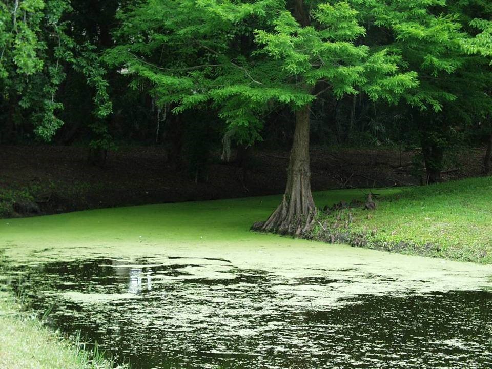
Another local water quality issue that is high on everyone’s mind is excessive nutrients. This is actually one of the largest concerns nationwide. Excessive nutrients can lead to algal blooms, which can lead to harmful algal blooms or low dissolved oxygen, which can lead to fish kills. In the Pensacola Bay area large fish kills have not occurred in decades, but nutrient monitoring continues. The UF IFAS Lakewatch program trains local volunteers how to collect water samples and measure water clarity. The samples are analyzed in the Lakewatch lab on campus in Gainesville and the results sent back to the community. In the Pensacola Bay area, we are currently monitoring six bodies of water (three stations in each). Nutrients values are stable, or improving, in four of the six locations. They are slightly elevated in Bayou Chico and one station in Bayou Texar is quite high in total nitrogen. Despite the values at those stations, no algal blooms or fish kills occurred in either Bayou Chico or Bayou Texar (or anywhere else in the Pensacola Bay area) in 2023. There are numerous sources for nutrients in local waterways and many behavior practices businesses and residents can adopt to help reduce nutrient pollution. In 2023 I wrote only one article on this topic but plan to provide more education in 2024.
A body of water receiving excess nutrients can turn green and unhealthy from too much algae growth. Photo Credit: UF IFAS FFL program
A third topic that caught attention this year was the warm water that occurred this past summer. Extreme water temperatures can decrease dissolved oxygen below levels where most estuarine creatures can survive. Many creatures have a thermal tolerance that could have been exceeded this year. Industries like oyster farming are negatively impacted. Many varieties of harmful algae thrive in warm conditions. My extension program does not conduct any citizen science project that monitors water temperatures within the bay. Working with our local oyster farmers, the local estuary program is beginning to monitor such, and more folks are taking notice of the issue. Extension agents posted four articles on the subject this year. Whether the summers of high-water temperatures will become more common is unknown. The first thought on cause is climate, and management practices on how to reduce climate change are well documented. It is also understood that adopting such practices will not reduce intense warm summers immediately but should still be adopted for the long term. It is also possible that the current extreme heat summers are cyclic, and things will cool down (relatively) in coming seasons. 2023 was an El Nino year. Monitoring and time will tell how this issue will play out. That said, it would be smart to consider behavior changing practices for the future. Extension will post more information on this topic in 2024.
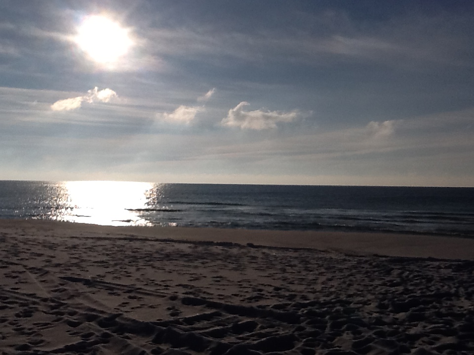
The Gulf of Mexico at sunrise. Photo: Rick O’Connor
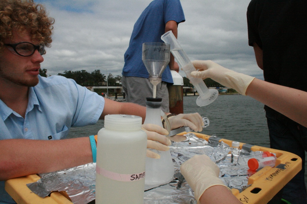
One issue of concern personally was the impact of increased rain on the salinity of our bay. There has been a noticeable (and measured) increase in rainfall in recent years. For Pensacola, we historically received about 60 inches of rain each year – one of the wetter locations in the southeast. But over the last decade this has increased to 70 inches per year. Along with the increase in rainfall, there has been a noticeable increase in development. This increase in development reduces the surface area of land that would naturally absorb this rainwater and recharge the much-needed aquifer. Instead, this rainwater is diverted from the new developments to stormwater management projects – some that work well, others that do not. The question I have on the table is whether this increase in stormwater run-off is decreasing the salinity of area waterways? And, if so, is it to a level where local marine species (and those we are trying to restore) will be negatively affected? To answer this question, I have trained volunteers to monitor salinity at locations around the bay area. They are monitoring once a week, at the surface, near the shoreline. Though the sampling location is not ideal, it is what our volunteers are able to do. I had determined that the data would be collected until each volunteer reached 100 readings (about two years). As of the end of 2023, five of the 13 monitoring locations (38%) have reached that 100-reading mark. We know that the turtle grass and bay scallops, both species we would like to see increase in our bay, require salinity be at (or above) 20 parts per thousand. Though there are many more weeks of monitoring needed to reach our mark, current data suggests that salinities have not altered from data posted decades ago and are high enough for these species to return in areas where they historically existed.
I will finish this review with a comment that articles were posted in 2023 on issues I am not directly involved with, but know they are a concern in many areas of the panhandle. Private drinking wells being one. There were several articles posted by Dr. Andrea Albertin addressing this issue in 2023 and for those interested in this topic I recommend they read these, and/or reach out to her directly (albertin@ufl.edu.). There was also an article that focused on water quality improvement BMPs in general posted by Khadejah Scott (Wakulla County) that may be of interest. https://nwdistrict.ifas.ufl.edu/nat/2023/10/05/simple-steps-to-improve-local-water-quality/.
With this being a large issue with many in the Florida panhandle, extension will continue to publish articles and have programs on this topic. Reach out to your local county extension office for more information.
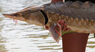
Mark Twain once said – “Everyone talks about the weather, but no one does anything about it.” A similar statement could be made about the Gulf Sturgeon – “Everyone talks about the Gulf sturgeon, but on one has actually seen one.” Those along the coast who have a dock, pier, seawall, or have placed a marina, artificial reef, or oyster farm over state submerged lands, have certainly heard about this fish. It is a portion of the permit in each case. Heck, maybe they have seen one. But it is a fish that many know about but seems elusive to encounter.
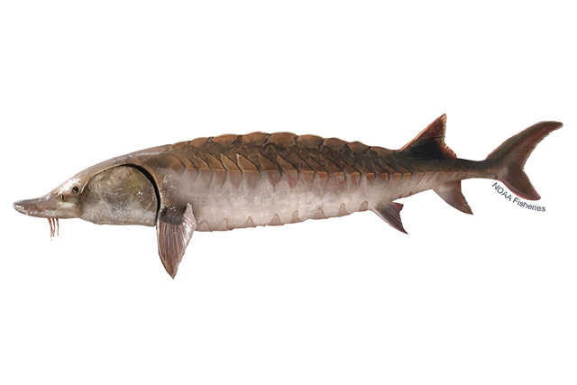
Left-facing Gulf sturgeon illustration. Lighter brown than Atlantic sturgeon. Credit: Jack Hornady for NOAA Fisheries.
The Gulf sturgeon (Acipenser oxyrinchis desotoi) is one of 27 species of sturgeon found worldwide. It is a subspecies of the Atlantic sturgeon. These are ancient fish, and they look it. Sturgeons are large, reaching lengths of up to eight feet and 300 pounds. They have armored looking scutes embedded into their skin, giving them a “dinosaur” appearance. They have a heterocercal caudal fin that resembles a shark. And like sharks, they have a cartilaginous skeleton and a spiral valve within their digestive tract. Their head has a pointed snout with whisker-like structures called barbels, which are used for detecting food buried in the sand, and they lack teeth. They have been swimming in our oceans since the era of the dinosaurs, about 225 million years.
Sturgeons are anadromous fish, meaning they (like salmon) spend their adult lives in salt water, traveling miles upriver to their location of their birth to lay eggs. The Gulf sturgeon spends the colder months (November through February) inhabiting our bays and the nearshore Gulf of Mexico in waters less than 100 feet. Now is the time when you may encounter one near the coast. Because they eat very little while in the river systems, they gorge on benthic invertebrates during the winter. They spend most of their time over sand flats and sand bars, using their barbels to detect a variety of buried invertebrates. When sturgeon sense warmer months coming, they begin their long migrations up the inland rivers seeking the area where they were born. At this time, they leap from the water like mullet and make splashes that can be heard from a long distance. They are famous for this in the Suwannee River and have, at times, been a concern for boaters and jet skiers. Many boaters have had to go to the hospital due to collisions with leaping sturgeon.
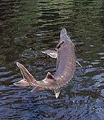
The Gulf Sturgeon.
Photo: U.S. Geological Survey
Once they reach the spawning grounds, if conditions are right – temperature, water flow, and pH – the female will lay between 250,000 – 1,000,000 eggs which will become fertilized by the smaller males. Most eggs will not survive, but for those that do, the cycle will begin again with the trek back towards the Gulf of Mexico beginning in September.
Why are they declining?
Early in the 20th century they were sought after for their meat and fertilized eggs (caviar). Most of the rivers within their range (which is between the Mississippi and Suwannee Rivers) have been damned, dredged, or both. Dams impede their ability to reach their nursery grounds and dredging can reduce the required conditions to stimulate breeding, or literally bury their eggs. Between these human activities, their numbers declined drastically. In 1991 they were listed both as a federally and state threatened species and have been protected and monitored ever since. The best population, and best chance to encounter one, is in the Suwannee River. This river has been left basically pristine and has not had the habitat altering activities of the others. Locally, they are found in the Escambia, Blackwater, and Yellow Rivers.
Winter is the time to see them in the lower parts of our bay. Maybe you will be lucky enough to encounter one.
References
The Gulf Sturgeon. Florida Fish and Wildlife Conservation Commission.
Diamondback terrapins are the only resident turtle within brackish water and estuarine systems. Their range extends from Massachusetts to Texas but, prior to 2005, their existence in the Florida panhandle was undocumented. The Panhandle Terrapin Project was developed to first determine whether terrapins exist in the panhandle (Phase I) and, if so, what is their status (Phase II and III).
The project began at the Marine Science Academy at Washington High School (in Pensacola) in 2005. Between 2005 and 2010 the team was able to verify at least one record in each of the panhandle counties. For Phase II we used what we called the “Mann Method” to determine the relative abundance of terrapins in each area. To do this we needed to conduct assessments of nesting activity in each county. In 2012 the project moved from Washington High School to Florida Sea Grant. At that time, we developed a citizen science program to conduct Phase II of this project. Effort first focused on Escambia and Santa Rosa counties, but in recent years has included Okaloosa County. Florida Sea Grant now partners with the U.S. Geological Survey (based out of Gulf County) to assist with Phase II and lead Phase III, which is estimating populations using mark-recapture methods, as well as satellite tagging to better understand movements and habitat use. The focus of Phase III has been Gulf County, but tagging has occurred in Okaloosa and Escambia counties.
Over the years we have trained 271 volunteers who have conducted thousands of hours of nesting surveys and helped obtain a better picture of the status of diamondback terrapins in the Florida panhandle. Here are the 2023 project results.
Results from 2023
We trained 67 volunteers; 35 (52%) of which participated in at least one nesting survey.
The volunteers conducted 196 surveys logging 212 hours.
During those surveys terrapins (or terrapin sign) were encountered 43 times; a Frequency of Encounter (FOE) of 22%.
Three terrapins were tagged. Two from Okaloosa and one from Escambia. All but two of the nine primary survey beaches saw nesting activity (78%). One new nesting beach was discovered.
Escambia County
Two nesting beaches. 47 surveys. 7 encounters (FOE = 15%).
The Mann Method assumes the sex ratio is 1:1 (male: female) but recent studies suggest the ratio may be as high as 5:1 (male: female). Based on these two rations the number of terrapins estimated to be using these beaches ranged from 4-36.
One terrapin (“Dollie”) was tagged. Fire ants and torpedo grass were reported on some beaches.
Santa RosaCounty
Three nesting beaches. 68 Surveys. 14 encounters (FOE = 21%).
The number of terrapins estimated to be using these beaches ranged from 6-30.
No terrapins were captured, though one was seen nesting. No invasive species were reported from the nesting beaches.
OkaloosaCounty
Four nesting beaches. 67 surveys. 21 encounters (FOE = 31%).
The number of terrapins estimated to be using these beaches ranged from 2-66.
Two terrapins were tagged (“Kennedy” and “Molly”). Phragmites were reported from all beaches.
Walton County
Walton county currently does not have a volunteer coordinator and surveys are not occurring at this time. We are working with an individual who may take the lead on this.
BayCounty
This team is just beginning and currently there are no primary beaches. The team focused on five beaches encountering terrapin nesting activity on one of them. They conducted a total of 14 surveys encountering terrapin tracks on 1 of those (FOE = 7%). The estimated number of terrapins using this beach ranged from 4-12.
Baldwin County Alabama
Due to the proximity of terrapin habitat and nesting beaches at the Alabama/Florida line, and the possibility of terrapins using habitat in both states, a team was developed in Baldwin County Alabama this year. The team began conducting Phase I surveys and encountered one deceased terrapin. No nesting beaches have been identified at this time.
Summary
The results of this year’s surveys suggest that, based on the number of nesting beaches we know of, there are anywhere from 2-66 terrapins utilizing them. Again, two of the primary beaches did not have nesting activity this year. USGS tagging studies will provide better population estimates and a better understanding of how these animals are utilizing these habitats. The current population estimate for Gulf County is a little over 1000 individuals and most are showing relatively small range of habitat utilization, although two individuals in the western panhandle moved from one county to the neighboring one.
Training for volunteers occurs in March of each year. If you are interested in participating, contact Rick O’Connor – roc1@ufl.edu.
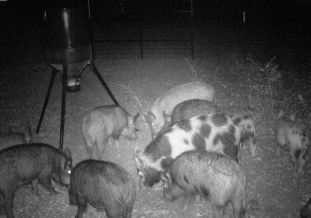
Despite efforts by public and private land managers, feral hog populations continue to rise in many areas in Florida. Feral hogs damage crop fields, lawns, wetlands, and forests. They can negatively impact native species of plants and animals. Their rooting leads to erosion and decreased water quality. Feral swine can also harbor and infect domestic swine with diseases such as African Swine Fever, foot-and-mouth disease, pseudorabies, swine brucellosis, and others.
USDA APHIS conducts feral swine monitoring for diseases to help safeguard our pork production here in the US. More than 6,000 samples are taken annually to test for diseases of concern. This monitoring effort not only keeps our domestic swine safe but also keeps humans safe from diseases that can infect us. African Swine Fever (ASF) is the main disease of concern right now for the state of Florida, especially those counties bordering the Gulf of Mexico.
ASF is a deadly disease of both feral and domestic hogs. It is not transmitted to humans so it is not a health or food safety concern. It is, however, highly contagious and would likely have a catastrophic effect on our domestic pork industry. Although it has not been found in the US, this disease has recently been detected in the Dominican Republic and Haiti.
This concern has led to a new monitoring program in Florida specifically for ASF in counties bordering the Gulf. USDA APHIS will begin trapping wild hogs in these counties in order to monitor populations for ASF. Landowners, both public and private, can benefit from this monitoring program. Professional trappers will be employed to remove wild hogs for this monitoring effort. For more information on this program, contact Buddy Welch, North Florida Assistant District Supervisor, USDA Wildlife Services, ASF Surveillance at edgar.welch@usda.gov.
Sounder of hogs in a corral trap. Photo Credit: Jennifer Bearden
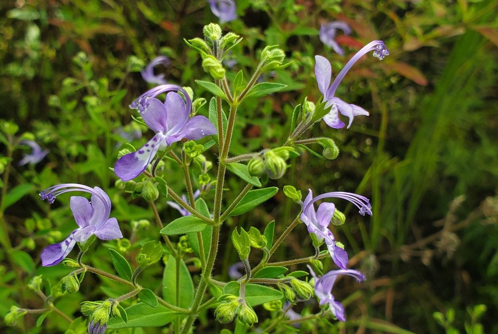
It’s no secret that fall, October specifically, is the best month for wildflower watching in the Panhandle. From the abundant vibrant yellow-gold display of various Sunflowers, Asters, and Goldenrods to the cosmopolitan bright pinks and purples of Mistflower, Blazing Star, and False Foxglove, local native landscapes light up each year around this time. However, if you’re lucky and know where to look, you can also spot two species, Azure Blue Sage (Salvia azurea) and Forked Bluecurls (Trichostema dichotomum) that sport that rarest of wildflower hues – vivid blue.
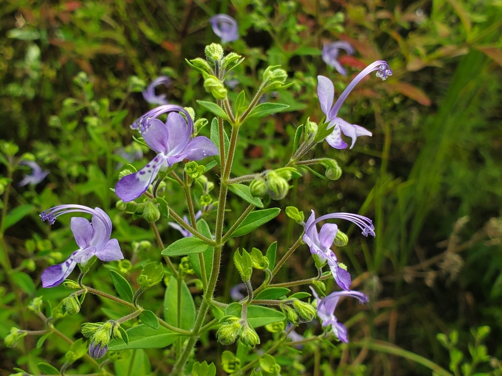
Forked Bluecurls begins its flower show in late summer, picking up steam in fall, and reaching its peak now as nights get cool and the days grow short. The species’ flowers are easily among the most unique around. Each flower has two distinct “lips” – the lower lip is white and dotted with blue specks, while the top is distinctly pure blue – with characteristically curled blue stamens rising to preside over the rest of the flower below. Though individual flowers are very small and only bloom in the morning, disappearing by afternoon, they appear by the hundreds and are very striking taken together. Various pollinators, especially bees, also find Forked Bluecurls flowers very attractive and frequent them on cool fall mornings. Though the flowers are obviously the highlight, the rest of the plant is attractive as well, growing to 3’ in height and possessing small, light-green fuzzy leaves. Forked Bluecurls, while not exceedingly common, can be found in sunny, sandy natural areas throughout the Panhandle, including well-drained flatwoods, sandhills, and open, disturbed areas.
Forked Bluecurls blooming in an open natural area in Calhoun County. Photo courtesy of Daniel Leonard.
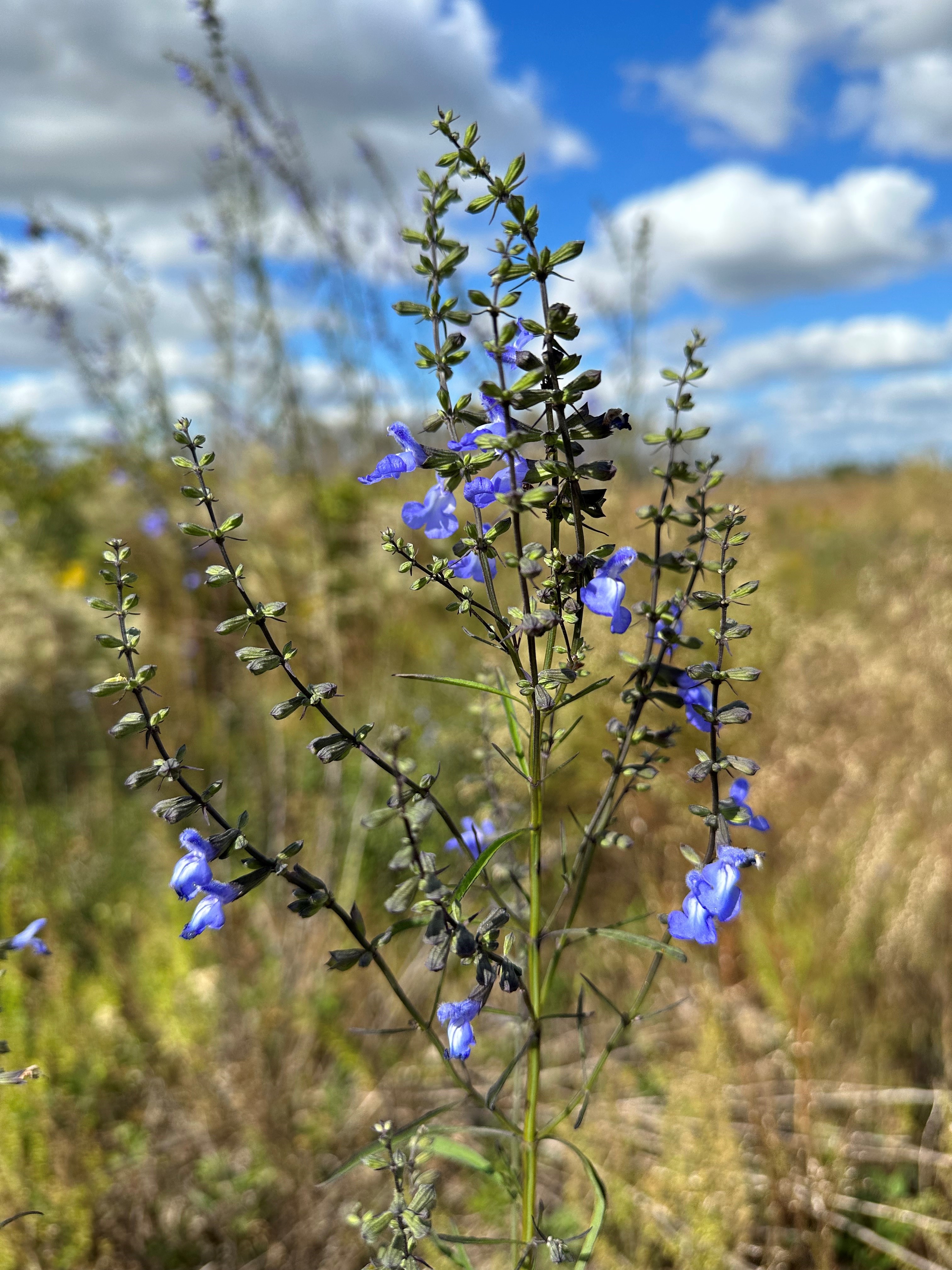
The second blue bloomer, Azure Blue Sage, is possibly even more striking in flower than Forked Bluecurls. Aptly named and blooming around the same time as Forked Blue Curls, Azure Blue Sage is a much larger plant (often 4-6’ in height) and holds its abundant sky-blue flowers high above the surrounding landscape. Because of their height and their propensity to occur in bunches, Azure Blue Sage’s brilliant tubular flowers are immediately noticeable to passersby and the myriad bee and butterfly pollinators that visit. Beyond its flowers, Azure Blue Sage is a very unusual looking perennial plant, tall and spindly with dark green, narrow leaves held tightly to square stems, a giveaway of its lineage in the Mint family. The species can be found in similar areas to Forked Bluecurls – natural areas in the Panhandle that possess abundant sunshine and very sandy, well-drained soil.
Azure blue sage blooming in a recently replanted pine forest in Calhoun County. Photo courtesy of Daniel Leonard.
Both species would make excellent additions to mixed perennial landscapes where the soil and sun conditions were right, as they are exceedingly low-maintenance and have the propensity to reseed themselves from year to year. Unfortunately, they are rarer in the nursery trade than they are in the wild and can only be found occasionally at nurseries specializing in Florida native plants. (Visit PlantRealFlorida.org to find native nurseries in your area!) However, even if you are unable to source a plant for your home, both these somewhat rare, blue-blooming fall beauties, Forked Bluecurls and Azure Blue Sage, are worth searching out in the many State Parks and public natural areas across the Panhandle! For more information about Forked Bluecurls and Azure Blue sage or any other natural resource, horticultural, or agricultural topic, contact your local UF/IFAS County Extension Office. Happy fall wildflower watching!