This is an amazing animal – the horseshoe crab (Limulus polyphemus). A relic of an age before the dinosaurs, they have been plowing the sediments of our marine and estuarine waters for over 400 million years.
They are thick armored tanks, shaped like horseshoes with a long spikey tail giving them appearance of a stingray. They are usually a deep green color, though some have a brownish hue, and have two lighter colored eyes on each side of the head, though there is a third you cannot see. They crawl across the bottom of the Gulf and bays seeking smaller invertebrates to eat. Their armor protects them from most predators, but they do have a few, like the loggerhead sea turtle. Though harmless to people, they don’t appear that way with numerous spines running along their abdomen and the long spine extending from the rear on a ball and socket joint that allows them to swing it, albeit slowly, in circles. They are pretty cool actually.
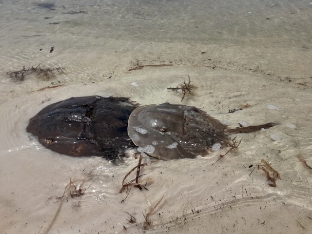
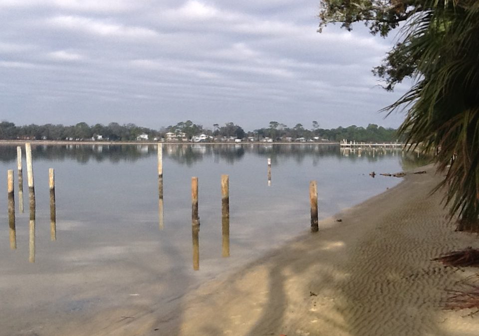
This female is carrying a male on a beach in Big Lagoon within the National Seashore.
Photo: Bob Pitts
They are actually not crabs. They are in the Phylum Arthropoda, like crabs, but not in the Subphylum Crustacea, as crabs are. Rather they are in the Subphylum Chelicerata and more closely related to the arachnids like spiders and scorpions. There are four species of these creatures remaining on the planet, three of those live in Asia, one along the Atlantic and Gulf coast of the United States.
Horseshoe crabs vary in size throughout their range but are typically between one to two feet in length and up to one foot across the head. This would be the size of a large female; males are much smaller.
They are benthic creatures exploring the bottom of both the bays and the open oceans searching for food.
Life for a horseshoe crab begins on the shore. Mom buries her eggs in the sand at the tideline during the spring high tide of either the spring or fall season. They young emerge between two and four weeks and begin life as plankton (though they resemble the adults at this stage). They eventually settle out as juveniles in the seagrasses near where they were born and begin their life as benthic creatures. The large adults eventually work their way out into the open ocean to feed before returning to start the cycle over.
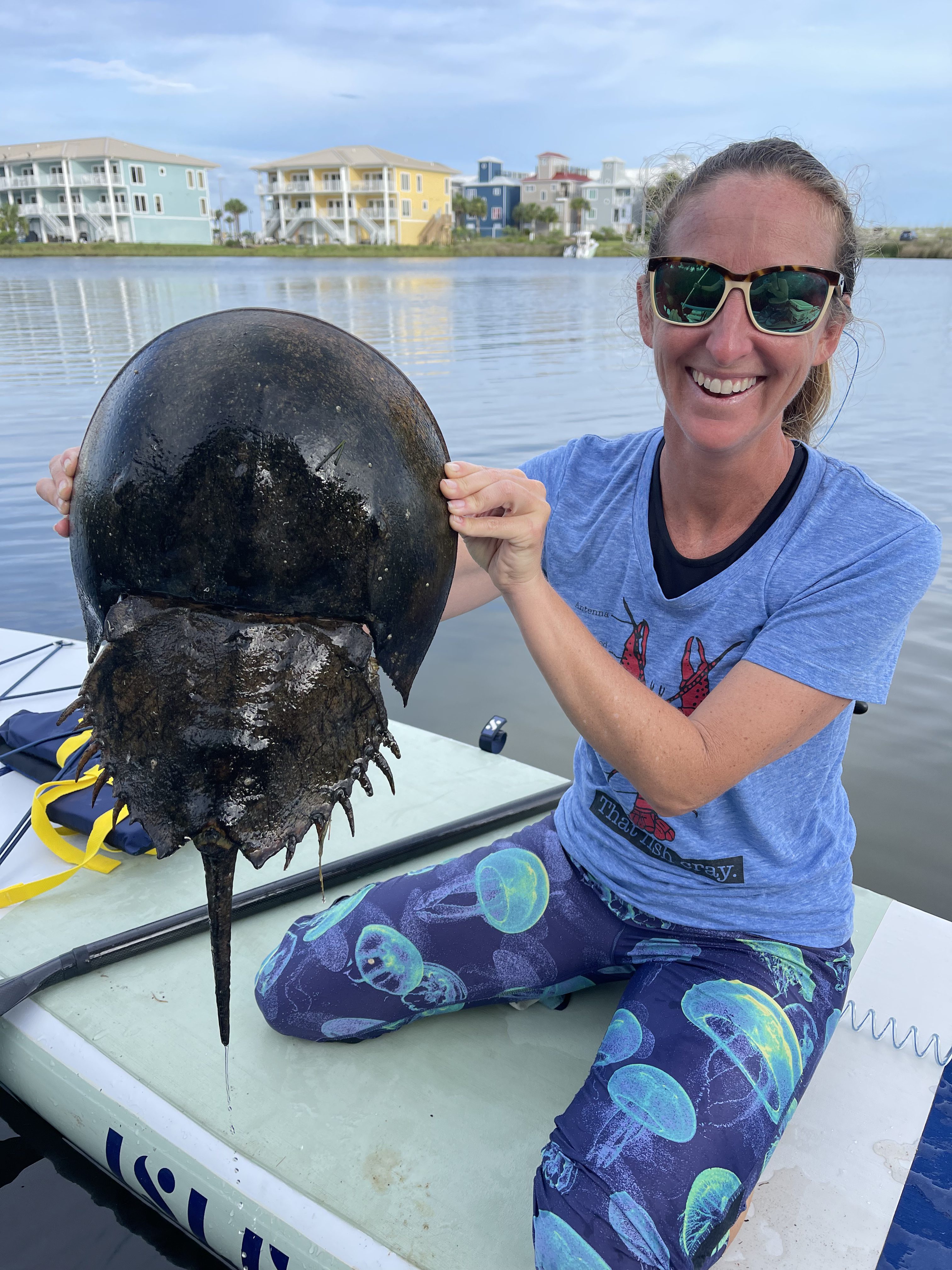
A large horseshoe crab found in Little Sabine.
Photo: Amanda Mattair
When the females return, smaller males pursue her to shore in hopes of being the one to fertilize her eggs. Many times, a male will use a modified claw that resembles a hook to grab on to the back of the female and ride in with her. But several other males, called satellites, will continue across the bottom in pursuit. Once on the beach she will begin to deposit her eggs in the sand at high tide and the males rush in to fertilize. Studies show that more often than not it is one of the satellites who is successful. And so, it goes over their 20 year life span, and this has been going on for hundreds of millions of years.
Their range extends from the Gulf of Maine to the Gulf of Mexico. Populations within this range have declined in recent years and there have been efforts throughout to manage this problem. Here in Florida the Florida Fish and Wildlife Conservation Commission (FWC) has developed a citizen science project they call The Florida Horseshoe Crab Watch where volunteers visit nesting beaches to collect information from the animals and tag them. Here in Pensacola Bay, though we have seen horseshoe crabs, we have not identified any nesting beaches and that is the focus of our Pensacola Bay Horseshoe Crab Hunt… to find those nesting beaches.
In 2017 we began marking horseshoe crab sightings in the Pensacola Bay area on a map. The purpose of this was to determine if there were “hotspots” (locations that had repeated sightings) that we could use to search for nesting locations. Beginning in 2020 we trained citizen science volunteers to survey one of nine such hotspot locations. Each of these were laid out with beach walking transects that ranged from 0.30 to 0.95 miles in length (mean = 0.69 miles).
In 2022 we trained 14 volunteers in March to survey these transects. They were instructed to visit one of the nine locations ± 30 minutes of spring high tide during the spring months (April-June). All of the spring tides were provided to them, but they had to use an outside resource to determine what time high tide as their location. Each volunteer was provided an FWC data sheet to complete after each survey and submit these to the local Sea Grant Extension Agent.
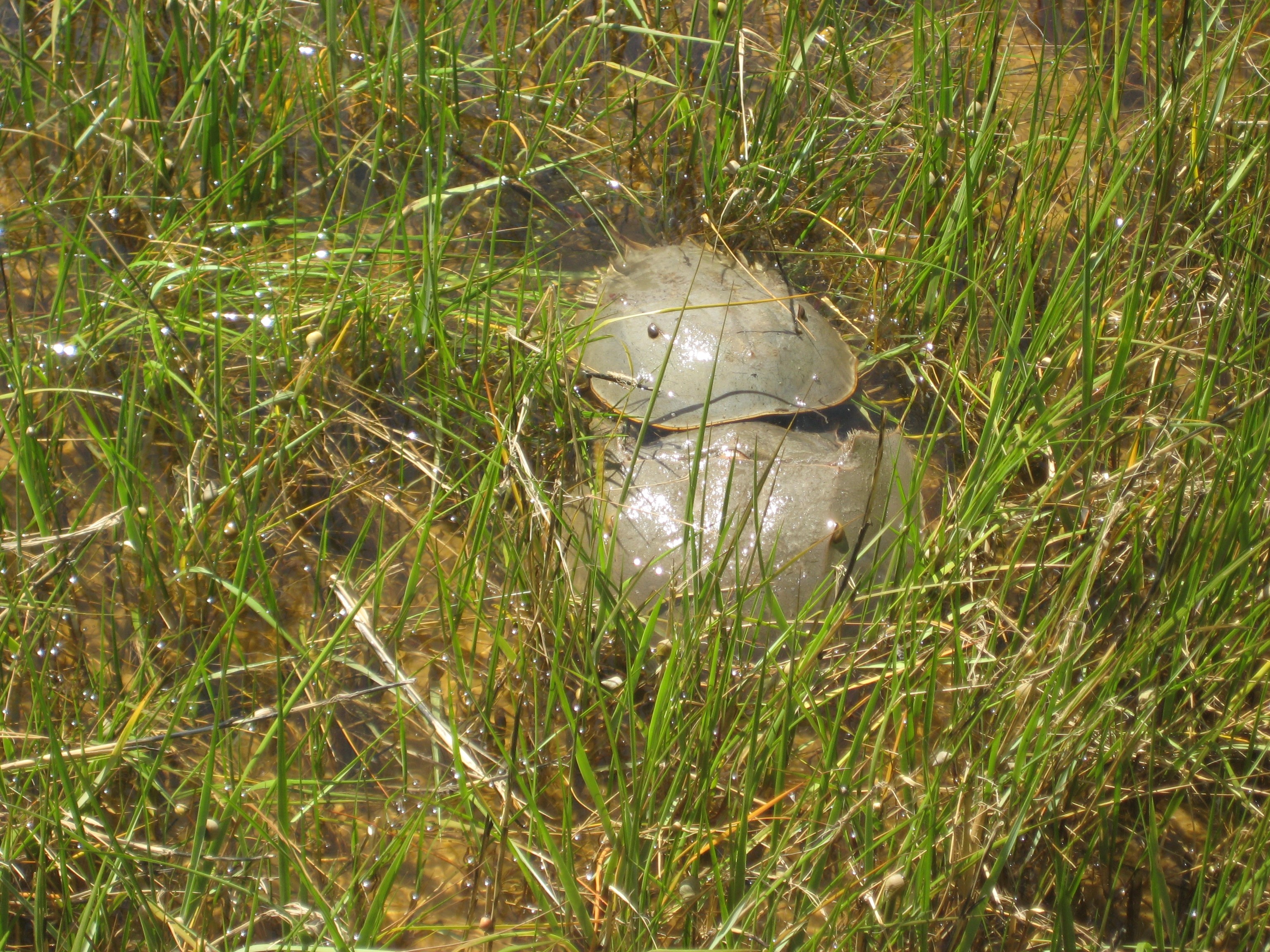
This horseshoe crab pair was found on shore near Wakulla Florida.
Photo: Charles Pulley
12 of the 14 volunteers (86%) did conduct at least one survey. These surveys covered six of the nine transect locations (67%) and others surveyed nine new locations.
A total of 77 surveys were conducted during the spring of 2022 for a total of 23.7 miles and logging 77 hours. No horseshoe crabs were sighted, and no nesting beaches were found.
That said, the general public continued to call in sighting reports outside of the official surveys. Six residents sent the Sea Grant Extension Agent records of sightings at six locations around the bay area. Three of these were locations were transect locations we are currently surveying, further confirming these are good places to search. Those three were Big Sabine, Little Sabine, and Sharp Point on Pensacola Beach. The other three locations included Portofino and the point at Ft. Pickens on Pensacola Beach as well as Navarre Beach.
Locations that were surveyed and no sightings were reported included Park West and Morgan Park on Pensacola Beach, Naval Live Oaks in Gulf Breeze, Sanders Beach and Bayou Grande in Pensacola, and Galvez Landing, Perdido Key State Park, Big Lagoon State Park and Tarkiln Bayou out near Perdido Key.
We will continue to search these sites each year in hopes of finding nesting horseshoe crabs. We encourage everyone to continue to report sightings to the Sea Grant Extension Agent in Escambia County (850-475-5230; roc1@ufl.edu ) and consider becoming a volunteer in the spring.
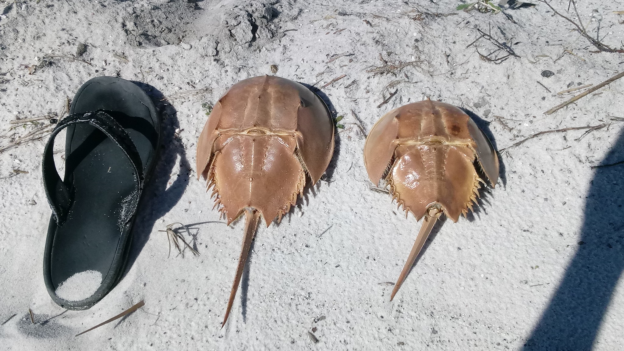
Horseshoe crab molts found on the beach near Big Sabine.
Photo: Holly Forrester.
When I joined Florida Sea Grant in 2012 my advisory committee told me water quality was one of their major concerns. Makes sense really. Some members were from the tourism and boating industry. Some were from commercial and recreational fishing. Others were homeowners. ALL had concerns. ALL depended on clean water for the success of their business and for the quality of their own lives. It is a big concern.
Since that time, we have been training volunteers to monitor nutrients and salinity. We just recently added harmful algae monitoring and we report fecal bacteria data collect by the Department of Health. All to (a) get people out there so they can see what is happening themselves, and (b) provide information we share with the members of the community.
Local bayous in the Pensacola Bay area have experienced fish kills due excessive nutrients in the past. The Lakewatch Program trains volunteers to monitor nutrients in these waterways today.
Photo: Rick O’Connor
Lakewatch is a program where volunteers use their boats to monitor nutrients at three locations in a particular waterway within the bay system. Excessive nitrogen and phosphorus can lead to agal blooms, which in themselves can be a problem, just ask the folks in south Florida. But when these organisms die, they form dense mats of organic matter that sink and decay. The decaying process is oxygen demanding and the dissolved oxygen in the system decreases to levels where fish kills can happen. Many may remember the large fish kills our bayous experienced in the 1960s and 1970s.
Their samples are analyzed by the Lakewatch lab in Gainesville for total nitrogen, total phosphorus, and total chlorophyll a (which is a proxy for phytoplankton in the water column – algae). The volunteers also measure the water clarity using a secchi disk. Water clarity decreases with increase algal blooms and this can be a problem for submerged seagrasses. The lab provides us with the salinity when they analyze the samples.
Below is a table of data since sampling began in 2007. However, some locations are JUST getting started.
Table 1. Nutrients in the Pensacola Bay Area
All values are the geometric means.
Body of Water
Total Phosphorus (µg/L)
Total Nitrogen (µg/L)
Total Chlorophyll a(µg/L)
Water Clarity (Feet)
Salinity (parts per thousand)
Pensacola Bay
Station 1
Station 2
15
275
5
7.3
Station 3
Bayou Texar
Station 1
17
803
6
3.5
8
Station 2
18
673
8
3.8
10
Station 3
17
592
8
3.8
10
Bayou Chico
Station 1
29
533
16
3.2
7
Station 2
27
548
13
1.0
7
Station 3
22
353
8
4.1
7
Bayou Grande
Station 1
15
311
4
4.5
14
Station 2
15
290
4
5.5
15
Station 3
17
312
5
5.4
16
Big Lagoon
Station 1
13
252
3
8.9
18
Station 2
Station 3
12
213
2
10.0
8
Lower Perdido Bay
Station 1
15
327
5
6.4
15
Station 2
15
324
5
5.4
15
Station 3
15
328
5
5.8
15
Pensacola Bay was only sampled for one year (2019-2020). These three stations extend from the near the mouth of Bayou Texar, along the east side of the 3-Mile Bridge to the middle where the “hill” is in the bridge. This site is open and in need a volunteer. If interested, contact me. You will notice as you glance at the data table there is very little information on this location. The data provided in this table is the geometric means over the period of monitoring. Only data from station #2 was enough to report on and the values for nutrients are on the lower side. The water clarity is one of the better locations at 7.3 feet and there is insufficient data to report on the salinity.
Again, this site was not monitored for long and there is not enough to see short- or long-term trends here. But based on the little information provided, there does not appear to be nutrient issue here.
Bayou Texar has been monitored the longest in this Lakewatch program. One volunteer monitored from 2000-2002 before stopping. A second volunteer began in 2007 and monitored until 2013 when a third volunteer took on these sites. There is a current need for a new volunteer to continue monitoring this location beginning in 2023 – contact me if interested. The Lakewatch data is provided in two sections, one covering the 2000-2002 monitoring period, and the other the 2007-present. The data provided in this report are those collected between 2007-present. The sample stations run north to south with #3 being closest to the mouth near Cervantes Bridge.
A quick glance at the data shows significantly high nitrogen values, particularly at station #1 (near the 12th Avenue Bridge). Most bodies of water monitored in this project have nitrogen values running between 200-400 µg/L (Bayou Chico being an exception – more on that next). The total nitrogen in Bayou Texar runs between 600-800 µg/L – MUCH higher than the others. Though the total nitrogen is higher, the total phosphorus and chlorophyll numbers are not much above other locations (again, Bayou Chico is an exception). Water clarity, between 3-4 feet, is low for most locations. The salinity is also lower than most.
Since 2007 there have been significant improvements in total phosphorus at stations #2 and #3 – meaning improvements as you go from the 12th Avenue Bridge to the Cervantes Street Bridge. Water clarity has significantly improved at all locations. This is all good news. However, the total nitrogen numbers have not changed significantly over that time and are much higher than other bodies of water sampled. When you look at the number of health advisories issued for Bayou Texar it tends to be around 30% of the samples collected. Much better than Bayou Chico but higher than other bodies of water monitored by the Health Department.
Bayou Texar does have a total nitrogen problem and the closer you get to the 12th Avenue Bridge, the worse it becomes. Sources of nitrogen can come from leaf litter, fertilizers, animal waste, and leaky septic tanks, or sanitary sewage overflows. Identifing which source is the problem will be difficult. Some suggest the issues may be coming further upstream in Carpenters Creek. It is recommended that local residents and businesses along the creek and bayou use some of the management practices listed at the end of this report to help reduce this problem. There is a large effort currently to try and improve conditions in and around Carpenters Creek. Many of the properties along the bayou might consider the BMPs listed at the end of the report. Based on the chlorophyll data, Bayou Texar is border lined eutrophic (excessive nutrients). Reduction of nitrogen would help.
There are records of seagrass growing in Bayou Texar as well as active ospreys, dolphins, and even manatee sightings.
Bayou Chico has been sampled since 2014. The stations run from west to east with station 3 being the closest to the mouth of the bayou (near the bridge). As you glance across the numbers you will notice the nutrient data is slightly higher than the other bodies of water. The other bodies of water have total phosphorus between 10-20 µg/L. However, Bayou Chico has the highest values running between 20-30 µg/L. Other than Bayou Texar, the total nitrogen values are between 200-400 µg/L. Though lower than Bayou Texar, Bayou Chico is high running between 300-600 µg/L. The same is true for the third nutrient parameter chlorophyll. At most locations, excluding again Bayou Texar, the chlorophyll values are less than 5 µg/L. Bayou Chico has the highest values running between 8-16 µg/L. Along with Bayou Texar it has the lowest water clarity between 3-4 feet and has the freshest water in our sample locations with salinities running at 7 ppt.
Though most parameters have improved slightly since 2014, there have been no significant changes in water quality. There has been a slight increase in nitrogen at two stations – but again, not significant.
These values do classify Bayou Chico as eutrophic (nutrient excessive). The lower water clarity and salinity suggest more freshwater input – possibly from stormwater runoff. The low water clarity could be from small algal blooms but could also be attributed to shore-based sediments entering the system via stormwater runoff. These excessive nutrients could be linked to the excessive health advisories issued here due to fecal bacteria entering the waters. Based on data from the Department of Health, over the years Bayou Chico has required a health advisory be issued 50-60% of the time they sampled – significantly more than the other bodies of water monitored. Since 2010, this is the only body of water currently being monitored that has experienced a large fish kill – though this fish kill was attributed excessive warm water (which, like algal blooms, is oxygen demanding). It is a body of water that has seen problems for decades and is the only body of water in our area that requires a state Basin Area Management Plan (BMAP).
There are records of seagrass growing in Bayou Chico – and this is good news. There are also reports of ospreys, dolphins, and manatee sightings here as well. The state has deployed oyster reefs to help remove nutrients. There is an invasive species present (giant salvinia – Salvinia molesta) that is of concern. The state is currently managing this plant. It prefers high nutrient, low energy (calm) freshwater water. The salinities of the other bayous may be too high for this plant, but we are trying to education residents about the situation and help monitor/remove it if it appears. You can contact the county extension office for more information on this plant if interested.
Bayou Grande has been monitored since 2012. The stations also run west to east with station #3 closest to the mouth near NAS main side bridge. As you glance across the numbers you will notice values at, or below, average for the areas sampled. Total phosphorus runs close to 15 µg/L. Total nitrogen values run close to 300 µg/L. Total chlorophylls are some of the lowest running close to 4 µg/L. Water clarity is the clearest of all three of the bayous running between 4.5-6 feet and is also the saltiest with salinities running around 15 ppt.
All though all parameters have shown improvement in water quality since 2012, most are not significant improvements. The one exception is water clarity at station #1 – it has shown significant improvement during this time.
In general Bayou Grande is in the best shape of the three bayous and compares well with the open bay stations being monitored. It is classified as mesotrophic – meaning nutrients are middle range (where you expect an estuary to be). The health advisory reports are usually between 20-30% of the samples taken and fish kills have not occurred here since we began monitoring. There have been improvements on septic to sewage conversions in these communities, as well as efforts to build living shorelines (which can help reduce nutrient runoff to the bayou coming directly from properties in lieu of storm drainpipes). It is also a larger bayou (hence its name) with less development along the southern shoreline. There are more efforts planned to try and improve sewage issues and in planting living shorelines using filter feeding oysters. Residents along Bayou Grande could also incorporate Florida Friendly Landscaping principals to help reduce nutrients further as well as incorporate clean boating practices. Information on these programs can be found at your county extension office.
Big Lagoon has only been monitored since 2020. Thus, there are gaps in the data table where there are insufficient data to calculate a geometric mean. The sample stations run from east to west with #1 being closest to Ft. McRee and the mouth of the Pensacola Bay system itself. Glancing at the data where a geometric mean was able to be determined you will see that nutrient values are some of the lowest in the bay area. The total phosphorus runs between 12-13 µg/L, total nitrogen between 200-250 µg/L, and the total chlorophyll between 2-3 µg/L. The water clarity data are the clearest in the bay area, running from 9-10 feet. The salinity is interesting. At station #1 (near Ft. McRee) the geometric mean for salinity is 18 ppt, but at station #3 (near Big Lagoon State Park) it is only 8 ppt.
Since sampling only began two years ago, it has not been long enough to determine any long-term trends.
The chlorophyll numbers are actually low enough to classify Big Lagoon as oligotrophic (nutrient poor). This is unusual for an estuary, which are typically bodies of water with moderate amounts of nutrients due to natural runoff. But remember (a) Big Lagoon does not have a lot of natural runoff and (b) we have only been collecting samples there for two years.
The interesting thing about the salinity is how low it is. Station #3 (near Ft. McRee) is 18 ppt and being so close to the mouth of Pensacola Bay, and the Gulf of Mexico, you would expect this to be higher – maybe between 25-30 ppt. The fact that there are thick beds of turtle grass (Thalassia testdidnium) suggest that the actual mean is probably higher than the 18 ppt reported here. The opposite side of Big Lagoon is interesting as well. Station #3 reports a geometric mean of 8 ppt. This is equivalent to the upper end of Bayou Texar (near the 12th Avenue Bridge) and most of Bayou Chico. This too seems very low for this body of water. The Department of Health samples for fecal bacteria near Big Lagoon State Park and it does, at times, get high enough (> 70 colonies/100ml) for a high bacteria reading. DOH usually takes a second sample to confirm the reading and most often the second reading is lower, and a moderate classification is given for that week. That said health advisories have been given in this region, albeit less than 10% of the samples taken. All of this suggest that there may be some runoff issues at the west end of the Lagoon. Obviously more sampling is needed.
This body of water does support plenty of seagrass, ospreys, dolphins, and an increase in manatee reports. There are diamondback terrapins and horseshoe crabs both reported here as well. But it was also a location where bay scallops once thrived and no longer do. Scallop searches have been ongoing here for six years and only one live animal has been found. There are several possible reasons for their decline, decrease in salinity maybe one of them. Monitoring will continue. It is also a location where the state has measured a decline in seagrass – also concerning. Sea Grant is currently partnering with the University of West Florida to monitor both seagrass abundance and water quality within Big Lagoon.
Lower Perdido Bay has been monitored since 2014. The three stations run from south to north. Station #1 is near Innerarity Point and station #3 is near Tarkiln Bayou. Glancing across the numbers of the lower Perdido you will see that they are similar to most of the other bodies of water being monitored. The total phosphorus is 15 µg/L. The total nitrogen is between 320-330 µg/L. And the total chlorophyll is 5 µg/L classifying this area of Perdido Bay as mesotrophic. Being an open bay, the water clarity is higher, running between 5-6 feet, and the salinity is reported at 15 ppt. As with Big Lagoon, the salinity seems lower than one would expect but historic records suggest that Perdido Bay in general may have been lower than most other open bays. Historically the mouth of the bayou open and closed frequently giving the Spanish the reason to name it Perdido (“Lost Bay”). This closer may have made it more of a freshwater system – similar to the dune lakes of Walton County and the historic Choctawhatchee Bay – and may play a role in the lower salinity of Big Lagoon.
The trends over time show that most parameters have improved but not significantly. The one exception is total nitrogen. The total nitrogen in lower Perdido Bay has significantly decreased over the period Lakewatch has been monitoring – and this is good news.
Perdido Bay has had a history of poor water quality, but this is due more to industrial compounds being released through the tributary creeks. These compounds did cause other problems, including some species of fish altering sex, and whether these are still an issue cannot be determined by these data – this project is monitoring for nutrients. The nutrient driven algal blooms and fish kills found in the bayous 50 years ago were not as common in this body of water and these data suggest that the system is mesotrophic as most estuaries are. As with most of the other bodies of water, ospreys, dolphins, and manatees have all been recorded here. Seagrasses are present but being a less saline system than Big Lagoon and Santa Rosa Sound, the species composition is different and abundance is less. There have been efforts to survey for bay scallops in the lower portions of Pensacola Bay, but no efforts have been made in the lower Perdido due to salinities currently, and historically, not being high enough. Again, the lower salinity is thought to be more natural than from heavy development and urban runoff.
Summary
In summary, these data suggest that the nutrient problems area waterways experienced in 1960s and 1970s have improved. Algal blooms and fish kills are no longer common. But there still could be dissolved oxygen (DO) issues at the bottom of our bays and bayous that reduce biodiversity. This is not monitored by Lakewatch and we are not aware of any long term monitoring of DO to know how things have changed in the last 50 years.
Anecdotal reports suggest the coverage of seagrasses in these systems are improving. Though there are seagrasses in Big Lagoon, some reports suggest there has been a decline in recent decades. There is a current citizen science project entitled Eyes on Seagrass where Sea Grant and the University of West Florida train volunteers to monitor both coverage and species composition. Data from this project will presented in a separate report later in the year. There are also separate citizen science efforts monitoring the presence of bay scallops, horseshoe crabs, and diamondback terrapins in the bay area. Horseshoe crabs are being encountered more often, as are terrapins, but bay scallops seem to still be missing. As with the seagrass monitoring, these reports will be coming later this year.
There are still concerns with both Bayou Chico and Bayou Texar – these being the only two nutrient eutrophic systems in this monitoring project (based on chlorophyll data). Efforts to better understand the sources of nutrients, and enact better management practices, should be considered for these waterways. Things such as reducing fertilizer use, mitigating fertilizer runoff with living shorelines, converting from septic to sewers, better maintenance of septic systems, and reduction of sanitary sewage overflows are all actions that citizens can take now to help improve these waterways. For information on how to do these, contact your county extension office and we will be glad to assist.
Lakewatch is a citizen science volunteer supported by the University of Florida IFAS
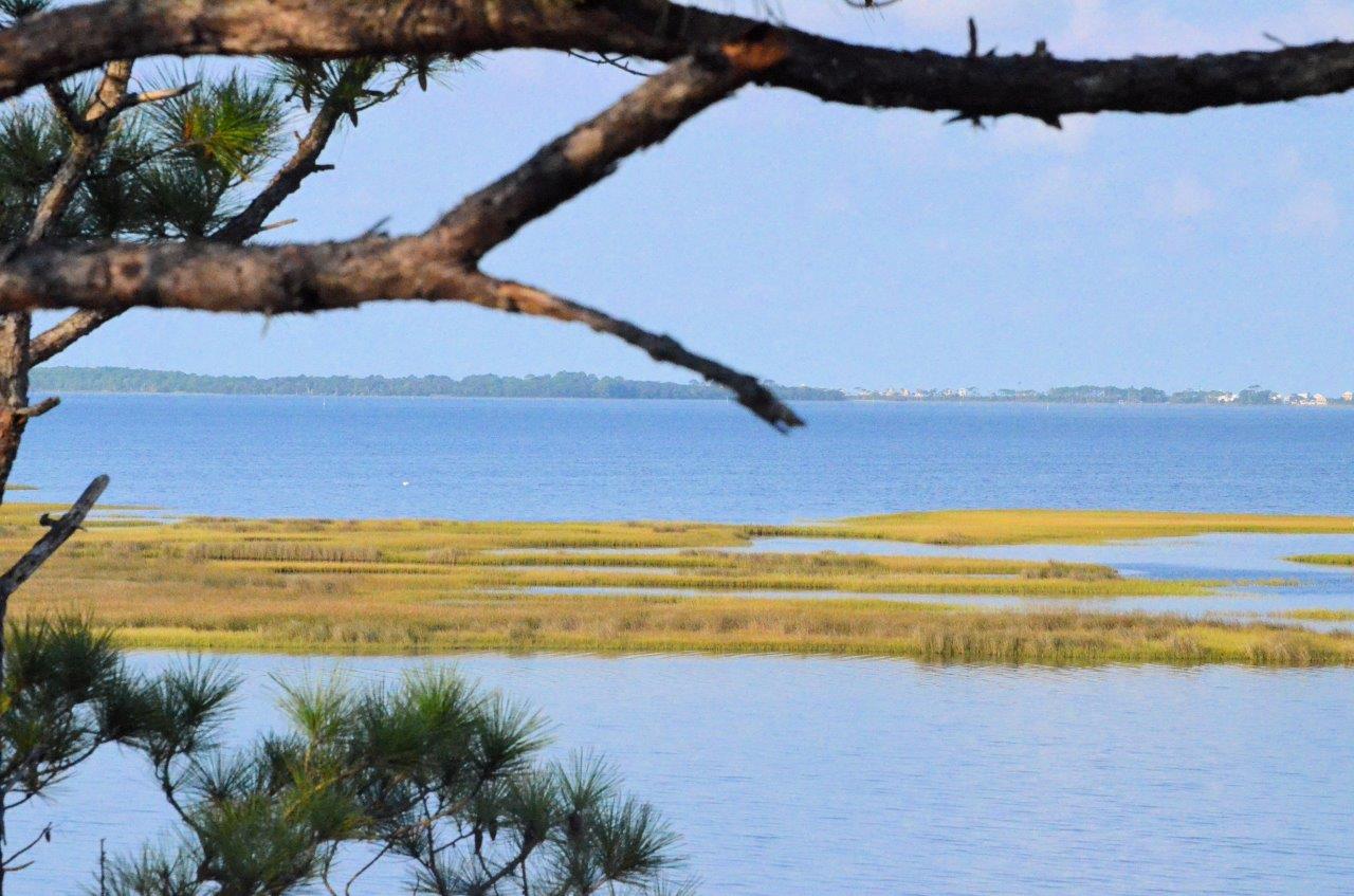
It has been a few months since we have posted an article on the changing wildlife over the course of a year on our barrier islands. I took the month of June off and just could not schedule a hike in July. But it is now August, and we DID get out this week.
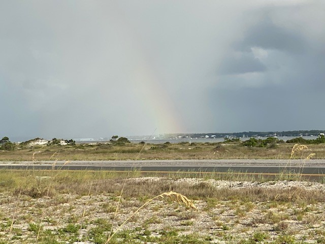
This is no surprise… it is hot and humid. I think everyone has noticed this. We are also in the rainy season. Based on the NOAA site I track, we are currently at 45.73” for the year. This is an average of 6.53 inches a month which would lead us to an annual amount of 78” if we keep that pace. This would be another wet year.
This rainfall does a lot to cover up tracks I am looking for. It will spook some creatures into hiding waiting out the weather, but there are plenty of others who enjoy the rain and are more on the move.
This rainbow indicates how wet this part of the year can be on our barrier islands.
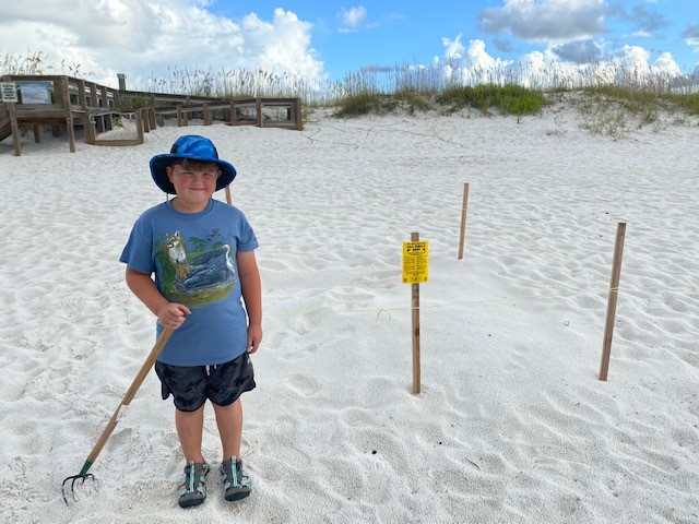
Today I took my grandson with me on the hike. He loves the outdoors and reptiles and amphibians especially. We began, as we always do, walking a section of the Gulf beach to see what we could see.
We immediately encountered a sea turtle nest. I understand that it has been a good year for sea turtles in our neck of the woods. The turtle patrol had roped this one off, but I did see human footprints inside the roped section. We encourage people NOT to do this. Compacting the sand can be a problem and if they hatch and detect vibrations they may not emerge. It is cool to see one, but do not go past the roped section.
The sea turtle patrols mark the nest with stakes and rope. People should not enter beyond the roped section.
We always search the wrack line for cool things and today we ran into a few. First, there were hundreds of small dead anchovies washed ashore. I am not 100% sure what happened but I am guessing a strong storm came and washed them in. Anchovies are a great source of food for many marine fish and these dead ones will certainly feed the numerous birds and ghost crabs that live along the shores. Anchovies play an important role in the ecosystem and, even though these were dead, it is nice to see them.
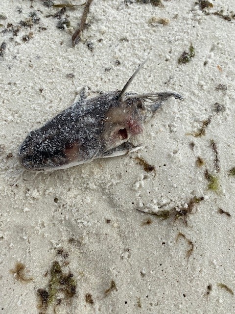
We did find several catfish heads. Saltwater catfish are not prized by Gulf fishermen. Many prefer to cut their heads off and leave them on the beach. The thing is that this does little to deter the population of this unpopular fish and the spines can be dangerous for beach combers walking barefoot. But the ghost crabs usually collect and feed on them.
The serrated spines of the hardhead catfish are still on this discarded head. beach combers should be careful when walking near these.
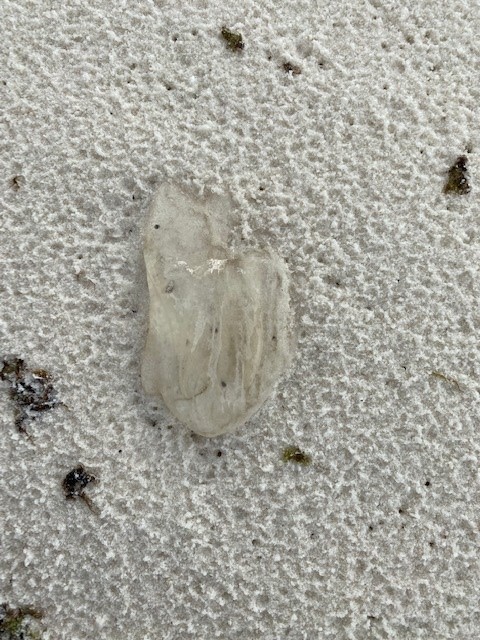
We also found a few comb jellies. These are members of a different phylum (Ctenophora) than the classic jellyfish (Cnidaria). They lack stinging cells and move using their rows of ctenes (cilia) that resemble the bristles of a comb as you run your finger over it. This is where it gets its common name. They do produce blue colored bioluminescence in the evening and are beautiful to watch.
Comb jellies do not sting and they produce a beautiful light show at night.
As we crossed the road and enter the dunes, I explained to my grandson how the foredune is dominated by grasses. These plants can tolerate the strong winds off the Gulf and the salt spray as well. On the other side of the road, you enter in the secondary dune field. This region is a mix of grasses and small shrubs, which can grow due to the primary dunes blocking some of the strong Gulf winds.
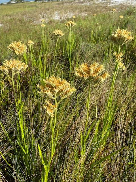
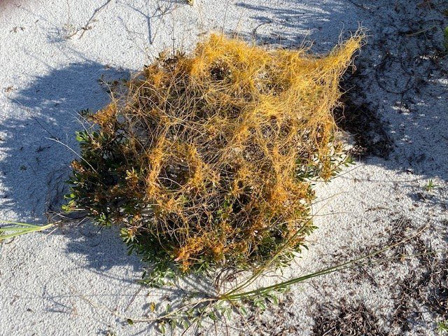
Today we saw several species of flowers in bloom. Different plants bloom at different times of the year and it is neat to see who is blooming at different times. The low swale areas were full of growing plants and flowers. There were plenty of sundews and ground pine. Some standing water but much was dry. We did find a plant in one of the wet swales I did not know. I am listing it here as redroot but I am not confident in that identification and would love if someone who knows it will share its name.
This once barren flat of sand is now full of grasses and flowers. This common secondary dune plant is what I call “square flower”. I am not sure what type of plant this is. I am calling it red root and hope someone with a better identification will let us know.
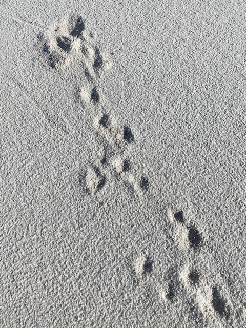
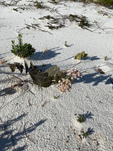
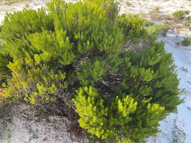
There were numerous tracks of armadillos but little else from the animal world. Again, the rains wash them away. The milkweed was still blooming awaiting for the now listed monarch butterflies. And the beach side rosemary was releasing its characteristic odor that says “Pensacola Beach” to me. The plants looked great and seem to enjoy the rain. FYI – we did get rained on during the hike, but not too bad. We had seen the parasitic dodder earlier in the year and the vine was still evident in August.
Though many of the tracks were washed away in the rain, some are still there. The animals are still moving. We first saw milkweed blooming in April. Here in August some are still in bloom. Seaside rosemary is one of the more aromatic plants on our barrier islands. Dodder is a parasitic vine often called “Love Vine”.
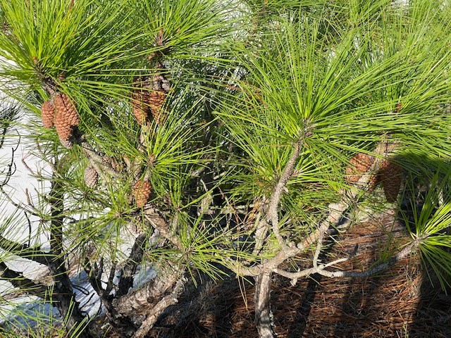
In the tertiary, or back dunes, is where I always hope to find tracks or animals of some kind. Today there was little evidence of any. There were raccoon tracks moving along the edge of tallest dunes and along the trails leading to Santa Rosa Sound. But not much else. The pines were bearing their cones and the sweet bay magnolias had their young blossoms forming.
Many of the pine trees growing in the back dunes are now producing cones. Sweet bay is in the magnolia family and produces a similar blossom.
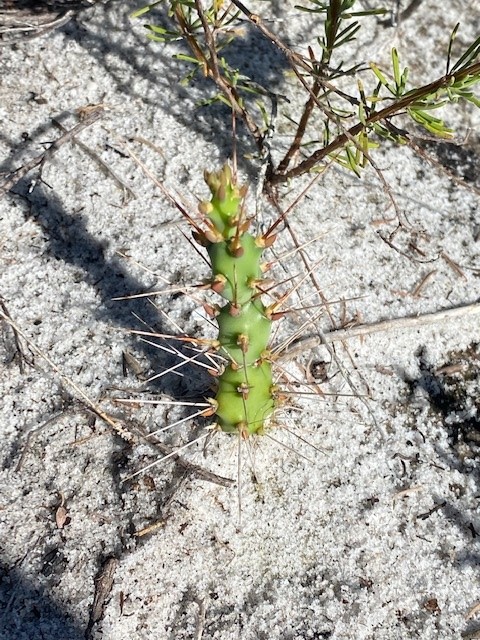
One species my grandson did not enjoy were the numerous devils’ joints. This branching cactus has very sharp spines and were all over the back dunes. We had to stop and remove them several times. He definitely wanted to find a different way back!
The Devil’s Joint is not one of the more pleasant plants to encounter in our dunes. We encountered plenty today!
We did reach the Sound and walked along its edge towards the old fish hatchery. He saw TONS of fish (as he put it) and the grass looked thick and healthy. We did get to explore and talk about the old fish hatchery. And then headed back towards the Gulf and our truck.
I think we got started a bit late to see a lot of the wildlife. This time of year, they will be hunkered down somewhere early in the morning to prepare for another hot day. With the overhead clouds I was hoping to see some movement, but we did not. We will try earlier in the day in September.
I hope you get out and explore our barrier islands. They are fascinating places. But plan to get into the water this time of year. We did. It was hot. We went snorkeling and saw numerous pinfish, a flounder, and snapper, and a nice sheepshead. This is a good way to spend the hot parts of the day. Let’s see what September may bring.
Mangroves in the northern Gulf of Mexico are a relatively new thing for most coastal counties. Some residents are aware they are arriving and are not concerned. Some are aware and are actually excited about it. Some are aware and are concerned. Some are not aware. And others have no idea what a mangrove is. Let’s start with that group.
Black mangroves growing near St. George Island in Franklin County. Photo: Joshua Hodson.
Mangroves are salt tolerant trees that are found all around the globe within the tropics. They grow along the shorelines in areas where they are protected from ocean wind and waves – they like estuaries. There are several species and their location along the shore depends on how long they can be submerged in water. There is a definite zonation of these trees.
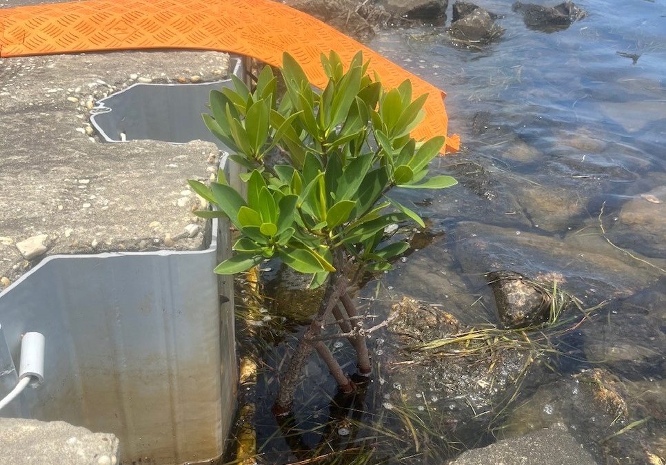
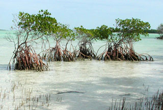
The red mangrove with their distinct prop roots. Photo: University of Florida
The red mangrove (Rhizophora mangle) is found closest to the waters edge. They can be identified by their prop roots which are designed to keep it standing when the water is moving and shifting the sediment below it. These prop roots also useful during tropical storms when the wave energy increases. The have distinct looking propagules, which are elongated floating seeds which allows the plant to disperse their offspring using the currents and tides. The propagules often wash ashore on northern Gulf beaches but usually in locations not conducive to growth, or they do not survive the winters. These plants can tolerate temperatures in the 30sF for a night or two, but when it drops into the 20sF, and certainly into the 10sF, they will not survive. Despite not being cold tolerant, they have been found growing in the northern Gulf of Mexico. All the mangroves found in the Pensacola area have been of this species.
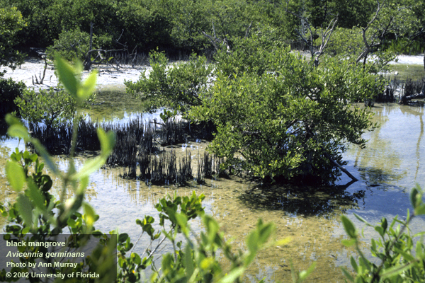
Black mangroves with their pneumatophores. Photo: University of Florida
The black mangrove (Avicennia germinans) is found higher in the intertidal zone. It lacks the prop roots of the red but rather has what are called pneumatophores, which resemble the knees of the cypress trees. These pneumatophores have structures that help increase the oxygen uptake for the plant, being that the sediments they live in are quite hypoxic. The seeds of the black mangrove are not elongated but rather resemble a bean. These trees are more tolerant of cold weather than the red mangrove and it is they that have led the march north. There are large stands of these trees in the Apalachicola area as well as barrier islands in Mississippi, Louisiana, and Texas. We have not found a black mangrove growing in Pensacola as of yet.
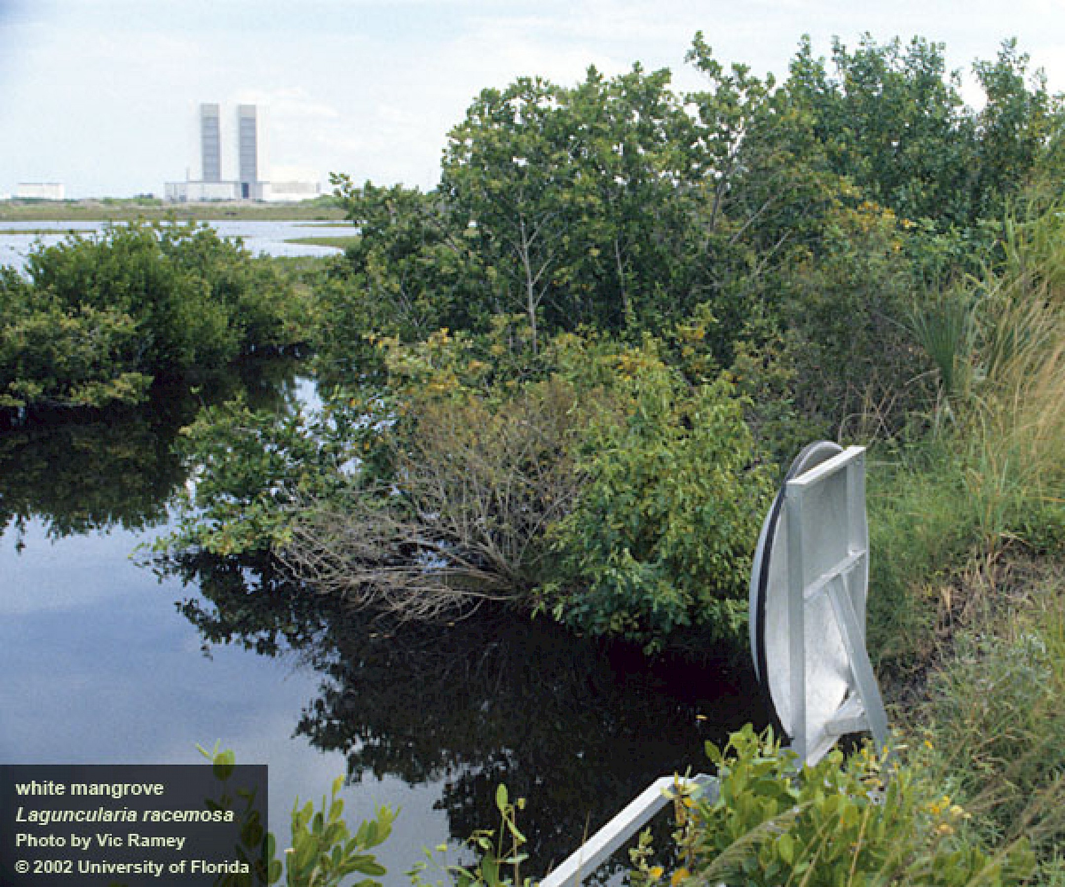
The larger white mangrove. Photo: University of Florida
White mangroves (Laguncularia racemosa) grow more inland than the other two. This species can grow into a large tree (up to 40 feet). Their leaves can excrete salt allowing them to live in saltier conditions. There are no records of this tree in the northern Gulf of Mexico to my knowledge.
Why would anyone be concerned about mangroves dispersing into the northern Gulf?
Those who are concerned are aware that is a shoreline tree that will grow and possibly block their view of the water. They also are aware that this tree is protected by the state, and they are not allowed to remove or trim the tree without a permit. In south Florida trimming mangroves is allowed in some counties during certain times of the year and only by certified arborist. Those concerned are not excited about potentially loosing their water view.
A red mangrove growing near the pass of Pensacola Bay. Photo: Whitney Scheffel.
Why would anyone be excited about mangroves dispersing into the northern Gulf?
Folks who are excited about the possible coming of the mangroves are so because they have spent time snorkeling and fishing in and around them in more southern locations. The prop roots of the red mangrove create an underwater wonderland of marine life. Small fish, crabs, anemones, starfish, mollusk and more find the large openings formed by the roots as great habitat. These in turn attract larger fish like snook, tarpon, rays, and flounder. Many species of larger fish are popular targets for anglers. Manatees are often found in mangrove swamps grazing on the algae and seagrasses growing nearby and enjoying the relatively calm water. Those who have experienced this in south Florida are excited they may have it here in the north.
How many mangroves, and which species, have dispersed into the northern Gulf is still being studied. Florida Sea Grant has partnered with Mississippi-Alabama Sea Grant and three of the National Estuarine Research Preserves to survey for mangroves in our panhandle counties and along coastal Mississippi and Alabama. Ten transects have identified in each that are surveyed once a year by volunteers using paddle craft. The presence of a mangrove is documented, measured, photographed and shared with the team, which is overseen by Whitney Scheffel of the Pensacola-Perdido Bay Estuary Program. If you are interested in participating in a survey, contact your county Sea Grant Extension Agent.
The University of Florida/IFAS Extension faculty are reintroducing their acclaimed “Panhandle Outdoors LIVE!” series. Conservation lands and aquatic systems have vulnerabilities and face future threats to their ecological integrity. Come learn about the important role of these ecosystems.
The St. Joseph Bay and Buffer Preserve Ecosystems are home to some of the one richest concentrations of flora and fauna along the Northern Gulf Coast. This area supports an amazing diversity of fish, aquatic invertebrates, turtles, salt marshes and pine flatwoods uplands.
This one-day educational adventure is based at the St. Joseph Bay State Buffer Preserve near the coastal town of Port. St. Joe, Florida. It includes field tours of the unique coastal uplands and shoreline as well as presentations by area Extension Agents.
Details:
Registration fee is $45.
Meals: breakfast, lunch, drinks & snacks provided (you may bring your own)
Attire: outdoor wear, water shoes, bug spray and sun screen
*if afternoon rain is in forecast, outdoor activities may be switched to the morning schedule
Space is limited! Register now! See below.
Tentative schedule:
All Times Eastern
8:00 – 8:30 am Welcome! Breakfast & Overview with Ray Bodrey, Gulf County Extension
8:30 – 9:35 am Diamondback Terrapin Ecology, with Rick O’Connor, Escambia County Extension
9:35 – 9:45 am Q&A
9:45- 10:20 am The Bay Scallop & Habitat, with Ray Bodrey, Gulf County Extension
10:20 – 10:30 am Q&A
10:30 – 10:45 am Break
10:45 – 11:20 am The Hard Structures: Artificial Reefs & Marine Debris, with Scott Jackson, Bay County Extension
11:20 – 11:30 am Q&A
11:30 – 12:05 am The Apalachicola Oyster, Then, Now and What’s Next, with Erik Lovestrand, Franklin County Extension
12:05 – 12:15 pm Q&A
12:15 – 1:00 pm Lunch
1:00 – 2:30 pm Tram Tour of the Buffer Preserve (St. Joseph Bay State Buffer Preserve Staff)
2:30 – 2:40 pm Break
2:40 – 3:20 pm A Walk Among the Black Mangroves (All Extension Agents)
3:20 – 3:30 pm Wrap Up
To attend, you must register for the event at this site:
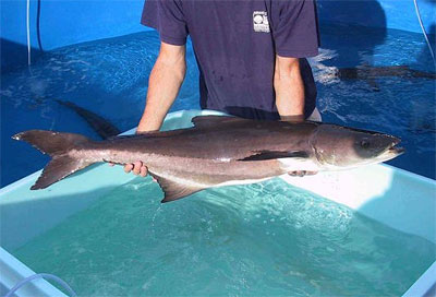
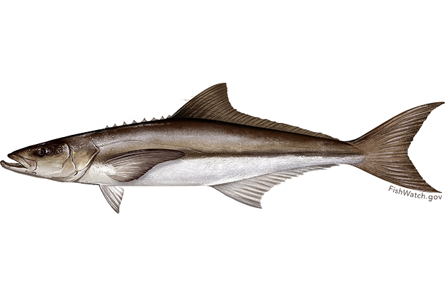
This fish is a classic example of why scientists use scientific names. There are numerous common names for this species and multiple ones even in the Gulf region. Ling, Cabio, Lemonfish, Cubby Yew, Black kingfish, Black salmon, Crabeater, and Sergeant fish to name a few. The Cajun name for the fish is Limon – possibly where the name Lemonfish came from. Based on the references, Cobia seems to be the most accepted name, but Ling is often used here along the Florida panhandle. Again, this is a great example of why scientists use scientific names when writing or speaking about species. There is less chance for confusion. I say less because at times the scientific names change as well, and some confusion can still occur.
The Cobia
Photo: NOAA
The scientific name for this fish is Rachycentron canadum. The genus name refers to the sharp spines of the first dorsal fin, which are sharp. The species name may refer to Canada. It is a common practice to give a species the name of the area/location in which it was first described. But it seems that Carlos Linnaeus, the biologist who first described it, used a specimen from the Carolinas to do so. So, not sure why the name was given4. It is the only North American fish in the family Rachycentridae and its closest relative are the remoras of the shark sucker family.
Some state that cobia have only one dorsal fin, but in fact they have two. The first is a series of 7-9 spines spaced with no membrane connecting. They are small, sharp, and somewhat embedded into the body. This is very similar to how the remoras and shark suckers first dorsal spines work, albeit remora’s first dorsal is softer. Cobia have a low depressed head that gives them the appearance of a shark when viewed from the side. It is often confused with sharks because they can get quite large – an average of five feet in length and up to 100 pounds in weight. The small juveniles resemble remora quite a bit. They are darker in color with pronounced lighter colored lateral stripes and their caudal fin (tail) is more lancelet and less lunate than the adults.
Biogeographically they are listed as worldwide, albeit tropical to subtropical – they do not like cold water. In the United States they are found all along the east and Gulf coast, but are absent from the west coast – again, a dislike for cold water. The literature states that there are two population stocks of cobia here. The Atlantic group and the Gulf of Mexico group all head south towards the Florida Keys for winter. However, breeding appears to take place in the northern parts of their range and so no genetics are exchanged while the two groups co-exist in the Keys. If this is the case, and it seems to be, there is a reproductive barrier, or behavioral barrier, that could, over time, isolate these two groups long enough that the gene pools could become different enough that attempts to breed between the groups would not produce viable offspring. If this were the case then they could be listed as subspecies, possibly the Atlantic and Gulf Cobia. But this has not happened. There are also studies that suggest in the Gulf there may be isolated groups. One comment is that there are cobia along Florida’s Gulf coast that migrate inshore and offshore but do not make the run to the Keys and back4. There are also studies that show a similar behavior with a group over near Texas. Obviously, there is a lot of work to be done on the movement and genetics of these possible subgroups to completely understand the biogeography of this animal. And don’t forget, there are cobia along the European/African coast of the Atlantic as well as the Indian and western Pacific.
Cobia resemble both shark suckers and sharks.
Photo: University of Florida
But migrate they do. The “Ling Run”, as it known in the Pensacola area, is something many anglers wait for early in the year. We even have some local bait and tackle shops monitoring water temperature to announce when the run will begin. When water temperatures warm to 67°F it is time. Local anglers flock the Gulf side piers and head out on their boats with high ling towers to search for them. At the beginning of the ling run I have seen the inshore Gulf of Mexico littered with hundreds of boats covering the surface like small dots as far as you can see. One boat I remember was about 20 feet long and had precariously placed a large step ladder in the center as a “ling tower”. The angler was perched at the top of the ladder, holding on in the chop, searching the waters for his target.
Cobia will travel alone or in groups of up to 100 and are often attracted to objects in the water. Flotsam like Sargassum weed, or marine debris are places that anglers focus on. They are known to shadow sharks, manta rays, and sea turtles. I know anglers when they see a sea turtle begin throwing bait in that direction in hopes that a cobia is nearby. To the west of us in Alabama they seem to visit the offshore gas rigs and are attracted to the fishing piers many communities have extending into the Gulf – hence the large crowds of non-boating anglers visiting them during the run. Many anglers are known to drop FADs (Fish Attracting Devices) into the water to attract cobia, though these are not allowed during cobia/ling tournaments – which also pop up across the panhandle during the run.
Despite this apparent heavy fishing pressure, it is considered a sustainable fishery. Cobia mature at an early age, 2 years for males and 3 for females – and they live for about 12 years. They mass spawn in the northern waters. A typical season will find females breeding 15-20 times and producing 400,000 – 2,000,000 per spawn event. There is no evidence that this fishery is overfished, and there is commercial fishery for them as well. Due to their quick growth rates, large size, and high-quality flesh, there is interest in offshore aquaculture of this species.
It is an amazing fish. One of the best fish sandwiches I have ever had was a fresh ling sandwich. It is also a very interesting species from a biographical point. Enjoy the next “Ling Run” along the panhandle – or “cobia run”, or “lemonfish run”, which ever you wish to call it.